The end of this long section marks roughly the halfway point of the London Countryway. Having set off from the side of the river Thames at Gravesend ferry pier, the route has followed a broad arc through the hills south of London and back across the heaths of Surrey and Berkshire to regain the river at Windsor. But rather than simply crossing to the opposite bank and heading out of the valley again as it does in the east, the Countryway tracks the river northwest for a while, following one of the Thames' long, lazy meanders, as if searching for the optium point to head off into the Chilterns on its second and final arc. Finding that point takes a while: it's another 23km, the single longest section of the route, before the Countryway's creator, Keith Chesterton, finally settles on quitting the Thames at Marlow.
Since the last edition of Chesterton's guide to the route was published in 1981, a whole new National Trail has been created along the riverside -- the Thames Path, opened in 1996, runs for around 300km from the source of the Thames near Kemble in Gloucestershire, on the edge of the Cotswolds, to the estuarine marshes between Crayford and Dartford on London's eastern edge. The National Trail passes right through the heart of the capital and in future this blog plans to follow it from Marlow downstream, so there will be a lot more to say about it and its rather long and tortuous history then. But for the time being it's a welcome and easy to follow stretch of well-signed footpath, one of a number of established trails that the Countryway samples on its journey.
If you were planning a walk from Windsor to Marlow today, following the Thames Path throughout would be the obvious option. In fact that option was in all essentials already available to Chesterton three decades ago, as at the core of the National Trail is the old Thames Towpath, developed back in the late 18th century as the river was systematically upgraded for navigation purposes. One of the challenges in creating the modern walking route was the large number of missing ferry links where, for historical reasons, the towpath swapped banks, but the stretch between Marlow and Windsor is relatively free of these except at Cookham where there is an obvious road diversion. Chesterton, however, adhered to his strategy of pursuing variety of surroundings. He gives us a good taste of the towpath from Eton to Maidenhead -- a classic stretch which, with its locks, "aits", public school bathing places, water meadows and picturesque riverside houses hiding behind gracefully draped osier willows, is about as close as you can get to the romantic straw hat and striped blazer image of the non-tidal Thames. But on reaching Boulters Lock at Maidenhead by Ray Mill Island, once one of the most fashionable Thames resorts, he opts instead for an alternative through flat marshes, fields and commons that grazes Cookham and reaches Marlow via an unexpectedly dramatic wooded chalk ridge as a foretaste of the Chilterns.
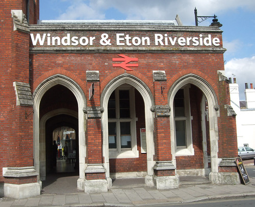
My last walk ended at Windsor & Eton Riverside station but as I'll be returning to Paddington, I head this time for Windsor's other station, Windsor & Eton Central. Both stations have their interest but Central certainly has the edge in terms of spectacle. Closest to the castle, it was opened in 1849 as the Royal station, designed to enable Victoria to commute from castle to palace in style, with a vast train shed entered through a grand ceremonial arch. Its extravagant architectural flatteries were, however, completely out of scale for the everyday transport needs of a town this size and with the decline in passenger numbers in the 20th century, maintaining the place became a serious challenge. By the 1970s only a single platform was still in use, as today providing a modest shuttle service to Slough, with the rest of the structure threatened with dereliction. We'll come across a similar story of a railway operator's royal forelock-tugging pretensions meeting everyday reality when we reach Crystal Palace station on the inner orbital Capital Ring route.
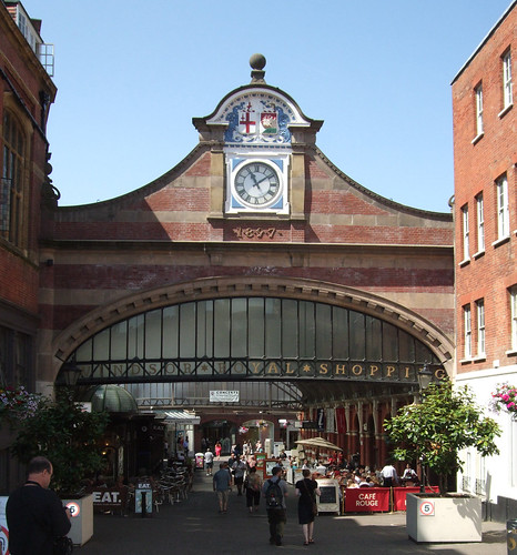
As a large scale visitor attraction Windsor did have the advantage over Crystal Palace and in the 1980s British Rail rebuilt the station in partnership with Madame Tussauds of waxworks fame to house an exhibition on Royalty and Railways, for which a full-sized replica steam locomotive called The Queen was built at Swindon. This closed in the 1990s but the building then found a new role as a spectacular shopping mall known as Royal Windsor Shopping. Nearly all the spaces between platforms have been filled in, along with the old goods yard, and are now lined with shops, while many of the station structures house restaurants. A wooden building -- presumably also an original feature -- is now an information centre. The loco is still there, though apparently robbed of its original firebox, and some of the old railway signs are still in situ. But the only section now in railway use is one short platform and a booking office at the far west end of the complex, a pitifully thin strand of permanent way almost lost in a thick sleeve of retailing. In some ways it's sad to see the immense Victorian Jubilee arch with its grand clock and arms of London and Windsor now welcoming you to a globalised lineup of middle market brands and chain restaurants, but at least there's still life in the proud old edifice, unlike Crystal Palace.
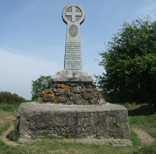
This time, rather than wiggling through alleyways and across car parks, I simply follow High Street and Thames Street down the valley, past one of the castle gateways and a striking war memorial to the historic bridge over the Thames. There's been a fixed crossing at this strategic point since at least the 1100s, but after centuries of wooden bridges requiring constant rebuilding, the current bridge, designed by architect Charles Hollis using the then-new wonder material of cast iron, was opened in 1824, originally as a toll bridge. As far back as the 1830s there were concerns that the cast iron would crack, but in fact the bridge survived many years of traffic levels far in excess of those Hollis could have envisaged before emergency action had to be taken in 1969, resulting in the bridge being closed to traffic in 1970, and a subsequent and not uncontroversial decision to pedestrianise it permanently. It was last refurbished in 2002, reopened by the Queen as part of her Golden Jubilee celebrations, after a period when even pedestrian movements had to be restricted. Today it's difficult to imagine this elegant bridge in its peaceful setting carrying heavy through traffic from the south coast bound for the Midlands.
On the Windsor side, a house that once belonged to architect Christopher Wren (whose work will feature in a good few future walks) is now a hotel, while off to the right is the landing stage for Salters Steamers, who once offered regular steam packet services along the Thames from Oxford to Richmond and Putney. Their business is now the leisure market and their routes much shorter and less regular but it's still possible to combine a boat trip with a riverside walk. Once on the bridge we've already joined the Thames Path, which crosses the river here, and which you could if you wish follow downstream towards Kingston (for the London Loop), Richmond (for the Capital Ring) and central London, although it's a meandering, roundabout journey this way. In joining the national trail here we're also rejoining European long distance path E2, which we've dallied with before along the North Downs Way and the River Wey Navigation -- it's also a roundabout route from here back to Wisley via the E2, involving a dogleg through Weybridge.
Windsor and Eton face each other across the river like Strasbourg and Kehl, Newcastle and Gateshead or Buda and Pest (more of them later), and on the other side we're welcomed to Eton and to the North Bank of the Thames by Wendy Ramshaw's curious sculpture installation from 2000: six distinctive stainless steel bollards, the one nearest the bridge surmounted by a viewing lens.
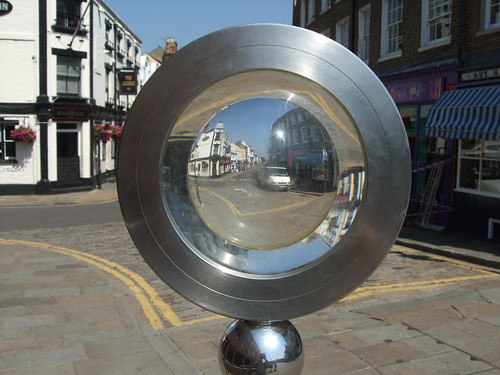
If your view of Eton is distorted it's likely not by Ramshaw's optics but by its association with Eton College, the educational establishment responsible for turning out generations of Britain's ruling class. Its list of old boys -- and yes, it's still only boys -- includes 19 prime ministers (perhaps soon to be 20 if David Cameron is successful at the next election), many royals and senior military officers, countless captains of industry and influential media and intellectual figures and a choice handful of KGB agents. It was founded by Henry VI in 1440, like many similar institutions as a philanthropic foundation for the education of the poor, and endowed with a good income through extensive land holdings. Today only about 10% of the students -- the King's Scholars -- attend through competitive scholarships, while the rest, known as Oppidans, enjoy the privilege mainly because their folks can find £28,000 a year in fees. And yet it's still a registered charity, and even has an appeal on its website for additional financial support, with donations qualifying for Gift Aid.
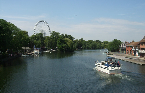
The school is up the High Street but I'm not planning to detour so I'll content myself with walking through some of its land, the first tranche of which is reached down Brocas Street, just after the bridge, where a path by the side of the Eton boathouse leads to the water meadow of the Brocas, now open as a public space. This is already a classic Thames-side setting, with locals enjoying the sunshine, sitting on the grass and looking at the boats. Across the river is Alexandra Gardens and the Royal Windsor Wheel, a semi-permanent 50m observation wheel seating visitors in enclosed capsules -- and surely sited here as a conscious echo of the much bigger (134m) London Eye at County Hall on the South Bank, a good way downstream.
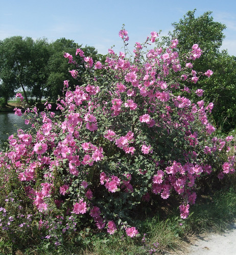
Seeing the wheel draws attentiono to the contrasting aspects of the river at both points, and underlines the fascination of a long river like the Thames, which grows from an erratic trickle to a vast and airy estuary. Walking the Thames Path, you'd witness the change gradually, but with a circular route such as the present one we're sampling the river at points significant distances apart, and it's hard to imagine we're encountering the same watercourse. At Gravesend the Thames was broad and tidal, a landscape of lighthouses and big boats from faraway places and mudflats that reeked of the sea. Here it's tamer, narrower and more intimate, and you can wave to the people on the boats and see their smiles as they wave back. The weather accentuates the contrast -- in Gravesend at the beginning of March it was grey and overcast, the river bleached pebble grey. It's now late June and the rich greens of vegetation, the green-brown Thames water, spectacular splashes of pink flowers and the red primary colours of the boats shine in bright sunlight.
This is the Edwardian Sylvan Thames of gentlemanly leisure and wicker hampers from Fortnum and Mason or Jerome K Jerome's Three Men in a Boat, the most English face of the river, imagined as a cosy stream locked off at Teddington from that other more dangerous Thames that flows through the cosmopolitan metropolis and out towards the North Sea, where, deep beneath the waves, it meets the waters of its estranged parent the Rhine. And yet, it is the same Thames, its ancient geological traces still reaching to the mainland under the water somewhere off Flanders. And its intimacy and gentleness are deceptive. It's the Thames of Mole, Ratty, Toad and Badger in The Wind in the Willows by Kenneth Grahame, who though born in Edinburgh grew up in Cookham. And for all the childhood innocence mention of that book evokes, the river still has a mysteical side. You can well imagine a mythical faun sirening Krishna-like on its flute from a half-forgotten osier-draped eyot, as happens in the novel's curious episode 'The piper at the gates of dawn'. The faun then wipes Ratty and Mole's recollection of the encounter, "lest the awful rememberance should remain and grow, and overshadow mirth and pleasure, and the great haunting memory should spoil all the after-lives of little animals helped out of difficulties, in order that they should be happy and light-hearted as before."
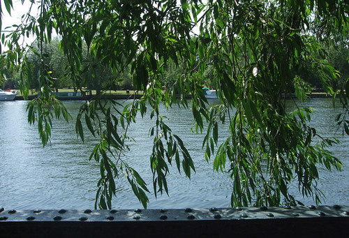
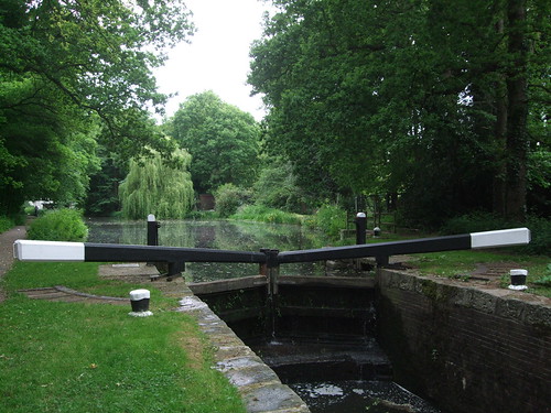
The designation "towpath" also highlights a contrast, for this isn't an artificially created canal like those we've previously encountered, but a natural river, improved for navigation but still wide and uneven, its meanders unpredictable. A margin of overgrowth and secondary woodland now hugs the riverside itself, providing an insurmountable obstacle to anyone who tried to use the towpath for its original purpose today. In places the river splits into several channels which then recombine, the areas of land thus isolated known in the Thames' own specific vocabulary not as "islands" but as "eyots" or "aits", derived from Old Norse "ey", the same root that gives the Isle of Skye its name. Locks are not neat black-and-white structures operated by passing boaters, but semi-industrial hydraulic installations with dedicated staff, baby brothers of the sort that admit sea-going container vessels into commercial docks. At each lock the river splits, so while the boats descend in controlled stages, the main flow plunges down a noisy weir that might imperil the heroine of the rapidly-edited climax of a silent epic by DW Griffith. Turbulence is never far beneath tranquility.
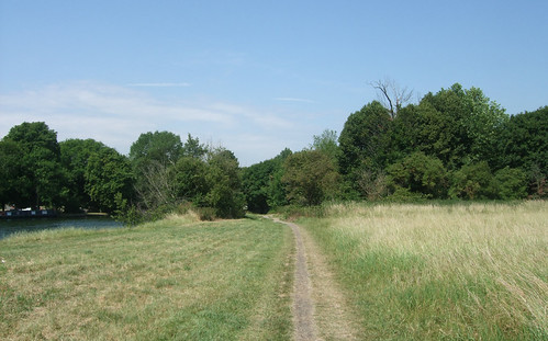
At the end of the Brocas the path passes under two bridges. First, Windsor Railway Bridge which carries the Great Western's Windsor branch, built by Isambard Kingdom Brunel in 1849, the world's oldest wrought iron bridge still in regular use and a forerunner of Brunel's spectacular Royal Albert Bridge linking Devon and Cornwall across the river Tamar. The great engineer cut his professional teeth on crossing the Thames, as project manager on his father Marc's Thames Tunnel between Wapping and Rotherhithe which we'll encounter on a later journey. Compared to that near-disastrous undertaking, this elegant bridge must have been a minor challenge, once the objections to the railway were overcome -- the College authorities thought it would facilitate truancy. Just upstream is the concrete Queen Elizabeth Bridge which carries the A322 Windsor bypass, opened in 1966 as the first bridge on the stretch of river between Windsor and Maidenhead, and since the pedestrianisation of Windsor Bridge the only direct link for motor traffic between Windsor and Eton. The route is shared for a while with National Cycle Route 4 (NCN4), the Thames Valley cycle route, which ultimately connects London and Fishguard, though the distinction seems academic as cyclists use this whole stretch of the riverside path even where they're not supposed to. There's quite a network of off-road cycle paths around Windsor and Eton which are not too busy and also make attraactive and very accessible routes for walkers, so you could easily combine a Thamesside walk with a circular route of your own devising.
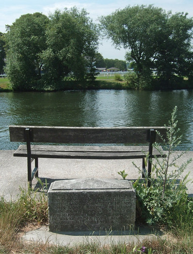
After the bridge a meander in the river creates a little headland and Chesterton chooses a path that cuts the corner, though the Thames Path sticks to the riverside. The two routes rejoin to run along the southern edge of another open space owned by the College, South Field, stretching up to the satellite hamlet of Eton Wick. Here the path passes a rather lonely spot that is a student "bathing place" (why does that term sound vaguely sordid?) known with unashamed public school pretentiousness as Athens. A bench marks the spot, while an inscribed stone records that the place was donated to the College by a father to commemorate a son killed in a flying accident in 1917.
So far we've been walking in the borough of Windsor and Maidenhead which, as explained on a previous walk from West Byfleet to Sunningdale, was part of the county of Berkshire until that was abolished in 1998 in favour of unitary authorities. But unsurprisingly the Thames itself forms a much older territorial boundary dating back before London became an administrative entity, for centuries separating off (almost completely consistently) Kent, Surrey and Berkshire on the south bank from Essex, Middlesex, Buckinghamshire and Oxfordshire on the north. From the 19th century onwards there have been various adjustments with administrative areas advancing and retreating in salients across previously alien riverbanks. Eton was once in Buckinghamshire, but in 1974 the boundary was massaged up to the M4 and around Eton Wick to unite it with Windsor. At the end of South Field, the path crosses Boveney Ditch on a footbridge, and now the Thames is back to being a boundary again, with our route continuing on the Buckinghamshire side. This still retains its two-tier structure: right now we're in South Bucks District, although we've not yet left Windsor and Maidenhead for good.
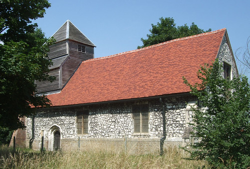
Shortly I pass my first Thames lock on the walk, Boveney Lock, originally built as a wooden lock in 1838. A little further is the tiny, isolated church of St Mary Magdalene, Boveney, dating from the 12th century and originally built to serve boat workers operating from a now-vanished adjaent quay. It's a pretty little chalk and flint building with a wooden tower and, apparently, with many rare 18th and 19th century vernacular fittings in the interior. Part of the parish of Eton, it was declared redundant in 1975 and was taken on in 1983 by the Friends of Friendless Churches. It's undergoing a lengthy restoration that has struggled for funding and consequently isn't complete, so the building is currently closed. Just behind it is the hamlet of Boveney with several Tudor wooden-framed houses.
A little further on you pass a contemporary-styled boathouse of steel and perspex and beyond this, if you look through the trees to your right, you'll catch sight of a huge expanse of water. This is Dorney Lake, Eton College's still water rowing course, constructed to provide a more controllable venue for rowing than the Thames. It was constructed between 1996-2006, mainly by Maidenhead aggregates company Summerleaze, a name that will crop up a few more times on today's walk. The site, which includes an arboretum and nature area, is generally open to the public although only at limited access points: you can reach it by following the footpath to Boveney behind the church or the cycle route by Summerleaze Bridge upstream but it's firmly fenced off, in some places by traditional hedge-laying techniques, from the Thames Path. No doubt this protection will be reinforced over the next few years as the lake is set to host the rowing events in the London 2012 Olympic and Paralympic Games.
Soon on the opposite bank you'll see Windsor Marina, "in a tranquil garden setting" according to its owners, and then the distinctive elaborately castellated profile of Oakley Court, built for Sir Richard Hall-Say in 1859, allegedly in the style of a French château in order to comfort his young and homesick French wife. If its fairytale towers and crenellations seem familiar, it might be that you've watched too many 1960s British films. The big white house next door is Down Place, built in 1750, which in 1951 became the base of British production company Hammer Films, later named Bray Studios. Hammer also made much use of Oakley Court, and when the owner died in 1965 the neighbouring property became an effective extension of the studio for a while. It's most famous for appearing in Hammer's horror films, reviled by critics in their day but since justly lauded and celebrated, though many other movies were made there -- it's also recognisable as notorious girls' boarding school St Trinians. As in Los Angeles, London's film industry went west, and Bray is the westernmost of a number of familiar names we'll encounter on these walks, including Denham, Ealing, Elstree and Shepperton.
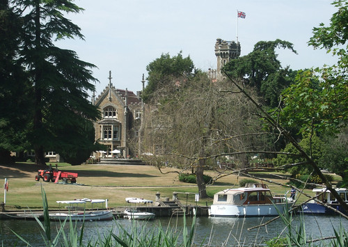
Hammer's most enduring icon is Christopher Lee in the role of Dracula, a character that regularly prowled Oakley Court. In Bram Stoker's novel Dracula (1898), which first codified much of the contemporary vampire myth, the bloodsucking Transylvanian count establishes his London base at Carfax Abbey, Purfleet (actually still just outside London but that's a discussion for another time), another Thameside site, much further downstream into the estuary, which we'll visit on the London Loop. Since Purfleet is on the north bank, the count would have needed to take care to visit Bray as, according to Stoker, crossing running water unaided is one of the many things there's a law against for the Undead. Bray Studios is still used for TV production, while Oakley Court has been a luxury hotel since 1981. If visualising a cloaked Christopher Lee baring his fangs on the well-manicured lawns doesn't suit you, then bear in mind it was also the location for the enduringly popular musical horror spoof The Rocky Horror Picture Show (1975), so imagine Meat Loaf, Susan Sarandon and Christopher Biggins doing the Time Warp in fishnets and suspenders instead.
The path then runs alongside the narrow channel of the river separating thickly wooded Queens Eyot, also owned by Eton College, from the bank, and reaches another junction with NCN4, marked by what I believe is our first sighting on the Countryway of one of the National Cycle Network's eccentric Millennium Mileposts. This one is one of the "Fossil Trees" designed by John Mills, the first such posts to appear on the network in the 1990's. They were conceived by network champions Sustrans as a way of providing the routes with distinctive and memorable landmarks, but conveniently, they're also classed as public art rather than traffic signs, therefore avoiding the strict regulations imposed on traffic signing by the Department of Transport, which would prohibit, for example, the Millennium Commission and Royal Bank of Scotland sponsor logos clearly displayed here. Oddly, the Mileposts aren't actually very good at indicating the route accurately, as can be seen here, so they're inevitably supplemented with various cycle route waymarks.
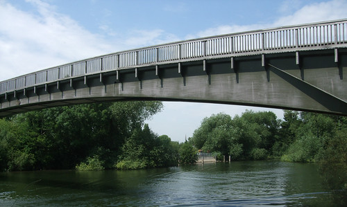
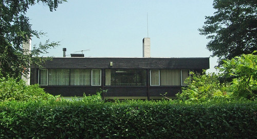
NCN4 is only with us for a few metres before crossing the Thames on the simple but elegant wooden Summerleaze Footbridge, which links to paths to Bray. The bridge is named after the aggregates company, and conceals a conveyor that was used to move spoil during the construction of Dorney Lake. Just past it the path runs along what are clearly the ends of posh house gardens: the first house in the row is a surprising modernist building faintly influenced by Frank Lloyd Wright, the sort of place they once thought we'd all be living in by now, probably watching jetpack squash on our holographic wallscreens while we enjoyed a meal of vitamin pills.
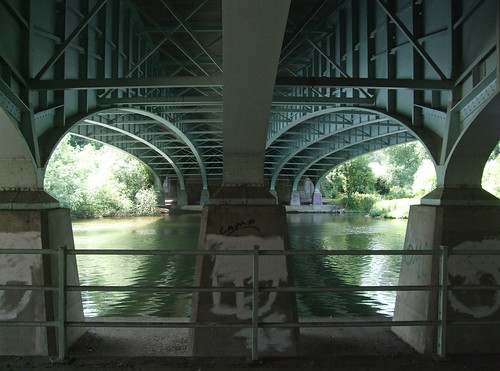
A little further on the path passes under a no-nonsense concrete bridge carrying the M4 motorway, the third of the radial motorways we've crossed so far. This section is one of Britain's earliest stretches of motorway, originally planned before World War II as the Maidenhead bypass, one of a series of bypasses envisaged along the A4 trunk route from London to Bristol and South Wales, and the first phase of construction had actually begun when war broke out in 1939. After the war, the decision was relieve the A4 completely by creating a new motorway route, so when the bypass was finally opened in 1963, it was as a motorway. Originally only two lanes, it was widened in 1971 to three, at which point the bridge would have been rebuilt. From the riverside you can barely glimpse passing lorries, and underneath the deck, despite the noise from above, the geometry of the bridge reflected in the water seems unexpectedly peaceful.
There are steps here to access pedestrian walkways which piggyback on the motorway to link with the Green Way walking route, more of which later. But instead I continue ahead along the river, past Bray Lock, dating from 1845, soon enjoying a view of Bray itself on the opposite bank, with pretty houses round a slipway looking a little like a film set.
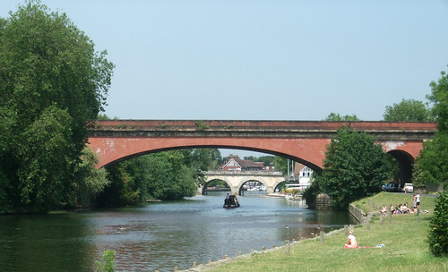
After this it's not long before the house gardens start again and the towpath becomes a surfaced riverside street lined with colourful cottages, with two further historic bridges ahead. The first is one of Brunel's unchallenged masterpieces, the 1838 Maidenhead rail bridge, the setting for JMW Turner's painting Rain, steam and speed (1844).
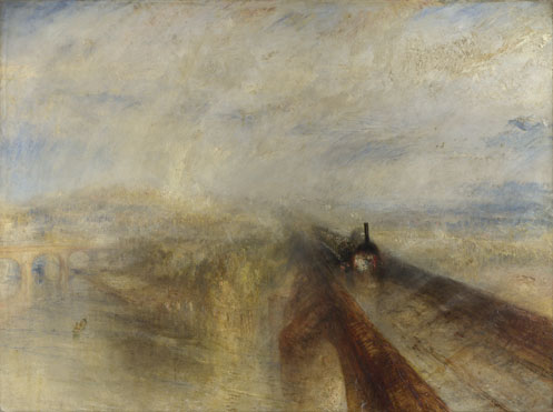
The bridge marks our first encounter with one of the great long distance main lines that in the 19th century first reached out from London to the far corners of Britain. South of the capital the tangle of commuter lines in the relatively compressed and densely populated space between city and coast makes it difficult to identify real main lines, but follow the Great Western from Paddington and it could be 491km before you finally hit the buffer stops in Penzance. The section from Paddington to Maidenhead was the first to be completed, so the bridge is a magnificent final gesture of the opening performance.
Its two brick arches were the widest and flattest in the world, a design dictated by the river's width and Brunel's desire to avoid a hump that would disturb the railway's flat gradient. Originally the Great Western was built to broad gauge of 2140mm and the bridge carried two tracks, but by the end of the 19th century it had been brought into line with the narrower 1435mm gauge adopted as standard by most of the railways of Britain and mainland Europe, and has since been enlarged to carry four tracks. In the next few years the view of it is likely to change significantly when the line to Maidenhead is electrified with overhead catenary as part of the Crossrail project. One side effect of the bridge's design is the acoustic properties of the arches which give a marked and lengthy echo that can be enjoyed from the towpath, thus its nickname 'the sounding bridge.' Download audio clip (WMA, 75kB).
The second bridge is Maidenhead Bridge and carries a much older long distance transport link -- the "Bath Road" or "Great Western Road", the ancient highway from London to Bath. A wooden bridge stood here as early as 1280, but the current bridge with its thirteen elegant stone arches dates from 1777. Tolls were charged to cross the river here for centuries until a legal challenge in 1903. The road is now classified as the A4, the third single digit radial A-road we've crossed, although unlike the A2 and A3 it's no longer a trunk road, having been superceded by the M4. The bridge remains something of a local bottleneck. The Thames Path and London Countryway use it to cross the river to Maidenhead, leaving Buckinghamshire temporarily for Windsor and Maidenhead borough's second major town.
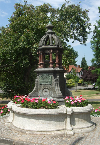
The route passes the small park of Bridge Gardens, occupying a corner between river and roads, and by a fine late Victorian fountain turns north to continue tracking the river along Ray Mill Road. This area by river and bridge is in fact the town's historic core, though in coaching days the centre of gravity shifted further west along the High Street to the Bath Road's crossing of the inland route to Windsor and Marlow, an area which grew further when the railway station opened nearby. I pass up the temptations of the current town centre and keep close to the Thames, past signs welcoming me to Maidenhead Riverside.
Despite the council's best efforts in installing hanging baskets along this stretch, it's hard to imagine what is now a rather dusty road, quite busy with traffic, as one of the most fashionable stretches of the Thames. The former pleasure gardens, just across the road, is now simply called Riverside Gardens and is an uninviting expanse of car park, lacklustre play area and areas of bare grass with few seats and little shade, though the chalet-style park café still does a good trade. Yet this was the place that Jerome K Jerome cuttingly described in Three Men in a Boat as "too snobby to be pleasant. It is the haunt of the river swell and his overdressed female companion. It is the town of showy hotels, patronised chiefly by dudes and ballet girls. It is the witch’s kitchen from which go forth those demons of the river – steam- launches. The London Journal duke always has his 'little place' at Maidenhead; and the heroine of the three-volume novel always dines there when she goes out on the spree with somebody else’s husband."
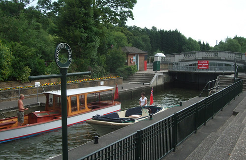
The former epicentre of the snobby, showy, overdressed Maidenhead of adulterously spreeing dudes and ballet girls is reached at Boulters Lock -- a "boulter" being a miller, referring to a nearby mill. There have been a succession of locks at this point since the late 16th century but the current layout dates from 1912, by which time it was well-established as a popular calling point for boating parties of the chattering classes, especially during the Ascot races -- a scene memorably portrayed by painter Edward John Gregory in Boulter's Lock, Sunday Afternoon.

It may no longer be the pinnacle of high Victorian leisure but it still maintains some appeal as a destination, with a hotel, bar, restaurant, refreshment kiosk and plenty of boats to watch on the lock. The adjoining Ray Mill Island is now an attractive park with an aviary, guinea pig zoo and some interesting public art.
The London Countryway parts company with the Thames Path and the E2 at Boulters Lock along what turns out to be a very interesting route through the varied landscape in the crook of the river between here and Marlow. At first it runs through the residential streets of the Maidenhead suburb of Summerleaze, from which the privately owned aggregates company that built Dorney Lake took its name. Their connection to the area is clear on the map: the two ragged edged lakes concealed behind the houses on both sides of Summerleaze Road are the obvious legacy of gravel extraction, while the landfill site at the end of the road is another of their enterprises.
A track runs from the entrance to the landfill site past the larger of the lakes -- Maidenhead Lake, base of the local sailing club -- and out into an unexpectedly intriguing patchwork of open space, with restored workings, arable fields, waterways and marshes flanked by ancient commons owned by the National Trust and council recreation grounds. Even the farmed bits have good access, with a network of broad, well-signed paths, creating a coherent space that has the feel of a single country park. The Environment Agency has a hand in this as the area plays a key role in the Thames flood relief scheme, with a concrete "bund" cutting across the middle of it from west to east. A few metres off route, just on the other side of a ditch and on the approach to the cricket and football ground, is a rather joky sculpture depicting a yawning mother hippopotamus and her calf -- I couldn't find an explanation for its origin or significance, unless it's a reference to the marshiness of the environment.

Just along the hippos' ditch, the Countryway joins one of southeast England's lesser-known signed walking routes, the Green Way, originally created by the old Berkshire County Council with input from the Ramblers in the late 1980s. This runs from Bray, with a link to the Thames Path over the M4 bridge, alongside several small waterways and through green spaces, passing through the centre of Maidenhead and on to Cookham, with another link back to the Thames. With various alternative routes and links, it's a total length of 19km. In the keywords I've called it the Green Way Maidenhead to distinguish it from other routes with similar names. Another potential confusion is that the term "greenway", without the space, has become a generic term for an off-road "multi-user" route accommodating walkers and cyclists, while the Green Way, though parts of it coincide with designated cycle routes, is promoted exclusively as a walking route.
The Green Way wiggles to include the National Trust commons and the London Countryway, which in any case predated the signed route, doesn't adhere strictly to it, preferring a straight course through flat fields and up the gently inclined concrete of the Environment Agency's flood relief bund. The two routes rejoin to run beside Strand Water, part of a minor Thames tributary that widens into a long, thin pond. The surroundings remind me of the marshy landscapes that flank the river further down into the estuary, on the other side of London; it's as if a chunk of the maritime Thames has migrated upriver.
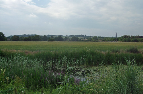
The path emerges by Moor Hall, a rambling complex centred on a mid-19th century mansion that's now the headquarters and conference venue for hire of the Chartered Institute of Marketing. The Hall sits on the southern edge of Cookham Moor, a rather bleak, heathy common that divides the village of Cookham in two. To the east, the historic village centre clusters on the riverside at Cookham Bridge -- it's best known as the home of early 20th century English quasi-primitivist painter Stanley Spencer, who set many of his works round here, and there will be more to say about it when I walk the Thames Path. To the west, linked across the moor by a raised causeway and parallel road, The Pound, is Cookham Rise, which grew up from the 1850s around Cookham station on the Marlow branch line. At Cookham there's also the opportunity of picking up another signed path back towards the edge of London -- the Beeches Way, a Buckinghamshire County Council route, starts just on the other side of Cookham Bridge and runs for 25km via the City of London-owned public woodland of Burnham Beeches to West Drayton on the Grand Union Canal and London Loop. This is also the route of the Shakespeare's Way linking Stratford-upon-Avon with the Globe Theatre at Bankside, London, following the Thames Path from Marlow to Cookham then the Beeches Way on its eastbound journey.
Across the Pound and through the National Trust car park we reach the end of the Green Way, passing an information board about it. and pick up a path signed as an easy access route -- although an unaided person in a conventional wheelchair might struggle a bit on the unsurfaced paths. It's soon obvious our course is parallel to the river, with boats and Thames Path walkers visible on the right, across the Strand stream and a water meadow known as Merlins Mead -- I'm unsure of the connection with the Arthurian figure of myth, if any. The path runs on a very slightly higher contour, and on the left there's a wooded bank, the beginnings of what becomes quite a dramatic change in the landscape.
There's one more link path to the Thames and then the route starts to bear away from the river, burrowing under the railway through a near cylindrical arch in a damp old brick bridge. And then, to the left, a more obvious grassy ridge begins to rise, such a contrast to the flat surroundings that you can almost identify the exact spot at which it first breaks ground. The springy turf and streaks of erosion reveal it's composed of chalk, our first sight of the Thames basin chalk erupting to the surface since the Countryway's descent from the Sheepleas at West Horsley. It's actually an outlying ridge of the North Wessex Downs, the name given to the chalk ridges southwest of London, but it acts as a foretaste of much more to come when we enter the Chilterns.
Here the Thames starts to bend west towards Marlow, and the river deposits caught between this bend and the chalk ridge have built up into what's now the National Trust's Cock Marsh, with bronze age long barrows and a popularity with wading birds that qualifies it as a Site of Special Scientific Interest. The path now becomes a broad chalky track that starts to mount the flank of the ridge, climbing above the marsh through dappled broadleaf woodlands to emerge on a road opposite a house called Chimneys -- its top-heavy Tudor-style stacks immediately giving a visual explanation for its name. The road brings us alongside Winter Hill, a stretch of open downland atop the ridge, with a small car park where locals park up, walk their dogs and sit in their cars gazing across the valley. There's a fine view across the riverside lakes at Westhorpe to Marlow and the hilly territories we'll soon be exploring around the Wycombes.
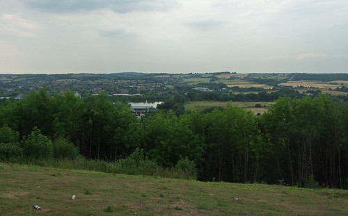
Behind the houses on Winter Hill the route enters a dense, rather gloomy woodland of mixed conifers and beeches known as Quarry Wood, first following a ridge path that curves up to a road and almost immediately plunging back into the wood on a steep, stepped descent back into the valley. The wood is part of Bisham Woods, an extensive strip along the top of the ridge, much of which is managed by the Woodland Trust and is a Special Area of Conservation. Kenneth Grahame is said to have been inspired to write The Wind in the Willows while walking in these woods -- they certainly could have been the inspiration for the Wild Wood in the novel, where small animals shouldn't dare to tread except in special circumstances.
Finally I reach the bottom of the hill and the road to Marlow, which passes the entrance of Longridge, an adventure and water sports centre for young people, much used by schools and youth organisations. Looking back, you can see the distinctive shape of the wooded ridge stretching away westwards, clearly delineated from the flat Thames flood plain at its foot.
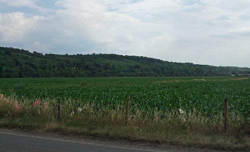
Our road passes under the A404 Marlow bypass, a relief for the old route from London to Maidenhead through the Chilterns and one of the few non-trunk roads we've encountered that actually carries the same number all the way to London, in this case starting at Paddington and initially running along Harrow Road. Soon the outlying houses of Bisham, Marlow's opposite number on the Berkshire bank, start to appear and I'm approaching the Thames once more.

Marlow Bridge is a graceful suspension bridge, the only suspension bridge over the non-tidal Thames, designed by William Tierney Clark and opened in 1828, replacing a succession of wooden bridges dating back to the 16th century. It's one of only two of Clark's suspension bridges to survive in use, the other one being the Széchenyi lánchíd over the river Danube, or as it's known locally, the Duna, linking Buda and Pest in Hungary, built to a similar design but on a grander scale as the the first permanent bridge in the city and in its day the longest in the world. The connection between Marlow and Budapest is commemorated on a marble plaque on Marlow Bridge in both English and Hungarian, the latter one of the more unexpected languages I would have anticipated appearing on a inscription along the London Countryway.
I linger on the bridge for a few moments, my eyes following a boat heading up in the direction of Henley, Reading and Oxford. This is the last junction with the Thames Path, and the point where the Thames itself fades from the view of this blog, the furthest point upstream of our London walks, and our last view of the river on the London Countryway until just before the end of the route, where we emerge on the north bank of the estuary just below Tilbury. It'll be a very different Thames that greets us then. It's also a farewell to the E2 which, if you were so inclined, would take you on from here to Oxford, Cannock Chase, along the eastern edge of Greater Manchester and along the Pennines before crossing the border and turning west along the Southern Upland Way to the port of Stranraer and its ferries to Belfast. The Thames Path junction is also where we pick up the only minimally signed Shakespeare's Way which shares the route of the Countryway very briefly on its way to Stratford-upon-Avon (in the other direction, as mentioned above, it follows the Thames Path to Cookham then the Beeches Way).
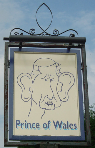
Aside from being a settlement on an important European river, Marlow has little in common with the bustling Hungarian capital -- it's a small but attractive market town, with roots as an Anglo-Saxon borough, and its celebrated previous residents include 18th century psychiatrist Dr William Battie, from whose name derives the expression "batty" to describe mental instability. There's no crumbling Hapsburg grandeur on show, though there is a fine church, dating from 1835, which makes a good match with the bridge, and Marlow Place, an impressive early 18th century house. The latter is just off the main route of the Countryway, on the way to the station; just a little further on is the Prince of Wales, a rambling mid-19th century pub that raises a final smile with its sign, a rather unflattering caricature of the current holder of that title.
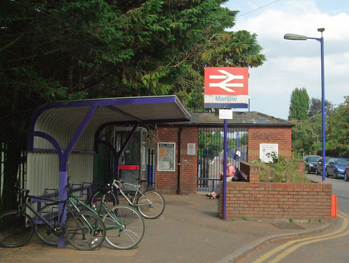
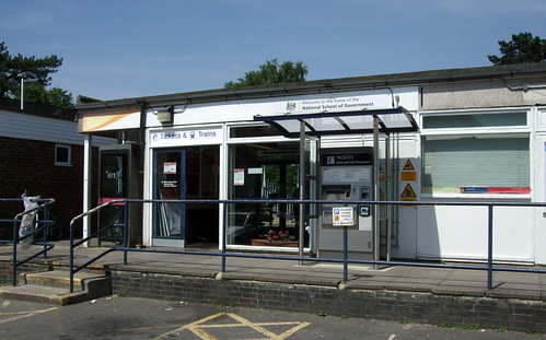
Marlow station is tucked away to say the least. The line was opened in 1873 as a short spur to Bourne End, a little downstream, where it connected with the line from the Great Western Railway at Maidenhead to High Wycombe, dating from 1854. The steam locomotive that worked the line came to be known as the Marlow Donkey, and that nickname has since extended to the service itself, also being borrowed by a nearby pub. The connection between Bourne End and High Wycombe fell victim to the savage postwar trimming of Britain's branch line network, finally closing in 1970, leaving Marlow as the terminus of the branch, with Maidenhead trains rather awkwardly reversing out of Bourne End. Today it's just a well hidden single platform with little more amenity than the average bus stop despite its urban setting. Perhaps the country halt feeling is a sign we're about to stray as remote from London as the Countryway will allow.
Download a route description PDF
View a Google map http://maps.google.co.uk/maps/ms?ie=UTF8&hl=en&oe=UTF8&num=200&start=219&msa=0&msid=117966169375523396049.00046414d40d8252e7b70&ll=51.550605,-0.714111&spn=0.191284,0.441513&t=h&z=11
View a Google map http://maps.google.co.uk/maps/ms?ie=UTF8&hl=en&oe=UTF8&num=200&start=219&msa=0&msid=117966169375523396049.00046414d40d8252e7b70&ll=51.550605,-0.714111&spn=0.191284,0.441513&t=h&z=11
More information
- Royal Borough of Windsor and Maidenhead http://www.rbwm.gov.uk/
- Windsor Tourism http://www.windsor.gov.uk
- Windsor Parks and Open Spaces http://www.rbwm.gov.uk/web/parks_openspaces.htm
- Windsor Public Rights of Way http://www.rbwm.gov.uk/web/prow_index.htm
- Windsor & Maidenhead walking leaflets http://www.rbwm.gov.uk/web/landenv_leaflets.htm
- David Nash Ford's Royal Berkshire History http://www.berkshirehistory.com/
- Slough to Windsor and Eton Line (Wikipedia) http://en.wikipedia.org/wiki/Slough_to_Windsor_%26_Eton_Line
- Staines to Windsor Line (Wikipedia) http://en.wikipedia.org/wiki/Staines_to_Windsor_Line
- Windsor Royal Shopping Centre http://www.windsorroyalshopping.co.uk/
- Windsor Castle (Royal Collection) http://www.royalcollection.org.uk/default.asp?action=article&ID=34
- River Thames (Environment Agency) http://www.environment-agency.gov.uk/homeandleisure/recreation/boating/31543.aspx
- National Trails http://www.nationaltrail.co.uk
- Thames Path National Trail http://www.nationaltrail.co.uk/Thamespath/
- River Thames (River Thames Alliance) http://www.visitthames.co.uk
- Salters Steamers http://www.salterssteamers.co.uk
- Windsor Bridge (Wikipedia) http://en.wikipedia.org/wiki/Windsor_Bridge
- Windsor's Bridges (Royal Windsor website) http://www.thamesweb.co.uk/windsor/windsorbridges/winbridge.html
- Eton Town Council http://www.etontowncouncil.org.uk/
- Eton (Eton Traders Association) http://www.eton.co.uk/
- Eton College http://www.etoncollege.com/
- Royal Windsor Wheel http://www.royalwindsorwheel.com/
- Windsor Railway Bridge (Wikipedia) http://en.wikipedia.org/wiki/Windsor_Railway_Bridge
- Queen Elizabeth Bridge (Wikipedia) http://en.wikipedia.org/wiki/Queen_Elizabeth_Bridge,_Windsor
- National Cycle Network Route 4 http://www.sustrans.org.uk/what-we-do/national-cycle-network/route-numbering-system/43
- Eton Wick History Group http://www.etonwickhistory.co.uk/
- Buckinghamshire County Council http://www.buckscc.gov.uk
- Visit Buckinghamshire http://www.visitbuckinghamshire.org
- Walking in Buckinghamshire (Visit Buckinghamshire) http://www.visitbuckinghamshire.org/site/walking-in-buckinghamshire
- Buckinghamshire Walks and Rides (Bucks CC) http://www.buckscc.gov.uk/bcc/row/getting_out_on_the_network.page?
- Buckinghamshire Leisure & Culture (including parks) http://www.buckscc.gov.uk/bcc/leisure/Leisure__culture.page?
- South Bucks District Council http://www.southbucks.gov.uk
- South Bucks Parks and Recreation http://www.southbucks.gov.uk/leisure__culture/parks_and_recreation/default.asp
- South Bucks Tourism http://www.southbucks.gov.uk/leisure__culture/tourism_and_travel/default.asp
- Dorney Parish Council http://www.bucksinfo.net/dorneypc/
- Boveney Lock (Wikipedia) http://en.wikipedia.org/wiki/Boveney_Lock
- St Mary Magdalene Boveney http://www.stjohnstjamesed.org.uk/page16.html
- Dorney Lake http://www.dorneylake.com/
- Bray Parish Villages http://www.brayparishvillages.com/
- Windsor Marina http://www.mdlmarinas.co.uk/mdl-windsor-marina/
- Oakley Court Hotel http://www.principal-hayley.com/venues-and-hotels/the-oakley-court
- Bray Film Studios (unofficial site) http://www.thestudiotour.com/bray
- Summerleaze Footbridge (Wikipedia) http://en.wikipedia.org/wiki/Summerleaze_Footbridge
- M4 Thames Bridge (Wikipedia) http://en.wikipedia.org/wiki/M4_Thames_Bridge,_Maidenhead
- M4 Motorway (Wikipedia) http://en.wikipedia.org/wiki/M4_motorway
- Bray Lock (Wikipedia) http://en.wikipedia.org/wiki/Bray_Lock
- Taplow Village http://www.taplow.org.uk/
- Maidenhead Railway Bridge (Wikipedia) http://en.wikipedia.org/wiki/Maidenhead_Railway_Bridge
- Great Western Main Line (Wikipedia) http://en.wikipedia.org/wiki/Great_Western_Main_Line
- Maidenhead Bridge (Wikipedia) http://en.wikipedia.org/wiki/Maidenhead_Bridge
- JMW Turner: Rain, Steam and Speed http://www.nationalgallery.org.uk/paintings/joseph-mallord-william-turner-rain-steam-and-speed-the-great-western-railway
- Bridge Gardens (RBWM) http://www.rbwm.gov.uk/web/parks_bridge_gardens.htm
- Riverside Gardens (RBWM) http://www.rbwm.gov.uk/web/parks_riverside_gardens.htm
- Boulters Lock (Wikipedia) http://en.wikipedia.org/wiki/Boulter%27s_Lock
- Ray Mill Island (RBWM) http://www.rbwm.gov.uk/web/parks_ray_mill_island.htm
- Edward John Gregory: Boulter's Lock, Sunday Afternoon http://www.liverpoolmuseums.org.uk/ladylever/collections/boulterslock.asp
- Maidenhead Sailing Club http://www.maidenheadsc.org.uk
- The Green Way (RBWM) http://www.rbwm.gov.uk/web/prow_publications-green-way-leaflet-download.htm
- Cookham Parish http://www.cookham.com/
- Moor Hall (Chartered Institute of Marketing) http://www.moorhallconferences.com/
- Beeches Way http://www.buckscc.gov.uk/assets/content/bcc/docs/row/promoted_routes/beechesway.pdf
- Easy Going Route: Cookham http://www.visitthames.co.uk/uploads/cookhamwalks08.pdf
- Maidenhead and Cookham Commons (National Trust) http://www.cookham.com/cookhamnow/clubssocieties/nationaltrust/NT%20guide%20web.pdf
- Maidenhead Commons and Cock Marsh (National Trust) http://www.nationaltrust.org.uk/main/w-global/w-localtoyou/w-thames_solent/w-thames_solent-countryside/w-thames_solent-places-countryside-list.htm#maidenhead_commons
- Marlow Branch Line (Wikipedia) http://en.wikipedia.org/wiki/Marlow_Branch_Line
- Bisham Parish Council http://www.bishamparishcouncil.org.uk/
- Bisham Woods (Woodland Trust) http://www.woodlandtrust.org.uk/en/our-woods/Pages/wood-details.aspx?wood=4424
- Longridge http://www.longridge-uk.org
- Marlow Bridge (Wikipedia) http://en.wikipedia.org/wiki/Marlow_Bridge
- Wycombe District Council http://www.wycombe.gov.uk/
- Wycombe Tourism http://www.wycombe.gov.uk/sitePages.asp?step=4&contentID=245&categoryID=1248
- Wycombe Parks and Recreation http://www.wycombe.gov.uk/sitePages.asp?step=4&contentID=239&categoryID=1132
- Marlow Town Council http://www.marlowtowncouncil.org.uk/
- All Saints Marlow http://www.allsaintsmarlow.org/
- Higginson Park http://www.wycombe.gov.uk/sitePages.asp?step=4&contentID=220&categoryID=3617
- Prince of Wales, Marlow http://www.the-prince-of-wales.co.uk





 Posts
Posts

