The London Countryway leaves the A413 and the South Buckinghamshire Way on the edge of Great Missenden to climb the east side of the uppermost reach of the Misbourne valley, tracing the edges of arable fields to continue its relatively uneventful journey across the rolling chalk ridges of the Chilterns Area of Outstanding Natural Beauty (AONB). Some sort of outdoor event is taking place in the fields just off the main road as I pass, with an assemblage of inflatable recreation facilities. So today's walk starts with a bouncy castle, and ends at Berkhamsted with a real ruined one.
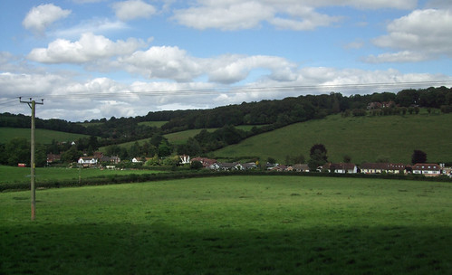
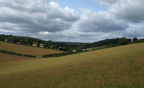
The path runs uphill relatively gently, with views behind to the Misbourne valley, to cross the first of a series of lanes running along the flat ridgetops.

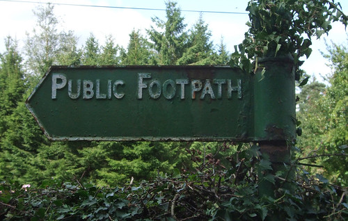
It emerges at a little collection of houses and farms at Potter Row, where by allotments there's an old style metal footpath sign pointing back the way we came.
Just where the next section of path strikes out across the fields is a small grassy square with a bench and a well head topped by some old mechanical lifting gear, looking serious enough to belong in a mine or quarry. Wells were a serious business up on these ridges: the porous chalk makes ground water scarce and the water table low, necessitating deep digging to reach it.

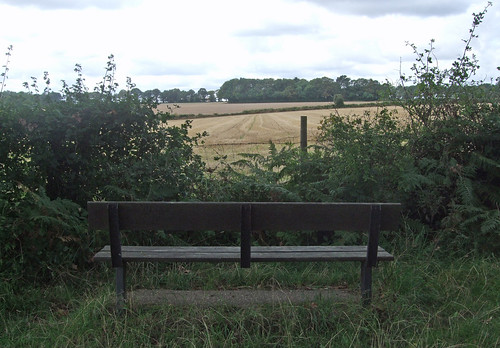
The next path cuts diagonally across more fields on clear paths, emerging onto a bridleway at Field Edge Grange where a bench tempts you to linger and enjoy the spot. then wiggles around a pretty farm and cottages at Field End Grange. The bench commemorates Emily Morris (1891-1976) and her three children, all now dead, of the Lee, the settlement just a little over to the left.
Beyond this the route descends slightly towards a strip of woodland which is presumably all that remains of Lee Common. Here the Countryway picks up a path that tracks the wooded strip, joining not only another section of the meandering Chiltern Heritage Trail but one of Buckinghamshire County Council's network of walking routes, the Chiltern Link. This short 13km trail was created to plug a strategic gap between the Chess Valley Way at Chesham and the Ridgeway at Wendover, and is based on an ancient trade route that used to link the two. In fact you can pick out a whole skein of almost parallel northwest - southeast roads and paths: the ridges and the routes fan out northwest from Chesham towards the main Chiltern dip.
Unlike many other European countries, no central organisation has yet emerged in the UK to oversee the development of a long distance walking network, but if ever anyone did set about sorting out the current sprawl, and conceived, for example, a long north-south route between Scotland and the south coast via London, their gaze might well fall on this little stretch of path through a pleasant but modest ancient Buckinghamshire woodland. Northwestwards, the Chiltern Link connects not only with the Ridgeway but the Aylesbury Ring, a circular route through the countryside around that town. A little way along that route, past Great Kimble, there's a junction with the North Buckinghamshire Way towards Milton Keynes. As mentioned in the previous section, the North Bucks Way is the first link in a longer chain of routes, the Midshires Way, connecting to the Pennine Way and the Pennine Bridleway National Trails that take ambitious walkers a long way north to the Scottish border. There are various options of shorter trails to close missing links in the Scottish Borders and Southern Uplands but you could reach Edinburgh, or Glasgow which has a continuous link to Inverness via the West Highland and Great Glen Ways.
Southeast the Countryway provides a link to the Hertfordshire Way; in turn this links to the Watling Chase Trail, the London Loop and the Dollis Valley Greenway, with the potential of a link through Hampstead Heath, along the Belsize Walk and through Regents Park to central London, a trajectory I'll eventually explore in more detail in this blog.
The Chiltern Link reaches a lane at Ballinger Bottom, a cluster of pretty cottages in a well-wooded dip, and from here there are several parallel routes tracking the edge of a ridge. The Countryway chooses a pleasant bridleway that hugs the northern edge of another strip of rich beech woods, with fields sloping steeply up to the left, leaving the Link past a tree house, though take care as the junction is narrowly angled and the fingerpost points between the two options. After a more open section the bridleway zigzags around the edges of blocks of woodland adjoining at right angles -- the paths here are very well kept and well signed, with the local parish council of Chartridge using their own bridleway signing.

After a short sharp climb the route joins a fine track between old hedges, hugging a contour with open views of fields, almost as though you're flying across the ridges. Reaching Chartridge I pass a cricket ground with a match in progress, and note with some surprise that this is the first example of such a stereotypically rural English scene that I've encountered on the whole walk, and so late in the season. Here once again the route dallies with the Chiltern Heritage Trail.
Chartridge -- "Caerda's Ridge" from an Anglo-Saxon personal name -- is a linear ridgetop village on what became the metalled road from Chesham to Wendover (these days it's faster by car to head for Great Missenden and take the A413). On the corner where we join the village street is Chartridge Village Hall and Reading Room, converted from an old blacksmith's shop in 1919 by Caroline Franklin, wealthy founder of the local Women's Institute.

Wheeler and her husband lived at Chartridge Lodge a little further towards Wendover, which they expanded and converted from a modest farm into a luxury home. It's now a posh residential conference centre and the base of a company that owns a whole network of such venues.
The path from Chartridge leaves by Chartridge Mission Church, a simple, small and neat chapel originally built for the Baptist congregation in 1844. I've noticed a number of these little chapels along the way and wonder if historically nonconformism had a particular appeal in the Chilterns. The path passes some pretty white cottages, one of which, in an unexpected echo of inner London, appears to have borrowed an Underground station sign from the Angel Islington, on display below a hanging basket. Angel is also on the route of the Jubilee Greenway. I'm becoming aware that the architectural character is changing, with flints giving way to stone and whitewash.

Then it's down and up again, with fine views behind, to the next ridgetop hamlet, Asheridge, little more than a row of houses along a lane.
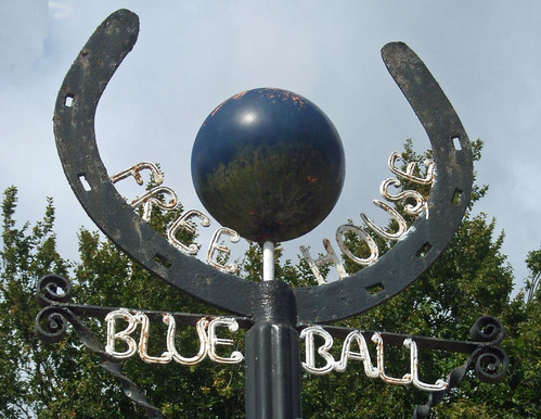
Here, turn left for a few paces rather than right to find a decent small pub, the Blue Ball, with an unusual sign: rather than the traditonal painted board, there's a three dimensional blue ball surrounded by a horseshoe at the top of a post. Patches of corrosion on the ball look strikingly like the continents of a fictitious planet, set against azure oceans.
From Widmore Farm, Asheridge, a concrete track passes a curious black wooden building on stilts and runs through fields where, here at the end of summer, rolled bales of hay form random patterns.

Then once more down and up, through a small wood, Widmore Wood, and up the next valley edge. Keith Chesterton, devisor and original describer of the Countryway, compares these waves of dry valleys to the Welsh Borders and you can see what he means, yet you could walk briskly to the tube station at Chesham from here in less than an hour. I wonder if the prevalence of chapels subconsciously reinforced the comparison.
On the next ridge is the more sprawling linear hamlet of Bellingdon, with another chapel. Here the route wiggles to pick up an old byway towards Ramscoat Wood. There is no right of way on the desire line straight down the ridge, but, writing in 1981, Chesterton tips his readers that local people simply go straight ahead down the edge of the wood anyway. In the intervening years someone has decided to put a stop to this, installing a sturdy fence, restoring the hedgerow and putting up "No public right of way" signs. I fail to understand this mindset -- I can't see any good land management reasons why the public shouldn't walk down the edges of these particular arable fields as it does along so many others that have an official right of way. Landowners may be concerned about the legal principle of presumed dedication, where if people use a path for 20 years without any evidence of a landowner trying to prevent them, it's presumed the landowner intended to dedicate the path as a right of way. But there are ways round this by opening up a path permissively with notices denying there's any intention to dedicate.
I duly walk around three sides of a square, cutting through the centre of the wood on the byway and then tracking back along the other side of it, briefly entangling with the Chiltern Heritage Trail again, before resuming my course uphill. Just below the summit, a more public-spirited person has placed a picnic bench in a well-chosen spot.

This is Hawridge, but there's no village astride it at this point, just a broad field bisected by a ridgetop path. Crossing this I descend to Nut Hazel Cross, no more than a farm on a junction of minor roads, but enough to qualify for its own named traditional fingerpost. The junction sits on a parish boundary and may have had a special significance in "beating the bounds" ceremonies.
The thin band of woods at the top of the next rise is managed under the Chiltern Woodlands project, started as the Small Woodlands Project by the Chiltern Society in 1989 and now an independent charity that conserves local woodlands, supporting land managers to implement sustainable forestry and public enjoyment.

On the other side you're out into the fields of Woodlands Farm, where you can't fail to notice the sturdy branded waymarker posts signing not only rights of way but a network of permissive paths, yet this is private commercial farmland, not part of a public or charity estate. Since 1999 the farm has been part of the landholdings of Copas Farms, based in Cookham, which we passed a few sections ago, and the company has a policy of welcoming public access, including providing open spaces and conservation areas and organising led farm walks, "in an effort to encourage people to understand farming, the countryside and wildlife." This progressive attitude is perhaps informed by the importance of the Pick Your Own market to Copas' business -- they are clearly used to welcoming the public to their land. But even so their attitude is praiseworthy and all too rare, such a contrast to the shortcut-blockers a little way behind us.
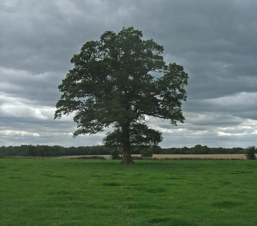
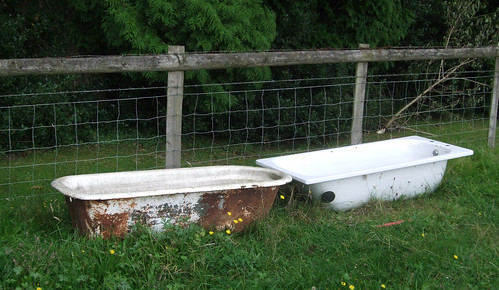
On the other side of Copas' fields I pick up a path which first runs alongside small paddocks, passing the second tree house I've spotted today, and then diagonally through them, via a series of well-maintained gates, passing two baths recycled as cattle troughs that present an incongruous site.
The local Parish Paths Partnership, a scheme where local people and the parish council can obtain small amounts of funding from the county or unitary council to improve their footpath network, has been active here. And here and elsewhere you'll also spot the Chiltern Society's white arrow waymarks, adopted before the now-standard yellow, blue, red and plum right of way arrows were introduced nationally.

The path emerges on Hog Lane on the outskirts of the village of Ashley Green, and yet again the Heritage Trail signs are on display. Ashley Green is a classically quaint village centred on a thin triangular green. Its position on the road between Chesham and Berkhamsted, only a short drive from the tube station at the former, makes it attractive to better off commuters. The flint and Bath stone church is a Victorian addition as the village only became the centre of a parish in 1876. On the green we're reminded again of the importance of wells -- the wooden well house, recently restored, is one of the more prominent features.

Once again the Countryway has deposited us some distance from the nearest major transport interchange. There are hourly buses from here to Chesham and Berkhamsted, but not on Sundays. Chesterton's suggestion for those who want to continue on foot is to head for Berkhamsted, which is nearer than High Wycombe is to West Wycombe, and also gives us the chance to add another county to today's walk.
This means continuing along the Countryway for a short distance, along a gravel track across the top of the green, past the well house and cottages and out into fields. You come past a fenced wooded area with "Danger - Deep Water" signs, perhaps an old reservoir, to an open field gate where there is a junction of well-defined tracks. The Chiltern Heritage Trail and the London Countryway (and my notional north-south route) fork right here while I keep ahead. There are numerous footpath options for reaching Berkhamsted, including leaving the Countryway before Ashley Green and passing through Hockeridge Wood, a "best practice" woodland management site owned by the Royal Forestry Society. But my route continues down a field edge to the bottom of a dry valley, and into the Hertfordshire borough of Dacorum.
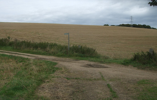
To the right the boundary follows a fence but there are no boundary markers to the left, just an imaginary line along the lowest contour and a noticeable strip of something different on the path surface where it crosses. On the other side you're welcomed to the new highway authority with a Hertfordshire-branded byway fingerpost: though it's clearly a continuation of the same path, which is only a footpath on the Buckinghamshire side, the different authorities must have made different interpretations of historical facts when defining their footpath networks.
I'll say more about Hertfordshire when the main route of the Countryway reaches it in the next section, but for now I'll declare an interest, as it's the county where I grew up, although some way east of here. We lived near a village called Little Berkhamstead and always wondered why it was so far from big Berkhamsted. In fact both gained the same name independently in Saxon times, "homestead among the birches", though with slightly different spellings, and the village has borne various additional epithets over the centures to distinguish it from its bigger namesake.
The byway curves up beside a wood, becomes a farm track past Harriotts End Farm, well sited on the corner of the ridge, and emerges on a quiet, tree-lined lane. I opt to follow this quiet lane northwards to its end. In the 18th century a number of parkland estates were developed round here and I could cut off to explore the remains of one of them, Ashlyns, where the Regency villa still stands, now used as offices, a residential care home and boarding school. Adjoining this was another villa in a park, Haresfoot, but only its pretty home farm remains, just off the lane to the right. But my eye is drawn on the map to a little pocket of wooded access land, presumably the remnants of a common, from where a long straight path runs mainly through open space straight towards the town centre.
The natural course of the lane is blocked by the A41 dual carriageway, where it's been diverted to run down to a split level junction. The road is a landmark of our clockwise progress: it's the first of the major roads north from London we've encountered on our journey so far, linking London, Birmingham and Birkenhead. This section is, of course, a modern bypass: the historic route ran through Berkhamstead as its high street, making use of a length of Roman road, Akeman Street, originally a link between St Albans and Cirencester. In 1762 it became a key link in the developing modern road system as part of the Sparrows Hernel Turnpike between Bushey and Aylesbury, linking to the Edgware Road to London's West End in the south (itself largely a Roman road) and turnpikes to Birmingham in the north. The whole route became a trunk road in the last century, threading an alternative course from Oxford Street near Marble Arch via Baker Street and Swiss Cottage, still the main route north from the West End. With the opening of the M40 and M42, its importance has declined and some sections have been detrunked and even renumbered, but here, just south of Berkhamsted, it's still a very busy highway of near-motorway proportions, embedded, like the M40, in a ditch.
On the other side of the motorway bridge, a stile built onto the crash barrier takes me into the woods and along a path that's clearly not especially well used, but still possible to follow as it winds between trees and holly bushes. It emerges on a street, Kingshill Way, that bounds Berkhamsted's built-up area. A short way along to the left is the J Paul Getty Jr Conservation Centre, the headquarters of the British Film Institute National Archive, one of the biggest film archives in the world, endowed by the American-born philanthropist John Paul Getty Jr (1932-2003). The walk, however, continues straight ahead through playing fields belonging to Berkhamsted School. This minor public school dates back to 1541, when it was founded by John Incent (1480-1545), then Dean of St Paul's Cathedral in London, which we'll pass when London Underfoot reaches the Jubilee Walkway.

The long, straight line of the footpath, bisecting the playing fields along a row of mature trees, suggests this is an old route into the town that once passed through farmland or open land at this point -- thankfully it's not (so far) been fenced off or shut by a child protection panic. After the playing fields it becomes a surfaced, enclosed path, crosses residential streets and continues through a public open space, Butts Meadow. The name immediately signals a connection to archery, and indeed this was an archery practice ground from at least the time of Edward the "Black Prince" (1330-76), whom we've encountered before as he held the estate of Byfleet. The last record of active archers is in the 18th century, and now it's a relatively plain but pleasant open space, surrounded by rich hedgerows and popular with dog walkers, with a verdant slope that gives a good prospect of the town down in the Bulbourne valley.
There are three keystones to Berkhamsted's history: the highway, the castle and the market. Roman Akeman Street found a convenient route through the Chilterns here, along the valley of the river Bulbourne, a tributary of another Chiltern stream, the Gade, with its confluence at Hemel Hempstead, eventually draining into the Thames via the Colne. Even before the Romans, there is archaeological evidence of Neolithic, Bronze and Iron Age occupation in the vicinity. The site of Berkhamsted Castle, on the opposite side of the Bulbourne from my viewpoint, was originally fortified in Saxon times, and Grim's Ditch, a Saxon earthwork of uncertain purpose that we'll later encounter on the London Loop, crosses Berkhamsted Common. Little is known of the early days, then the town bursts spectacularly into the historical record in one of those years every British school child once had embedded in their memory -- 1066.
Berkhamsted was the point at which the Norman invasion of England became the Norman Conquest; Guillaume le Bâtard (1027-87), the Duke of Normandy, secured his claim to becoming William I of England; and the Celtic and Germanic cultures of the British Isles started their metamorphosis into the weird Anglo-French hybrid we know today. In early December 1066, with the Norman forces encircling London, Edgar Ætheling (1051-1126), uncrowned heir to the English throne and descendant of the house of Wessex, surrendered to the Conqueror here. Guillaume could have been crowned there and then, but clearly thought this Hertfordshire backwater an insufficiently glamourous and symbolic backdrop. Instead, he demanded the keys to London, where his coronation went ahead in Westminster Abbey (also on the Jubilee Walkway) on Christmas Day.
Following the Conquest, the castle was rebuilt in stone and became a favourite haunt of the Plantagenet royals. Doomed Archbishop of Canterbury Thomas Becket was once the constable -- his overspending on the castle is thought to be one of the things that enraged his patron Henry II, contributing indirectly to his assassination. An equally ill-fated historical figure connected with the town is Edward II: he gave the castle to his lover Piers Gaveston, who got married there. The Black Prince had a particular affection for the town, choosing it as his honeymoon location and giving it an historic connection to the Duchy of Cornwall. With its military function long since superceded, the castle was finally abandoned in 1495, in the early days of Tudor England.
Meanwhile, in 1217 Berkhamsted had become a market town, making it a thriving local centre as well as a stop on a major highway. The road was turnpiked in 1762, and in 1798 a new line of communication opened alongside it, when the Bulbourne was largely dug up to become part of the Grand Union Canal. 1838 saw the opening of the London and Birmingham Railway, a third trunk transport route squeezing along the valley. Berkhamsted Common, northwest of the town, was the site in 1866 of a celebrated campaign to save common land for the enjoyment of all against enclosure.
 Our path, once the route linking the Butts to the Castle, emerges by a school and the obvious route ahead becomes Prince Edward Road, recalling the historic connection to the Black Prince. This emerges on the High Street right by the market. Old Akeman Street is now bypassed and traffic calmed, displaying a mix of building styles that still preserves some houses and pubs that would have been familiar to coach passengers passing on the turnpike. The historic market place has succumbed to car parks and shopping centres, but open air traders still set out their stalls on the High Street on this mild September Saturday. A town sign displays the arms, featuring a stylised castle with gold dots -- "besants" -- on a black border, the heraldic code for the Duchy of Cornwall.
I keep as straight ahead as I can, across the High Street, through the car park which now occupies the market square site, and along Mill Lane, passing another campus of Berkhamsted School. A short stretch of residential street takes me past Canal Fields, a pleasant public space that received a Millennium makeover, with the twin ribbons of the canal and the railway ahead. A short stretch of recently reengineered footpath takes me up to a bridge and over the canal where the station is immediately visible on the left.

The 220km Grand Union Canal links London and Birmingham, from the river Thames at Brentford, with an arm to Paddington and on via the Regents Canal to the Thames at Limehouse, to Warwick Bar by the Banana Warehouse on the edge of Birmingham city centre. Stretches of the canal towpath further towards London form key sections of the London Loop, Capital Ring and Jubilee Greenway, so we'll say more about it when we walk these routes. The London and Birmingham railway, later part of the London and North Western and the London Midland and Scottish Railways, is our first encounter with a major intercity railway line north from the capital. It now forms part of Network Rail's West Coast Main Line, one of Britain's most important trunk routes, carrying Virgin Pendolino tilting trains from Euston not only to Birmingham, Britain's second biggest city, but on to Manchester, Liverpool and Glasgow, the country's ninth, fourth and third biggest cities respectively.
Don't jump on a train, however, without detouring under the railway and visiting the site of the Castle, just behind the station and also on the Berkhamsted Heritage Walk. Since its desertion at the end of the 15th century, much of its masonry has been cannibalised -- some is even incorporated into the viaduct and embankment of the railway -- but you can still climb the motte and survey the line of the moat, with just enough remnants of walls to pick up the floor plan.

The site is now in the care of English Heritage, the government agency that presides over most of the "heritage" the National Trust hasn't snaffled up, and it's free to visit, with a good job made of interpretation boards. With all the grass it's a pleasant open space, though perhaps undervalued for a site that witnessed such a vital turning point in English history. Imagine the Black Prince and his retinue celebrating his wedding party if you can, or Edgar kowtowing to his new Norman masters (how did it feel as the agent of such a seismic shift in history?) or maybe the doomed Edward and Piers in a passionate embrace among the overgrowth sprouting from the decaying brickwork as the Pendolini whistle past nearby. On the way back, a cluster of curious bollards topped with luminous green will guide you to an alternative station entrance.

Download a route description PDF
View Google map
http://maps.google.com/maps/ms?ie=UTF8&hl=en&oe=UTF8&start=323&num=200&msa=0&msid=117966169375523396049.00046414d40d8252e7b70&ll=51.707134,-0.706859&spn=0.001599,0.00478&t=h&z=18
More information
- Buckinghamshire County Council http://www.buckscc.gov.uk/
- Visit Buckinghamshire http://www.visitbuckinghamshire.org/
- Walking in Buckinghamshire (Visit Buckinghamshire) http://www.visitbuckinghamshire.org/site/walking-in-buckinghamshire
- Buckinghamshire Walks and Rides (Bucks CC) http://www.buckscc.gov.uk/bcc/row/getting_out_on_the_network.page?
- Buckinghamshire Leisure & Culture (including parks) http://www.buckscc.gov.uk/bcc/leisure/Leisure__culture.page?
- Chiltern District Council http://www.chiltern.gov.uk/
- Chiltern tourism and walks http://www.chiltern.gov.uk/tourism
- Chilterns Area of Oustanding Natural Beauty http://www.chilternsaonb.org/
- Chiltern Society http://www.chilternsociety.org.uk/
- Great Missenden Parish Council http://www.greatmissendenpc.co.uk/
- Great Missenden and Prestwood visitor guide http://www.chiltern.gov.uk/downloads/GM.pdf
- South Buckinghamshire Way http://www.buckscc.gov.uk/assets/content/bcc/docs/row/promoted_routes/South_Bucks_Way_Leaflet.pdf
- Chiltern Heritage Trail http://www.chilternsaonb.org/site_details.asp?siteID=222
- Roald Dahl Museum and Story Centre http://www.roalddahlmuseum.org/
- London to Aylesbury Line (Wikipedia) http://en.wikipedia.org/wiki/London_to_Aylesbury_Line
- River Misbourne (Wikipedia) http://en.wikipedia.org/wiki/River_Misbourne
- The Lee http://www.thelee.org.uk/
- The Lee and Lee Common Stile Free Walk http://www.chilternsaonb.org/site_details.asp?siteID=473
- Chiltern Link http://www.buckscc.gov.uk/assets/content/bcc/docs/row/promoted_routes/ChilternLink.pdf
- Chartridge Parish Council http://www.chartridgeparishcouncil.org.uk/
- Copas Farms http://www.copasfarms.co.uk/
- Ashley Green Community Association http://www.ashleygreen.org.uk/
- Ashley Green Stile Free Walk http://www.chilternsaonb.org/site_details.asp?siteID=474
- Ashley Green Chesham Walk http://www.chilternsaonb.org/downloads/publications/CheshamWalks6AshleyGreen.pdf
- Hertfordshire County Council http://www.hertsdirect.org/
- Hertfordshire Tourist Information http://www.hertsdirect.org/comdirectory/comvol/infoad2y/intour3y/
- Hertfordshire countryside and rights of way http://www.hertsdirect.org/envroads/environment/countryside/
- Dacorum Borough Council http://www.dacorum.gov.uk/
- Dacorum Tourism and Travel http://www.dacorum.gov.uk/default.aspx?page=1542
- Dacorum parks, countryside and open spaces http://www.dacorum.gov.uk/default.aspx?page=77
- Berkhamsted Town Council http://www.berkhamsted.gov.uk/
- A41 (Wikipedia) http://en.wikipedia.org/wiki/A41_road
- BFI National Archive http://www.bfi.org.uk/nftva/
- Berkhamsted School http://www.berkhamstedcollegiateschool.org.uk/
- River Bulbourne (Wikipedia) http://en.wikipedia.org/wiki/Bulbourne
- Grand Union Canal http://www.waterscape.com/canals-and-rivers/grand-union-canal
- Grand Union Canal walking http://www.waterscape.com/canals-and-rivers/grand-union-canal/walking
- West Coast Main Line (Wikipedia) http://en.wikipedia.org/wiki/West_Coast_Main_Line
- Berkhamsted Castle (Local History & Museum Society) http://www.berkhamsted-castle.org.uk/
- Berkhamsted Castle (English Heritage) http://www.english-heritage.org.uk/berkhamstedcastle
- Berkhamsted Heritage Walk http://www.angelfire.com/journal/ggbtps/bherit01.htm


