|
| A view to rival any in London, north across the heath from Addington Hills viewing platform. |
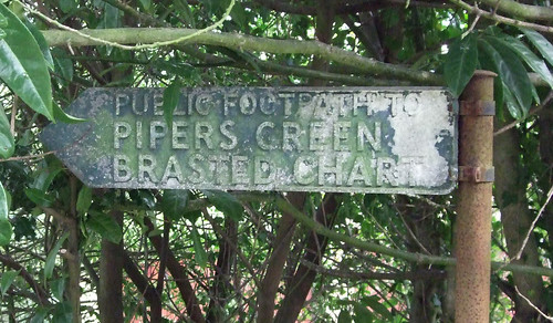
Coney Hall and West Wickham
Without continued management, trees rapidly recolonise cleared woodland, as we’ve seen in some of the historic commons along the trail. There are various ways of ensuring the land stays clear: the best-known is grazing livestock on it, but an alternative is rabbit grazing, a practice recorded around here in the 15th century and still acknowledged in the place names Coney Hill and Coney Hall, the latter once the name of a farm on the old West Wickham manorial estate.
We’ve already encountered local landowner Henry Lennard, from whom the remaining commons were rescued in the 19th century. But his successors were successful in selling off some of his land for development following his death in 1928, and today the area is largely occupied by the Coney Hall estate, built in the years immediately following by Morrell’s builders, also responsible for Petts Wood in section 2. Originally the roads in the area were so bad that London Transport refused to provide a bus service, so the developer ran a private bus to Hayes station instead.
 |
| You are now entering Western Earth. Coney Hall Recreation Ground. |
Once past the houses the trail is relatively open for a while, though not as a result of rabbit grazing. Soon after the start, the path that heads straight across Coney Hall Recreation Ground passes an obelisk marking the Prime Meridian of 0° longitude, running north-south through the Royal Observatory in Greenwich, agreed as the international standard meridian at a conference in Washington DC in 1884.
Meridians are essentially arbitrary but you can still amuse yourself with the notion that you’re now passing officially from the eastern hemisphere into the western one. If you have a GPS you might like to keep an eye on its latitude and longitude readout along the way. The meridian marker adds a little interest to what’s otherwise a very bland grassy space largely used for sports pitches.
 |
| St John the Baptist, West Wickham. Once for aristocrats only, now decidedly happy-clappy. |
But the site has a history dating back at least to the Bronze Age. There’s a decidedly rural feel to the path that descends from the church through the fields of Wickham Court Farm, where to your left there was once a busy roadside Romano-British settlement.
On the other side of busy Addington Road, which links Bromley and Croydon along the valley, is Sparrows Den Playing Field, a 12.5 ha portion of farmland bought in 1934 by the old Bromley Rural District Council, mentioned in the previous section, for public use, with the authorisation of the Board of Health. It’s home among others to Beccehamian rugby club, founded in 1933 by former students of Beckenham School (now Langley Park Boys School). The mini-golf course was added in the mid-1960s.
About halfway down the path along the top of the rugby pitches between the clubhouse and the corner of woodland you cross the line of the old Roman road from what’s now North Peckham, on Watling Street, to Lewes, then an important port. 20th century archaeological digs have exposed the surface of this road but today there’s nothing to see on the ground other than grass and goalposts. A close look at the aerial photos on Google Earth, though, reveals a faint line heading south towards the site of the old settlement northwest of the church. Another buried feature of Sparrows Den, rediscovered in a 2005 dig, is the seasonal stream which once ran along the valley, a tributary of the Ravensbourne: the site is marked on a 1632 map as ‘Bourne Field’.
Spring Park and Shirley Heath
The woods begin as soon as you turn out of Sparrows Den and start climbing the hillside into Spring Park. This ancient broadleaf woodland, dominated by tall oaks, has survived because it stands on relatively poor, sandy soil that wasn’t worth cultivating so was managed instead by the manor as a source of fuel and timber. Many of the trees have historically been coppiced: cut back periodically to near ground-level to encourage the growth of numerous thin trunks, ideal for firewood and wooden stakes, a technique that also prolongs a tree’s life. The Lennard family gifted the site to the City of London in 1926, and like nearby West Wickham Common and many other sites along the Loop, it’s still in the City’s management today.
 |
| The London Loop crosses the historic boundary between Kent (foreground) and Surrey (background) in Spring Park, West Wickham. The path cuts across a woodbank running left to right here. |
The word ‘Kent’ derives from a Celtic word meaning a rim or border, likely a reference to its coastal location on the border with mainland Europe. Following the Roman withdrawal, the area east of the river Medway was settled mainly by Jutes, from Jutland in what’s now southern Denmark: they established a Kingdom of Kent which by the 6th century had expanded west of the Medway.
This kingdom is the first to appear in the historical record of Anglo-Saxon England, in a text from 597, and it retained its old administrative divisions when all of southeast England was united under Alfred the Great of Wessex in 892. The county motto, ‘Invicta’ or ‘undefeated’, refers to the fact that Kent never formally surrendered to William of Normandy in 1066. For a general introduction to Kent, see the London Loop alternative route from Dartford Crossways to Crayford.
Surrey was settled by various Saxon tribes, and may once have been part of a kingdom that stretched both north and south of the Thames, the southern section being known as the ‘Southern kingdom’ or ‘Suthrige’, thus the name. By the 7th century, Surrey was disputed between the kings of Essex, Sussex, Kent, Mercia and Wessex. In the 780s it was decisively incorporated into Wessex but as a distinct political unit or ‘shire’, largely defining the shape of the historic county that survived to modern times. As we’ll see in a future section, sites in Surrey played an important role in the life cycle of Saxon kings.
These two historic counties once covered all of what’s now London south of Thames, with the northern end of the boundary between them meeting the river just upstream of Deptford Strand, by the confluence of a small river known as the Earl’s Sluice. The boundary line through Spring Park was in place by the 1170s, most likely derived from the extent of the old Roman settlement that formed the basis of Wickham manor: there’s a record from 1176 noting Kent was expanded slightly to incorporate a parcel of land in the ownership of the manor that previously fell on the Surrey side.
London as a functioning city spilled onto the south bank of the Thames, where the bridge and ferries landed, pretty much from the start. But officially it didn’t help itself to portions of Kent, Surrey and other neighbouring counties until the creation of the London County Council in 1889, which brought the areas that now fall under the boroughs of Greenwich and Lewisham, in Kent, and Lambeth, Southwark and Wandsworth, in Surrey, into London.
The creation of the Greater London Council in 1965 transferred much more of Kent and Surrey to London, including Bromley and Croydon. And by and large the modern boroughs still fit within the shapes of the old counties as they were known to the Anglo-Saxons. In some places, as we’ll see, there have been a few tweaks, but here in Spring Park the boundary follows a line last altered 800 years ago.
There’s a boundary stone nearby, and a Loop waymark post marking the fact that you’re now leaving Spring Park and entering Threehalfpenny Wood, essentially a 10.1 ha extension of the same band of woodland. The latter section, though, was once part of a different county, parish and manor, Addington in Surrey, and is now owned by the London Borough of Croydon.
From the late 19th century this area was part of Croydon Rural District but underwent a similar process to the one I described for Bromley’s countryside in the previous section: as newly built-up areas were transferred to urban districts, the rural district became increasingly less viable. Addington was briefly attached to Godstone, further south, in the early 20th century before being absorbed by Croydon, then a ‘county borough’ within Surrey, in 1925.
There’s a grisly tale to explain how the wood got its name. In 1805, a corpse was discovered in a nearby pond which, although badly decomposed, was identified as that of Robert Rutter, the parish clerk of Sanderstead, who had disappeared two and a half years earlier. The identification was made largely on the basis that three halfpennies (1½d or 0.625p) were found on the corpse, the precise sum Rutter was known to be carrying when he was last seen.
Leaving the wood, the Loop crosses a more open area now known as Shirley Heath, though in the 14th century it was simply called The Heath and later Jacksons Common. The name Shirley now applies to a locality clearly distinct from though bordering on Addington, but originally this was all part of Addington parish and manor. In the 19th century this swathe of woodland and fields became popular with well-off Londoners who built mansions in substantial grounds, and one of these, Shirley Park, gave its name to the wider area.
Much of the area the Loop now passes through was part of the estate of Monks Orchard (nothing to do with monasteries: a family called Monk once owned an orchard here), a 19-bedroom mansion to the north, built in 1854 and presiding over 6.2 square km of grounds. The estate was broken up in the 1920s and the mansion was demolished and rebuilt as the latest and still-current home of psychiatric facility the Bethlem Royal Hospital, once notorious as ‘Bedlam’. In an example of 1990s boundary tweaking, the hospital site was transferred to Bromley, but the rest of the former estate remains in Croydon.
Taking advantage of a growing population, in 1922 Shirley Heath, its surrounding woods and a swathe of woodland and countryside to the north became a golf course. In 1934, to cope with a growing housing shortage, Croydon council compulsorily purchased the land and began erecting prefabricated houses on the north of the site. In the early 1960s these were replaced by the Shrublands Estate, which still stands, with the southern part of the woods and the heath preserved as recreational space.
After the Heath, the Loop passes through Kennel Wood, so-called because a resident of Shirley Park once kept and trained foxhounds there. Now it’s the point where the trail briefly joins up with the Waterlink Way, part of National Cycle Network Route 21, though those used to the cycle networks of certain other countries may puzzle as to how this muddy track qualifies as a national route.
NCN 21 starts on the river Thames at Deptford right by the confluence of the river Ravensbourne, the source of which we passed on the last section, and ends on the south coast at Eastbourne. The first section, which follows the Ravensbourne and its tributary the Poole, is largely off-road and also an attractive walking route as far as South Norwood Country Park, but further south a few too many road-based stretches reduce its appeal to those on foot: this length is one of the exceptions.
Shirley
 |
| Shirley Windmill. |
Then you pass another former part of the Monks Orchard estate which survives as a public remnant woodland, Foxes Wood, and the end of South Way, which leads into Shrublands. Just past this and also on the right, Shirley Church Recreation Ground is another site saved as green space, this time by a council purchase in 1928, with the benefit of a view to remind you of how high up you are, providing clear sight of the City and Canary Wharf. There’s an even better view to come.
Just short of St John the Evangelist church, an 1856 building designed by George Gilbert Scott, the trail once again regains a traffic-free path at another woodland remnant called Pinewood. This turns out to be a misnomer for another broadleaved wood populated largely by oak and beech. You don’t walk through the wood but around its edge, with school playing fields on the other side, to emerge at a landmark hilltop pub, the Sandrock, on Upper Shirley Road.
It’s worth a short detour here to see another reminder of Shirley’s agricultural past. Tucked away in a side street a little downhill to the north is Shirley Windmill, one of the few still-working windmills in London. In 1809 a post mill was built on this site, thus the name of the street, Postmill Close, but this burned down in 1854 and was replaced by the current 16.8 m-tall five-storey Grade II-listed brick tower mill with its four double sails.
It’s likely that the mill was transplanted from another site: most likely it was originally built at Stratford, in east London, in the mid-18th century, and one of the timbers bears the date of 1740. It spent its last commercial days grinding animal feed and was abandoned in 1892, though various restorations were carried out in the early 20th century.
In 1952 Croydon council acquired the land for a new school, and would have demolished the mill but for the listing and keen local interest. In the 1990s the school moved to make way for the present housing estate, and in 1996 the mill was restored and turned into a museum with the aid of a Lottery grant. Now largely managed by volunteers, it’s open to the public at least once a month over the summer.
Addington Hills
 |
| Old pollards at Addington Hills. |
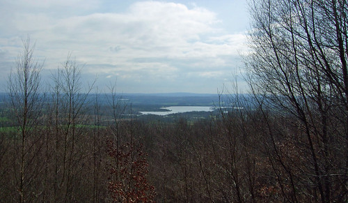
Addington Hills, also known as Shirley Hills, is one of the most remarkable open spaces in London, and a highlight of this section of the Loop. An outcrop of pebbly Blackheath beds forms a plateau about 140 m above sea level that incorporates the capital’s largest area of heather heathland. To the north the plateau falls away sharply, exposing the rough pebble beds, and nearby are more modest but steeply folded valleys carved by now-vanished springs. These rugged surroundings have an unexpected wildness about them, as if a fragment of rough upland has been dropped into suburbia. And as if this wasn’t enough, the site also offers one of London’s best and widest views.
The area was once known as Preble Dean, which means ‘gravelly valley’, and once you’ve scrambled up the gravel cliff to the viewing platform on rough winding paths through heather, ferns, bilberry and gorse, you’ll understand why. The edge of the ancient woodland nearby did once extend into part of the site – the northern section contains some of the oldest trees. But much of the current tree cover is from recolonisation and planting in recent times.
The conditions were impossible for agriculture and unattractive for development, but there was obvious potential for a public green space and in 1874 Addington Hills became one of the first in the area preserved for this purpose when the main heathland area was bought by the Croydon health board. Adjacent land acquired over the next few decades gradually expanded the site to its current 53 ha extent: the section where the Loop enters on the Shirley side in 1906; the strip of woodland in the west as a gift from newspaper magnate Frank Lloyd, who also donated Lloyd Park nearby, in the 1910s; and the pinewoods in the southeast in 1919.
The viewing platform was built to celebrate 1,000 years of Croydon, if just a little late: the first written record of the town dates from 960, though the platform itself didn’t open until 1963. On a good day, it rewards the scramble with a breath-taking panorama. To the east you can see Shooters Hill and beyond it Epping Forest in the distance. The Millennium Dome (O2) and the towers of Canary Wharf are obvious. The wooded ridge of Sydenham, Dulwich and Forest Hill interrupts the line of sight towards the City but the taller buildings – the Shard, the Gherkin (30 St Mary Axe), the Leadenhall Building (Cheesegrater), Tower 42 (the NatWest Tower) and the Walkie-Talkie (20 Fenchurch Street) – peek over it like cheeky meerkats.
Ahead there’s the turbine-crested Strata at Elephant and Castle, Vauxhall’s St George Wharf Tower, Centre Point, the BT Tower and the London Eye, with the arch of Wembley Stadium in the distance. Over to the west and much closer by are the towers of central Croydon, which has striven over the past few years to become its own mini US-style downtown. And finally on the western edge you should be able to spot Windsor Castle. London blogger Diamond Geezer says the view made him realise how spread-out London is: “Can it really be that far from the BT Tower to the City, and the same again from there to Canary Wharf? Evidently so.”
 |
| Coombe Lane tram stop, looking towards Croydon. |
Street-running trams provided London’s first successful mass transit system, first appearing in horse-drawn form in 1860. By 1914 the capital had the largest tram network in Europe. But after World War II, trams were viewed by transport planners as an obsolete mode of transport that got in the way of private cars. The last of the historic London trams ran in 1952 and by 1962 practically every tram service in the UK had been closed.
But the automobile dream soon turned out to be a nightmare of congestion, pollution, road danger and degraded environments, and only a couple of decades later trams and ‘light rail’ in general were back on the agenda as one of the ways to tame car-clogged streets. Trams now once again trundle through the heart of several UK cities, though London’s only true tram service (the Docklands Light Railway uses tram-like vehicles but on segregated track) is out here in the suburbs.
The 28 km network is centred on Croydon and when it was first opened in 2000 was known as the Croydon Tramlink. It’s since been rebranded simply as London Trams, which perhaps gives a misleading impression of its extent, but it does reach into Bromley and Merton boroughs and there are vague plans for extensions. Commissioned in the 1990s, during a period when there was once again no cross-London government, it was built as a private finance initiative, but in 2008 Transport for London bought it out and it’s now much more closely integrated with the rest of the transport network.
Much of the route makes use of former conventional rail lines, and the only extensive sections of traditional street running are in Croydon town centre. The line through Coombe Lane, however, was newly built, primarily to improve transport connections to New Addington, a far-flung housing estate built between the 1930s and 1960s on a hilly ridge to the southeast, which suffered badly from isolation and deprivation. There was some concern at the time that, here and elsewhere, the line claimed a strip of green space. But in practice the quiet and smooth-running trams are minimally obstrusive. And there’s something charming about stumbling on a tram stop surrounded by woodlands.
Slightly off the route, amid the trees to the right of the tram stop, is the only fenced-off area of Addington Hills, which contains a covered reservoir built in 1888. At first the reservoir was a visitor attraction with a café in the valve house, but an outbreak of typhoid traced to the site in 1937 put a stop to that. An associated structure, a water tower, is visible through the foliage on the other side of the tramway to the left as you leave the site on a pleasant tree-lined path parallel to Coombe Road.
Heathfield
 |
| Parkland and the fields of the erstwhile model farm at Heathfield, Addington, not yet asset-stripped by Croydon council. |
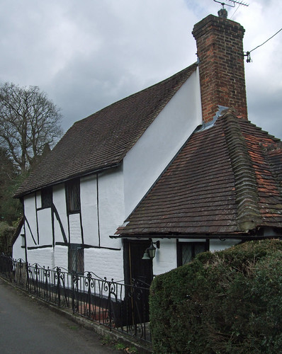
This is Heathfield, an ancient manorial farm turned into a country estate in its own right sometime in the late 18th or early 19th century. It owes much of its present form to businessman, philatelist, ceramics collector and keen gardener Raymond Riesco (1877-1964) who bought and restored the long-neglected site in 1927, later managing the farm as a model farm. Riesco arranged with the council to buy the estate, complete with its collection of antique Chinese ceramics, on his death, and the grounds have been a public park ever since, though the house is used as a training centre and isn’t open to the public. The fields are tenanted and still a working farm, though entirely surrounded by built-up areas.
Croydon council was widely accused of ‘asset stripping’ in 2011 when it sold 17 pieces from the Riesco collection for just over £8 million at a Hong Kong auction to fund rebuilding of the Fairfield Halls; a selection of what remains is displayed at the Croydon Clocktower.
Ignore the ‘Private Road’ sign at the end of select Riesco Drive, as there’s public access here to Bramley Bank Local Nature Reserve, which takes the trail back beneath the trees. The 11 ha wood is also part of the Heathfield estate transferred to the council, though is now managed by the London Wildlife Trust. It’s a mix of semi-natural oak and ash woodlands bright with bluebells in spring, and planted Austrian pines and sweet chestnuts. Just off the path to the right near the entrance is the largest woodland pond in Croydon.
Selsdon
 |
| Across the meadows in Littleheath Woods |
Leaving Bramley Bank there’s barely a glimpse of brick before you’re plunged into Littleheath Woods, now a 25 ha oasis almost completely surrounded by houses. In the early 19th century this was actually more of a mixed landscape with several separate woods and a big field in the middle, but when farming ceased, the trees refilled the gap. The whole lot would have been built on, but a public fundraising subscription helped the council buy the land as a green space.
The path soon leaves the trees to cross the biggest remaining meadow, Fallen Oak Field, lovingly maintained by an active Friends Group and especially delightful in early summer. Then it runs through an area of older woodland, Foxearth Wood, past a 1950s water tower well-hidden in the trees and through a gradually narrowing strip to Selsdon Park Road.
A substantial fingerpost just inside Foxearth Wood indicates the Loop has now joined forces with the 106 km Vanguard Way, one of the first walking trails to link London with the surrounding countryside, crossing the North Downs, the Weald, Ashdown Forest and the South Downs on its way to the south coast. It was proposed in 1978 by members of the Vanguards Rambling Club, so-called because the club was established on a return journey from a walk in the guard’s van of an overcrowded train.
Most of the members lived around Croydon so the original intention was to link East Croydon station with the village of Berwick, East Sussex, on the edge of the South Downs, where the Vanguards often assembled in the local pub for a post-walk pint or two. When the first printed guide appeared in 1980, the destination had been extended to the coast at Seaford, and was later advanced further to Newhaven, which has a ferry link to Dieppe, so if you plan on walking from London to Paris this is a good route to take. At first it was an ‘unofficial’ trail existing only as a written description but has since been signed with the support of local councils.
 |
| Start of the bridleway through Selsdon: just follow the wall. |
In the event the Conservatives unexpectedly won the election, but Heath rapidly backtracked from implementing the manifesto in the face of massive opposition led by the trade unions. In reaction to this, a band of unapologetically libertarian Tories founded a pressure group known as the Selsdon Group, which still functions today. It was a major influence on the rejection of Keynesian economics, ferocious opposition to trade union solidarity and championing of economic free-market libertarianism spearheaded by Margaret Thatcher which in various forms has dominated British politics ever since. Of course if everything had been left to market forces, the Selsdon Men would not have enjoyed such pleasantly rural surroundings in which to plot their assaults on the living standards of the rest of us.
Following the trail blazed along a convenient succession of off-road paths by the Vanguard Way, the Loop takes an old bridleway preserved when the area was developed as a fenced path tucked away behind the houses. The area to the left, known as Forestdale, was originally developed in the 1920s by the Surrey Garden Village Trust with the intention of providing war veterans with smallholdings, but things didn’t work out as intended as the plots were too small to be viable, and in the 1960s and 1970s the area was redeveloped with more conventional private housing. A similar but more enduring initiative can be found further along the Loop at Woodcote on section 7.
 |
| Helpful additional wayfinding through the coppices of Selsdon Wood. |
An opening ceremony in 1936 was attended by the Lord Mayor of London. Both councils were later combined into the London Borough of Croydon, which now manages the site with the support of a Friends Group. Following council reorganisation, a programme of replanting was implemented, and the extent of woodland cover has increased, though some fields have been kept to the west. The woods, laced with an enticing network of footpaths which the Loop studiedly ignores, was declared a Local Nature Reserve in 1993.
Farleigh and the edge of London
 |
| The edge of London at Selsdon Wood. The bridleway and everything to the left of it are in Farleigh, Surrey, while the woods on the far right are in the London Borough of Croydon. The woodbank marks the boundary. |
For a while, though, the trail remains in Croydon as it follows a path known as Addington Border. At one point this divided the Templars’ land at Selsdon Park, on the right, from Addington on the left, where the woodland is known more properly as Court Wood. It no longer has any ownership or administrative significance, but it provides a good walk uphill and down through the oak, beech and sweet chestnut trees, especially in spring when the bluebells are in flower.
Finally, the gate at the end of the path by the woodland edge takes the London Loop outside London for the first time, into Tandridge district in Surrey. A third trail joins here, the Tandridge Border Path, which does what it says on the tin, following as closely as possible the district boundaries over a 100 km route. It was developed in 1999 at the behest of the district council by Per-Rambulations, a small walking consultancy and publisher, and it’s since been signed, although not quite as thoroughly as the Loop or the Vanguard Way. Southwards, it’ll take you eventually to the North Downs Way at Tatsfield.
The houses you can see to the left are in London, but all three trails turn in the opposite direction, along a broad bridleway called Baker Boy Lane which tracks the boundary on the Surrey side just outside the wood, with an old hedgerow on the left concealing yet another golf course. On the right, over the fence, a prominent ditch and woodbank mark the ancient line that long separated Selsdon from Farleigh, the next parish south.
Interestingly, this is one of the rare places where the Greater London boundary has shifted. In the early 20th century, Farleigh, like nearby Addington, was part of Godstone Rural District in Surrey, but in the 1930s, it was transferred to Couldson & Purley, on the expectation that like neighbouring areas it would soon be subsumed by London.
In the event, as we have seen many times, the tide of urbanisation was halted by war and the Green Belt, but Farleigh was nonetheless included when the rest of Coulsdon & Purley merged into the London Borough of Croydon in 1965. It would have remained one of those anomalous swathes of London’s countryside, like the parts of Bromley crossed in the previous section, but for a group of vocal residents who were having none of it. Following a well-orchestrated campaign, the parish was taken out of Greater London and put back into Godstone in 1969, becoming part of Tandridge in 1974.
The whole area from the boundary south is also now part of the Surrey Hills Area of Great Landscape Value (AGLV). This is a ‘Local Landscape Designation’ which predates the nationally recognised and better-known Surrey Hills Area of Outstanding Natural Beauty (AONB) around the main ridge of the North Downs and the Greensand Ridge further south: it was first designated by the council, though originally over a much smaller area, in 1951. When the AONB was created, encompassing much of the AGLV, in 1958, Surrey County Council, fearful of London’s further expansion, progressively extended the AGLV. This section in northern Tandridge was added in 1984.
There’s a push from government to rationalise these local designations, and in 2007 a new review concluded that there was little logic to the boundaries of the AGLV, as much of it was of comparable character to the AONB. As a result of this, government agency Natural England are reviewing the AONB designation and it may well be extended to cover much of the AGLV. This little corner, however, was identified in the 2007 work as having little AONB character so may even lose its special designation.
I observed on this blog’s first encounter with an AONB that in some respects the idea of an officially designated area of outstanding natural beauty is rather odd. As outlined above, there’s very little natural about the landscape of most of the UK, especially in leafy Surrey. And beauty is in the eye of the beholder, so how can local bureaucrats decide consistently and objectively between what does and does not count as beautiful?
The 2007 study reveals that indeed in the past the basis of such judgements wasn’t unclear, and likely influenced by subjectivity and local political expediency. Today the process is rather more sophisticated. In 2007 the consultant rated areas both within and outwith the AONB against a list of seven characteristic features associated with the Surrey Hills landscape (gently undulating landform; shaws and hedgerows; scattered settlements…) and nine ‘perception’ criteria (views, scale, enclosure, variety…), then drew these together and evaluated them against four overall criteria (homogeneity, concentration or density of features, condition, strategic context). It was this process that highlighted the similarities between numerous AONB and AGLV areas.
Such quibbles don’t detract from the pleasant surroundings of this walk, as the golf course soon gives way to another council-owned woodland on the Tandridge side, Puplet Wood, and the route strikes away from the boundary deeper into Surrey. I walked this way on a fine day in autumn when every gust of wind triggered a burst of what sounded like heavy rain but was actually chestnuts and acorns falling to the ground.
Reaching Old Farleigh Road, the Loop parts company with the Vanguard Way and passes the very rural-looking Elm Farm, with its late 16th century Grade II listed farmhouse. Look around the rolling landscape here: the landscapes deeper into Croydon once would have looked broadly similar to this.
At the end of the farm track you’re back in London again, though the surroundings take an even more rustic turn as the Loop plunges into a steep coombe and through a little wood known as Mossyhill Shaw. On the other side it joins a track that grazes the edge of the final woodland on today’s section, the 60 ha Kings Wood, bought by the council in 1937 as public open space.
Unless you detour you won’t see much of the wood, but maps clearly show the geometric layout of the woodland paths, created in the 19th century when the site was used for shooting. An old Romano-British settlement straddles the northern boundary and there have been numerous archaeological finds in the area. A little further on the path passes the drive to Kingswood Lodge: it’s thought this originally had no connection with the wood, which is shown on early 19th century maps as Sanderstead Wood, but later mapmakers assumed it did, inadvertently renaming the woodland to match.
Where the path, Kingswood Lane, bends right after the lodge, the Loop rejoins the London boundary yet again, running along the wood edge on the right. Further on, the lane has been built up into a residential street, and if you’re the sort of person who spots these things, you might notice that while the street lighting on both sides belongs to Tandridge, the houses on the right have wheelie bins emblazoned with Croydon logos. Hamsey Green, where this section ends, is one of those settlements that straddles both sides.
Hamsey Green
 |
| The Croydon half of Hamsey Green, and a less impressive transport interchange than usual. |
There’s a small pond on the corner to the right as you reach the main road that’s thought to date from Neolithic times and was certainly around in the 13th century, and this and the little green triangle opposite have provided a focus for a 1930s parade of shops.
For a long time, there was a pub at this spot, the Good Companions, but its charming name wasn’t enough to save it from the fate of so many local pubs, as the hoardings by the northbound bus stop attested last time I passed by. The boundary here cuts across continuous urbanisation: there’s no rhyme nor reason why all of Hamsey Green, and indeed Warlingham and neighbouring Caterham, shouldn’t be in London, aside from the old limits of mediaeval estates.
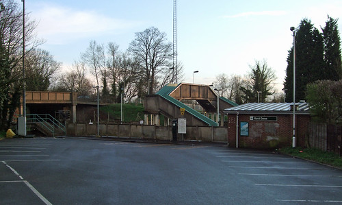
This is one of only two places where a Loop section officially ends, not at a railway station, but at a bus stop. The 403 regularly trundles through from Croydon and Sanderstead: the northbound bus stop is in London, while the southbound one is in Surrey. But the whole route to its terminus at Warlingham is safely within the London bus zone. Transport for London, at least, takes a practical view of the edge of the capital.
- Download full route description (PDF)
- View Google map
- View official Transport for London web page
- Green Croydon For All: useful map of the borough's green spaces with interactive and PDF versions.