Tuesday 26 May 2009

London Countryway 3: West Byfleet - Sunningdale

chobhamcommon-views2

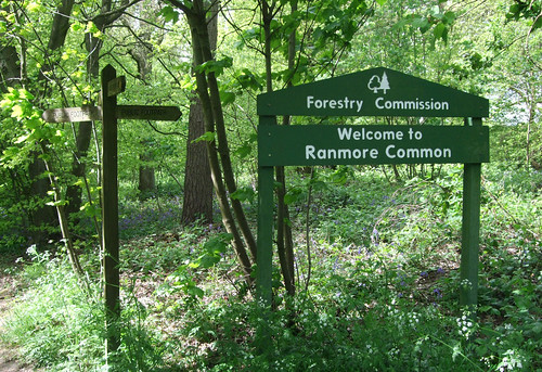
Sandy heaths and canal towpaths were notable features of the previous section of the London Countryway, but on today's walk they take joint centre stage -- almost all of the route is in the surroundings of one or the other, with brief interludes through fields and alongside a small airfield. The scale and extent of the heathland is particularly striking and if you don't know the area you'll no doubt be as surprised as I was -- what with this and the hills explored on previous sections, the Countryway is doing a sterling job of debunking Surrey's image as a land of leafy suburbia packed with commuting stockbrokers. Among other unexpected curiosities are a lump of masonry that claims to be part of Waterloo Bridge and a near-century old Islamic cemetery that testifies to the long history of British multiculturalism. The Countryway also prepares to say goodbye to Surrey today, and ventures out of the county near the very end.

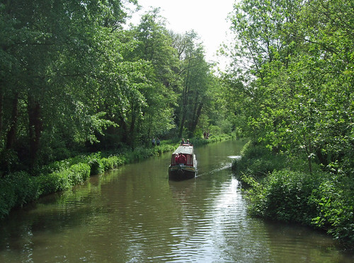
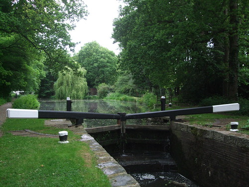
A short stroll from West Byfleet station, across an underutilised urban green space, the road peters out into a carpark and a footpath crosses a ditch where the route leaves the borough of Woking and enters, briefly, the borough of Runnymede. A few short steps further is the towpath of the Basingstoke Canal, where the picturesque ivy-clad lock keeper's cottage stands guard on Woodham Lock No 3, one of a six-strong flight of locks between here and Weybridge. This is an environment much changed since Keith Chesterton published his last edition of the London Countryway guidebook in 1981 -- the canal was then derelict and largely unnavigable although the early stages of its restoration were already underway.

woodhamlocks

The canal was opened in 1794 from Basingstoke to the Wey Navigation as a way of transporting timber and agricultural goods from Hampshire to London, with coal and manure moving in the other direction via the Wey and the Thames. It was only ever a moderate success and first went into receivership in the 1850s following competition from the railway. One of a number of minor waterways not nationalised in 1949 as what later became the British Waterways network, by the 1960s it was still in private hands but in an advanced state of overgrowth and dereliction, and some sections had even been built on, though various lengths of the towpath were still popular with walkers. The lack of maintenance was causing flooding problems for nearby homeowners in some places and there were even proposals to fill the whole thing in.

Then in 1966 local people formed the Surrey & Hampshire Canal Society to campaign for its restoration and ten years later they were successful in persuading the two county councils involved to acquire the canal by compulsory purchase. The restoration resulted in the 51km between the Wey and the Greywell Tunnel at North Wanborough officially reopening throughout to navigation in 1991 -- a remarkable achievement for a workforce comprised entirely on volunteers, as is evident from comparing "before" photos, including one in Chesterton's book, with what's there today. The Society still aspires to reopen the final 8km into the centre of Basingstoke but the tunnel itself and later buildings and motorways obstructing parts of the route have limited progress. The reopened canal is now managed by the Basingstoke Canal Authority, set up by the county councils, and the whole length is designated a Site of Special Scientific Interest (SSSI).

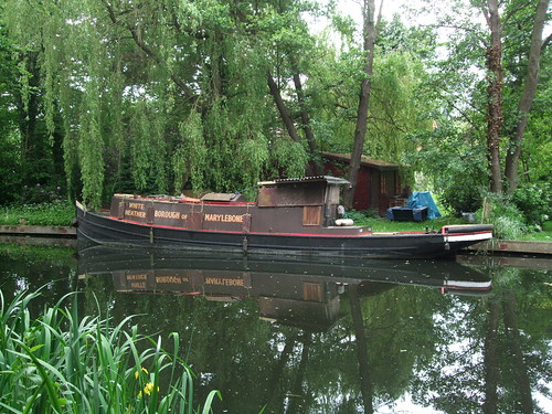
Like most canals through built-up areas, the stretch I'm on has that odd feeling of separation from its surroundings, a sort of parallel geography from a zone where time moves at a different rate, imposed on the everyday framework of streets and paths. Back in 1981 Chesterton found a "decaying charm" in the dereliction, with "water lilies, swans, rusted bikes and oil drums all together on one shallow patch of water." Such scenes are now long gone, and perhaps they are a loss of sorts, but the canal still has the feel of a quiet backwater -- it's a lesser-used waterway for navigation with sections of it sometimes closed to conserve water, and with waterside patches of reeds and vegetation it sometimes seems like a long, thin pond. It's a while before I encounter my first moored boat, the White Heather, a utilitarian narrowboat with a name plate that announces it is registered in the Borough of Marylebone -- a London local authority that encompassed the head of navigation of the Grand Union Canal at Paddington but which has been defunct since 1965 when it merged with the City of Westminster. Later two moving boats, the Puffin and the Pluto, pass me in succession. Far more people are using the towpath on this May bank holiday, mainly walkers and runners, with few cyclists in evidence.

whiteheather-basingstokecanal

The route passes three more locks, at the last of which the towpath crosses back into Woking borough, and threads under Sheerwater Bridge. This area, Sheerwater, is a large residential estate of 1,300 homes built by the London County Council in the 1950s as infill between West Byfleet and Woking, replenishing housing stock lost in the Blitz of World War II. I'll be saying a lot more about the LCC, founded as the first proper unified municipal authority for the metropolis in 1889 and superceded by the much bigger Greater London Council in 1965, but it's interesting to note that, like the much older City of London Corporation, the council exercised an influence way beyond its own boundaries, into areas that were already in practice the outer orbits of the capital, although still officially separate even today. The influx of inner city Londoners was unwelcome locally, especially when the newcomers returned Labour and even Communist members to a formerly solidly Conservative local council.

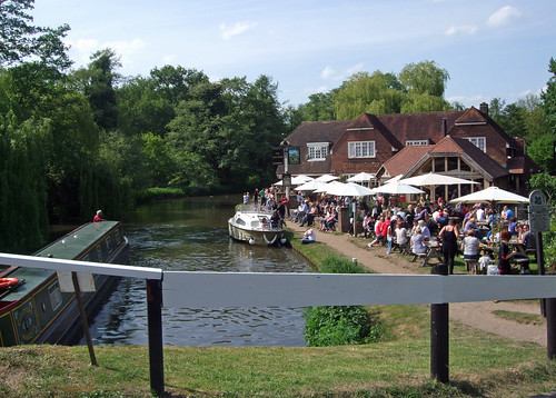
From the towpath, buffered by strips of straggly woodland, you see little of the housing development, and a while after Sheerwater Bridge there's open green space beyond the trees -- Sheerwater Recreation Ground, part of the original community layout, with a play areas, playing fields and an athletics track. Opposite, across the canal, the gardens of better-appointed houses stretch down to the waterside, with willows and wooden gazebos. It's a fair stretch of over 3km along the canal, at a good pace along the straight, flat and well-surfaced path, before finally reaching Monument Bridge on the edge of Woking.

When the canal was first built, this whole area was a huge heathy common, once part of Windsor Great Park which was originally far greater in extent, but by the 18th century in the hands of the earl of Onslow, who was determined to protect the common and not let it fall to enclosure. Two things in particular changed that situation. One was the opening of the London and South Western Railway from Vauxhall to Woking Heath in 1838, and its later extension to Basingstoke and Southampton. The other was the London Necropolis & National Mausoleum Company's project for a vast cemetery with its own dedicated rail service to London in the 1850s, on land compulsorily purchased from the Onslow family. Both have already been discussed at the end of the previous section as they also affected West Byfleet. In the event the Necropolis Company bought much more land than it needed -- only the first stage of its plans, the 162ha Brookwood Cemetery, was completed, and the surplus land was eventually sold to private developers who built a town of the living rather than a city of the dead.

Or, as some would have it, the partly living, as Woking is pretty much the paradigm case of the soulless English commuter town -- 'A Town Called Malice' as Paul Weller, who grew up here in Stanley Road, put it, where:
Rows and rows of disused milk floats
Stand dying in the dairy yard
And a hundred lonely housewives
Clutch empty milk bottles to their hearts.
In the same song, Weller alludes to the Necropolis Railway: "The ghost of a steam train / echoes down my track. / It's at the moment bound for nowhere." Weller himself, of course, was bound for somewhere -- London itself was luckily just down his track and he's very much a London writer, though notably with the particular sensibility borne of a youth driven by creativity crushed in the capital's outer shell of net curtain-twitching suburbia.

The Countryway doesn't quite wander into Woking proper, but instead crosses the bridge north towards Horsell Common, where an information board leads me to a curiosity only a few steps off the route not included in Chesterton's guide. Hidden in the trees just northeast of Monument Bridge is the Muslim Burial Ground, built in 1917 for the bodies of Muslim soldiers from Indian regiments who died in special hospitals on England's south coast after being injured on the Western Front during World War I. The War Office commissioned the work in response to rumours that the armed forces hadn't been conducting proper Islamic ceremonies. There were more burials during World War II, but the site was later neglected and the graves were removed to the military section of Brookwood Cemetery in the 1960s. The gateway and courtyard remain, built in a prosaically English interpretation of Islamic style.

muslimburialground-gate

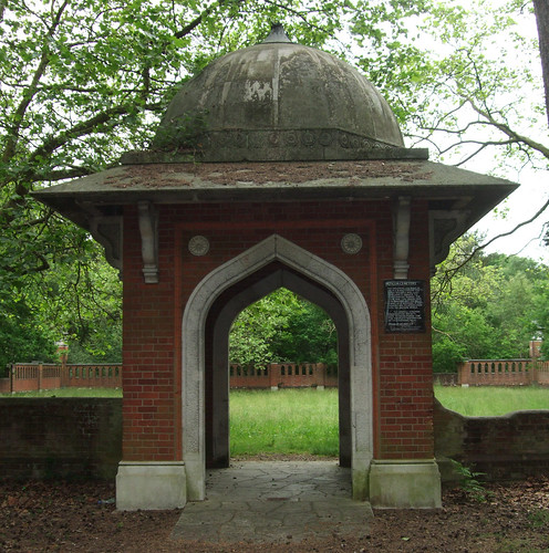
It's strange to read the list of Shahs and Khans and reflect on the strange currents of history that brought these men from places like the Punjab through what's still the bloodiest conflict in human history to a last resting place in a Surrey wood. It's also a demonstration that British multiculturalism goes back far beyond the mass immigrations of the post-World War II age -- one reason the burial ground was located here was the proximity of Woking's Shah Jehan Mosque, built in 1889 as the earliest purpose-built mosque in the UK.

An appeal is currently underway to restore the remaining structure. It could begin by removing the disgraceful National Front logo that is currently defacing a plaque on the main gate. I guess those responsible for the grafitti would be too stupid and hateful to recognise the irony that the people originally buried here gave their lives fighting a war for the British Empire.

The use of this area as a burial place stretches back much further than World War I. Just behind the car park near the Muslim Burial Ground, the uneven ground is in fact a 4,000-year-old bell barrow, used for interring the remains of tribal leaders. On the opposite side of Monument Road, if you take the first footpath west (as I first did by mistake), you'll cross a heathy open area with two further barrows, a bell and a disc, types that are unusual in Surrey. The bronze age people who built these were initially responsible for clearing the trees and exhausting the sandy, acidic soil by arable farming, creating the heaths that are such a characteristic feature of today's walk.

Horsell Common is unusual among public commons in that, along with most other large public open spaces in Woking, it is not owned by a council or a big institution like the National Trust but by a private charity, the Horsell Common Preservation Society. As previously mentioned, the Onslow family ended up owning the extensive common land hereabouts and resisted its enclosure and development -- today's Horsell and Pyrford commons are the legacy of this. By the early 20th century the Onslows were finding management responsibilities a burden so passed them to a trustee management board, which later became an independent membership society that in 1966 finally purchased the land freehold at £1 an acre. The common has since been designated an SSSI and a European Special Protection Area (SPA) for its bird life. Rather pleasingly, the Society still retains a vestige of old common rights by granting wood licenses allowing people to pick up fallen wood for personal use.

The common is also celebrated as the landing place of the "shooting star" that turns out to be the vanguard of a Martian invasion in HG Wells' The War of the Worlds (1898). Ogilvy rides out to find it on an "early morning [that] was wonderfully still, and the sun, just clearing the pine trees towards Weybridge, was already warm...Find it he did, soon after dawn, and not far from the sand pits. An enormous hole had been made by the impact of the projectile, and the sand and gravel had been flung violently in every direction over the heath, forming heaps visible a mile and a half away. The heather was on fire eastward, and a thin blue smoke rose against the dawn. The Thing itself lay almost entirely buried in sand, amidst the scattered splinters of a fir tree it had shivered to fragments in its descent. The uncovered part had the appearance of a huge cylinder, caked over and its outline softened by a thick scaly dun-coloured incrustation."

Bromley-born Wells was another creative smalltown boy who suffered a stultifying childhood and no doubt took great delight in wishing murderous heat ray-toting Martians on the worthies of Woking, though they might have proved marginally more welcome that the Communist-voting Cockneys of Sheerwater.

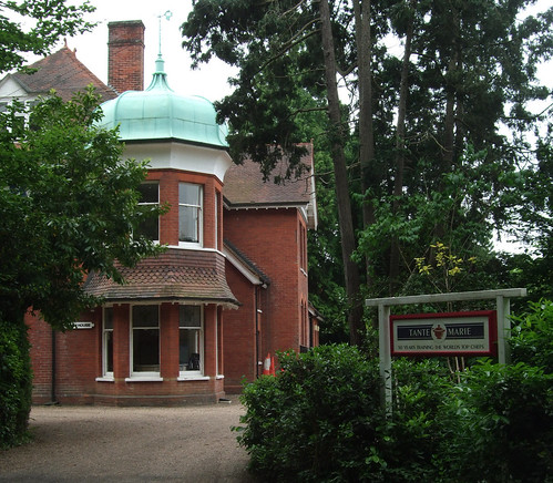
The route passes mainly through wooded sections of the common, which initially has a very urban feel, criss-crossed by busy roads. For a while it follows Carlton Road, an unadopted private road with sizeable houses looking out on the edge of the woodland. One of them is an early 20th century house in an odd-looking jumble of styles, surmounted by an extravagant cupola, which houses the 50-year-old Tante Marie cookery school, now part owned by foul-mouthed celebrity chef Gordon Ramsay. After crossing the A245 and passing the last bus stop on the route until the end, the noise of the traffic soon fades.

tantemarie-horsell

The quiet path runs through birch and scented Scots pine and along the edge of more open, heathy areas, then picks up a fine old bridleway through a spindly arm of woodland jutting northwards from the bulk of the common.

horsellcommon-path

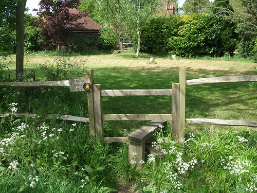
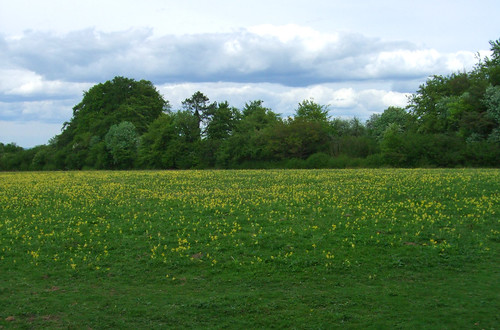
Here there are green meadows to the left known as Bourne Fields, a recent acquisition of the Preservation Society who were keen to create an additional buffer to the common proper. The river Bourne, on the opposite boundary of the meadow, is one of those tautological names which, like the river Avon, means "the river River", as 'bourne', cognate with Scottish and Northern English 'burn', is from an Anglo-Saxon word for a small river or stream. This particular river River rises in heathland southwest of here and flows by a circuitous route to the Thames near Weybridge. I soon cross it on a fine wooden footbridge, where it marks the boundary between Woking and Surrey Heath boroughs and the northern limit of Horsell Common.

fairoaksairport

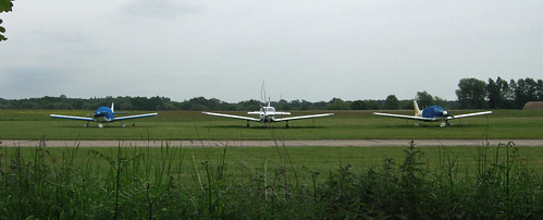
The bridleway continues ahead, now running along the western boundary of a grassy airfield used by private light aircraft, flying schools and police helicopters which names itself, with some overstatement, Fairoaks Airport (FRK). Flying is supposed to have started here in 1931 when it was still a farm, then the land was requisitioned by the Air Ministry in 1936 to use as an RAF training school. It passed into private hands, still with a grass runway, in 1967 and there was much wrangling in the late 1970s over planning permission for the present tarmac runway. The approaches to the runway are right over the bridleway, giving rise to the rather incongruous site of full-sized Low Flying Aircraft triangular warning signs on a leafy rural path.

lowflyingaircraft

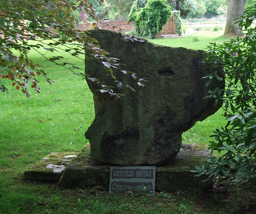
Crossing the A319 Chertsey Road, the route climbs wooded Stanners Hill, once part of the nearby Ottershaw Park estate -- it still appears to be in private ownership, although it's open as access land. The bridleway approaches the woodland along a residential drive where, in the garden of Stanyards Farm to the right, is a lump of granite masonry labelled "Waterloo Bridge -- a chip off the old block". I presume it's claiming to be a fragment of the original 1810 bridge across the Thames. When this was replaced by the current bridge in the 1940s, lumps of it were distributed as far afield as New Zealand, so it's conceivable one found its way to Chobham.

waterloobridge

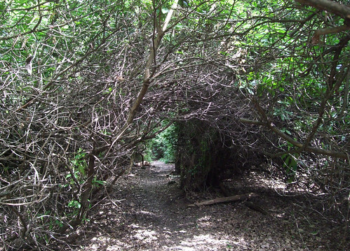
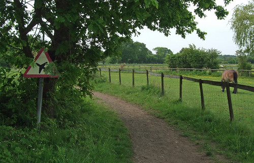
On the other side of the hill, by a junction with the wonderfully named Gracious Pond Road (probably a corruption of a proper name, Cratchett's Pond), the route comes within a few metres of, but does not cross, the boundary with Runnymede borough, its evocative name, forever associated with one of the better known incidents of English history, indicating our increasing proximity to the river Thames. Instead I enter for the first time the boundary of Chobham Common, crossing a southeastern protrusion of it along the side of an open, heathy area where the soft sand underfoot is heavy going for a while. Through the woods on the other side the route crosses farmland, or, rather, equestrian land, rounding the edge of a wood where a row of horse boxes is tucked just inside the trees. Another fine bridge then leads across farm tracks and across another road.

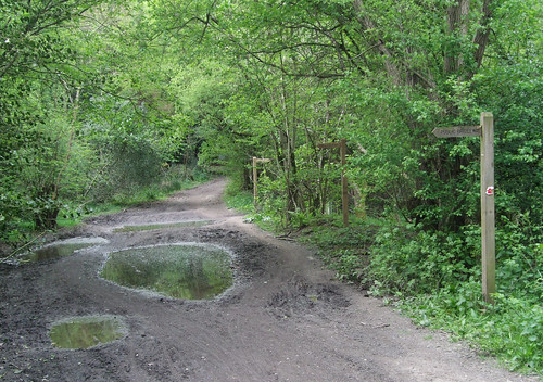
Keeping up the equestrian theme, the route then heads of the drive of Langshot Stud Farm and starts to circumnavigate the farm, before a yellow footpath waymark sends me off through woods on the right and into the common proper. This path is rough and hard to follow, partly as it's blocked by a large fallen gorse bush, and then you're picking your way on rough ground on the open common to gain the main track. It's a relatively short section but if I was rewriting the route from scratch I'd find an alternative that's more straightforward: some are obvious from the map.

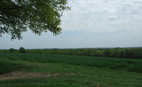
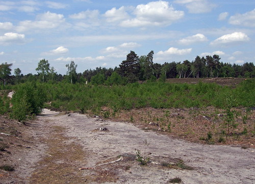
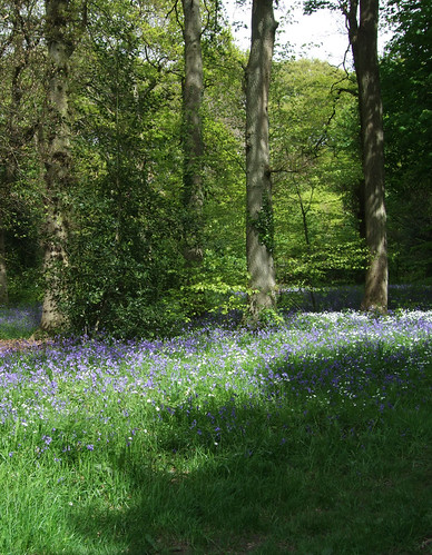
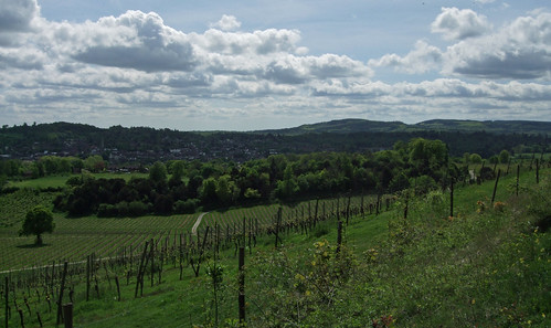
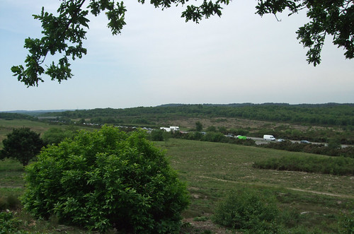
These difficulties will soon be forgotten, however, once you find yourself on the fine main track across the common. If you've never been here before, you'll be as astonished as I was that such an extensive and wild open space can be found in the Home Counties within an hour's journey of the capital. All around stretches a rugged, undulating surface of dirty sand dotted with gorse, bracken, lone stubby trees, still gloomy ponds, bogs and tight dark patches of woodland, the only built structures within sight the lines of gaunt electricity pylons which somehow emphasise rather than shrink the scale of the place.

chobhamcommon-ponds

Yes, as I explained in the previous section, heathland is the result of human management, but this feels very much the kingdom of nature and more than a little lonely and desolate, a rare quality in such a populated area, though sections of some of the bigger open spaces closer in such as Richmond Park and Epping Forest can almost achieve the illusion. It could almost be a brown moorland of England's Pennine north, and indeed has often played that role for the benefit of London-based film crews saving on travelling time -- many a grim-faced TV detective has prodded a grisly fake corpse from its shallow grave here to a soundtrack of portentous strings.

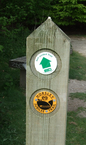
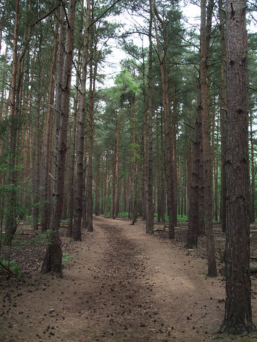
At over 574ha -- almost 6 km2 -- Chobham Common is the biggest remaining heath in Surrey, the largest National Nature Reserve (NNR) in southeast England and, according to its managers, Surrey Wildlife Trust, "one of the finest remaining examples of lowland heath in the world". Like Horsell Common, the site was once part of the wastes of Windsor Great Park, the still-extensive area of which we're due to cross in our next section. As with Horsell, it later belonged to the Earl of Onslow, whose family sold it to the council for £1 in 1966. In wildlife circles it's particularly famed for its invertebrates such as spiders and ladybirds, but also birds, snakes, amphibians and one of the UK's biggest colonies of water voles. There are self-guided trails around the site and a walking leaflet is downloadable from the Wildlife Trust website.

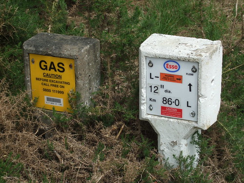
My route is now straightforward for the rest of the section, following the broad main track northwest across the common, presumably a former carriage drive -- curiously the first section of this is not a public right of way but is of course open under the general public access policy of the site. I spot markers just off the path to the right indicating the passage of oil and gas pipeliens.

chobhamcommon-pipeline

The path climbs Staple Hill, emerges between huge boulders on a lane and enters a car park that's currently out of use, although it was one of the first two car parks to open on the common, back in 1936, catering for the growing demand for car-based leisure access. From the hillock to the east of the car park is a breathtakingly extensive view of rolling open country, interrupted only by the M3 motorway in the dip below.

chobhamcommon-m3

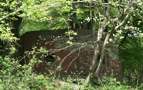
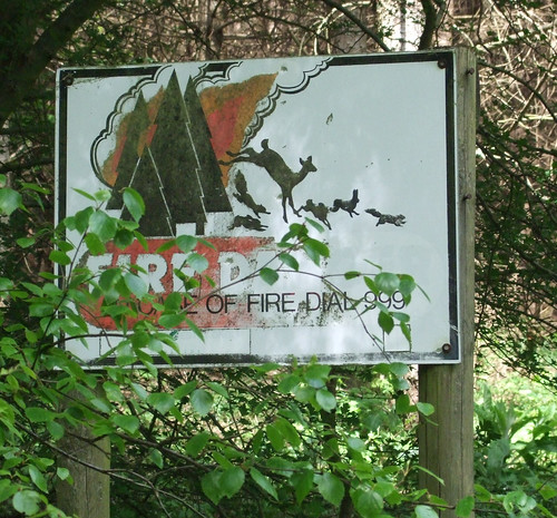
This area once suffered badly from summer fires, but is now managed with more effective fire prevention techniques since a particularly destructive series of fires in the 1970s. From here you can look across to the northeast corner of the common, site of the former Longcross Defence Evaluation and Research Agency facility where the Ministry of Defence once used to test tanks and other military vehicles -- this is now in the hands of a private defence technology company, QinetiQ, who make a supplementary income out of it by renting it to film crews.

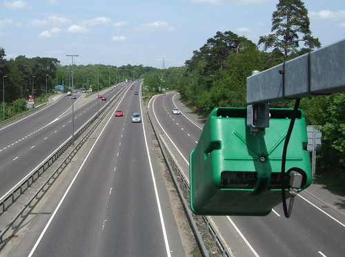
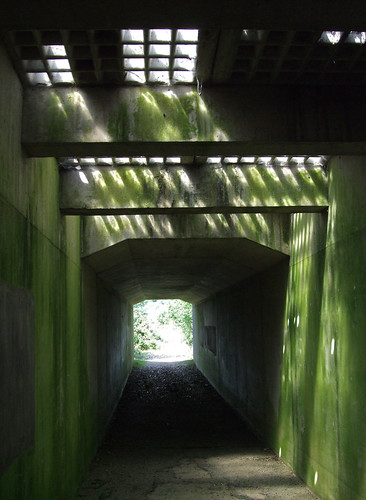
The M3, the first single digit radial motorway we've so far crossed, links London and Southampton, opening in stages from the 1970s to relieve traffic on the A30, a road we'll reach right at the end of this section. This was the second stage, opened in 1974. I cross under it in a damp and spooky subway, its green lichened walls lit by thick glass skylights through to the carriageway above. I wonder how long it's been since someone stood there and looked down.

chobhamcommon-m3subway

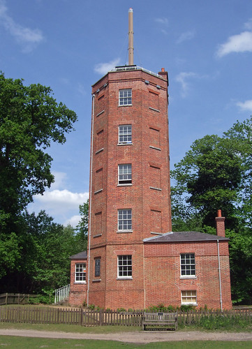
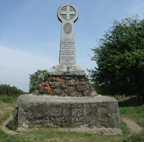
Beyond the motorway the path, now a bridleway, continues in more-or-less the same direction, still across open heath, crossing the minor B386 road and passing one of the common's few significant built structures. The Queen Victoria Monument, looking perhaps unintentionally like a Celtic cross, was erected on the queen's death in 1901. This site was chosen as it was where Victoria had reviewed a gathering of troops in 1853 prior to their being sent off to the Crimea, including the notorious Light Brigade. The weather was appalling and the dire conditions of this temporary encampment led to the Army developing Aldershot, not far west of here, as a permanent base.

chobhamcommon-monument

After the monument the path descends to follow a woodland edge until it's forced left by the railway, a branch of the London and South Western Railway opened between Staines and Ascot in 1856 and one of the earlier British main line railways to be third rail electrified, in 1916. Finally I leave the common and emerge on Chobham Road just on the other side of the railway bridge from Sunningdale, a large, sprawling village, parts of which are also known as Broomhall. Passing through the gate from the common I leave the administrative area of Surrey, the county through which I've been walking for six sections of the Countryway, although I'll be making a brief return in the next section. What's less clear is which county I enter.

As the maps in the 1981 London Countryway guide show, this whole section was then entirely within Surrey. But part of Sunningdale fell into Berkshire, the boundary crossing the railway just west of the station where we finish this walk. And while most of Surrey's portion of the village was within Surrey Heath, some of the northeast fell into Runnymede, a case of more recent development around a railway station failing to align with administrative boundaries dating back centuries and a challenge for effective local government.

Then, towards the end of the 1980s, the Conservative government set about their grand plan to restructure the existing two-tier system of local government in the UK, with powers split between larger County (or in Scotland, Regional) councils and smaller District or Borough councils, restructuring them into a single tier of unitary authorities. This policy has been widely interpreted as motivated by a desire to strengthen the power of central government by making it more difficult for influential local power blocs to develop, as had happened in London where the Greater London Council led by Ken Livingstone has been a constant thorn in the side of prime minister Margaret Thatcher (two characters we will undoubtedly encounter again). The government first abolished the GLC, then the other "Metropolitan Counties" in England's big cities, their powers cascading to their constituent boroughs, then, clearly having gained a taste for the Balkanising bug, applied the same principles to Scotland and Wales and began on non-metropolitan England. Here, however, the process was piecemeal, beginning mainly with excising middle-sized cities from their surrounding counties, and rapidly stalling thereafter. Oddly, the only historic county to be dismembered completely in this tranche was the true blue Tory Royal County of Berkshire, which was split into six unitaries in 1996. It wasn't until 2009 that further unitaries were created, and Cheshire and Bedfordshire have followed Berkshire into administrative oblivion.

Back in Sunningdale, the 1996 reorganisation saw some judicious boundary tweaking which, following a controversial consultation, saw the whole village incorporated into the new unitary incarnation of the Royal Borough of Windsor and Maidenhead. Which leaves the question of which county our little section is in -- while the bulk of Windsor and Maidenhead was once Berkshire, and it's convenient to group those six unitaries as Berkshire still, thus its listing on the keywords for this entry, none of this section was in Berkshire when that county still existed. Of course if you're a sign-defacing supporter of the Association of British Counties who believes that such boundaries have an immutable power linking blood to land, then there's no problem -- if Edward I would have called it Surrey, then Surrey it is.

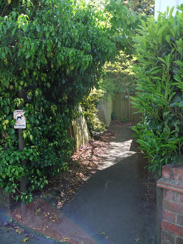
On the other side of the railway, the Countryway turns down Onslow Road, a final tip of the hat to the landowning family who preserved much of the countryside I've just walked through. Chesterton describes a station link that simply follows roads, but a more interesting alternative is along an old footpath, Halfpenny Lane, that threads between the backs of houses to emerge on the A30 nearer the station.

sunningdalefootpath

The A30, or Great South West Road, is historically one of London's most important arterial links and, at 457km, Britain's third longest A-road, reaching from London, or to be more precise Hounslow where it leaves the A4, about as far west as you can go to Land's End in Cornwall. Unlike a number of other key radial routes, however, it's been superceded by parallel roads like the M3 and the A303 rather than upgraded on its traditional alignment, and only about half the route is now part of the strategic trunk network. Through Sunningdale it still passes along a high street where a level crossing still intermittently interrupts traffic flow, though it's busy enough to cause you to rue the absence of a conveniently placed controlled pedestrian crossing with which to reach the station.

sunningdalestation

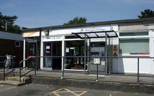
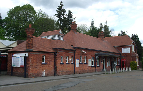
Sunningdale station is a modest structure with the feel of a temporary building, plastered with signs that welcome you to the "Home of the National School of Government" -- the main training centre for Britain's beaureaucrats, formerly known as the Civil Service College, which occupies a fine Neo-Classical mansion some distance northwest of the station, not far from John Lennon's former house, the equally well-appointed Tittenhurst. Railway companies must make a bit of extra cash from this kind of station branding, but, like the even more ridiculous branded roundabouts, their customers rarely seem to get more exciting than training colleges, insurance companies and call centres. "Welcome to Sunningdale, Gateway to Chobham Common National Nature Reserve" would have a much more alluring ring.

View a maphttp://maps.google.co.uk/maps/ms?ie=UTF8&hl=en&oe=UTF8&msa=0&msid=117966169375523396049.00046414d40d8252e7b70&num=200&start=73&z=11

Route description pdf

More information

Tuesday 12 May 2009

London Countryway 2: Horsley - West Byfleet

chatleysemaphoretower

UPDATE: It seems the problem crossing the Wey Navigation reported in December 2016 was resolved in August 2018. See below.

If proof were needed of the variety of countryside around London, today's walk is a fine demonstration. Most of the last section was still within rugged chalk hills -- today there are verdant meadows and rough lowland heaths as well as a celebrated garden, a stretch of towpath and a strip of suburbia. It's entirely outside an area with a major protected countryside designation like the Surrey Hills AONB but in many ways this patchwork of landscape types and land uses makes for a more interesting walk than some of the route's longer treks through the more traditionally "beautiful" wooded ridges.

Heading north from East Horsley, in the Surrey borough of Guildford, along Ockham Road North with its largish 20th century houses, I reach a junction where a strip of woodland beside a lane with the attractive name The Drift has a board announcing it's part of The Forest Community Woodland, a long neglected ancient woodland, once part of Horsley Common, that in 2002 was bought by Surrey Wildlife Trust following an appeal organised by the Horsley Countryside Preservation Society (HCPS). Keith Chesterton's guide to the London Countryway, written many years before, simply has the route following the lane here, but while I can't see an obvious way of rerouting to include more of The Forest, I do at least take advantage of this roadside strip.

This also involves a further brief stretch of the Horsley Jubilee Trail, another HCPS project, its yellow waymarks familiar from the previous section. But otherwise we won't be seeing much signing for named trails today: this section has the lowest proportion yet of paths shared with other "promoted routes" and there won't be another one until we join the River Wey Navigation towpath. Nonetheless all the paths on the route are clear and easy.

Chesterton comments that the Blue Ride, the path leading away from The Forest and up into another, presumably privately owned, woodland, once came under threat when The Drift golf course was created further along the lane, and may have been lost if it wasn't for the persistence of local Ramblers members. As with so many similar paths, there's nothing on the ground to record this fact so most users of what's now a fine, well-maintained path around a field and up into the wood will have no idea they have the Ramblers to thank. The wood is rich in rhodedendrons and climbing uphill I pass through a bower where the shrubs have formed an arch over the route. It's mid-May and the bluebells are still out in force, but I doubt they are the blue that gave the path its name.

blueridebower

From the Blue Ride the route continues along a fine path between thick hedgerows and lines of mature trees, with gaps on the right giving a view back to the North Downs and earlier sections of the path -- you can see the wooded dip slope and over the top of the ridge a faint line of the further Surrey Hills.

maysgreendownsview

A woodland edge then leads to a road which takes us towards the hamlets of Martyrs Green and Mays Green. There's a walkable verge along the road but a wooden railing, clearly a piece of public path furniture, tempts me up into a field where a broad path runs parallel to the road along the headland on the other side of the hedge. There are no signs indicating this is public but nothing to keep us out either, and it's clearly well trodden. A clatter of phuts emanates from a paintball centre on the other side of the road.

Emerging on a lane near the cottages and farm buildings of Mays Green I almost lose the way: at a complex junction, a well-kept fingerpost distracts me from the correct route, which runs over a low stile just before the fingerpost and across a lawn in what is clearly a private garden.

maysgreen-gardenstile

After a narrow stretch between garden fences and a turn around a horse paddock, now in the Surrey borough of Elmbridge, the route continues on a farm track. Here a sign on a gatepost says "Private road -- No unauthorised access" but right next to it is a yellow public footpath arrow pointing confidently ahead.

The system of public rights of way (PRoW) in England and Wales is sometimes described as unique. That's a little misleading, as a number of other countries (including France, Belgium and some US states) have similar categories in their legal systems, but the geographical coverage and density of the network in England and Wales, and its importance to outdoor access, is remarkable. It's very much a product of the principle of "common law" and, as I once heard an erudite German walking campaigner explain to a puzzled Slovenian in a conversation at an international conference, partly a legacy of England's never having had a proper bourgeois revolution to sweep away the remnants of feudal law.

It's sometimes said that under the feudal system, the Lord of the Manor "owned" the land and, in some sense, the serfs that worked it. But for that system to be workable, there were rights and responsibilities on both sides, including the right of the serfs to earn their means of subsistence from what was nominally the Lord's land. As nearly everyone on a particular manor was tied socially and economically to that land and needed access to work it, it would have made little sense to stop people wandering as they chose. Even in pre-industrial but post-feudal times, in any one locality there would only be at most a handful of big landowners, with nearly all the local population working on their land and little sense in preventing access to it, with the exception of a few privileged areas set aside for hunting where the imperative was to control access to game.

What changed all that was the emergence of modern capitalism in the 18th century, the concentration of capital and the new mobility of labour and goods. In the countryside this meant enclosure, with landowners seeking better to control and exploit their land, through more intensive farming methods or through development to other uses -- housing, mining and quarrying, commercial forestry, private parkland -- and part of that meant controlling access. Ambitious landowners forcing through enclosure acts were happy to ignore the old-established rights of local people to footpaths and commons, but where local campaigns to fight back succeeded, it was on the basis of these traditional rights.

One such right is the right to movement, to "pass and repass" as the law puts it. For most of our history, the majority of journeys were local, short and purposive walks between home, workplace, market, school, pub, place of worship. Our basic infrastructure of routes emerged to support such journeys, mainly by the simple expedient of being trodden over centuries by countless passing feet, with the occasional help of a bridge or a few flagstones over a muddy patch. Longer distance travel was relatively rare, and for very limited and specific purposes. One important purpose was military -- from at least Roman times, it's the armed forces that emerge with both the interest and the means to create practical longer distance routes, closely followed by the state bureaucracy and its tax and excise officers. Given the strategic importance of these activities for the emerging state, it's not surprising that roads gained special privileges as "the king's highways" which even enclosing landlords sometimes found difficult to challenge.

Again it was in the 18th century that the increasing demand for movement of goods and people in horse-drawn vehicles as well as on foot created an enhanced need for longer distance routes which the crumbling network of millennia-old Roman roads, ancient trackways and local paths simply could not meet. The literature of the time is full of examples of the newly mobile bemoaning the state of the nation's roads. With no developed local authority structure, the responsibility for highways through rural areas fell to parishes, and various schemes to get each one to maintain the roads passing through it in good condition foundered as parishioners often saw little benefit to themselves in the upkeep of routes that were mainly used by passing strangers. The first breakthrough came with the Turnpike Trusts -- businesses that improved and developed sections of road using investor funding then profited by charging tolls to users. It's important to note that the Trusts never "owned" their roads -- instead they were essentially franchised by the state, which retained the fundamental right to pass and repass. When the Trusts proved inadequate, the newly emerging central and local government structures took on the role, which became ever more demanding with the coming of motorised transport.

The basic network dates from a time where there was little distinction between a road and a path -- all routes were walkable, and some were additionally accessible to horses or horse-drawn vehicles. From the mid-19th century onwards some of the busiest roads, particularly in urban areas, were being stablised with various sealed surfaces, and this process accelerated after World War I as more and more routes were made ready for motorists -- Tarmac was patented in 1901, and in 1919 the newly established Ministry of Transport began systematically to identify, hierarchically classify and number roads from a strategic, national perspective. Today people understand "road" as somewhere you can drive a car, which is one reason why the now-defunct PRoW category "Road used as a Public Path" caused so much confusion.

Over roughly the same period, a new demand emerged for the ability to move around in the outdoors for other reasons -- leisure and relaxation, access to wildlife and heritage, health and escape from polluted industrial cities. By the beginning of the last century this demand had coalesced into a movement that became a notable lobbying force. A key interest of that movement was the network of remaining local routes that had not yet fallen to tarmac, and it was able to marshal arguments to enhance the legal protection of these based on rights and customs dating back many centuries.

Even today, there is still no fundamental distinction in law between a trunk road and a humble local footpath -- both are highways, and the public has the basic right to pass and repass on foot on both of them. Some highways, including the trunk roads, have "higher rights" -- to go on horseback, or in a horse drawn vehicle, on a cycle or in a car. But walking remains at the heart of the right, as it should, considering it's our most basic means of locomotion. Contrary to what most drivers assume, I have as much right to walk the A3 at 6km/h as I have to drive it at 100 km/h, though if I did so in the middle of the carriageway I'd be in breach of the highway code and might be charged with causing an obstruction. To remove the right to walk on a road, you either have to pass a specific traffic regulation order (as is the case with some very busy roads and underpasses) or make it a motorway -- these have their specific post-war legislation.

As to changes to the network, there is the maxim "Once a highway, always a highway." In practice this means that if you can demonstrate a route was used as a public highway for a particular period (normally 20 years), and the landowner showed no intention to prevent this, it is a highway in law, and therefore the relevant local authority -- usually the county or unitary council -- has a duty to ensure it is kept open. What kind of highway depends on the kind of use. It might be a footpath, with only a right on foot, or a bridleway, with an additional right on horseback and, with certain conditions, on a pushbike, or a restricted byway, with all these plus an additional right for non-motorised vehicles, or a Byway Open to All Traffic (BOAT) -- a route not maintained as a proper traffic road but which motor vehicles still have a right to use. Or it could be a fully fledged road. Any proposed changes to an established right of way have to go through an elaborate statutory process with provision for public objection and a final appeal to the relevant Secreatary of State. Note not all paths effectively open to the public are rights of way -- some are open by blanket permission, or by other legislation that grants wider rights of access to certain areas, but that's a discussion for another time.

If you stray from the route, you're probably not breaking the law, though you may be giving the landowner the opportunity to sue you for trespass. In Britain trespass is largely a civil matter, unless you intend to commit a crime, or go onto certain specific areas of land where trespass is criminalised, like railway land, military land and the like, or fall foul of some kneejerk repressive legislation introduced following the moral panics about new age travellers and loved up ravers in the late 1980s. This is why notice boards saying "Trespassers will be Prosecuted" are usually meaningless and misleading nonsense. Having said that, it's probably not a good idea to provoke the ire of land managers while on a relaxing stroll and the surest way to avoid trouble is to walk where you either have a right or permission.

The system certainly has its advantages and has been well worth defending: it's already given us much to enjoy and celebrate on this walk. It's ensured a huge breadth of countryside access, and visitors from overseas are often surprised at how readily walkers can cross English farmland along field edges and across fields. But it has its limitations, which are now becoming increasingly apparent as the need to encourage walking for everyone, not just dedicated ramblers, is moving higher up the political agenda.

The most obvious issue is that the network largely derives from mediaeval land use patterns rather than the needs of today. In some places paths no longer lead anywhere relevant, in other places there are missing links. Unfortunately past attempts to clean some of this up have been overinfluenced by cost-cutting councils and landowning interests keen to reduce the scope of the network, leaving a generation of footpath campaigners inherently suspicious of any proposals for "rationalisation". Rights of way work is also badly resourced and few councils carry out their duties adequately across the whole network, but because it is a statutory duty, it's very difficult to fund through other means. The paths on our route have so far been well-maintained and unproblematic, but that's partly thanks to being part of a relatively well-known longer route that favours the more popular and interesting places -- use is often the best maintenance.

Among other problems, the focus on rights of way has worked against the right to walk safely on the road, which for obvious historical reasons is often the most direct route for a practical journey. And few councils have attempted to grapple with the issue of accessibility -- the statutory test of "open and easy to use" assumes a confident, fit, experienced, able bodied and well-shod user skilled in navigation, leaving much of the network a no-go area for beginners, non-map readers, pushchair pushers and people who can't afford specialist footwear, as well as those with mobility issues from wheelchair users to someone with a bit of a dodgy hip who finds it a challenge to hoik their legs over stiles. A new approach is needed before Public Rights of Way can realise their true potential in walking provision.

Back to the footpath curiosities around Mays Green, the path across the garden is one of those examples sometimes cited by the opponents of advocates of access rights -- "Ramblers want the right to stomp through your back garden!" But it's almost certain that the path was here before the garden was, though sometimes property owners and buyers are unaware of the existence of rights of way when drawing up plans. In this case much of the route has been managed by fencing it off, and a sign on the stile perfectly reasonably reminds walkers to respect other users and keep to the path.

The "private road -- no unauthorised access" sign needs to be read in the context that the surfaced drive it marks is suitable for use by motor vehicles, while the right of way is only for those on foot, so if you drove, or indeed rode or cycled, along it without permission, the landowner could allege trespass. Even so, it seems to me a borderline case of a misleading sign. One could, I suppose, argue that walkers are already authorised as this is a public footpath, but in practice it's confusing and discouraging for anyone who isn't confident in the ways of the system.

The path, which from here to Ockham Common is shared with Surrey council's Downside Circular Walk, leads between various properties on the edge of Mays Green and Martyrs Green, one of which proclaims itself a "cat hotel". I have visions of self-indulgent moggies ordering smoked salmon from room service, raiding the minibar for cream and pigging out in front of the free five minutes on the pay-per-view Frisky Felines cable channel. I imagine the reality is rather more prosaic and involves concrete and chicken wire.

sumafarmcathotel

Along a lane just past the cat hotel there is a row of almshouse-type gothic cottages painted an unmissable shade of shocking pink, a refreshing contrast to the manorial stockbroker belt properties that surround it.
pinkcottagemartyrsgreen

Along another broad surfaced drive, in evidence of local prosperity, a vast mansion can be seen across the fields to the right. This is Hatchford Park, an 1850s mansion on the site of an older manor house which once served as a school but is now a complex of luxury flats and houses. If it looks a bit too red and fake, that's because it's been substantially rebuilt following a disastrous fire in 2000. It also served as a Doctor Who location, appearing as a cottage hospital in Jon Pertwee's debut story, 'Spearhead from Space' (1970). Beyond the fields on the left is the site of the former Wisley Airfield, on land requisitioned by the military in 1943 on the basis that it would be returned immediately after the war. That promise was broken -- instead the airfield was used for testing purposes by Vickers until 1973 when it fell out of use, and the footpaths were only reinstated in 1985. Local campaigners have since fought off plans for executive jets, housing development and waste disposal and the land is still unused. A sign on a gatepost rather worryingly announces that the horses in the adjoining field are security tagged, and further along the drive is another luxury homes complex behind solid security gates.

securehorses

A short distance beyond, through Hatchford Wood, the surroundings change dramatically and unexpectedly from the verdant agricultural countryside so far encountered. The path climbs slightly and the woodland opens out into an extensive area of scrubby heath sloping up in front of me, with an undulating, sandy surface colonised by untidy patches of heather and tough shrubs, with older trees -- thin birch and straggly Scots Pine -- dotted among them. This is Chatley Heath, part of a 336ha chunk of heathland that also includes Ockham and Wisley Commons.

chatleyheath

It seems a wild, random landscape but again it's the result of millennia of human management of areas with poor, sandy, acidic soil that doesn't retain sufficient nutrients for cultivation. Prehistoric farmers cleared the trees of what would have been virgin forest and sent in the cows, whose grazing of young shoots prevented the woodland reestablishing itself, leaving opportunities for a select few plant species that could adapt to these conditions, such as heather, gorse and bracken. Over time many of the heathy areas in southeast England became commons which local people had the right to use for rough grazing, but with economic change these uses ceased and many of the heaths either reverted to woods or were developed in other ways. It might not be the image that springs to mind when you think of the Surrey countryside but the county retains 13% of the UK total of lowland heath. Much of it, as here, is owned by the county council and managed by Surrey Wildlife Trust as designated nature reserves, with selective tree clearance and the restoration of grazing now helping conserve its unique character. This particular complex of heaths is a Local Nature Reserve, a Site of Special Scientific Interest and a European Special Protection Area.

I've decided to take a liberal approach to Chesterton's original route across the commons -- when his guide was published, a footbridge connection across the A3 was planned but not yet open, so rerouting to take advantage of this is justified, and I'd also like to visit a landmark which he mentions as a detour, and which has fascinated me ever since I first saw the photo of it in the 1981 guidebook. So first I head east, to Chatley Semaphore Tower. This is also, incidentally, the closest we've been for a while to the M25 -- it's only 250m or so northeast of the tower but in a deep cutting that stops its noise from being too intrusive.

Telecommunications -- the technology to send messages beyond the reach of a voice and independent of people or animals having to carry them -- didn't start with the electronic era of Morse, Edison and Bell. Among early examples like smoke and drum signals were the ancient chains of beacon hills sometimes used to warn of foreign invaders. These could send only a single bit of information but in the late 18th century the same basic principle of optical transmission, enhanced by telescopes, was combined with the system of semaphore to transmit fully alphanumeric messages. Each station on a line would have two operators, one to read the semaphore from the preceding station and one to transmit the message on to the next in the chain. The British Admiralty built several such semaphore lines, of which the last and most sophisticated was the line from London to Plymouth, operational between 1822-1847 and passing through Chatley Heath. In good weather skilled operators could transmit messages accurately along the whole line in around 15 minutes -- which in the days when you can download the whole of this over-expansive blog from the other side of the world in a fraction of a second doesn't seem much, but was massively faster than even the fastest post rider.

Chatley is the only five-storey tower of the chain still standing: in the photo in Chesterton's guide it's boarded up and looks sad and derelict, but it was splendidly restored in 1989 and has become the proud symbol of the open space, with images of an admiral in traditional headgear peering through a telescope appearing on local waymarks. Presiding over a grassy green with picnic benches, it's also a venue for events and open to the public several times a year.

From the tower I strike westwards across the heath to cross onto Ockham Common, now back in the borough of Guildford. On this fine, warm day the sandy banks with their ragged pines have an almost Mediterranean atmosphere. On the western side of the common I'm back into woods of Currie's Clump and a path that leads to the A3 Portsmouth Road footbridge, taking me across the first single digit road I've encountered since the A2 just south of Gravesend near the start of the walk, the increasing numbers a sure sign of my clockwise capital-encircling course.

The A3, as its name here suggests, is a historic surface link between London and England's principal naval port of Portsmouth and was one of the first "arterial routes" to be designated in the early 1920s. At its north end it's the single digit road that gets closest to the original focal point of the strategic road network at the Bank of England, starting at Monument station and running south across London Bridge. Like many such roads it originally ran through town centres which have since been bypassed -- one of Britain's earliest bypasses takes it around Kingston, for example -- but here, just south of its junction with the M25 at the Wisley interchange, it's still on its original alignment, although massively widened to near-motorway standards with a three-lane carriageway and hard shoulder, all under the gaze of CCTV.

a3camera

On the other side is Wisley Common, sandier and rougher-looking than Ockham Common. The route winds around Hut Hill, surmounted not by a hut but a cottage, and turns north through an area where some stocky black and white cattle are grazing to a car park on Wisley Lane, almost opposite the northern entrance of Wisley Gardens.

The Royal Horticultural Society Garden at Wisley has its nucleus in the Oakwood Experimental Garden started in 1878 by businessman and horticulturalist George Ferguson Wilson adjoining his newly purchased house, Oakwood -- the site is now the Wild Garden. The next owner, Quaker gardening enthusiast Sir Thomas Hanbury, gifted this and a wider estate of uncultivated woodland as well as the adjoining Glebe Farm to the RHS in 1903. The 24ha site is now the Society's flagship public garden and a major visitor attraction, although its use as a site for testing cultivation techniques and experimenting with new varieties and species has continued. The Countryway takes a fenced public footpath through recently installed tall kissing gates intended to keep out animals, running initially between two sections of the garden -- but if you're tempted to take a free tour through gates on each side that are sometimes left open, do take note of the notices on the fences reminding you the RHS is a charity.

wisleyglimpses

Shortly, the path runs alongside a watercourse on the right -- the river Wey. This rises as two separate branches at Blackdown and Alton in Hampshire, and joins the Thames at Weybridge, outside the London boundary. This short but attractive length of path is the first significant secton of waterside walking on our route for some time, with much more to come. Leaving the river and rounding a corner, there's a fine view to the left of Wisley's spectacular new Glasshouse, designed by Dutch architect Peter van der Toorn Vrijthoff and opened by celebrity gardener Alan Titchmarsh to mark the RHS's bicentenary in 2007.

wisleyglasshouse

The route then pulls away from the edge of the garden to cross more commercial-looking horticultural land with plastic cloches, emerging on a lane a short distance from Ockham Mill. This is about the closest we get to the village of Ockham, noted as the birthplace of philosopher William of Ockham (c1288-c1348), celebrated wielder of Ockham's Razor, still an essential weapon in the armoury of anyone battling silly and irrational ideas.
ockhammillpond

Inevitably, the mill has been converted for private housing but the mill race, fed by a stream that runs into the Wey, still churns refreshingly beneath sheltering willows. An old lane, Wharf Lane, leads me on and across the river itself on a wooden bridge, crossing the boundary into Woking District.

Update October 2018. Pigeonhouse Footbridge, the wooden bridge mentioned above, was badly damaged by floods in winter 2013-14 and had to be removed with little immediate hope of replacement given the state of council funding. A second bridge, a short distance upstream from the missing one, is the private property of Wisley Golf Club and negotiations to access it proved complicated. So for a long time a southerly dogleg diversion was in place from Mill Lane, crossing the navigation at Walsham Lock. I now understand that as of 14 August 2018 the original path is open again, with access agreed over the golf course bridge, in part necessitated by the fact that there are now access problems at Walsham Lock! So it looks like Countryway walkers can now return to almost the original route. Even so my advice is to proceed with caution and follow any signs and notices on the site carefully. Thanks to Mappiman for the news.

This canalised section of the Wey is one of Britain's earliest artificial watercourses, opening in 1653 to give various mills around Guildford access to London via the Thames and later extended to Godalming via the Godalming Navigation. Curiously, unlike many canals, it remained functional and self-supporting even in the railway era and still does, having been donated to the Trust in 1964 by its last commercial owners -- though these days the income is from licenses for the many pleasure craft that use the waterway in this particularly prosperous corner of England. Also rejoining the route here, though unsigned on the ground, is the E2 European Long Distance Path, which has taken a dogleg route along the North Downs Way to Guildford and then north along the towpath.
riverweynavigation

Joining the towpath northwards I pass the picturesque Pyrford Lock where the waterside Anchor pub beside the narrow road bridge is doing a roaring trade, the marina just beyond it crowded with narrowboats in traditional colours.

anchor-pyrfordlock

On this fine Sunday I find myself sharing the towpath not only with numerous walkers but also cyclists. Tucked away in the small print of the information board by the lock is a note that responsible cyclists are welcome so long as they give way to pedestrians -- though not everyone seems to have read this. I overhear a cyclist clearly narked that I didn't immediately leap out of his path when he rang his bell from behind on a particularly narrow stretch say to his companion, "I think these walkers are making a point because they're pissed off at us using their paths." Too right if that's the way they behave.
At the next footbridge, Dodd's Bridge, the Countryway leaves the Navigation, while the E2 continues, shall we say, doggedly on another dogleg to the Thames at Weybridge where it turns upriver towards our next encounter. My route follows Dodds Lane, a broad bridleway with a bonded gravel surface clearly installed relatively recently to satisfy the needs of cyclists and other wheeled users while providing a comfortable surface underfoot and not intruding too much on the rural character as tarmac can sometimes do. I can only approve. The path winds alongside hedgerows and across a meadow to reach houses on the edge of West Byfleet.
West Byfleet was originally simply the west end of the ancient Parish of Byfleet, a settlement on the west bank of the river Wey dating back to Neolithic times -- the name simply means "by the river". The estate has an association with the Duchy of Cornwall -- one of the manor's better-known occupants was Edward the "Black Prince" (1330-76), the first Duke of Cornwall and later Prince of Wales. Byfleet village, now on the other side of the M25, has a heritage centre in the library which tells the story, opened by no less a distinguised personage than Sir Cliff Richard.
Today this whole area is part of a more-or-less continuous strip of urban sprawl from southwest London through Weybridge to Woking, in the middle of which, like the copper core in a ribbon of cable, is the railway. The London and South Western Railway opened between Nine Elms station at Vauxhall, another area with historic links to Cornwall and the Black Prince that we'll visit on a later walk, and Woking Heath in 1838 as the first stage of a line to Southampton, at a stroke turning a quiet area of Surrey heathland into a potential commuter belt for London workers. The railway ran some distance north of Byfleet village and West Byfleet -- originally Woodham and Byfleet -- became the first station in the parish when it opened in 1887 on what was then common land but was soon under development. From 1852 it was also used by less lively passengers -- the trains of the Necropolis Railway ran through here from their own special terminal at Waterloo to the massive cemetery at Brookwood on the edge of Woking -- a last resting place near the extreme tip of an arm of the capital's sprawl.
westbyfleet-library

Some of the big houses I pass along Pyrford Road are Victorian or Edwardian but the centre of the village is pure early 197os -- a concrete block shopping centre and library which local councillors calling for its redevelopment recently described as "like East Berlin". Brutal and decaying it may be, but personally I hope at least some examples of this building style are preserved and they don't all fall to current postmodernist fads. Rather than the prescribed route along Station Approach I keep straight ahead on a parallel course for a while, along the walkway past shops, then down onto Station Approach to reach the rather unwelcoming sight of the station wall.
westbyfleetstationmurals-2

A final feature of interest is the brightly coloured murals by local schoolchildren in the station subway, while the station itself turns out to be a functional modern building looking out onto a pleasant but underexploited green. The trains today are operated by South West Trains out of Waterloo, the changing National Rail franchises on the radial routes from London another sign of our slow but sure progress.

View a map http://maps.google.co.uk/maps/ms?ie=UTF8&hl=en&oe=UTF8&msa=0&msid=117966169375523396049.00046414d40d8252e7b70&num=200&start=73&z=11

Route description pdf

More information

Saturday 9 May 2009

London Countryway 1: Box Hill - Horsley

ranmorebluebells

So far almost all this outermost orbit of the London area has been on or alongside the hilly ridges of the North Downs and Greensand Way that guard the southern edges of the Thames basin. Today, having moved sufficiently far west to miss the heart of the city itself, I finally start to draw away from the southern hills and descend towards the Thames Valley. But before that, there's one last lengthy stretch along the wooded tops, mainly through an extensive agglomeration of woodlands known variously as Ranmore Common, White Downs and Hackhurst Down which is in, as a very informative interpretation board along the way puts it, "a mosaic of ownership" -- some private, some National Trust, some Surrey County Council, with the Surrey Wildlife Trust and, to a lesser extent, the Forestry Commission involved in its management.

In some ways it's one of the most remote sections of the route so far -- the only public transport between start and finish is very near the end (unless you count a once-a-week bus) and the only convenient midway break point is still a 4o-minute walk from a station with a two-hourly service. Nevertheless it's well used and you probably won't walk far without passing someone on the path, especially at weekends -- even the privately owned bits are mainly subject to long term access agreements and the whole area is crisscrossed with well-signed paths and dotted with car parks. I walked it on the fine Sunday of the early May bank holiday and encountered probably my highest headcount outside of an urban area on the route so far, including a good few off-road cyclists taking advantage of the fact that many of the paths are bridleways and therefore also open to them.

boxhillstation-signs

The area's popularity is immediately obvious when I get off the train, this time at Boxhill and Westhumble station, and find a good number of other passengers are getting off here too, some of them clutching Ordnance Survey Explorer maps and route guides. A small group of young women are hefting improbably bulky backpacks. The station is also a starting point for the Thames Down Link to the London Loop and Kingston, which we'll be walking at some stage in the future -- there's an information board about this particular trail -- and has easy links to the Mole Gap Trail to Leatherhead. A substantial peleton of leisure cyclists whizzes past along the A24 as I walk the link from station to the point where the North Downs Way national trail crosses this main road.

Today is also our leavetaking of the national trail, with which we finally part company about halfway through. I've mentioned before that the North Downs Way also forms part of European Long Distance Path E2, which we'll bump into again on a couple of occasions, but perhaps now is the time to explain a little further. The E2 is one of a network of very long paths across Europe which have been designated by the European Ramblers Association (ERA), or, if you prefer, Fédération Européenne de la Randonnée Pédestre (FERP) or Europäische Wander-Vereinigung (EWV), a Europe-wide federation of voluntary countryside leisure walking and hiking organisations.

Professionally I've had some dealings with the ERA and it's a curious organisation that has its origins in a very different age. Although its logo now incorporates the European Union circle of stars and the appearance of its paths on Ordnance Survey maps is likely to make the sort of people that have bulldogs rather than blue stripes on their car number plates reach for their venomous ink, it was actually set up in 1969 within the structure of the Council of Europe and its members covered the continent from west to east long before the collapse of the Soviet Union, in the days when the EU was still the EEC and consisted of only six countries. Somewhere in there is the whiff of the Cultural Exchange and the not unattractive notion that bringing people from different backgrounds together to walk in the outdoors and enjoy the natural environment will overcome barriers and enable us to find common humanity and planetary citizenship. And there's also a detectable Germanic influence, of das Wandern is des Müllers Lust and the ideology of links to the land and what speakers of many European languages are prone to mistranslate rather endearingly and tellingly into English as "the Nature" (la nature, die Natur). At an operational level, it's the huge differences between the organisations involved that are the most difficult to bridge, some tiny and entirely volunteer-supported, some large with an extensive professional staff, working in very different legal contexts with different relationships to their relevant statutory bodies, so unsurprisingly the pace of progress is slow and, rather like a walking group of very mixed ability, very widely spread.

The ERA has two main activities. Some of its activists like organising walking events bringing different member organisations together. Some, as is often the case among walking enthusiasts (present company not excepted), like to draw lines on maps -- very large maps, with very long lines. The network of 11 E-paths runs for tens of thousands of kilometres and if it's ever completed will stretch from Lapland to Cyprus and the Straits of Gibraltar, and from Galway to St Petersburg and Istanbul. Like the E-roads -- another project often thought to emanate from Brussels but actually a post-war United Nations initiative -- the paths are mainly not new creations in their own right but superimposed on the existing path networks of member countries, coordinated by a committee working with member organisations. Partly as a result of this approach and partly because they tend to prioritise significant and impressive landscapes, they often run by very indirect routes -- we'll see a relatively minor example of this on the E2. As is often the case with routes of this generation, they tend to be metrophobic and avoid big cities -- sadly you can't follow an E-path from London to Paris or Amsterdam to Warszawa.

In Britain the E-paths have been promoted not by the Ramblers (though it is an ERA member) but by the Long Distance Walkers Association (LDWA), a much smaller and entirely volunteer-driven organisation. Three venture across the North Sea and Channel via ferry ports: as well as the E2 there is the E8, which follows part of the Trans Pennine Trail between Liverpool and Hull, and an alternative loop of the E9 European Coastal Path between Plymouth and Dover. They're not especially well-known though as mentioned above they do now appear on Ordnance Survey maps. Unsurprisingly there are no standard guidebooks -- instead you'll need to patch together guides to the various component paths, which of course may be in various languages. You will very rarely find them signed on the ground, though the recently established Bournemouth Coastal Path is signed as the E9 and the Trans Pennine Trail publicises its E-status. The E2 is supposed to be signed at major junctions but I've not yet spotted any evidence of this despite being sad enough to go deliberately looking for it in a few places -- I'd welcome any notification to the contrary.

In some respects drawing up these paths feels like a fantasy game -- only a very tiny number of people are going to walk them throughout, and promoting them too avidly could even be discouraging if people who could benefit from walking more think they must aspire to such vast and challenging distances. You can see the paths' potential as exemplars of best practice and symbols of international cooperation and the breaking down of borders, except that the ERA has found it difficult to agree on what best practice actually is. From a personal point of view, though, it's quite nice to think that I could in theory walk from the North Downs to the Alps on continuously signed footpaths, even if I never do.

The E2 is in theory one of the more coherent E-paths as it is based on one of the best known long distance walking routes in mainland Europe, the GR5 north-south route through eastern France linking the Ardennes, the Alps and the Mediterranean coast, created by the French walkers' organisation FFRandonnée (formally Fédération Française de la Randonnée Pédestre). Through cross-border cooperation this route has long been extended northwest through Luxembourg, Belgium and the Netherlands, countries that all use the same waymarking system as in France, to Bergen-op-Zoom, just over the Dutch side of the Dutch-Belgian border.

With the E2 extension into Britain, things get complicated, with two distinct branches. The route to Bergen continues northwards along the Dutch coast to Hoek van Holland, picking up on the other side of the ferry crossing at Harwich and running via a succession of linking paths along the Stour Valley, through the Fens and the Lincolnshire Wolds, across the Humber Bridge, through the Yorkshire Wolds and along the Yorkshire coast and Teesdale to the North Pennines. From here it doglegs via the Pennine Way, St Cuthbert's Way and Southern Upland Way to Stranraer, with the hope that eventually there will be a link from Larne on the other side of the Irish Sea to Galway on the Atlantic coast.

The alternative splits off in a woodland nature reserve near Zoersel in the Belgian Kempen, right by a pretty little cottage café called 't Boshuisje, and runs by a circuitous route to Oostende. This was planned to connect by ferry to Dover, but that particular ferry route ceased a few years after the opening of the Channel Tunnel -- the only ferry from Oostende now goes to Ramsgate and doesn't accept foot passengers, and the nearest port with a connection to Dover is Calais, some way down the coast. From Dover the E2 picks up the North Downs Way, and so eventually joins our route, though as we'll see it finds a different way to the Thames. It then runs via Oxford, the West Midlands and via a succession of local routes on the edge of the South Pennines to the Pennine Way, eventually rejoining the other branch at Middleton-in-Teesdale.
There's no signpost to Stranraer pointing through the attractive black steel designer gates through which my path leaves the main road just north of Dorking, but there is a solid wooden North Downs Way fingerpost, one of many that will guide our way for some time. The gates mark the boundary of Denbies Wine Estate, England's biggest vineyard. Once owned by property developer Thomas Cubitt, the man who built Belgravia, the estate was operated as a pig farm, with the chalk slopes planted with maize for silage, until in 1986 its owners had the brainwave of reinventing it as a vineyard, with the first harvest in 1989.
"English wine" is wine made from fresh grapes grown in England, as opposed to park bench-friendly British wine which is made in Britain from imported grape concentrate, and tends towards the fine, artisanlly produced and domain-bottled side of the market. As such it might be viewed as something of a modern affectation that might have something to do with global warming, but in fact grape growing and winemaking has a history in Britain that goes back at least to the Roman occupation. The traditional division of Europe into "belts" according to alcoholic drink of choice -- grain spirits in the north, beer and cider in the middle and wine in the south -- has very blurry edges. One clue is that English speakers have that special old Anglo-Saxon word, 'vineyard', with its irregular pronuciation, not "grape field" or "grape orchard" or "grape farm". Admittedly wine production in the UK had ceased by World War II -- its revival in recent decades is significant but small, with English wine accounting for only around 1% of total domestic wine sales. Grapes do have a hard job ripening properly in the English climate, even this far south, but even so Denbies manages to work with "noble" grape varieties like Chardonnay and even the red Pinot Noir as well as hardier German hybrids.
After the sharp descent from Box Hill it's a relief to find myself climbing back up from the Mole Gap to the ridge on a gentler route, along a broad, well-surfaced track through woodlands. I catch a glimpse or two of vines through the trees before the surroundings open out to a truly exhilirating view: vines marshalled on canes raking the rolling chalk slopes below in a way that, had you actually walked here from Nice on the E2, would seem very familiar; the brown woolly-wooded ridge of Box Hill coming to its sharp end at the Mole Gap, bare chalk visible through scratch wounds on its slopes; Dorking down in the gap; and Leith Hill, the tallest point in Southern England, rising from the Greensand ridge ahead. Vines, the wine books tell you, do best when they have to struggle with the soil. This may not be the gravel of the Medoc, but the grapes seem to do well enough on this spectacular south facing pebbly chalk slope, benefiting from the shelter of surrounding hills.
surreyhillsfromdenbies
I pass a Land Rover slowly towing a land train well-loaded with passengers along the track from the opposite direction, and with a cheerful smile the driver obligingly pulls up to let me take a photo. I've never been on one of these novelty tourist services -- they usually run on routes I can and would rather walk -- but as they're theoretically a form of scheduled public transport running to a fixed route they always perk my interest. The one at Denbies is an indication of how important tourism is to their business plan, as well as wine production. As they say in the student information pack on their website, the one feeds the other. Of course they're gifted with a magnificent site, but there's also something about a vineyard that makes it a special place to go in its own right. Even in France, where vineyards are not exactly remarkably rare, you'll find many of them sporting brown tourist signs. Part of the appeal is provenance, the fact that the whole process from fruit to bottle takes places on the same site. While a number of breweries have realised their potential as visitor destinations, I doubt a land train round a barley field would have quite the same allure. I reflect again that someone ought to plant a hectare or so of inner London with vines, in answer to those on Montmartre, just opposite the Lapin Agile cabaret where Aristide Bruant once performed -- Parliament Hill, for instance, has gravelly soil and south facing slopes.
denbiesroadtrain

Past the vineyard the trail leads back into woodlands thick with bluebells at this time of year, and up to Ranmore Common Road where the broad grass verges are not only busy with walkers but with congregants leaving the self-proclaimed "Church on the North Downs Way", St Barnabas. The church, opened in 1859, is a legacy of Cubitt's time as owner of Denbies estate and was designed by architect George Gilbert Scott, best known for the Midland Hotel at St Pancras Station and the Albert Memorial in Kensington. With a touch of confident chauvinism typical of their times, Scott and his followers rejected the neo-classical and Romanesque styles to which their predecessors defaulted when called upon to design grand buildings, regarding them as too southern European and, ultimately, pagan and favouring instead what they saw as the healthily Germanic and Christian Gothic style. Now, Gothic may be remarkable when writ large on station hotels and town halls -- and there's some irony in the fact that what was seen as a masculine style produced, in Scott's hands, such camp extravagances as the Midland Hotel -- but it's wholly unremarkable when applied to country churches. St Barnabas is a modest and quietly elegant building with an octagonal tower and slender spire, somehow anticipating the more homely and less ambitious work of the Arts and Crafts movement that followed the decline of high Victoriana.

stbarnabas-ranmore1
Where Ranmore Common Road bends round a T-junction with Ranmore Road, there's another "beauty spot" with a car park, ice cream van and a small wooden shelter containing an information board about the North Downs Way -- it still bears the logo of the old Countryside Commission (since succeeded first by the Countryside Agency and now by Natural England) and may well date back to shortly after the trail opened in 1978. Beyond it is the National Trust's Steers Field, with another open view towards the south, and our last convenient connection to the Greensand Way signed ahead and downhill. Our route, however, continues along the springy turf at the top of the field and back into the woodlands of Ranmore Common.
ranmorecommon-signs
A sign for the Forestry Commission indicates that for the first time the Countryway is passing through the territory of another of Britain's big institutions managing land for public access. One of the few surviving state commissions of the past century, it was established in 1919 as a development of government intervention to coordinate timber production for the war effort. For most of its existence it was primarily concerned with promoting timber production on an industrial scale, and associated with large scale afforestation with quick-growing conifers, but in recent years it's taken a broader approach to the function of forestry and now claims to be Britain's biggest recreation provider. Its continuing existence as an arm of the state in the era of privatisation and external commissioning is less to do with its touchy-feely Kids in the Woods and tree hugging side, though, and more to do with the continuing strategic importance of timber. We've seen its stylised conifer-and-broadleaf logo before where it's taken a role in the management of woodlands owned by others, including encouraging public access, but this is our first large scale encounter.
The long stretch of clear woodland track that continues is a classic woodland walk, fresh, cool and colourful with the trees in their best fresh spring green and the floor splashed with bluebells, dappling the green with an Impressionist's dabs of complementary purple-blue.

Through the woods to the north is another remarkable survivor -- Tanners Hatch Youth Hostel, an old-style country hostel that can only be reached on foot, bike or horseback, converted from two 18th century cottages, with gas lighting, traditional triple bunks and open fires. When I last stayed there in the early 1990s the only form of lighting was gas, but they've since installed electricity and central heating, a small price to pay since the hostel should long since have been rationalised out of existence now the YHA is more interested in modern big city backpacker hostels, and indeed would have been if it wasn't for an enthusiastic warden and user group. I recall one of my fellow guests on that occasion had walked to Tanners Hatch that day from central London, something I aim to do myself before they finally close the place.
ranmoregrafitti

The long path leads past a pair of old trees with thick trunks carved with graffiti, some of which purports to date from 1878, to arrive at a T-junction by a Surrey County Council information board mapping circular walks in the area, with an intriguing map of land ownership -- much of the land, it shows, is in private ownership and used for commercial forestry but also managed for public access, while some is controlled by the National Trust. Most of the area I walk through is part of the Wotton estate, the historic nucleus of which is Wotton House at Wotton village, at the bottom of the slope to the south. This was the birthplace of diarist John Evelyn (1620-1706), who later lived at Sayes Court, Deptford, now on the Thames Path and only a short stroll from my flat. The estate is still the property of the Evelyn family, although the house is now a hotel and conference centre.
Another feature of the stretch between here and the point where the Countryway leaves the North Downs Way is a succession of old pillboxes or, more correctly, Hardened Field Defences, installed in the 1940s when, as at the time Reigate Fort was built (see London Countryway 22), the North Downs were seen as the first line of land defence for London. Thousands of these structures still survive, scattered not only on the Downs but all over the country, and these particular examples are familiar hexagonal ones built of red brick. Embedded in the wooded hillside, they're easily missed. The roof of the first one I pass has just been used as a convenient flat surface for a picnic by a family out cycling.
whitedowns-bunker
A number of paths and tracks run along the ridge here, some public rights of way, some "permissive" paths open to the public, and when Keith Chesterton devised his original London Countryway route, the alignment of the North Downs Way through here hadn't been finalised, so it's not obvious which route I should choose for my own excursion. In the end I opt for leaving the North Downs Way early and choosing a slightly higher path, though for one final view south from the Downs you could continue along the national trail through an obliging stretch of open downland as far as the gate to the National Trust's Hackhurst Downs property, then turn north. In leaving the North Downs Way you'll also part company with the E2, although we'll pick up the E-path again later on -- indeed, if you're walking the E2 and want to cut off a corner, the Countryway is a good alternative, taking a much more direct route from here to the Thames Path than the E2's dogleg via Guildford and the entire length of the River Wey Navigation.
Either way, you'll start to descend slowly to Blind Oak Gate, a complicated path junction deep in the woods where a succession of wooden fingerposts marks no less than seven possible routes. Some of the paths here mark the boundaries of adjoining woodland holdings, and there are also remnants of 1940s military use.
blindoakgatessigns

It's at this point that, should you wish to break your journey, there's a linkvia Abinger Hammer to Gomshall station on the North Downs Line. But the Countryway continues northwest, now descending the gentler dip side of the ridge on a rutted forestry track between two woodlands, partly broadleaf, partly conifers. Shortly after leaving Blind Oak Gate the boundary between Mole Valleydistrict and Guildford boough joins us and runs along our route for a while, though unless a chipped and eroded fragment of pebbly concrete emerging from the ground is the remains of a boundary post, there is no obvious visible evidence. Just opposite is a firebreak between the conifers, with one of those classic forest fire warning notices featuring a Bambi-nightmare silhouette of deer and bunnies fleeing the flames.

firesign

I pass a timber yard with a rather attractive wooden chalet and, now definitively in the borough of Guildford, join the broad drive, which leads through piles of felled timber -- including some massive trunks well over a metre in diameter -- to a small pond and path crossing by a lane called Honeysuckle Bottom, where Chesterton drily remarks that he's never seen any honeysuckle. Neither do I, but I do pause to enjoy the peace of this curiously sombre and lonely place.

honeysucklebottom-logs

I'd thought descending to here that I was finally leaving the Downs but the Countryway has one final chalky climb to challenge me with -- a short sharp clamber left from the track and back into woodland along a northern spur of the ridge. This is Mountain Wood, a Surrey council site that is of interest to geologists as it has a unique deposit of gravel from the Lower Greensand on top of the chalk. It's a lovely old wood with woodbanks and rhodedendrons, splashed with early season flowers.

rhodendendrons

The path levels out and crosses a lane to enter a better known and more visited council site, the Sheepleas, bought from a private landowner to prevent development in the 1930s and now managed by Surrey Wildlife Trust. This is an interesting and varied site, with centuries-old coppiced woodland alternating with more open, grassy areas and meadows famed for butterfiles and rare flowers, the whole area webbed with footpaths and tracks. Once again there are quite a few people about, and I start to spot waymarks telling me I'm on the Horsley Jubilee Trail, a 15km circular route so called because the last section of it, a new right of way, was opened in Elizabeth II's Golden Jubilee Year of 2002.

horsleyjubileewaymark

The Sheepleas would once have been as thickly wooded as some of the other areas I've passed through on the Downs, but thanks to the legacy both of 1987's Great Storm and subsequent deliberate clearances in the interest of biodiversity, it now has a lighter and less enclosed feel, and -- as I delightedly discover on reaching the lip of the ridge, a view to the north. It's not especially clear, just glimpsed through the trees as the path mounts a small summit, but it's definitely the Thames valley, and the first time the Countryway has given us a view from the other side of the ridge since Willey Park Farm near Caterham (London Countryway 21). It's with a renewed sense of purpose, then, that I begin my final descent from the chalk hills, following the yellow Jubilee Trail waymarks across grassy meadows well-used by picnickers and dog walkers, one of which is currently thick with wild primroses.

wildflowers-sheepleas

The path emerges at the bottom of the slope by St Mary's Church, West Horsley on the A246 Epsom Road linking the two Horsleys, where we finally leave the Surrey Hills Area of Outstanding Natural Beauty and the North Downs, and enter the Thames basin. The two Horsleys have long histories -- both have entries in Domesday, and the foundations of the church are 11th century, though it was much rebuilt in the 1840s. The squat tower with its curious roof dates from 1120 and the ladder used to build it remained bricked up inside it for 900 years: near-fossilised, it now hangs in the south aisle.

westhorsleychurch

A rather more grisly curiosity is that the head of Walter Raleigh (c1592-1618) is said to be buried under the chapel floor -- his wife Elizabeth had it embalmed after his execution and allegedly carried it around with her, keeping it at West Horsley place where she came to live with her son Carew, though other accounts say it was reunited with his body and is now in his tomb at St Margaret's, Westminster. Raleigh was very much a man of his time in serving the interests of the emerging British state, putting down Irish rebellions and helping conquest the New World, but he had his quirks, and, as a Protestant closely linked to Elizabeth I, sank in the shifting sands of Tudor and Stuart politics when the Catholic James I and IV succeeded to the throne. He founded the colony at Roanoke island in Virginia where all the colonists mysteriously disappeared without trace, the only enigmatic clue the word "Croatoan" carved on a tree, and of course he was a poet with more than a tinge of melancholy:

As in a country strange, without companion,
I only wail the wrong of death's delays,
Whose sweet spring spent, whose summer well-nigh done
Of all which pass'd only the sorrow stays.
Across the road from the church, the contrast in landscapes is immediately evident, as the path runs along the edges of flat green fields. There is a lattice of paths through these fields, not all shown as public rights of way on the map but still well-used by local people: ours keeps north, passing the only stiles on the route, although all have gaps beside them and don't require climbing, before emerging on a lane by farm buildings. The final stretch is a lengthy tarmac path by the side of the railway -- opened as the South Western Railway's New Guildford Line in 1885, and an early convert to third rail electrification in 1925. Eventually the path emerges by a recreation ground and a cluster of public buildings -- a village hall, a GP surgery -- at East Horsley, and a residential street leads to Horsley station and Station Parade, a welcome strip of of suburbia with shops and banks.

horsleystation

The village's gothic mansion was used for the Nigel Kneale TV drama The Stone Tape, a science fiction horror tale that hypothesised ghosts are "recordings" of traumatic events in the stuff of buildings and structures. I don't believe in ghosts, even as recordings, but we've certainly seen plenty of traces of the past incised into the present, with many more to come.
View a map http://maps.google.co.uk/maps/ms?ie=UTF8&hl=en&oe=UTF8&msa=0&msid=117966169375523396049.00046414d40d8252e7b70&num=200&start=73&z=11

Route description pdf

More information