
It's been a while. Five months ago I arrived on the grassy ramparts of Berkhamsted Castle at the end of my last London Countryway walk. Until now, other commitments, travel and illness have kept me from taking up the trail again. Not that I haven't enjoyed some good walks in that time, including a long loop of San Francisco taking in the Pacific coast and the length of Golden Gate Park, a venture out from Manchester city centre along the Medlock valley to Oldham, and a challenging but exciting day leading 100 people along the Jubilee Greenway between Angel and Hackney Wick. Those last two trips benefited from coinciding with some of the few glimmers of better weather in what's been a cold and gloomy winter. My luck holds out today too -- after weeks of rain, sleet, snow and frost, here are blue skies, a sun that's more out than in, and temperatures that in context feel almost indecently balmy.

The trip begins with a minor irritation. I've decided not to retrace my steps on foot from Berkhamsted to the main route at Ashley Green, but to catch the bus instead. Having checked the timetable on the Traveline website the night before, I turn up at the stop outside Berkhamsted station to find a scrappy handwritten notice half-obscuring one of the timetables: "No buses until the road under the rail bridge is opened again." No date or indication of currency, no suggestion of alternative stops or services, and no clue as to which bridge, although I assume the writer meant the railway arch visible from the stop, next door to the station. I phone Traveline to check and am assured services are running as normal. Shouldn't someone take the notice down then? "That's not our job, it's the council's," replies the operator rather testily. I'm still not convinced until the bus actually appears, five minutes late and indeed through that arch next to the station. Living in London, the only place in Great Britain where the buses are properly regulated and where most bus stops now have a wealth of clear and reliable information, you forget with quite what level of contempt local public transport users are still treated in real life, driving a vicious circle of declining usage and declining level and quality of service. It's not surprising that, once the two elderly people who join us in the town centre have disembarked in the residential outskirts, I have the bus to myself all the way to Ashley Green.
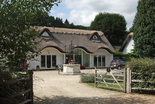
I might have taken a break but the world hasn't gone away. The sight of Ashley Green with its quaint little well house and gravel path leading out into the meadows somehow makes me feel it was only yesterday I was last there. Retracing a little of the previous section, I spot the Thames Water signs by a works entrance to the side of the path -- the fenced woodland with its "Danger: Deep Water" signs is presumably part of the sewage treatment works. I'm soon at the path junction with the clear path ahead rolling across fields into Hertfordshire, back towards Berkhamsted, but this time I take the narrower field edge path uphill on the right, continuing with the main route of the London Countryway for the last few kilometres in Buckinghamshire. This is also the route of the elusive and meandering Chiltern Heritage Trail, for which I've since obtained a photocopy of the out-of-print leaflet: the walk was a millennium project but Chiltern council's support for it hasn't even lasted a decade.

The path climbs up a relatively shallow hillside and down into a dry valley, a gentle echo of the previous sections' rollercoaster rides, then gains a little more height across the shallow shoulder of the next hill. After this, as Countryway inventor Keith Chesterton assures us, the route will level out, leaving the Chilterns to cross a broad upland between the Chess and Bulbourne valleys. In fact the whole of this section is outside the boundaries of the Chilterns AONB though the beginning shares its geography, and looking back from this hill gives our last airy view of the characteristic rolling pastures dotted with wooded clumps.
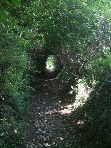
Then the going turns muddier underfoot as the Countryway sets out across flatter country, passing the attractive Gothic-styled cottage of Sales Farm, the first of three farms that punctuate this first part of the section. Beyond this farm, a straight and sticky path leads across the centre of a huge flat field towards Hemmings Farm, swinging southwest along a hedge-hugging bridleway and doglegging through a woodland. Here I encounter the worst mud hotspot of the day, finding myself tiptoeing precipitously on a sliver of dry verge while clinging gingerly to the barbed wire doing its utmost to force me into the water. The way emerges in the large farmyard of Moors Farm, passing cattle byres before another bridleway, a fine and thankfully relatively dry green lane between thick hedgerows, cuts southeast again to the B4505 Chesham Road and the county boundary.
The bridleway emerges at a place with the picturesque name of Pocketts Dell, near a bend where a number of old lanes converge. Looking at the map and seeing the ground, I'd guess the current bend is a result of work at some point to smooth what was a right angle in the B4505: a bridleway continues ahead on the line of the road, with the remains of a hard tarmac surface underfoot. It runs alongside a low earth bank lining a strip of wood, marking the boundary between Buckinghamshire and Hertfordshire. A few metres on, while the Chiltern Heritage Trail continues ahead, our route turns left across the boundary along another broad bridleway, also with the remains of a hard surface underfoot, guarded by posts bearing vandalised Hertforshire County Council "no motor traffic" signs.
I spent my later childhood and teenage years in Hertfordshire and must confess I always regarded it as a rather bland county. I remember my mother, a south Londoner, being excited about moving there not only because it was in easy reach of London but also because of the glamour she imagined must shine out from the film studios in Elstree and Leavesden. Of course that was quite a way from the rural outskirts of Hertford, where we lived, and by the early 1970s the British film industry had been reduced to the decidedly unglamorous production of exploitation films and spinoffs from TV sitcoms. Instead we found a county which, in terms of landscape outside the Chilterns in the west and the southern metropolitan sprawl that frequently bursts across the Greater London boundary, is mainly rich but muddy and undistinguished farmland. Few great historical events played out here, though the synod at Hertford in 673, the first in England, is a milestone in British religious history. The city of St Albans, with its rich Roman heritage, is admittedly a gem which provides the destination of the next section. There are some pretty market towns and villages, but the most remarkable major settles are the 20th century New Towns orbiting London: the county includes two pre-World War II pioneer Garden Cities at Letchworth and Welwyn, and two major post-war examples at Hemel Hempstead and Stevenage. It strikes me that London's New Towns would provide a fascinating theme for a walk, but unsurprisingly the London Countryway studiously avoids them. The towns were supposed to be self-contained communities, where people relocated from London could live and work locally, but of course like all the other settlements within the throw of our route they are now dominated by commuting, acting primarily as dormitory suburbs of the capital.
Crossing into Hertfordshire also takes the London Countryway into its second English region, leaving South East England and entering the East of England, at least as far as government and administration is concerned. The nine English regions don't figure much in the popular consciousness -- indeed, if you believe the Daily Mail, they're part of a plot hatched by Brussels bureaucrats to undermine national sovereignity by fragmenting the power of the big member states (I must admit if I was an EU official tasked with the challenge of achieving consistent governance in the face of squabbling member states, such a thought might well have crossed my mind). But England is a big country with a large population, and running anything on a national basis is highly likely to require geographical divisions that the historic pattern of counties is just too small and fiddly to supply. Attempts to meet such needs date back at least to Oliver Cromwell's Protectorate in the 1650s, when the country was carved up between ten Major Generals, but there was no official, unified government scheme until very recently -- instead, different regions were used for different purposes, making it difficult to compare like with like. In 1994 John Major's government finally put in place a unified scheme of Government Office Regions which would henceforth be used to structure both statistics and the local activities of central government, originally based on 10 regions but in 1998 reduced to nine with the merger of Merseyside into North West England. By then the move was indeed supported by EU policy, and specifically the Maastricht Treaty which established a Committee of the Regions.
There is an argument for subdivision for administrative convenience, but there has also been a longstanding pressure for an English regional structure in terms of democratic participation in government which, oddly enough, arises most sharply from the demands of parts of the British Isles with a more distinct separate identity. The process of implementing "home rule" in Ireland early in the last century also saw the first proposals for self-governing regions in other parts of the UK. More recently, devolution in Scotland, Wales and the six counties of Northern Ireland, and to a more limited extent in Greater London (which is counted as the ninth English region although it is the only one with a directly elected political body) has raised the question not only of consistency, as all these bodies have varying powers, but of what should happen to resolve the anomaly that the rest of England remains governed directly from Westminster, where the UK Parliament is also a de facto English parliament, allowing MPs from the devolved countries and London to influence decisions that don't apply to their constituents.
The problem, as anyone from Whitehall and Brussels mandarins through broadcasters to people compiling lists of Wetherspoons pubs soon discover, is that England just doesn't break neatly into roughly equal parts, and while there are strong feelings in certain places about local and regional identities, equating these to hard-drawn boundaries that also make sense in terms of practical factors like population size and transport accessibility is a huge challenge. John Prescott was very keen on the regional agenda when he held his extended brief as Deputy Prime Minister -- the 1997 Labour government created regional assemblies and regional development agencies that began as appointed bodies but were planned to grow into directly elected assemblies with devolved powers. Referenda were planned but the first to be held, in North East England in 2004, uncovered an embarassing lack of popular enthusiasm for the idea. Since then the assemblies have been replaced by Local Authority Leaders' Boards and new models of City Regions inspired by the system in London have been proposed for the more metropolitan areas.
Which brings us back to the boundary we've just crossed, a good example of the messiness of the regional divisions. For all the issues with the Greater London boundary already mentioned in this blog, it has at least established itself as a recognised and sensible subdivision of England, but dividing up the surrounding territory is more of a problem. Traditionally the counties immediately adjoining London are known as the Home Counties, a usage probably derived from the former "home circuit" of an itinerant 19th century law court. The term is sometimes confined to those counties that touch the London boundary -- Kent, Surrey, Buckinghamshire, Hertfordshire, Essex and, since 1994, the former Berkshire unitary of Slough -- and is sometimes extended to cover West and East Sussex. Another term heard informally is "southeast England", which might also reach out into Oxfordshire and Hampshire and maybe even beyond. All these places are well within the commuting hinterland of the capital -- the former British Rail division of Network SouthEast got as far as Exeter, Peterborough and Kings Lynn.
The problem is that this well-stuffed donut around London would simply be too big and too rich to function as a single region. The rather uncomfortable solution chosen in 1994 and still with us today is to divide split the London hinterland between two regions. South East England, through which we have walked up to this point, is a rather untidy L-shape, stretching from Oxfordshire in the northwest south through the Berkshire unitaries to Hampshire and the Isle of Wight, then east between London and the sea -- West Sussex, East Sussex, Surrey and Kent. The remaining Home Counties of Hertfordshire and Essex, along with Bedfordshire, have been put together with Cambridgeshire, Suffolk and Norfolk to form the East of England region. This makes a sort of sense for Essex, which is separated in the south by the Thames and much of which geographically forms part of that rump on England's eastern seaboard also known as East Anglia, but with Hertfordshire and Bedfordshire it's a bit of a stretch.
Hertfordshire was one of the smallest traditional counties but still retains its two tier district and county structure -- in fact it's now the smallest of the remaining "shire" counties. The first of its districts we enter is Dacorum, officially known as a borough, although the difference between boroughs and districts as subdivisions of shire counties is purely ceremonial. The borough name rather self-consciously invokes several periods of pre-Norman history, perhaps to offset its origin as a thrown-together administrative convenience around the new town of Hemel Hempstead in 1974. It's derived from a Roman term for "Danish" which once graced an old Saxon hundred, referring to the proximity of the boundary of the Danelaw, the area ceded by the Saxons to Danish rule in the late 9th century.

The broad and well-surfaced leafy track along which we enter the district, shown on street maps as Pocketsdell Lane, presents an intriguing anomaly for connoisseurs of such things. A few hundred metres along, the reason for the "no motor vehicles" signs becomes apparent -- a fingerpost indicates its bridleway status is upgraded to a byway open to all traffic. But there's no apparent reason for the change at this point: theres no junction, no difference in the physical character of the track, only a field boundary on the other side of the hedge. Presumably when the right of way was classified it was only possible to demonstrate vehicular rights to that point.
Towards its end the path does indeed become more of a surfaced drive, emerging onto Hill Lane at Pudds Cross on the edge of Bovingdon. From here Chesterton found the shortest route to the Countryway's next objective, Bovingdon Green, unacceptably disrupted by sand quarrying, and recommended a dogleg detour for some distance along Shantock Hall Lane opposite. As on the approach to High Wycombe, I hazard that these problems will have been sorted out in the intervening three decades and aim to follow the obvious more direct footpath route shown on the Explorer map. A newish foothpath sign bearing the destination Bovingdon Green and pointing along a path that starts off parallel to the lane looks promising, and sure enough the path turns out to be clear and easy to follow. There's no current quarrying in evidence though the trail does wind through a brickfield, Bovingdon Bricks, which may well have made use of this local supply of rich red sand, still to be seen underfoot. Founded in the 1920s, the brickworks is now the county's last, and specialises in traditional and specialist bricks, some of which are hand made. "Beautiful bricks," claims the website, which also explains how the company's original clay extraction site at Boxmoor, now on the edge of Hemel Hempstead to the northeast, has been restored as public space now in the hands of a trust.

Bovingdon Green is a big village green to the south of Bovingdon itself, presenting a stereotypical English rural scene with cottages, gravel paths and white railings around a triangle of mown grass, with a small pond in the corner. It has a preservation society but it's surprisingly underpromoted given its size and it's not obvious from the OS map that this remarkably pleasant wedge of green is there at all. The Countryway wanders along the southern edge of the green and stops just short of the Royal Oak, the big pub that overlooks it, which makes a point of selling beer from small Chiltern and Hertfordshire brewers, as well as local food.

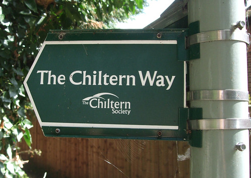
 From the eastern corner of the green a field edge path heads northeast to a T-junction with a path that carries two signed trails. One is an old friend, the Chiltern Way, which we encountered just past Marlow: this follows a more southeasterly route than the Countryway via the Chalfonts and Chorleywood, and northwards wanders in a long and straggly U-bend past Hemel Hempstead, around Dunstable and Luton and down to the Thames at Goring before heading back towards Marlow again. The other is the Hertfordshire Way, a 305km circuit originally devised by local Ramblers members -- you can't help but thinking with a certain amount of defiance to received wisdom about the attractiveness of the county -- and now promoted by a separate Friends group. The route it follows is often quite roundabout and meandering, deliberately taking in all corners of the county and a range of rural environments while avoiding most of the bigger towns, though we join it for a relatively straight stretch which, having descended from the Chiltern ridges into the Bulbourne valley to skim the east of Berkhamsted, is soon to turn roughly east, paralleling the London boundary. Although devised after the Countryway, its developers have clearly made many of the same choices here, and the distinctive white waymarks will accompany us for the rest of this section and much of the next.
A broad but rather muddy path between thick hedgerows emerges on Flaunden Lane, with the obvious alignment continuing ahead on another picturesequely named lane, Holly Hedges Lane. Here the Chiltern Way leaves us briefly, preferring to save a little tarmac walking by following three sides of a square, but the Hertfordshire Way and the Countryway press ahead along the lane. A good decision in my view -- it's a very narrow and quiet lane that forces the few cars using it to crawl along, and a hard and well-drained surface underfoot is rather welcome after all that mud. Rather pleasingly, it lives up to its name as it is flanked by holly hedges. Passing a few other walkers, we're rejoined by the Chiltern Way temporarily, before it heads off south to Chorleywood and back towards Marlow. I reach the corner of a woodland and find myself already in the second Hertfordshire district of the walk, Three Rivers. The district is another 1970s creation covering the suburban sprawl to the west of Watford, so this is an uncharacteristically rural corner of it. The three rivers in question are the Gade, the Chess and their main stream, the Colne -- both confluences are in the district. We'll soon cross the Gade and pass close to the source of the Colne, and will encounter the Chess on a later London underfoot walk. We're in the parish of Sarratt, location for a fictitious M16 interrogation centre in the novels of John Le Carré -- and if that doesn't stretch the bounds of imagination, it might be because the countryside round here is familiar from so many paranoid cold war TV thriller series produced from Hertfordshire studios.
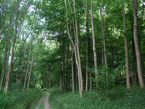
Woodman's Wood, named after a nearby farm, is managed by the Forestry Commission, and therefore open for public access, though other information on it is sparse -- it's listed on the register of surplus public sector land and I've also seen mentioned in documents relating to the Highways Agency so perhaps it was once blighted by a road scheme such as one of the various ringways proposed in the long and tortuous development of the M25. Whatever, it's a very pleasant old beech woodland on the Chiltern fringe. The lane narrows further as it penetrates deep into the wood, then the tarmac suddenly bends away, but a quick shimmy through a barrier reveals a clear path continuing ahead in the same direction, presumably once part of the original lane. This emerges from the wood and tracks a field edge towards the hamlet of Belsize, and if at this point it is indeed still Holly Hedges Lane, it's still obligingly living up to its name.
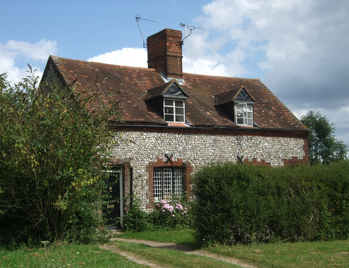
The view ahead is a feint echo of the rolling landscapes recently traversed, as I'm descending to a lane that tracks a dry valley with a slope rising up opposite, but this time it's terraced with cottages, and the slope leads not to a chalk ridge but to to the clay and flint Sarratt Plateau and the extensive 47ha of woodland and green space of Chipperfield Common, the star feature of this section of the walk. A few paces along the pavement to the right and I'm back in Dacorum again, with a clear gravelly bridleway leading me up onto the common. Just opposite is a pleasing composition that could have come from the sepia plates of a 1930s motor touring guide: the pretty lodge to Woodmans Farm with its dormer window and gothic front door, and outside it an old-fashioned roadside fingerpost.

 Chipperfield Common was once the property of a Dominican friary at Kings Langley, and commoners continued to exercise grazing rights on it into the 20th century. It was given to the local authority in 1936, by which time traditional grazing management had declined and the woodland seen today had started to develop. It boasts eight sweet chestnut trees allegedly planted to delight Isabella, the Castillian infanta who was the first wife of the first Duke of York, Edmund of Langley, when she rode over from the couple's home in what's now Kings Langley -- though as the trees are thought to be about 350-400 years old, this doesn't quite add up, as Isabella died in 1392. There are also some bronze age tumuli and a historical link to former US president Jimmy Carter, whose ancestors came from Chipperfield village.
Once again the paths have evidently been improved since Chesterton researched his 1981 guide: he reports that the most direct route, the bridleway that traces the southern edge of the common, is best avoided as it gets churned up by horses. It's now a good, broad, gravelly surfaced track, well signed with wooden fingerposts that indicate it's part of an easy access route, providing a good stretch of straight walking with a few houses and then glimpses of fields on the right and the pleasantly wooded common on the left. Nearing its end you reach Apostles Pond, so called because of the twelve tall lime trees that surround it, where I stop for lunch. Once the friars' fishpond, with its benches and numerous paths it's now a nexus of strollers and dog walkers. The sun has gone in temporarily and winter is back for a while: the pond is still, sombre and slightly gloomy, and children's voices in the nearby woods seem to come from far away. One of the sweet chestnuts looms nearby, and a notice announces a new plan to improve the environment around and raise awareness of these veteran trees, including a competition for the public to suggest individual names for them all.

At the pond our trail leaves the bridleway on a path striking northeast, which turns out to be a notably straight and direct footpath to Kings Langley. Just before leaving the common, waymarks in jolly primary colours of traditional narrowboat liveries announce we've also joined the Kings Langley and Hemel Hempstead Grand Union Canal circular walk, an 18km loop that's left the canal at Hemel to cross Roughdown Common and various local woodlands before tracing the edge of Chipperfield Common here. Then the sunshine returns, brightening what Chesterton rightly describes as a "fine striding path" between what is now much more of a typical Hertfordshire landscape of rolling fields, and bringing a spring to my step. I reflect that one of the pleasures of today's walk has been that at least since the Hertfordshire boundary every path has been relatively direct, giving a real feeling that you are progressing straightforwardly from A to B on a genuine alternative car-free route, rather than wiggling around from one short footpath to another in an effort to dodge the growup transport network, as is so often the case on walking routes of this kind.

The fine striding path encounters but one interruption, the near-motorway-standard A41, already discussed when I crossed it just outside Berkhamsted in the previous section. Adjoining the embankment that takes the path up to the footbridge across the road is the Centenary Community Woodland, planted in 2008 to celebrate the centenary of Hertfordshire council's rural estate -- its own farms and countryside holdings, which total 4,000ha including working farms as well as recreation sites. There's something compelling about the long term vision of such projects -- today just saplings in plastic tubes rather overwhelmed by the deafening roar of the road.
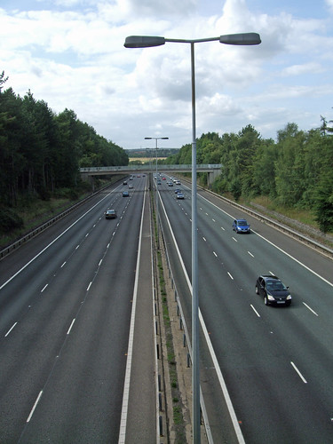
From the footbridge there's a clear view back towards London. I spot a pedestrian walking towards me down the hard shoulder from an obviously broken down car. He looks incongruously and unhappily marooned, still locked into the enclosed that runs like an entirely separate tranche of reality from my footpath, slowed to a snail's pace on a surface built for speed. It's almost embarassing as he catches my eye, as if we shouldn't be sharing the same space.

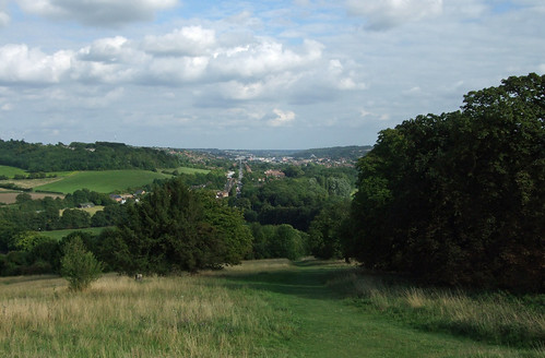
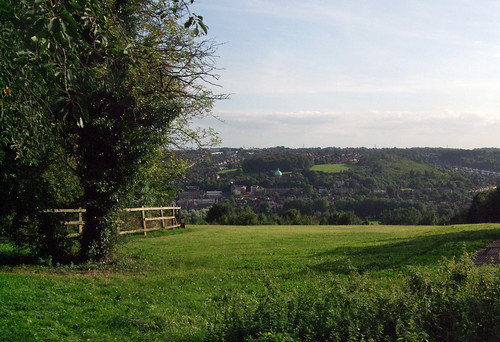
On the other side of the A41 the route starts to descend, still on the clear and broad field edge path, from the lip of the Gade valley, revealing a fine prospect with physical and human geography clearly laid out before you. Kings Langley's buildings cluster in the valley's crease, where the Grand Union Canal hides, and trains on the West Coast main line trace a course a little above the floor on the opposite bank. On the green hillside beyond, in direct line of sight, a single wind turbine towers 36m above the old Ovaltine Egg Farm at Beaufort Court. The M25, spotted for the first time since Merstham, sweeps in from the right, flying against the grain of the landscape on a lengthy concrete viaduct, while off to the left, in the distance, traffic on the north-south M1 is just visible, though the M25/M1 junction is hidden behind a hill. Doubtless many walkers on this path will decry the motorway viaduct and even the wind turbine as carbuncles and blots but there's a stark elegance to both and from this angle the accidental composition is quite striking. They also say as much about the interrelationship between humanity and the physical environment as the canal and the railway, both in their day equally intensive attempts to overcome natural challenges that are now regarded as unintrusive and even picturesque.

Kings Langley owes its existence to the valley's capacity to facilitate easy passage through the Chilterns -- a Roman road, the same one we encountered in Berkhamsted, passed this way and there is a villa site nearby. The Plantagenet dynasty had a palace here, founded by Eleanor of Castile, Edward I's wife, thus the royal ephithet, and the aforementioned first Duke of York, Edmund of Langley, lived here with another Castillian royal consort, the infanta Isabella, related by marriage to the famous Jan van Gent or John of Gaunt, Duke of Lancaster -- both rose houses, but a generation before they went to war on one another. Richard II was buried here for a while. It remained a relatively small place until the modern age of communications -- first the Sparrows Herne turnpike road (later the A41, now diverted along the bypass we've already crossed), then the canal, then the railway, all of which also ran via Berkhamsted, so much of the discussion of these phenomena in the previous section applies here. Today it's probably best known as the former home of Ovaltine, that bedtime soporific of many a bourgeois English childhood, of which there will be more to say in the next section.
A 20th century sprawl of housing, light industry and offices has turned Kings Langley into a substantial settlement of over 5,000 people, easily enough for a small town, but the place is still officially a village, as testified in signing that indicates the village centre. And indeed our final approach is a rural one as the fine striding path runs its final metres past a pond, a black clapboard cottage and through the authentically cowpatted farmyard of Wayside Farm, at the southern end of the village street.

 Here we turn away from the village centre and continue east down an old lane, now supplanted by a newer, broader parallel road serving the industrial estates, towards the Home Park Mill on the valley floor. This soon crosses the Grand Union Canal, here supplanting the course of the Gade, by the pretty Home Park Mill lock, where the circular walk picks up the towpath left to complete its loop towards Hemel Hempstead. The canal, and the Grand Union Canal Walk, will form the basis of more than one future London underfoot walk, so there will be much more to say about them beyond the brief notes in the previous section.
Continuing beyond the canal, and now on the modern Home Park Mill Link Road, I very shortly cross the millrace, where a sign announces the rather dull surrounding light industrial and office units include "Imagination House". The station, at the end of this section, is a short hop down Station Road. It's a modest building, in a 1980s mock vernacular cottage style, although there's been a station here since 1839, originally known as Kings Langley and Abbots Langley. It's actually just over the Dacorum boundary in Three Rivers -- the canal marks the boundary, and the M25 thunders on its viaduct right over the London end of the platforms. The traffic above is heading round but for the time being at least, I'm heading back.

Download a route description PDF
View Google map
http://maps.google.com/maps/ms?ie=UTF8&hl=en&oe=UTF8&start=323&num=200&msa=0&msid=117966169375523396049.00046414d40d8252e7b70&ll=51.707134,-0.706859&spn=0.001599,0.00478&t=h&z=18
More information:
- Buckinghamshire County Council http://www.buckscc.gov.uk/
- Visit Buckinghamshire http://www.visitbuckinghamshire.org/
- Walking in Buckinghamshire (Visit Buckinghamshire) http://www.visitbuckinghamshire.org/site/walking-in-buckinghamshire
- Buckinghamshire Walks and Rides (Bucks CC) http://www.buckscc.gov.uk/bcc/row/getting_out_on_the_network.page?
- Buckinghamshire Leisure & Culture (including parks) http://www.buckscc.gov.uk/bcc/leisure/Leisure__culture.page?
- Chiltern District Council http://www.chiltern.gov.uk/
- Chiltern tourism and walks http://www.chiltern.gov.uk/tourism
- Ashley Green Community Association http://www.ashleygreen.org.uk
- Ashley Green Stile Free Walk http://www.chilternsaonb.org/site_details.asp?siteID=474
- Ashley Green Chesham Walk http://www.chilternsaonb.org/downloads/publications/CheshamWalks6AshleyGreen.pdf
- Hertfordshire County Council http://www.hertsdirect.org/
- Hertfordshire Tourist Information http://www.hertsdirect.org/comdirectory/comvol/infoad2y/intour3y/
- Hertfordshire countryside and rights of way http://www.hertsdirect.org/envroads/environment/countryside/
- Dacorum Borough Council http://www.dacorum.gov.uk/
- Dacorum Tourism and Travel http://www.dacorum.gov.uk/default.aspx?page=1542
- Dacorum parks, countryside and open spaces http://www.dacorum.gov.uk/default.aspx?page=77
- Dacorum Heritage Trust http://www.dacorumheritage.org.uk/
- Bovingdon Parish Council (including walks)
- Bovingdon Bricks http://www.bovingdonbricks.co.uk
- Bovingdon Green Preservation Society http://bovingdon-green.org/
- Royal Oak, Bovingdon Green http://www.royaloakbovingdon.co.uk/
- Chiltern Way (Chiltern Society) http://www.chilternsociety.org.uk/about-ChltnWay.php
- Chiltern Way interactive map http://www.chilternsaonb.org/place_details.asp?siteID=219
- Friends of the Hertfordshire Way http://www.fhw.org.uk/
- Three Rivers District Council http://www.threerivers.gov.uk/
- Three Rivers Parks and Recreation http://www.threerivers.gov.uk/Default.aspx/Web/ParksRecreation
- Three Rivers Tourism http://www.threerivers.gov.uk/Default.aspx/Web/TourismTravel
- Sarratt Parish Council http://sarratt.hertsparishes.gov.uk/
- Chipperfield Parish Council http://www.chipperfield.org.uk/
- Kings Langley Parish Council (including walking map) http://kingslangleyparishcouncil.hertsparishes.gov.uk/
- A41 (Wikipedia) http://en.wikipedia.org/wiki/A41_road
- Grand Union Canal http://www.waterscape.com/canals-and-rivers/grand-union-canal
- Grand Union Canal walking http://www.waterscape.com/canals-and-rivers/grand-union-canal/walking
- River Gade (Wikipedia) http://en.wikipedia.org/wiki/River_Gade
- Abbots Langley Parish Council (including walks) http://www.abbotslangley-pc.gov.uk/
- West Coast Main Line (Wikipedia) http://en.wikipedia.org/wiki/West_Coast_Main_Line
- M25 motorway (Wikipedia) http://en.wikipedia.org/wiki/M25_motorway





 Posts

