Showing posts with label Mole Gap Trail. Show all posts

Saturday, 9 May 2009

London Countryway 1: Box Hill - Horsley

ranmorebluebells

So far almost all this outermost orbit of the London area has been on or alongside the hilly ridges of the North Downs and Greensand Way that guard the southern edges of the Thames basin. Today, having moved sufficiently far west to miss the heart of the city itself, I finally start to draw away from the southern hills and descend towards the Thames Valley. But before that, there's one last lengthy stretch along the wooded tops, mainly through an extensive agglomeration of woodlands known variously as Ranmore Common, White Downs and Hackhurst Down which is in, as a very informative interpretation board along the way puts it, "a mosaic of ownership" -- some private, some National Trust, some Surrey County Council, with the Surrey Wildlife Trust and, to a lesser extent, the Forestry Commission involved in its management.

In some ways it's one of the most remote sections of the route so far -- the only public transport between start and finish is very near the end (unless you count a once-a-week bus) and the only convenient midway break point is still a 4o-minute walk from a station with a two-hourly service. Nevertheless it's well used and you probably won't walk far without passing someone on the path, especially at weekends -- even the privately owned bits are mainly subject to long term access agreements and the whole area is crisscrossed with well-signed paths and dotted with car parks. I walked it on the fine Sunday of the early May bank holiday and encountered probably my highest headcount outside of an urban area on the route so far, including a good few off-road cyclists taking advantage of the fact that many of the paths are bridleways and therefore also open to them.

boxhillstation-signs

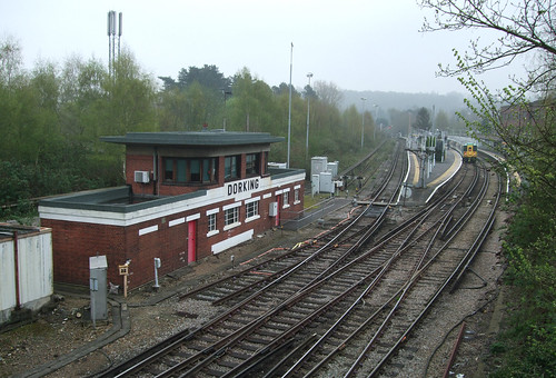
The area's popularity is immediately obvious when I get off the train, this time at Boxhill and Westhumble station, and find a good number of other passengers are getting off here too, some of them clutching Ordnance Survey Explorer maps and route guides. A small group of young women are hefting improbably bulky backpacks. The station is also a starting point for the Thames Down Link to the London Loop and Kingston, which we'll be walking at some stage in the future -- there's an information board about this particular trail -- and has easy links to the Mole Gap Trail to Leatherhead. A substantial peleton of leisure cyclists whizzes past along the A24 as I walk the link from station to the point where the North Downs Way national trail crosses this main road.

Today is also our leavetaking of the national trail, with which we finally part company about halfway through. I've mentioned before that the North Downs Way also forms part of European Long Distance Path E2, which we'll bump into again on a couple of occasions, but perhaps now is the time to explain a little further. The E2 is one of a network of very long paths across Europe which have been designated by the European Ramblers Association (ERA), or, if you prefer, Fédération Européenne de la Randonnée Pédestre (FERP) or Europäische Wander-Vereinigung (EWV), a Europe-wide federation of voluntary countryside leisure walking and hiking organisations.

Professionally I've had some dealings with the ERA and it's a curious organisation that has its origins in a very different age. Although its logo now incorporates the European Union circle of stars and the appearance of its paths on Ordnance Survey maps is likely to make the sort of people that have bulldogs rather than blue stripes on their car number plates reach for their venomous ink, it was actually set up in 1969 within the structure of the Council of Europe and its members covered the continent from west to east long before the collapse of the Soviet Union, in the days when the EU was still the EEC and consisted of only six countries. Somewhere in there is the whiff of the Cultural Exchange and the not unattractive notion that bringing people from different backgrounds together to walk in the outdoors and enjoy the natural environment will overcome barriers and enable us to find common humanity and planetary citizenship. And there's also a detectable Germanic influence, of das Wandern is des Müllers Lust and the ideology of links to the land and what speakers of many European languages are prone to mistranslate rather endearingly and tellingly into English as "the Nature" (la nature, die Natur). At an operational level, it's the huge differences between the organisations involved that are the most difficult to bridge, some tiny and entirely volunteer-supported, some large with an extensive professional staff, working in very different legal contexts with different relationships to their relevant statutory bodies, so unsurprisingly the pace of progress is slow and, rather like a walking group of very mixed ability, very widely spread.

The ERA has two main activities. Some of its activists like organising walking events bringing different member organisations together. Some, as is often the case among walking enthusiasts (present company not excepted), like to draw lines on maps -- very large maps, with very long lines. The network of 11 E-paths runs for tens of thousands of kilometres and if it's ever completed will stretch from Lapland to Cyprus and the Straits of Gibraltar, and from Galway to St Petersburg and Istanbul. Like the E-roads -- another project often thought to emanate from Brussels but actually a post-war United Nations initiative -- the paths are mainly not new creations in their own right but superimposed on the existing path networks of member countries, coordinated by a committee working with member organisations. Partly as a result of this approach and partly because they tend to prioritise significant and impressive landscapes, they often run by very indirect routes -- we'll see a relatively minor example of this on the E2. As is often the case with routes of this generation, they tend to be metrophobic and avoid big cities -- sadly you can't follow an E-path from London to Paris or Amsterdam to Warszawa.

In Britain the E-paths have been promoted not by the Ramblers (though it is an ERA member) but by the Long Distance Walkers Association (LDWA), a much smaller and entirely volunteer-driven organisation. Three venture across the North Sea and Channel via ferry ports: as well as the E2 there is the E8, which follows part of the Trans Pennine Trail between Liverpool and Hull, and an alternative loop of the E9 European Coastal Path between Plymouth and Dover. They're not especially well-known though as mentioned above they do now appear on Ordnance Survey maps. Unsurprisingly there are no standard guidebooks -- instead you'll need to patch together guides to the various component paths, which of course may be in various languages. You will very rarely find them signed on the ground, though the recently established Bournemouth Coastal Path is signed as the E9 and the Trans Pennine Trail publicises its E-status. The E2 is supposed to be signed at major junctions but I've not yet spotted any evidence of this despite being sad enough to go deliberately looking for it in a few places -- I'd welcome any notification to the contrary.

In some respects drawing up these paths feels like a fantasy game -- only a very tiny number of people are going to walk them throughout, and promoting them too avidly could even be discouraging if people who could benefit from walking more think they must aspire to such vast and challenging distances. You can see the paths' potential as exemplars of best practice and symbols of international cooperation and the breaking down of borders, except that the ERA has found it difficult to agree on what best practice actually is. From a personal point of view, though, it's quite nice to think that I could in theory walk from the North Downs to the Alps on continuously signed footpaths, even if I never do.

The E2 is in theory one of the more coherent E-paths as it is based on one of the best known long distance walking routes in mainland Europe, the GR5 north-south route through eastern France linking the Ardennes, the Alps and the Mediterranean coast, created by the French walkers' organisation FFRandonnée (formally Fédération Française de la Randonnée Pédestre). Through cross-border cooperation this route has long been extended northwest through Luxembourg, Belgium and the Netherlands, countries that all use the same waymarking system as in France, to Bergen-op-Zoom, just over the Dutch side of the Dutch-Belgian border.

With the E2 extension into Britain, things get complicated, with two distinct branches. The route to Bergen continues northwards along the Dutch coast to Hoek van Holland, picking up on the other side of the ferry crossing at Harwich and running via a succession of linking paths along the Stour Valley, through the Fens and the Lincolnshire Wolds, across the Humber Bridge, through the Yorkshire Wolds and along the Yorkshire coast and Teesdale to the North Pennines. From here it doglegs via the Pennine Way, St Cuthbert's Way and Southern Upland Way to Stranraer, with the hope that eventually there will be a link from Larne on the other side of the Irish Sea to Galway on the Atlantic coast.

The alternative splits off in a woodland nature reserve near Zoersel in the Belgian Kempen, right by a pretty little cottage café called 't Boshuisje, and runs by a circuitous route to Oostende. This was planned to connect by ferry to Dover, but that particular ferry route ceased a few years after the opening of the Channel Tunnel -- the only ferry from Oostende now goes to Ramsgate and doesn't accept foot passengers, and the nearest port with a connection to Dover is Calais, some way down the coast. From Dover the E2 picks up the North Downs Way, and so eventually joins our route, though as we'll see it finds a different way to the Thames. It then runs via Oxford, the West Midlands and via a succession of local routes on the edge of the South Pennines to the Pennine Way, eventually rejoining the other branch at Middleton-in-Teesdale.
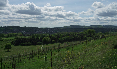
There's no signpost to Stranraer pointing through the attractive black steel designer gates through which my path leaves the main road just north of Dorking, but there is a solid wooden North Downs Way fingerpost, one of many that will guide our way for some time. The gates mark the boundary of Denbies Wine Estate, England's biggest vineyard. Once owned by property developer Thomas Cubitt, the man who built Belgravia, the estate was operated as a pig farm, with the chalk slopes planted with maize for silage, until in 1986 its owners had the brainwave of reinventing it as a vineyard, with the first harvest in 1989.
"English wine" is wine made from fresh grapes grown in England, as opposed to park bench-friendly British wine which is made in Britain from imported grape concentrate, and tends towards the fine, artisanlly produced and domain-bottled side of the market. As such it might be viewed as something of a modern affectation that might have something to do with global warming, but in fact grape growing and winemaking has a history in Britain that goes back at least to the Roman occupation. The traditional division of Europe into "belts" according to alcoholic drink of choice -- grain spirits in the north, beer and cider in the middle and wine in the south -- has very blurry edges. One clue is that English speakers have that special old Anglo-Saxon word, 'vineyard', with its irregular pronuciation, not "grape field" or "grape orchard" or "grape farm". Admittedly wine production in the UK had ceased by World War II -- its revival in recent decades is significant but small, with English wine accounting for only around 1% of total domestic wine sales. Grapes do have a hard job ripening properly in the English climate, even this far south, but even so Denbies manages to work with "noble" grape varieties like Chardonnay and even the red Pinot Noir as well as hardier German hybrids.
After the sharp descent from Box Hill it's a relief to find myself climbing back up from the Mole Gap to the ridge on a gentler route, along a broad, well-surfaced track through woodlands. I catch a glimpse or two of vines through the trees before the surroundings open out to a truly exhilirating view: vines marshalled on canes raking the rolling chalk slopes below in a way that, had you actually walked here from Nice on the E2, would seem very familiar; the brown woolly-wooded ridge of Box Hill coming to its sharp end at the Mole Gap, bare chalk visible through scratch wounds on its slopes; Dorking down in the gap; and Leith Hill, the tallest point in Southern England, rising from the Greensand ridge ahead. Vines, the wine books tell you, do best when they have to struggle with the soil. This may not be the gravel of the Medoc, but the grapes seem to do well enough on this spectacular south facing pebbly chalk slope, benefiting from the shelter of surrounding hills.
surreyhillsfromdenbies
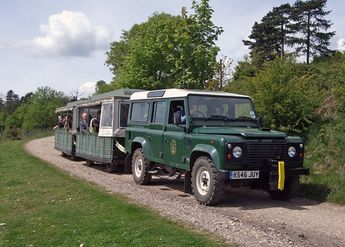
I pass a Land Rover slowly towing a land train well-loaded with passengers along the track from the opposite direction, and with a cheerful smile the driver obligingly pulls up to let me take a photo. I've never been on one of these novelty tourist services -- they usually run on routes I can and would rather walk -- but as they're theoretically a form of scheduled public transport running to a fixed route they always perk my interest. The one at Denbies is an indication of how important tourism is to their business plan, as well as wine production. As they say in the student information pack on their website, the one feeds the other. Of course they're gifted with a magnificent site, but there's also something about a vineyard that makes it a special place to go in its own right. Even in France, where vineyards are not exactly remarkably rare, you'll find many of them sporting brown tourist signs. Part of the appeal is provenance, the fact that the whole process from fruit to bottle takes places on the same site. While a number of breweries have realised their potential as visitor destinations, I doubt a land train round a barley field would have quite the same allure. I reflect again that someone ought to plant a hectare or so of inner London with vines, in answer to those on Montmartre, just opposite the Lapin Agile cabaret where Aristide Bruant once performed -- Parliament Hill, for instance, has gravelly soil and south facing slopes.
denbiesroadtrain

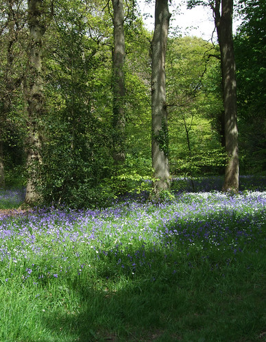
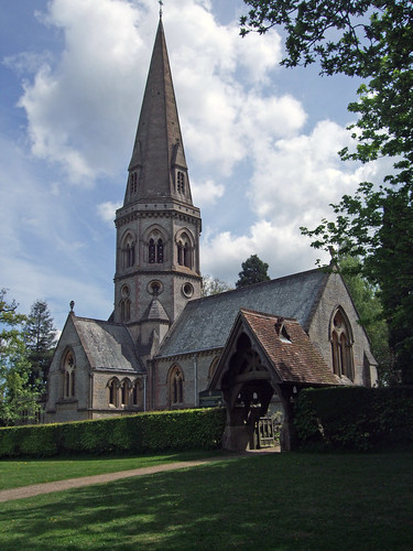
Past the vineyard the trail leads back into woodlands thick with bluebells at this time of year, and up to Ranmore Common Road where the broad grass verges are not only busy with walkers but with congregants leaving the self-proclaimed "Church on the North Downs Way", St Barnabas. The church, opened in 1859, is a legacy of Cubitt's time as owner of Denbies estate and was designed by architect George Gilbert Scott, best known for the Midland Hotel at St Pancras Station and the Albert Memorial in Kensington. With a touch of confident chauvinism typical of their times, Scott and his followers rejected the neo-classical and Romanesque styles to which their predecessors defaulted when called upon to design grand buildings, regarding them as too southern European and, ultimately, pagan and favouring instead what they saw as the healthily Germanic and Christian Gothic style. Now, Gothic may be remarkable when writ large on station hotels and town halls -- and there's some irony in the fact that what was seen as a masculine style produced, in Scott's hands, such camp extravagances as the Midland Hotel -- but it's wholly unremarkable when applied to country churches. St Barnabas is a modest and quietly elegant building with an octagonal tower and slender spire, somehow anticipating the more homely and less ambitious work of the Arts and Crafts movement that followed the decline of high Victoriana.

stbarnabas-ranmore1
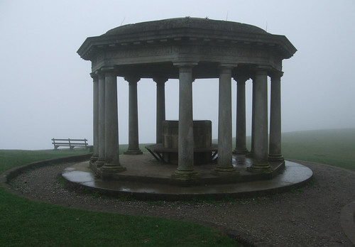
Where Ranmore Common Road bends round a T-junction with Ranmore Road, there's another "beauty spot" with a car park, ice cream van and a small wooden shelter containing an information board about the North Downs Way -- it still bears the logo of the old Countryside Commission (since succeeded first by the Countryside Agency and now by Natural England) and may well date back to shortly after the trail opened in 1978. Beyond it is the National Trust's Steers Field, with another open view towards the south, and our last convenient connection to the Greensand Way signed ahead and downhill. Our route, however, continues along the springy turf at the top of the field and back into the woodlands of Ranmore Common.
ranmorecommon-signs
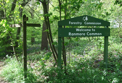
A sign for the Forestry Commission indicates that for the first time the Countryway is passing through the territory of another of Britain's big institutions managing land for public access. One of the few surviving state commissions of the past century, it was established in 1919 as a development of government intervention to coordinate timber production for the war effort. For most of its existence it was primarily concerned with promoting timber production on an industrial scale, and associated with large scale afforestation with quick-growing conifers, but in recent years it's taken a broader approach to the function of forestry and now claims to be Britain's biggest recreation provider. Its continuing existence as an arm of the state in the era of privatisation and external commissioning is less to do with its touchy-feely Kids in the Woods and tree hugging side, though, and more to do with the continuing strategic importance of timber. We've seen its stylised conifer-and-broadleaf logo before where it's taken a role in the management of woodlands owned by others, including encouraging public access, but this is our first large scale encounter.
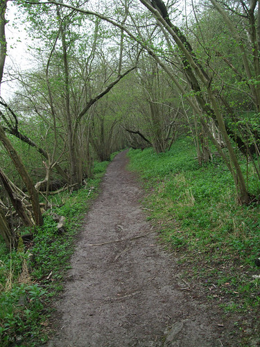
The long stretch of clear woodland track that continues is a classic woodland walk, fresh, cool and colourful with the trees in their best fresh spring green and the floor splashed with bluebells, dappling the green with an Impressionist's dabs of complementary purple-blue.

Through the woods to the north is another remarkable survivor -- Tanners Hatch Youth Hostel, an old-style country hostel that can only be reached on foot, bike or horseback, converted from two 18th century cottages, with gas lighting, traditional triple bunks and open fires. When I last stayed there in the early 1990s the only form of lighting was gas, but they've since installed electricity and central heating, a small price to pay since the hostel should long since have been rationalised out of existence now the YHA is more interested in modern big city backpacker hostels, and indeed would have been if it wasn't for an enthusiastic warden and user group. I recall one of my fellow guests on that occasion had walked to Tanners Hatch that day from central London, something I aim to do myself before they finally close the place.
ranmoregrafitti

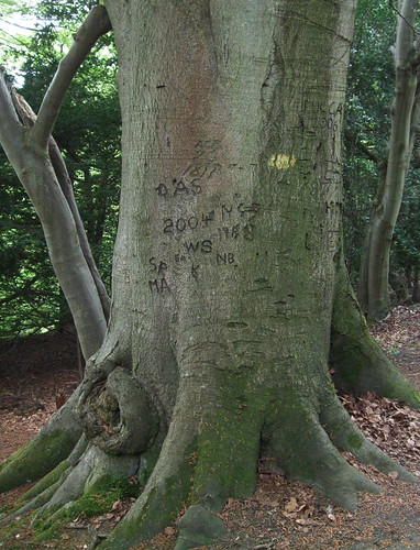
The long path leads past a pair of old trees with thick trunks carved with graffiti, some of which purports to date from 1878, to arrive at a T-junction by a Surrey County Council information board mapping circular walks in the area, with an intriguing map of land ownership -- much of the land, it shows, is in private ownership and used for commercial forestry but also managed for public access, while some is controlled by the National Trust. Most of the area I walk through is part of the Wotton estate, the historic nucleus of which is Wotton House at Wotton village, at the bottom of the slope to the south. This was the birthplace of diarist John Evelyn (1620-1706), who later lived at Sayes Court, Deptford, now on the Thames Path and only a short stroll from my flat. The estate is still the property of the Evelyn family, although the house is now a hotel and conference centre.
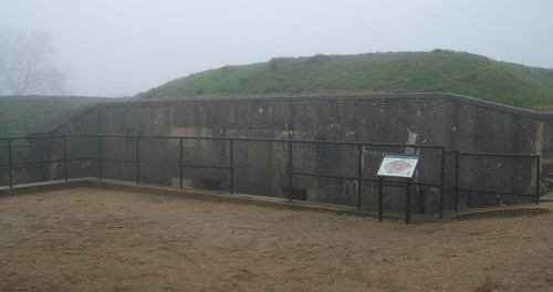
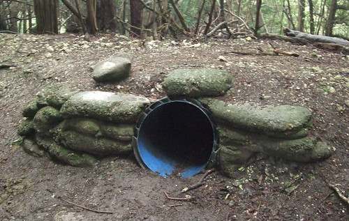
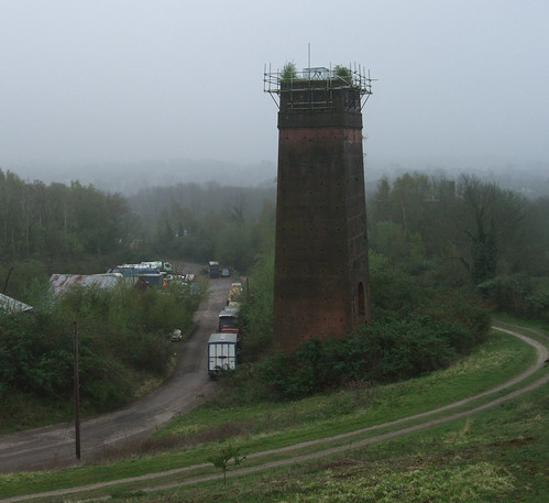
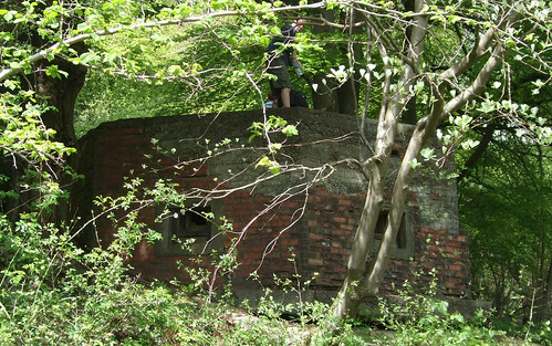
Another feature of the stretch between here and the point where the Countryway leaves the North Downs Way is a succession of old pillboxes or, more correctly, Hardened Field Defences, installed in the 1940s when, as at the time Reigate Fort was built (see London Countryway 22), the North Downs were seen as the first line of land defence for London. Thousands of these structures still survive, scattered not only on the Downs but all over the country, and these particular examples are familiar hexagonal ones built of red brick. Embedded in the wooded hillside, they're easily missed. The roof of the first one I pass has just been used as a convenient flat surface for a picnic by a family out cycling.
whitedowns-bunker
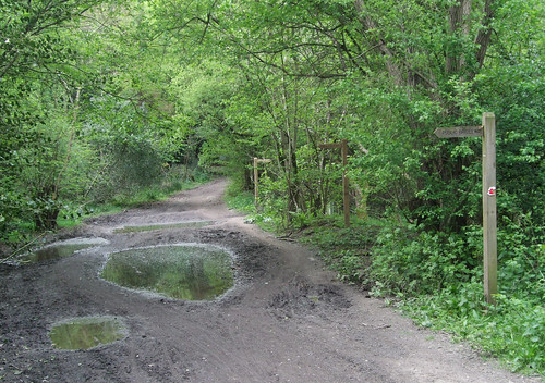
A number of paths and tracks run along the ridge here, some public rights of way, some "permissive" paths open to the public, and when Keith Chesterton devised his original London Countryway route, the alignment of the North Downs Way through here hadn't been finalised, so it's not obvious which route I should choose for my own excursion. In the end I opt for leaving the North Downs Way early and choosing a slightly higher path, though for one final view south from the Downs you could continue along the national trail through an obliging stretch of open downland as far as the gate to the National Trust's Hackhurst Downs property, then turn north. In leaving the North Downs Way you'll also part company with the E2, although we'll pick up the E-path again later on -- indeed, if you're walking the E2 and want to cut off a corner, the Countryway is a good alternative, taking a much more direct route from here to the Thames Path than the E2's dogleg via Guildford and the entire length of the River Wey Navigation.
Either way, you'll start to descend slowly to Blind Oak Gate, a complicated path junction deep in the woods where a succession of wooden fingerposts marks no less than seven possible routes. Some of the paths here mark the boundaries of adjoining woodland holdings, and there are also remnants of 1940s military use.
blindoakgatessigns

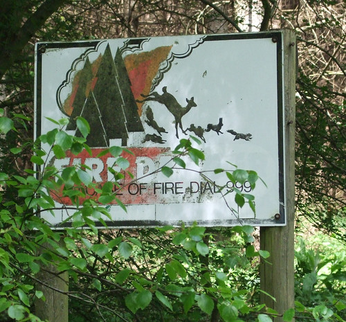
It's at this point that, should you wish to break your journey, there's a linkvia Abinger Hammer to Gomshall station on the North Downs Line. But the Countryway continues northwest, now descending the gentler dip side of the ridge on a rutted forestry track between two woodlands, partly broadleaf, partly conifers. Shortly after leaving Blind Oak Gate the boundary between Mole Valleydistrict and Guildford boough joins us and runs along our route for a while, though unless a chipped and eroded fragment of pebbly concrete emerging from the ground is the remains of a boundary post, there is no obvious visible evidence. Just opposite is a firebreak between the conifers, with one of those classic forest fire warning notices featuring a Bambi-nightmare silhouette of deer and bunnies fleeing the flames.

firesign

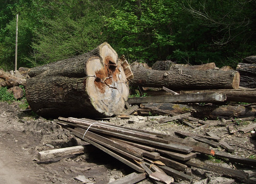
I pass a timber yard with a rather attractive wooden chalet and, now definitively in the borough of Guildford, join the broad drive, which leads through piles of felled timber -- including some massive trunks well over a metre in diameter -- to a small pond and path crossing by a lane called Honeysuckle Bottom, where Chesterton drily remarks that he's never seen any honeysuckle. Neither do I, but I do pause to enjoy the peace of this curiously sombre and lonely place.

honeysucklebottom-logs

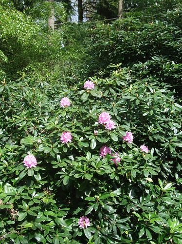
I'd thought descending to here that I was finally leaving the Downs but the Countryway has one final chalky climb to challenge me with -- a short sharp clamber left from the track and back into woodland along a northern spur of the ridge. This is Mountain Wood, a Surrey council site that is of interest to geologists as it has a unique deposit of gravel from the Lower Greensand on top of the chalk. It's a lovely old wood with woodbanks and rhodedendrons, splashed with early season flowers.

rhodendendrons

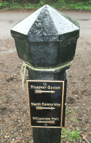
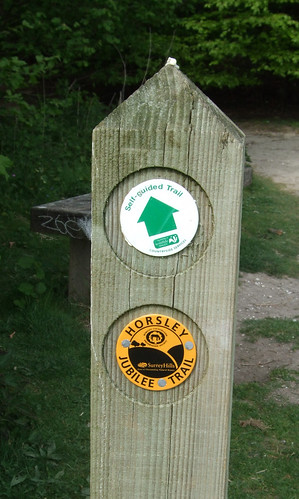
The path levels out and crosses a lane to enter a better known and more visited council site, the Sheepleas, bought from a private landowner to prevent development in the 1930s and now managed by Surrey Wildlife Trust. This is an interesting and varied site, with centuries-old coppiced woodland alternating with more open, grassy areas and meadows famed for butterfiles and rare flowers, the whole area webbed with footpaths and tracks. Once again there are quite a few people about, and I start to spot waymarks telling me I'm on the Horsley Jubilee Trail, a 15km circular route so called because the last section of it, a new right of way, was opened in Elizabeth II's Golden Jubilee Year of 2002.

horsleyjubileewaymark

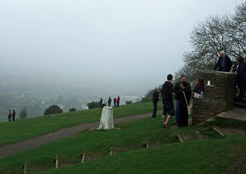
The Sheepleas would once have been as thickly wooded as some of the other areas I've passed through on the Downs, but thanks to the legacy both of 1987's Great Storm and subsequent deliberate clearances in the interest of biodiversity, it now has a lighter and less enclosed feel, and -- as I delightedly discover on reaching the lip of the ridge, a view to the north. It's not especially clear, just glimpsed through the trees as the path mounts a small summit, but it's definitely the Thames valley, and the first time the Countryway has given us a view from the other side of the ridge since Willey Park Farm near Caterham (London Countryway 21). It's with a renewed sense of purpose, then, that I begin my final descent from the chalk hills, following the yellow Jubilee Trail waymarks across grassy meadows well-used by picnickers and dog walkers, one of which is currently thick with wild primroses.

wildflowers-sheepleas

The path emerges at the bottom of the slope by St Mary's Church, West Horsley on the A246 Epsom Road linking the two Horsleys, where we finally leave the Surrey Hills Area of Outstanding Natural Beauty and the North Downs, and enter the Thames basin. The two Horsleys have long histories -- both have entries in Domesday, and the foundations of the church are 11th century, though it was much rebuilt in the 1840s. The squat tower with its curious roof dates from 1120 and the ladder used to build it remained bricked up inside it for 900 years: near-fossilised, it now hangs in the south aisle.

westhorsleychurch

A rather more grisly curiosity is that the head of Walter Raleigh (c1592-1618) is said to be buried under the chapel floor -- his wife Elizabeth had it embalmed after his execution and allegedly carried it around with her, keeping it at West Horsley place where she came to live with her son Carew, though other accounts say it was reunited with his body and is now in his tomb at St Margaret's, Westminster. Raleigh was very much a man of his time in serving the interests of the emerging British state, putting down Irish rebellions and helping conquest the New World, but he had his quirks, and, as a Protestant closely linked to Elizabeth I, sank in the shifting sands of Tudor and Stuart politics when the Catholic James I and IV succeeded to the throne. He founded the colony at Roanoke island in Virginia where all the colonists mysteriously disappeared without trace, the only enigmatic clue the word "Croatoan" carved on a tree, and of course he was a poet with more than a tinge of melancholy:

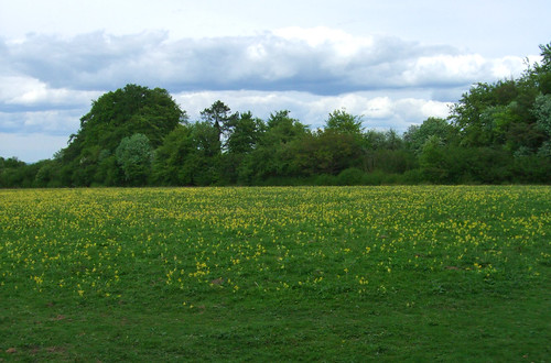
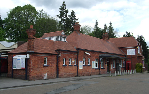
As in a country strange, without companion,
I only wail the wrong of death's delays,
Whose sweet spring spent, whose summer well-nigh done
Of all which pass'd only the sorrow stays.
Across the road from the church, the contrast in landscapes is immediately evident, as the path runs along the edges of flat green fields. There is a lattice of paths through these fields, not all shown as public rights of way on the map but still well-used by local people: ours keeps north, passing the only stiles on the route, although all have gaps beside them and don't require climbing, before emerging on a lane by farm buildings. The final stretch is a lengthy tarmac path by the side of the railway -- opened as the South Western Railway's New Guildford Line in 1885, and an early convert to third rail electrification in 1925. Eventually the path emerges by a recreation ground and a cluster of public buildings -- a village hall, a GP surgery -- at East Horsley, and a residential street leads to Horsley station and Station Parade, a welcome strip of of suburbia with shops and banks.

horsleystation

The village's gothic mansion was used for the Nigel Kneale TV drama The Stone Tape, a science fiction horror tale that hypothesised ghosts are "recordings" of traumatic events in the stuff of buildings and structures. I don't believe in ghosts, even as recordings, but we've certainly seen plenty of traces of the past incised into the present, with many more to come.
View a map http://maps.google.co.uk/maps/ms?ie=UTF8&hl=en&oe=UTF8&msa=0&msid=117966169375523396049.00046414d40d8252e7b70&num=200&start=73&z=11

Route description pdf

More information

Tuesday, 14 April 2009

London Countryway 22: Merstham - Dorking

colleyhillmonument

Today's walk veers back towards the North Downs after negotiating the motorways at Merstham and then clings to the ridge pretty much all the way, following the North Downs Way National Trail through some of the most celebrated beauty spots of the Surrey Hills, including Reigate Hill and Box Hill. Unfortunately the weather isn't kind to me -- Easter Sunday dawns mild but misty and the thick veil of water vapour refuses to lift. The view from the ridge, which on a clear day stretches to the South Downs, is little more than a featureless white haze. Still, I remember the first time I walked these paths, on a day in early May in the early 1990s, I got caught in an unseasonal blizzard.

I've already discussed the geology of the chalk ridge when we first encountered it (London Countryway 18: Sole Street - Borough Green). The history of the North Downs Way is less than a blink from the perspective of geological time, but as a long distance walking route, it's ancient. Chalk trackways may have begun as animal tracks, but were undoubtedly in use by humans in the days when you could still walk across land from England to Flanders.The ridges offer long lengths of uninterrupted contours, obvious navigation, well-drained soil, springy turf that seems to shape itself to the passage of feet, and a lofty elevation that makes it harder to be ambushed successfully. They still just feel right to walk on, although the earliest walkers would not have appreciated the views we know today as the hillsides were well wooded in their natural state.

Alongside a growing interest in many other aspects of the natural and historic environment, the desire to identify and document Britain's ancient roads flourished in the Victorian era. It was apparently Ordnance Survey cartographers who first coined the term "Pilgrims' Way" for a specific line of tracks along the North Downs, on the assumption that it would have been used by pilgrims from Winchester Cathedral bound for the shrine of assassinated "turbulent priest" Thomas Becket at Canterbury Cathedral, and in the other direction by those aiming to pay their respects to St Swithun. The term was popularised by Hilaire Belloc and became part of folk geography, giving its name to various streets and other features along the route, some of which bear the oyster shell symbol associated with pilgrims on their name boards.

But it now seems the idea of a Pilgrims' Way was a romantic notion with little basis in fact, and has led to a number of misunderstandings. Firstly, it immediately makes most people think of Geoffrey Chaucer's anthology of lengthy narrative poems The Canterbury Tales (c 1400). But Chaucer's fictitious pilgrims set off from Southwark, not Winchester, so would have followed the old Roman road, Watling Street, predecessor of today's A2, which we encountered near the beginning of our journey just south of Gravesend. Secondly, the trackways long predate both Becket and Christianity -- archaeological finds go back to 500BCE and there is every reason to suppose these paths were trodden long before that. A more technical issue is that the idea of there being a specific, designated route reflects a modern reductionist approach to transport topography -- in fact in many places there are several parallel tracks at different heights on the ridge, so Pilgrims' Ways would be slightly more accurate.

The Victorian interest in the outdoor environment became one of the strands in a movement for better access to the countryside for everyone, including working class people in Britain's industrial cities, which achieved a sharp political focus in the inter-war years. Towards the end of World War II, as the vision of an egalitarian and beneficient welfare state for the new peace developed, countryside access was one of many items on the agenda of the government think tanks charged with shaping the post-war world. Two government commissioned reports by committees chaired by John Dower (1945) and Arthur Hobhouse (1947) led to the National Parks and Access to the Countryside Act 1949, which in England and Wales put in place the current framework for the management of public rights of way and led to the creation of National Parks, Areas of Outstanding Natural Beauty and what were then called Long Distance Paths. The paradigm this act put in place has limitations which have become increasingly evident in the face of social change, particularly as regards exercise -- notably an assumption that the kind of countryside access most worth facilitating is a challenging walk in the hills, of the sort that even in mid-century already held a relatively narrow appeal -- and the process of implementation proved lengthier and more challenging than can possibly have been foreseen in the mood of post-war optimism.

Those Long Distance Paths were a reflection of the shopping list of the outdoor access movement -- their particular founding manifesto is usually taken to be Ramblers General Secretary Tom Stephenson's 1935 article in the Daily Herald calling for a "long green trail" along the Pennines, inspired by the development of wilderness trails in the national parks of the USA. The embryo of today's public rights of way system already existed, but these paths were generally short routes based on local use. The government, argued the walking movement, should also be developing longer routes that link paths together seamlessly with new links where needed, and maintaining them to a high standard to provide hours and days of uninterrupted good walking. The Hobhouse Committee agreed, and so another everyday English phrase sprouted capital initials and came to designate the outcome of a bureaucratic process governed by statute and managed by a government agency.

These days Long Distance Paths have been rebranded as National Trails and fall within the remit (in England) of Natural England, an agency of the Department for the Environment, Farming and Rural Affairs (Defra). NE funds them 75%, the rest picked up by local authorities, and appoints managers to oversee each one. The process for creating them is still governed by the 1949 act and involves a lengthy and expensive process that culminates in the route being signed off by the relevant Secretary of State. Progress since 1949 has been agonisingly slow -- it took 26 years before the first one, the Pennine Way, was opened throughout.

Meanwhile, as the role that recognised, named and signed routes could play in promoting walking, and particularly walking tourism, became more evident, less cumbersome methods of creating non-statutory routes were found, usually through partnerships of local authorities, user groups and, sometimes, land managers, and taking advantage of the powers given to councils in 1968 to waymark rights of way. Thus the confusing situation in Britain where there are now very many named and signed routes -- "promoted routes" as they're known in the trade -- supported by a number of different agencies, but only a handful of National Trails. We've already encountered quite a few -- from well-established and well-signed non-statutory recreational walking routes like the Wealdway and Greensand Way to the short circular walks promoted by the National Trust on their own land.

The Pilgrims' Way was originally on the Hobhouse list but investigation revealed that much of the length of the way originally named on OS maps was now part of the metalled road network and of course it was out of the question that these paths could be reclaimed from traffic. So a route was created making use of sections of various parallel trackways, many of them higher up the ridge, and to save potential confusion and a challenge to the canonical status of the OS route, the new trail was named the North Downs Way, opening in 1978. It follows the line of the Downs from Farnham to Dover, with an additional long loop running via Canterbury. At the western end, for reasons I'm not aware of, the national trail itself falls short of that other pilgrim destination, Winchester, though in recent years Hampshire council have plugged the gap with the St Swithun's Way between Winchester and Farnham. Before the Thames Path was opened the North Downs Way was the closest National Trail to London, actually grazing the boundary in the southern reaches of the London Borough of Bromley, and it's also been designated part of European Path E2, more of which on a later walk.

National Trails in England and Wales have for decades been waymarked with a standard acorn symbol -- I don't know why it was chosen specifically but it's stylised, easily reproducible and recognisable. The oak is a stereotypically English tree so perhaps this played a part -- oak leaves feature in other logos we've encountered such as the National Trust and Woodland Trust. Perhaps also the creators of the national trail logo were thinking of the proverb "From little acorns...", though a rather unexpected crop of mutant oaks has sprung up from this particular glans.

As previously noted, the London Countryway leaves the national trail temporarily to run through Merstham station and past a tiny fire station that's now been converted for private use.

mersthamfirestation

It soon catches up with the national trail again leaving town via Quality Street, once part of the High Street and offering a particularly fine lineup of historic residential buildings, some of which date back to the 16th century. The Old Forge was the home of actors Seymour Hicks and Ellaline Terriss, celebrated in their day for their performances as leading characters Major and Miss in the West End production of JM Barrie's play Quality Street (1902), and the street was later renamed in their honour, no doubt to the delight of local estate agents. Today the name is more likely to conjure up images of toffees and chocolates consumed to excess at Christmas from large tins. Halifax confectioner Mackintosh (now part of Nestle) referenced the play when it branded its enduring assortment in 1936, though the images of the Major and Miss long featured on the packaging were based on the children of the original brand designer rather than the likenesses of Hicks and Terriss.

From now on the Countryway will stay welded to the North Downs Way to the end of the section, apart from a diversion of my own making. Leaving Quality Street to the ghosts of late Victorian stereotypes, I climb gently but steadily uphill through a golf course, where early bird golfers look suitably ghostly themselves in the thick mist, with the roar of the M25 clearly audible -- the route parallels it for some time. This section of route was also walked by Iain Sinclair in his millennial psychogeographic anticlockwise pedestrian excursion around the motorway recounted in his book London Orbital. Mertsham golf course prompts him to observe drily that "without golf, the M25 would be entirely encicled by smears of oil seed rape, boarding kennels and deconstructed Victorian asylums. Golf stetches the suburban lawn into the motorway landcape; the kiddies' sandpit, the lake that is not to be fished or swum."

The path runs between hedgerows and emerges by the main entrance to the Royal Alexandra and Albert School, where an impressive lodge and gateposts indicate this was once more than simply a school building. In fact it's the gateway to the extensive estate of Gatton Park, originally a manor dating back before Domesday. In the mid-18th century it was owned by the Colebrook family who had the grounds made over by leading landscape gardener Lancelot "Capability" Brown. His characteristic rolling green "natural" landscapes are still in evidence, the first example of his work we've encountered. Back then the estate was notoriously one of the "rotten boroughs" where, thanks to mediaeval privileges, a handful of easily paid-off electors had the right to return Members of Parliament while rapidly growing industrial cities like Manchester and Birmingham remained disenfranchised. The estate even has a town hall -- a neo-classical folly that must surely have been built as a self-conscious celebration of the abuse of democracy -- now open only on specific days. In 1830 Frederick John Monson bought the estate specifically for its political privileges. Two years later, Parliament abolished them. The last private owners were the Colman family of Norwich mustard fame -- all in all, quite a history.

The school dates back to a charitable institution, a school for orphans established at Hoxton, just outside the City of London, in 1759. Anti-slavery campaigner William Wilberforce, who seems to crop up a lot on London walks, was once a governor. In 1948 it merged with another orphan school originally founded in honour of Prince Albert, Queen Victoria's consort, and, through a complicated arrangement with Surrey County Council, relocated to Gatton Park, which had been requisitioned from the Colmans during the war. The council's involvement means that though a boarding school, unusually it is also a state school, and charges relatively low fees. The school only occupies part of the original estate -- most of the rest is now in the hands of the National Trust, and the estate management is coordinated by a partnership called the Gatton Trust. As announced on the gateposts, the grounds are managed under the Countryside Stewardship scheme, where land managers receive funds to manage for conservation and to allow access, our first encounter with this category of land.

I don't detour to visit the church and town hall but stick to the signed North Downs Way route which runs past a fine chapel building looking like it dates from the 1960s and past a great piece of public art by a sculptor called Peter Dawson tacked on the end of a building -- I can find out little else about him or the work.

gattonpeterdawson

In the mist I also miss the Millennium Stones which bear various religious and philosophical quotations from each of the past ten centuries, including Eliot's prodding for the still point of a turning world. It's odd to be walking so close to school buildings in these paranoid times, although the numerous CCTV cameras are some evidence of the Colditz-style security that these days normally separates schools from public space.

Now in the National Trust section of the estate I pass the first of a number of retro-styled black bollards rather resembling vicious mediaeval weapons that waymark the Discover Gatton walk, a round tour of the estate.

gattonbollards

The bollards also indicate the route of the North Downs Way and the "Millennium Trail". As the world must now be littered with Millennium Trails, it's worth pointing out the one in question is the Reigate & Banstead Millennium Trail, which is another of our links to London -- although it doesn't actually cross the boundary, it does link to the London Loop where the latter route makes one of its forays out of London at Banstead Downs. The trail will stay with us now as far as Reigate Hill.

I emerge past information boards on Gatton at Wray Lane car park, a site managed by Reigate and Banstead council that's well known for offering an extensive and panoramic view from the Downs -- except today, where the arrows indicating far landmarks point optimistically at blank nothingness, a fantasy limbo of the sort where Q might transport Captain Picard for a spot of crass moral debate in a Star Trek episode where they were running short of cash for sets. The highlight of the car park is its long-established refreshment kiosk, mentioned by Chesterton, a very welcome sight the day I walked through the unseasonal blizzard and still there today dishing out tea, cakes and sandwiches for consumption on the surrounding picnic seating. There are toilets too. It's not long since breakfast and I don't really need to, but I can't resist buying a cuppa and a slice of Victoria sponge. A few other dog walkers, leisure walkers nad cyclists are out and about despite the mist, also patronising the kiosk. I love finding places like this on walks -- I think I even treasure them more than some of the obvious "heritage" attractions. I hope the kiosk by the pub at High Beach in Epping Forest is still there by the time we get round to it.

wraylanekiosk

A convenient footbridge behind the kiosk takes me across the A217, which zigzags precariously down the chalk ridge here into Reigate. There's a steeper descent, but a more pleasant walk, on a footpath that leaves our route to the left a little way past here if you want to head into Reigate. Otherwise it's back into National Trust land -- making up for last week's Trust-free walk, well over half of today's route must be through Trust property -- past Reigate Fort, one of the best preserved of the London Defence Positions, a chain of forts built along the Downs in the 1890s when Britain feared invasion by France, reinforcing the defensive capacity of this natural wall around London. The forts weren't permanently staffed but designed to be occupied at short notice by mobile contingents. They quickly came to be regarded by the military as obsolete and were sold off in 1907. The Trust had owned this fort in a derelict state since 1932 but at the turn of the millennium got a grant to restore it for public visits -- it's been open free of charge since 2007. It's atmospheric in the mist, but difficult to imagine looking out with your finger on the trigger in the expectation of the French army appearing over the Greensand ridge. Behind the fort a water tower and mobile phone mast loom up dramatically through the trees.

reigatefort-view

We're now on Reigate Hill viewpoint, at 220m (the seventh highest point in Surrey) normally offering fine views, with the commuter conurbation of Reigate and Redhill, swollen from the nucleus of an old market town, nestling on the flat ground between the chalk and greensand. A short walk further on and part of the same parcel of land managed for public access is Surrey's sixth highest point, Colley Hill (230m), surmounted by a curious neo-classical temple-style round shelter with a beautiful blue mosaic ceiling depicting the zodiac. It looks like it's escaped from Portmeirion, a Venetian alchemist's fantasy. Stumbling upon it on his M25 walk during a stretch of "the sort of walking guidebooks promote" on the North Downs Way enhanced Sinclair's sense of unreality.

colleyhillmonument-ceiling

Near here, by a fence, the Millennium Way snakes away downhill on its way to Gatwick, also providing a link to the Greensand Way which runs to the other side of the urban area.

Finally the path along the top of the open slope ends at a gate leading to a wooded space near houses and you feel very much like you've crossed into a new zone. Indeed you have -- this is an old parish boundary now the boundary of Reigate and Banstead Borough and the neighbouring Mole Valley District, and historically it was also one of the boundaries of one version of London, or at least London's influence. The evidence is still there in the form of a white post just past the gate bearing a white shield with a red cross and an upside-down sword, or "argent a cross gules, in the first quarter a sword in pale point upwards of the last", part of the arms of the City of London.

colleyhill-coalpost

London developed from a cluster of mediaeval urban "cities" and boroughs treasuring their own independence, and surrounding rural areas and villages that fell under traditional counties -- Middlesex, Surrey, Kent and later Essex -- administrated mainly by parishes that combined both civil and religious functions, and until the mid-19th century there was no properly constituted civil authority coordinating what was, from a functional point of view, a single city. The most powerful body in London comparable to a local authority was the City of London Corporation, which could claim a legacy dating back to pre-Norman conquest times and which represented the core of the city and its business interests. And so in the vacuum surrounding it the corporation came to exercise influence and powers way beyond its traditonal boundary, the so-called "one square mile" of the City itself.

The City of London had been exercising powers to tax coal and other commodities entering an extensive area beyond its own boundaries since mediaeval times, powers confirmed in various royal charters and later legislation. In the 19th century the City began staking out its territory with posts and bollards marking the limits of its taxation powers, and in 1861, after a new act consolidated these powers and defined a revised area over which they could be exercised, the City began a programme of marking points where paths, roads, rivers, canals and railways crossed this boundary with standard cast iron posts and plaques which came to be known as "coal posts". Around 200 of these have survived, not all in their original positions. The example here is fairly typical of a wayside post, and there's another one just round the corner, of a slightly different, squatter design. Interestingly, the contemporary boundary of Greater London established in the 1960s occupies a lesser area than the 1861 tax boundary, despite the huge growth in urban development during the intervening century.

Another curiosity by the coalpost is a public footpath that appears to go through a wooden door, presumably into the world of Narnia.

footpathdoor

My path now descends sharply downhill on a spongy earth track -- a sign at the top warns of the steep descent and it isn't joking. There are sheer slopes above, partly the result of previous quarrying of chalk and the prized "Reigate stone", and at several points piles of chalk nuggets are piled up against the fence above the path, apparently having cascaded down the hillside. At one point a circular plastic tunnel about 30cm in diameter has been pierced through an earth bank sloping downhill to my right -- whether for drainage or ambulatory animals of some sort I don't know. Heading downhill I finally start to lose the noise of the M25 as both the route and the motorway veer away from each other.

animaltunnel

Near the bottom of the slope the North Downs Way turns back along the contour line again, this time only a few metres up from the foot of the ridge, on a trail along the bottom of the National Trust's Juniper Hill. Chesterton really likes this path, which goes on for a good 3km with scrubby slopes to the right and fields to the left, some of them full of what appear to be strangely shaped haystacks despite the season, but in the damp conditions the mix of chalk and clay has formed a sticky, slippery path surface, a bit like walking on bread dough that's been made with too much water.

juniperhillpath

In places, rainwater mixed with chalk has streamed across the path, forming rutted puddles and staining the grass white, as if someone's gone ape with one of those devices used for marking out sports pitches. It's quite tiring keeping my balance on the narrow path and by the end of it I'm longing for some nice hard tarmac. Part of the route is along a wider track that passes some spectacular tree routes, clinging to the ridge and studded with chalk fragments.

treeroots

Eventually, to negotiate a road and quarry ahead, the North Downs Way deviates south onto the flat farmland below the ridge. Here Chesterton's verbal description seems to follow the current route of the national trail and doesn't quite correspond to his outline map -- he says changes have been made for safety reasons. I decide to explore an obvious alternative route, about the same distance and giving a direct rail connection at Betchworth station, so I continue on the bridleway that's led me off the Downs, passing some attractive farm buildings and reaching a level crossing, complete with attractive keeper's cottage, at the end of a lane. A pleasant path now hugs the railway line, crossing it (and temporarily leaving the AONB, the southern boundary of which runs along the line here) through its own secluded little tunnel and continuing on the other side up the edge of a railway cutting.

The railway is the North Downs Line between Reading and Gatwick, one of the few in the region that isn't a radial route from London -- it was opened by the South Eastern Railway in 1849 so that passengers travelling from the west to the south could avoid the hassle of changing between London terminals, so it's actually a fragment of a potential orbital line, although it once offered through trains from Reading to Charing Cross via Redhill. In the most recent reshuffle of the private companies that now run Britain's passenger rail services under franchises, it was allocated to First Great Western, whose principal business is operating westwards from Paddington via Reading. Betchworth is a rustic station that makes much of its position as a gateway to the AONB, with a huge Surrey Hills logo and information boards.

betchworthstation

Betchworth was also the connection to the national rail network for the extensive system of standard and narrow gauge lines that served adjacent Betchworth Quarry and Brockhole lime pits, and it's round the site of these that I wander next as my walk rejoins the North Downs Way and regains the ridge. Climbing back through the woods I reflect that industry wasn't always something associated with large urban settlements -- primary industries like forestry, mining and quarrying have always taken place out on the land, and the immediate processing of their products, such as charcoal burning and lime making, formerly took place close to the source.

Besides its railway, Betchworth Quarry's other claim to fame is that following its closure in 1960 it became one of those notorious quarry locations chosen by the producers of TV science fiction as a quick fix for an alien landscape in the days before CGI made such things too easy. Both Doctor Who and Blake's 7 were shot here, and in one classic Who story of the T0m Baker era, 'The Deadly Assassin' (1976), the rails featured too, in a nightmare sequence where the Doctor is trapped in the "virtual reality" of the Matrix (decades before Keanu Reeves and the Wachowski Brothers discovered bullet time). In one scene our hero gets his ankle caught in railway points and is about to be run down by a locomotive driven by a mysterious masked assassin. The fact that the loco is a titchy narrow gauge model sadly fails to add to the menace.

brockhamlimeworks

The lime works closed even earlier, in 1936. When Chesterton visited in 1981 some of the rail system was still in existence and operated as a museum. All this has now gone, although some of the locomotives are now in preservation, including one that featured in Wilbert (Reverend W) Awdry's Thomas the Tank Engine books. These days the site is managed as a nature reserve and Site of Special Scientific Interest by the Surrey Wildlife Trust, open to the public for free and with many of the lime works buildings still standing. This trust is one of a federation collectively known as the Wildlife Trusts, forming between them one of the country's biggest organisations managing nature reserves, often in partnership with local authorities and government bodies. We caught a glimpse of a neighbouring trust's reserve when overlooking Bough Beech reservoir in a previous walk, but this will be our first visit in London underfoot to a Wildlife Trusts reserve. "People and nature together have created a unique landscape," says the information board.

The path ups and downs bracingly around quarry edges and through mixed woodland, reaching the top of the ridge and quitting the nature reserve near houses and fully fledged grave complete with headstone that turns out to be for a racehorse, Quick, "an English thoroughbred" according to the inscription. We're now back in National Trust territory, in their Box Hill estate, and this isn't the only curious burial in the vicinity -- to the north of our route, near Box Hill fort (another of the London Defence Positions now being restored), is the grave of Major Peter Labelliere (1726-1800), who left a will wishing to be buried upside down, since the world was topsy turvy, and that his youngest son and his landlady's daughter should dance on his coffin -- although it may be this is just a memorial stone, and his remains are elsewhere in a more conventional grave.

quicksgrave

Through the woods I soon find myself walking parallel to the obviously named Zigzag Road, near the settlement at the top of the hill that is actually called Box Hill. Several sources, including a 1990s edition of the official North Downs Way guide, mention a Wimpy Bar here. Nostalgia overcomes me for this dowdy 1960s and 1970s British answer to an American fast food chain, once owned by Lyons of Corner House fame, with its formica tables, jam jar lid-size burgers, buns the colour of corduroy flares, and similarly flare-evoking Brown Derby desserts consisting of a tough old ring donut topped with chicken-fat-and-sugar soft ice cream. Wimpy still exists, forever trying to refresh its image, but not at the top of Box Hill -- instead I find the Smith & Western Steak House and Diner, located in a wooden chalet. A group of people wearing cowboy hats have just parked up and are heading for the door.
Box Hill (193m) is the first undisputed 24-carat beauty spot on the route. There are records of its being admired back in the 1650s -- diarist John Evelyn (who has numerous connections to London walks) found it "extremely agreeable" and it was one of the places that pleased the early 19th century Romantic taste for a particular form of apparently natural landscape, at a considerably shorter distance from London than better known Romantic favourites such as the English Lakes. John Keats and Jane Austen praised the place and as transport links to London improved it became a classic bank holiday destination for Londoners looking for some nearby natural beauty. The key areas were donated to the National Trust in 1914, and since then various adjoining parcels of land have been added to the public estate. Its popularity has certainly not decreased with the burgeoning car ownership of the post-war years, and it's also become known as "the best biker destination in the south of England."

So what's inherently special about Box Hill? It's not just the view from the top of the Downs -- there are numerous other points that offer equally wide views -- but also its position on the edge of the Mole Gap, where the river Mole has cut a sheer cliff through the chalk, described by the National Trust as "the finest natural river cliff in the county, if not in southern Britain." The eponymous box trees, along with yew, cling to the cliff. The Mole is the first direct tributary of the London Thames I've so far encountered: rising in the West Sussex Weald and running under the runway at Gatwick, after slicing through the Downs it flows northwest through Surrey suburbia to join the Thames just upriver from the latter's tidal limit at Teddington Lock. Other communication channels have taken advantage of the gap in the downs, notably the Roman road now known as Stane (Stone) Street from London to Chichester, now partly incorporated in the modern A24 trunk road. Dorking, a staging post on the Roman road and later an important market and coaching town, is laid out on the flat land upriver of the Gap, spread out beneath your feet as you stand on the springy turf of the hill.
At least, it is on a day when you can see more than 10m in front of your face. By the time I get to the viewpoint and trig point that are the focus of the site, the mist has lightened slightly -- you can at least see that there's something down there. Despite the mist, there's still a fair number of people out and about, undeterred from their Easter day out, and quite a cluster around the viewpoint.

boxhillmist

The path takes me through another band of trees and across another open slope, where a group of young men are enhancing their enjoyment of the hill with sausages fried on a camping gas ring a spliff or two, then down the precipitous descent through woods to the river, rendered more hazardous by damp conditions and sticky mud.
Safely at the bottom, I reach one of the site's other celebrated features, the stepping stones that still cross the stream at a centuries-old ford, although there is the choice of a more accessible footbridge a few metres downstream. When I first read about these stones I imagined some rickety old pebbles worn by centuries of running water, but the current stones are a streamlined, modern interpretation of this ancient method of river crossing, a set of solid, evenly sized and regularly spaced hexagons. And people love them -- one of the attractions of the place, especially for children, is simply to cross and recross the river on the stones. One interesting aspect of them, as well as being a pedestrian-only piece of infrastructure design, is that they are one-way only: each stone is only large enough to accommodate one person at one time, so while several people can move in one direction at once, it's impossible to cross safely in the opposite direction while someone is coming towards you, which requires contact and negotiation with fellow users on the opposite bank. I'm glad the stones survive and haven't fallen victim to the health and safety police.
boxhillsteppingstones

Emerging from the National Trust car park I reach Stane Street, now the busy dual carriageway of the A24. The Roman road starts at London Bridge and follows what's now the A3 via Elephant, Clapham and Morden, where the modern A3 heads for Portsmouth and the A24 inherits the ancient route to Chichester. And here it is still piggybacking on the Mole's cut through the downs, flat, straight and dualled, with spacious walkways and cycleways. Northwards a short way is the landmark Burford Bridge Hotel, now the Mercure Burford Bridge, where Horatio (Lord) Nelson stayed with his mistress Emma Hamilton before the Battle of Trafalgar. To the left and opposite is Denbies Wine Estate, England's biggest vineyard, which we'll pass through on the next section.
If I'd been following the layout of Keith Chesterton's guide rigorously, we'd have now reached the end of this volume of London underfoot, as the Box Hill Stepping Stones are the landmark at which he starts and ends his description of the London Countryway. As it is, having started at Gravesend, we're about a quarter of the way round, a milestone of sorts but with a considerable distance still to go.
The recommended rail connection for the North Downs Way and London Countryway here is at Boxhill and Westhumble, in a rural setting slightly north of this point, but not much further in the opposite direction, and along those broad footways beside the Roman road, is Dorking, which, I'm surprised to note, has TfL bus stops. Dorking has three stations: there's Dorking Deepdene and the infrequently served Dorking West on the North Downs line, but for London, and nearest to our route, there's just plain Dorking. This is on the Sutton and Mole Valley Lines, a relatively complex network of suburban lines constructed by both the London Brighton and South Coast and the London and South Western railways, with links to three London termini, London Bridge, Victoria and Waterloo. Still today all these terminals are served, with services provided by both Southern and South West Trains. The station was opened in 1867, originally as Dorking North, but was rebuilt in the 1980s: you might need to look twice as it's been completely incorporated into a rather dull office block.
dorkingstation

There are other connections from here too: those cycleways along Stane Street carry National Cycle Network route 22 from Banstead, on the edge of London, to the New Forest. And there are two walking routes, both developed under the aegis of another Surrey countryside partnership project, the Lower Mole Project: the Mole Gap Trail, between Dorking and Leatherhead, and the Thames Down Link, from Kingston to Box Hill. The latter runs along a section of the London Loop and connects the North Downs Way with the Thames Path, so falls well within the scope of London underfoot, and we'll reach Box Hill by it some other day -- hopefully when the mist has lifted.
View a map http://maps.google.co.uk/maps/ms?ie=UTF8&hl=en&oe=UTF8&msa=0&msid=117966169375523396049.00046414d40d8252e7b70&num=200&start=73&z=11

Route description pdf

More information