So far almost all this outermost orbit of the London area has been on or alongside the hilly ridges of the North Downs and Greensand Way that guard the southern edges of the Thames basin. Today, having moved sufficiently far west to miss the heart of the city itself, I finally start to draw away from the southern hills and descend towards the Thames Valley. But before that, there's one last lengthy stretch along the wooded tops, mainly through an extensive agglomeration of woodlands known variously as Ranmore Common, White Downs and Hackhurst Down which is in, as a very informative interpretation board along the way puts it, "a mosaic of ownership" -- some private, some National Trust, some Surrey County Council, with the Surrey Wildlife Trust and, to a lesser extent, the Forestry Commission involved in its management.
In some ways it's one of the most remote sections of the route so far -- the only public transport between start and finish is very near the end (unless you count a once-a-week bus) and the only convenient midway break point is still a 4o-minute walk from a station with a two-hourly service. Nevertheless it's well used and you probably won't walk far without passing someone on the path, especially at weekends -- even the privately owned bits are mainly subject to long term access agreements and the whole area is crisscrossed with well-signed paths and dotted with car parks. I walked it on the fine Sunday of the early May bank holiday and encountered probably my highest headcount outside of an urban area on the route so far, including a good few off-road cyclists taking advantage of the fact that many of the paths are bridleways and therefore also open to them.

The area's popularity is immediately obvious when I get off the train, this time at Boxhill and Westhumble station, and find a good number of other passengers are getting off here too, some of them clutching Ordnance Survey Explorer maps and route guides. A small group of young women are hefting improbably bulky backpacks. The station is also a starting point for the Thames Down Link to the London Loop and Kingston, which we'll be walking at some stage in the future -- there's an information board about this particular trail -- and has easy links to the Mole Gap Trail to Leatherhead. A substantial peleton of leisure cyclists whizzes past along the A24 as I walk the link from station to the point where the North Downs Way national trail crosses this main road.
Today is also our leavetaking of the national trail, with which we finally part company about halfway through. I've mentioned before that the North Downs Way also forms part of European Long Distance Path E2, which we'll bump into again on a couple of occasions, but perhaps now is the time to explain a little further. The E2 is one of a network of very long paths across Europe which have been designated by the European Ramblers Association (ERA), or, if you prefer, Fédération Européenne de la Randonnée Pédestre (FERP) or Europäische Wander-Vereinigung (EWV), a Europe-wide federation of voluntary countryside leisure walking and hiking organisations.
Professionally I've had some dealings with the ERA and it's a curious organisation that has its origins in a very different age. Although its logo now incorporates the European Union circle of stars and the appearance of its paths on Ordnance Survey maps is likely to make the sort of people that have bulldogs rather than blue stripes on their car number plates reach for their venomous ink, it was actually set up in 1969 within the structure of the Council of Europe and its members covered the continent from west to east long before the collapse of the Soviet Union, in the days when the EU was still the EEC and consisted of only six countries. Somewhere in there is the whiff of the Cultural Exchange and the not unattractive notion that bringing people from different backgrounds together to walk in the outdoors and enjoy the natural environment will overcome barriers and enable us to find common humanity and planetary citizenship. And there's also a detectable Germanic influence, of das Wandern is des Müllers Lust and the ideology of links to the land and what speakers of many European languages are prone to mistranslate rather endearingly and tellingly into English as "the Nature" (la nature, die Natur). At an operational level, it's the huge differences between the organisations involved that are the most difficult to bridge, some tiny and entirely volunteer-supported, some large with an extensive professional staff, working in very different legal contexts with different relationships to their relevant statutory bodies, so unsurprisingly the pace of progress is slow and, rather like a walking group of very mixed ability, very widely spread.
The ERA has two main activities. Some of its activists like organising walking events bringing different member organisations together. Some, as is often the case among walking enthusiasts (present company not excepted), like to draw lines on maps -- very large maps, with very long lines. The network of 11 E-paths runs for tens of thousands of kilometres and if it's ever completed will stretch from Lapland to Cyprus and the Straits of Gibraltar, and from Galway to St Petersburg and Istanbul. Like the E-roads -- another project often thought to emanate from Brussels but actually a post-war United Nations initiative -- the paths are mainly not new creations in their own right but superimposed on the existing path networks of member countries, coordinated by a committee working with member organisations. Partly as a result of this approach and partly because they tend to prioritise significant and impressive landscapes, they often run by very indirect routes -- we'll see a relatively minor example of this on the E2. As is often the case with routes of this generation, they tend to be metrophobic and avoid big cities -- sadly you can't follow an E-path from London to Paris or Amsterdam to Warszawa.
In Britain the E-paths have been promoted not by the Ramblers (though it is an ERA member) but by the Long Distance Walkers Association (LDWA), a much smaller and entirely volunteer-driven organisation. Three venture across the North Sea and Channel via ferry ports: as well as the E2 there is the E8, which follows part of the Trans Pennine Trail between Liverpool and Hull, and an alternative loop of the E9 European Coastal Path between Plymouth and Dover. They're not especially well-known though as mentioned above they do now appear on Ordnance Survey maps. Unsurprisingly there are no standard guidebooks -- instead you'll need to patch together guides to the various component paths, which of course may be in various languages. You will very rarely find them signed on the ground, though the recently established Bournemouth Coastal Path is signed as the E9 and the Trans Pennine Trail publicises its E-status. The E2 is supposed to be signed at major junctions but I've not yet spotted any evidence of this despite being sad enough to go deliberately looking for it in a few places -- I'd welcome any notification to the contrary.
In some respects drawing up these paths feels like a fantasy game -- only a very tiny number of people are going to walk them throughout, and promoting them too avidly could even be discouraging if people who could benefit from walking more think they must aspire to such vast and challenging distances. You can see the paths' potential as exemplars of best practice and symbols of international cooperation and the breaking down of borders, except that the ERA has found it difficult to agree on what best practice actually is. From a personal point of view, though, it's quite nice to think that I could in theory walk from the North Downs to the Alps on continuously signed footpaths, even if I never do.
The E2 is in theory one of the more coherent E-paths as it is based on one of the best known long distance walking routes in mainland Europe, the GR5 north-south route through eastern France linking the Ardennes, the Alps and the Mediterranean coast, created by the French walkers' organisation FFRandonnée (formally Fédération Française de la Randonnée Pédestre). Through cross-border cooperation this route has long been extended northwest through Luxembourg, Belgium and the Netherlands, countries that all use the same waymarking system as in France, to Bergen-op-Zoom, just over the Dutch side of the Dutch-Belgian border.
With the E2 extension into Britain, things get complicated, with two distinct branches. The route to Bergen continues northwards along the Dutch coast to Hoek van Holland, picking up on the other side of the ferry crossing at Harwich and running via a succession of linking paths along the Stour Valley, through the Fens and the Lincolnshire Wolds, across the Humber Bridge, through the Yorkshire Wolds and along the Yorkshire coast and Teesdale to the North Pennines. From here it doglegs via the Pennine Way, St Cuthbert's Way and Southern Upland Way to Stranraer, with the hope that eventually there will be a link from Larne on the other side of the Irish Sea to Galway on the Atlantic coast.
The alternative splits off in a woodland nature reserve near Zoersel in the Belgian Kempen, right by a pretty little cottage café called 't Boshuisje, and runs by a circuitous route to Oostende. This was planned to connect by ferry to Dover, but that particular ferry route ceased a few years after the opening of the Channel Tunnel -- the only ferry from Oostende now goes to Ramsgate and doesn't accept foot passengers, and the nearest port with a connection to Dover is Calais, some way down the coast. From Dover the E2 picks up the North Downs Way, and so eventually joins our route, though as we'll see it finds a different way to the Thames. It then runs via Oxford, the West Midlands and via a succession of local routes on the edge of the South Pennines to the Pennine Way, eventually rejoining the other branch at Middleton-in-Teesdale.
There's no signpost to Stranraer pointing through the attractive black steel designer gates through which my path leaves the main road just north of Dorking, but there is a solid wooden North Downs Way fingerpost, one of many that will guide our way for some time. The gates mark the boundary of Denbies Wine Estate, England's biggest vineyard. Once owned by property developer Thomas Cubitt, the man who built Belgravia, the estate was operated as a pig farm, with the chalk slopes planted with maize for silage, until in 1986 its owners had the brainwave of reinventing it as a vineyard, with the first harvest in 1989.
"English wine" is wine made from fresh grapes grown in England, as opposed to park bench-friendly British wine which is made in Britain from imported grape concentrate, and tends towards the fine, artisanlly produced and domain-bottled side of the market. As such it might be viewed as something of a modern affectation that might have something to do with global warming, but in fact grape growing and winemaking has a history in Britain that goes back at least to the Roman occupation. The traditional division of Europe into "belts" according to alcoholic drink of choice -- grain spirits in the north, beer and cider in the middle and wine in the south -- has very blurry edges. One clue is that English speakers have that special old Anglo-Saxon word, 'vineyard', with its irregular pronuciation, not "grape field" or "grape orchard" or "grape farm". Admittedly wine production in the UK had ceased by World War II -- its revival in recent decades is significant but small, with English wine accounting for only around 1% of total domestic wine sales. Grapes do have a hard job ripening properly in the English climate, even this far south, but even so Denbies manages to work with "noble" grape varieties like Chardonnay and even the red Pinot Noir as well as hardier German hybrids.
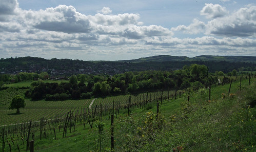
After the sharp descent from Box Hill it's a relief to find myself climbing back up from the Mole Gap to the ridge on a gentler route, along a broad, well-surfaced track through woodlands. I catch a glimpse or two of vines through the trees before the surroundings open out to a truly exhilirating view: vines marshalled on canes raking the rolling chalk slopes below in a way that, had you actually walked here from Nice on the E2, would seem very familiar; the brown woolly-wooded ridge of Box Hill coming to its sharp end at the Mole Gap, bare chalk visible through scratch wounds on its slopes; Dorking down in the gap; and Leith Hill, the tallest point in Southern England, rising from the Greensand ridge ahead. Vines, the wine books tell you, do best when they have to struggle with the soil. This may not be the gravel of the Medoc, but the grapes seem to do well enough on this spectacular south facing pebbly chalk slope, benefiting from the shelter of surrounding hills.
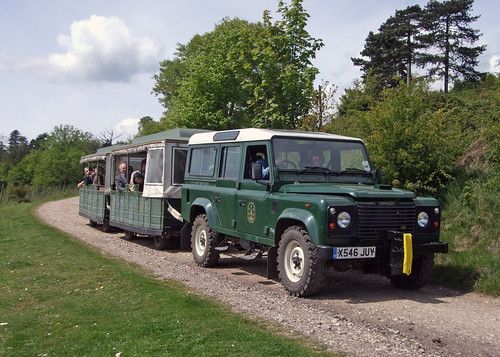
I pass a Land Rover slowly towing a land train well-loaded with passengers along the track from the opposite direction, and with a cheerful smile the driver obligingly pulls up to let me take a photo. I've never been on one of these novelty tourist services -- they usually run on routes I can and would rather walk -- but as they're theoretically a form of scheduled public transport running to a fixed route they always perk my interest. The one at Denbies is an indication of how important tourism is to their business plan, as well as wine production. As they say in the student information pack on their website, the one feeds the other. Of course they're gifted with a magnificent site, but there's also something about a vineyard that makes it a special place to go in its own right. Even in France, where vineyards are not exactly remarkably rare, you'll find many of them sporting brown tourist signs. Part of the appeal is provenance, the fact that the whole process from fruit to bottle takes places on the same site. While a number of breweries have realised their potential as visitor destinations, I doubt a land train round a barley field would have quite the same allure. I reflect again that someone ought to plant a hectare or so of inner London with vines, in answer to those on Montmartre, just opposite the Lapin Agile cabaret where Aristide Bruant once performed -- Parliament Hill, for instance, has gravelly soil and south facing slopes.
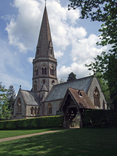
Past the vineyard the trail leads back into woodlands thick with bluebells at this time of year, and up to Ranmore Common Road where the broad grass verges are not only busy with walkers but with congregants leaving the self-proclaimed "Church on the North Downs Way", St Barnabas. The church, opened in 1859, is a legacy of Cubitt's time as owner of Denbies estate and was designed by architect George Gilbert Scott, best known for the Midland Hotel at St Pancras Station and the Albert Memorial in Kensington. With a touch of confident chauvinism typical of their times, Scott and his followers rejected the neo-classical and Romanesque styles to which their predecessors defaulted when called upon to design grand buildings, regarding them as too southern European and, ultimately, pagan and favouring instead what they saw as the healthily Germanic and Christian Gothic style. Now, Gothic may be remarkable when writ large on station hotels and town halls -- and there's some irony in the fact that what was seen as a masculine style produced, in Scott's hands, such camp extravagances as the Midland Hotel -- but it's wholly unremarkable when applied to country churches. St Barnabas is a modest and quietly elegant building with an octagonal tower and slender spire, somehow anticipating the more homely and less ambitious work of the Arts and Crafts movement that followed the decline of high Victoriana.
Where Ranmore Common Road bends round a T-junction with Ranmore Road, there's another "beauty spot" with a car park, ice cream van and a small wooden shelter containing an information board about the North Downs Way -- it still bears the logo of the old Countryside Commission (since succeeded first by the Countryside Agency and now by Natural England) and may well date back to shortly after the trail opened in 1978. Beyond it is the National Trust's Steers Field, with another open view towards the south, and our last convenient connection to the Greensand Way signed ahead and downhill. Our route, however, continues along the springy turf at the top of the field and back into the woodlands of Ranmore Common.
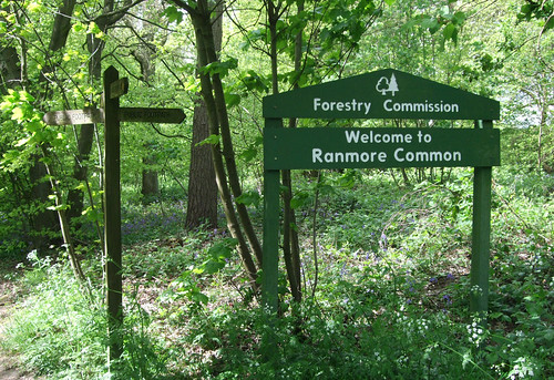
A sign for the Forestry Commission indicates that for the first time the Countryway is passing through the territory of another of Britain's big institutions managing land for public access. One of the few surviving state commissions of the past century, it was established in 1919 as a development of government intervention to coordinate timber production for the war effort. For most of its existence it was primarily concerned with promoting timber production on an industrial scale, and associated with large scale afforestation with quick-growing conifers, but in recent years it's taken a broader approach to the function of forestry and now claims to be Britain's biggest recreation provider. Its continuing existence as an arm of the state in the era of privatisation and external commissioning is less to do with its touchy-feely Kids in the Woods and tree hugging side, though, and more to do with the continuing strategic importance of timber. We've seen its stylised conifer-and-broadleaf logo before where it's taken a role in the management of woodlands owned by others, including encouraging public access, but this is our first large scale encounter.
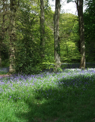
The long stretch of clear woodland track that continues is a classic woodland walk, fresh, cool and colourful with the trees in their best fresh spring green and the floor splashed with bluebells, dappling the green with an Impressionist's dabs of complementary purple-blue.
Through the woods to the north is another remarkable survivor -- Tanners Hatch Youth Hostel, an old-style country hostel that can only be reached on foot, bike or horseback, converted from two 18th century cottages, with gas lighting, traditional triple bunks and open fires. When I last stayed there in the early 1990s the only form of lighting was gas, but they've since installed electricity and central heating, a small price to pay since the hostel should long since have been rationalised out of existence now the YHA is more interested in modern big city backpacker hostels, and indeed would have been if it wasn't for an enthusiastic warden and user group. I recall one of my fellow guests on that occasion had walked to Tanners Hatch that day from central London, something I aim to do myself before they finally close the place.
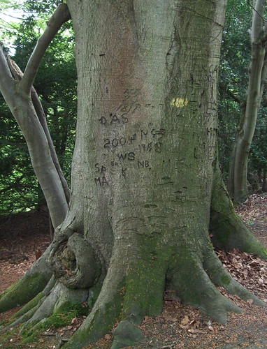
The long path leads past a pair of old trees with thick trunks carved with graffiti, some of which purports to date from 1878, to arrive at a T-junction by a Surrey County Council information board mapping circular walks in the area, with an intriguing map of land ownership -- much of the land, it shows, is in private ownership and used for commercial forestry but also managed for public access, while some is controlled by the National Trust. Most of the area I walk through is part of the Wotton estate, the historic nucleus of which is Wotton House at Wotton village, at the bottom of the slope to the south. This was the birthplace of diarist John Evelyn (1620-1706), who later lived at Sayes Court, Deptford, now on the Thames Path and only a short stroll from my flat. The estate is still the property of the Evelyn family, although the house is now a hotel and conference centre.
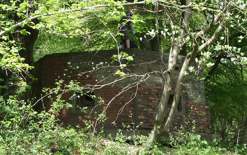
Another feature of the stretch between here and the point where the Countryway leaves the North Downs Way is a succession of old pillboxes or, more correctly, Hardened Field Defences, installed in the 1940s when, as at the time Reigate Fort was built (see London Countryway 22), the North Downs were seen as the first line of land defence for London. Thousands of these structures still survive, scattered not only on the Downs but all over the country, and these particular examples are familiar hexagonal ones built of red brick. Embedded in the wooded hillside, they're easily missed. The roof of the first one I pass has just been used as a convenient flat surface for a picnic by a family out cycling.
A number of paths and tracks run along the ridge here, some public rights of way, some "permissive" paths open to the public, and when Keith Chesterton devised his original London Countryway route, the alignment of the North Downs Way through here hadn't been finalised, so it's not obvious which route I should choose for my own excursion. In the end I opt for leaving the North Downs Way early and choosing a slightly higher path, though for one final view south from the Downs you could continue along the national trail through an obliging stretch of open downland as far as the gate to the National Trust's Hackhurst Downs property, then turn north. In leaving the North Downs Way you'll also part company with the E2, although we'll pick up the E-path again later on -- indeed, if you're walking the E2 and want to cut off a corner, the Countryway is a good alternative, taking a much more direct route from here to the Thames Path than the E2's dogleg via Guildford and the entire length of the River Wey Navigation.
Either way, you'll start to descend slowly to Blind Oak Gate, a complicated path junction deep in the woods where a succession of wooden fingerposts marks no less than seven possible routes. Some of the paths here mark the boundaries of adjoining woodland holdings, and there are also remnants of 1940s military use.
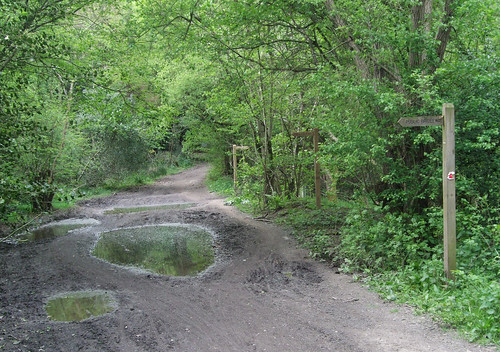
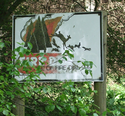
It's at this point that, should you wish to break your journey, there's a linkvia Abinger Hammer to Gomshall station on the North Downs Line. But the Countryway continues northwest, now descending the gentler dip side of the ridge on a rutted forestry track between two woodlands, partly broadleaf, partly conifers. Shortly after leaving Blind Oak Gate the boundary between Mole Valleydistrict and Guildford boough joins us and runs along our route for a while, though unless a chipped and eroded fragment of pebbly concrete emerging from the ground is the remains of a boundary post, there is no obvious visible evidence. Just opposite is a firebreak between the conifers, with one of those classic forest fire warning notices featuring a Bambi-nightmare silhouette of deer and bunnies fleeing the flames.
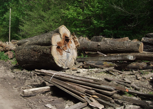
I pass a timber yard with a rather attractive wooden chalet and, now definitively in the borough of Guildford, join the broad drive, which leads through piles of felled timber -- including some massive trunks well over a metre in diameter -- to a small pond and path crossing by a lane called Honeysuckle Bottom, where Chesterton drily remarks that he's never seen any honeysuckle. Neither do I, but I do pause to enjoy the peace of this curiously sombre and lonely place.
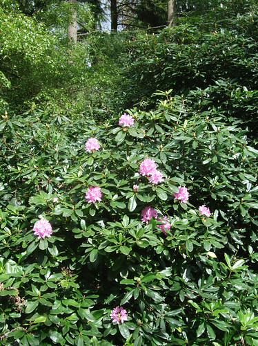
I'd thought descending to here that I was finally leaving the Downs but the Countryway has one final chalky climb to challenge me with -- a short sharp clamber left from the track and back into woodland along a northern spur of the ridge. This is Mountain Wood, a Surrey council site that is of interest to geologists as it has a unique deposit of gravel from the Lower Greensand on top of the chalk. It's a lovely old wood with woodbanks and rhodedendrons, splashed with early season flowers.
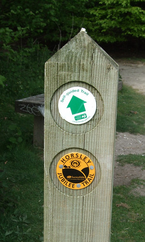
The path levels out and crosses a lane to enter a better known and more visited council site, the Sheepleas, bought from a private landowner to prevent development in the 1930s and now managed by Surrey Wildlife Trust. This is an interesting and varied site, with centuries-old coppiced woodland alternating with more open, grassy areas and meadows famed for butterfiles and rare flowers, the whole area webbed with footpaths and tracks. Once again there are quite a few people about, and I start to spot waymarks telling me I'm on the Horsley Jubilee Trail, a 15km circular route so called because the last section of it, a new right of way, was opened in Elizabeth II's Golden Jubilee Year of 2002.
The Sheepleas would once have been as thickly wooded as some of the other areas I've passed through on the Downs, but thanks to the legacy both of 1987's Great Storm and subsequent deliberate clearances in the interest of biodiversity, it now has a lighter and less enclosed feel, and -- as I delightedly discover on reaching the lip of the ridge, a view to the north. It's not especially clear, just glimpsed through the trees as the path mounts a small summit, but it's definitely the Thames valley, and the first time the Countryway has given us a view from the other side of the ridge since Willey Park Farm near Caterham (London Countryway 21). It's with a renewed sense of purpose, then, that I begin my final descent from the chalk hills, following the yellow Jubilee Trail waymarks across grassy meadows well-used by picnickers and dog walkers, one of which is currently thick with wild primroses.
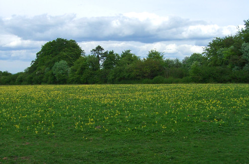
The path emerges at the bottom of the slope by St Mary's Church, West Horsley on the A246 Epsom Road linking the two Horsleys, where we finally leave the Surrey Hills Area of Outstanding Natural Beauty and the North Downs, and enter the Thames basin. The two Horsleys have long histories -- both have entries in Domesday, and the foundations of the church are 11th century, though it was much rebuilt in the 1840s. The squat tower with its curious roof dates from 1120 and the ladder used to build it remained bricked up inside it for 900 years: near-fossilised, it now hangs in the south aisle.

A rather more grisly curiosity is that the head of Walter Raleigh (c1592-1618) is said to be buried under the chapel floor -- his wife Elizabeth had it embalmed after his execution and allegedly carried it around with her, keeping it at West Horsley place where she came to live with her son Carew, though other accounts say it was reunited with his body and is now in his tomb at St Margaret's, Westminster. Raleigh was very much a man of his time in serving the interests of the emerging British state, putting down Irish rebellions and helping conquest the New World, but he had his quirks, and, as a Protestant closely linked to Elizabeth I, sank in the shifting sands of Tudor and Stuart politics when the Catholic James I and IV succeeded to the throne. He founded the colony at Roanoke island in Virginia where all the colonists mysteriously disappeared without trace, the only enigmatic clue the word "Croatoan" carved on a tree, and of course he was a poet with more than a tinge of melancholy:
As in a country strange, without companion,Across the road from the church, the contrast in landscapes is immediately evident, as the path runs along the edges of flat green fields. There is a lattice of paths through these fields, not all shown as public rights of way on the map but still well-used by local people: ours keeps north, passing the only stiles on the route, although all have gaps beside them and don't require climbing, before emerging on a lane by farm buildings. The final stretch is a lengthy tarmac path by the side of the railway -- opened as the South Western Railway's New Guildford Line in 1885, and an early convert to third rail electrification in 1925. Eventually the path emerges by a recreation ground and a cluster of public buildings -- a village hall, a GP surgery -- at East Horsley, and a residential street leads to Horsley station and Station Parade, a welcome strip of of suburbia with shops and banks.
I only wail the wrong of death's delays,
Whose sweet spring spent, whose summer well-nigh done
Of all which pass'd only the sorrow stays.
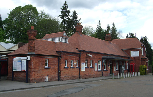
The village's gothic mansion was used for the Nigel Kneale TV drama The Stone Tape, a science fiction horror tale that hypothesised ghosts are "recordings" of traumatic events in the stuff of buildings and structures. I don't believe in ghosts, even as recordings, but we've certainly seen plenty of traces of the past incised into the present, with many more to come.
View a map http://maps.google.co.uk/maps/ms?ie=UTF8&hl=en&oe=UTF8&msa=0&msid=117966169375523396049.00046414d40d8252e7b70&num=200&start=73&z=11
Route description pdf
More information
- Surrey County Council http://www.surrey.gov.uk/
- Surrey Countryside http://www.surreycc.gov.uk/countryside
- Surrey Interactive Maps http://surreymaps.surreycc.gov.uk/
- Surrey Walking (John Harris) http://www.walkinginsurrey.co.uk/
- Visit Surrey http://www.visitsurrey.com/
- Exploring Surrey's Past http://www.exploringsurreyspast.org.uk/
- Surrey Hills AONB http://www.surreyhills.org/
- Mole Valley District Council http://www.molevalley.gov.uk/
- Mole Valley Parks and Open Spaces http://www.molevalley.gov.uk/index.cfm?articleid=412
- Mole Valley Visitor Information Centre http://www.molevalley.gov.uk/index.cfm?articleid=380
- National Trails http://www.nationaltrail.co.uk/
- North Downs Way National Trail http://www.nationaltrail.co.uk/northdowns/
- European Ramblers Association http://www.era-ewv-ferp.org/
- E2 (Ramblers) http://www.ramblers.org.uk/info/paths/name/e/e2.htm
- Long Distance Walkers Association http://www.ldwa.org.uk/
- National Trust http://www.ldwa.org.uk/
- North Downs (National Trust) http://www.nationaltrust.org.uk/northdowns
- Sutton and Mole Valley Lines http://www.nationaltrust.org.uk/northdowns
- Lower Mole Project (including Thames Down Link and Mole Gap Trail) http://www.surreycc.gov.uk/SCCWebsite/sccwspages.nsf/LookupWebPagesByTITLE_RTF/Lower+Mole+Project?opendocument/LookupWebPagesByTITLE_RTF/Lower+Mole+Project?opendocument
- Stane Street (Wikipedia) http://en.wikipedia.org/wiki/Stane_Street
- A24 (Wikipedia) http://en.wikipedia.org/wiki/Stane_Street
- National Cycle Network 22 http://www.sustrans.org.uk/default.asp?sID=1099056191265
- Denbies Wine Estate http://www.denbiesvineyard.co.uk/
- Diocese of Guildford: Dorking with Ranmore http://www.cofeguildford.org.uk/index.cfm?fuseaction=places.content&cmid=65
- Greensand Way http://www.kent.gov.uk/leisure-and-culture/explore-kent/walking/greensand-way-walk.htm
- Forestry Commission http://www.forestry.gov.uk/
- Surrey Wildlife Trust http://www.surreywildlifetrust.co.uk/
- Our Places - Surrey Wildlife Trust (White Down, Hackhurst Down, Sheepleas) http://www.surreywildlifetrust.co.uk/Default.asp?EntityID=%7BE6649CB3-2A6E-428D-BCE1-2D309F16379B%7D
- North Downs Line (Wikipedia) http://en.wikipedia.org/wiki/North_Downs_Line
- Guildford Borough Council http://www.guildford.gov.uk/
- Guildford Parks and Countryside http://www.guildford.gov.uk/GuildfordWeb/Leisure/ParksCountryside/
- Guildford Tourism http://www.visitguildford.com/
- Shere Parish Council http://www.shereparishcouncil.gov.uk/
- West Horsley Parish Council http://www.westhorsley.info/
- Horsley Jubilee Trail -- leaflet from Surrey Hills AONB or see http://www.westhorsley.info/
- St Mary's Church, Horsley http://www.l1fe.org/
- East Horsley (Wikipedia) http://en.wikipedia.org/wiki/East_Horsley
- New Guildford Line (Wikipedia) http://en.wikipedia.org/wiki/New_Guildford_Line


3 comments:
I walked this section a week or so ago and can confirm that the "Alternative more direct route from Boxhill & Westhumble station to Denbies Vineyard, missing out a short section of the Countryway" is perfectly walkable and the instructions given are adequate - no more "research" is necessary. The first part of the footpath is not very pleasant, being narrow and between high fences - I missed the entrance when I first passed it, but there is a fingerpost in the bushes.
This was a pleasant section, with good paths and better views south than previous sections where the paths had trees on both sides.
Apropos beginning of this section of route (as Leonard, above): for the record, a slightly more detailed description follows (after walking this last week, 23.8.18).
Exit Boxhill & Westhumble station Platform 2 and turn immediately Left up steps (not station footbridge) onto path leading up onto road bridge. Turn Left and cross bridge. Beyond bridge, fork Left up Chapel Lane. The footpath soon sets back from road as it passes several houses, rejoining roadside where a dead-end road (Pilgrim Way) comes off Left. Just past this point, a little further up Chapel Lane, a narrow, secluded footpath goes off Left between fences/houses - look for stone set into ground, into which is set a metal arrow bent at a right-angle to indicate entrance to footpath.
Follow footpath between fences/properties, at one point crossing a lane. The footpath is signposted 'Dorking' in one or two places. After a quarter-mile/half-kilometre, the path crosses a small field. Beyond the far side of field, in trees, the North Downs Way crosses. Turn Right onto NDW to continue LCW route to Horsley (alternatively, keep ahead on footpath for Dorking town, or turn Left onto NDW for Dorking stations, Boxhill etc).
Thanks for these comments, people. I'll eventually be looking at this section again.
Post a Comment