The political leaders of ancient Rome were remarkably active in fronting personally the armed force of their state, despite living in an era in which travel in Europe was measured in weeks rather than hours. The first major documented figure to appear on Britain's historical stage is none other than Gaius Julius Caesar (100-44BCE), historian, First Consul and key architect of the Roman Empire although never an emperor himself. In the summer of 55BCE, having led his legions in the conquest of Gaul (roughly, modern day France and Belgium), Caesar stepped ashore at Deal at the head of a small expeditionary force -- the likely landing place is passed on the Saxon Shore Way walking route, part of European Long Distance Path E9, although it's considerably outside the scope of this project.
Caesar had driving ambitions to expand the frontiers of Roman power as well as amassing personal wealth, and Britain was regarded as rich in silver and other valuable items, but it may be that his initial interest in Britain was more to do with securing power in Gaul. The territory on both sides of the Channel was dominated by a tribal people known as the Belgae. Links between mainland and island-based Belgae remained strong and Britain provided a potential safe haven for troublesome insurgents opposed to Roman power. On that first visit, Caesar achieved a couple of local victories. He returned the next year and succeeded in establishing his Belgic ally, Commius, as king of powerful tribe the Atrebates, with a promise of tribute to Rome, but Caesar never returned and the arrangement didn't last. Nonetheless the wet island in Europe's northwest corner was now very much on Rome's radar, and trade and other links between the island and the Roman world flourished over the following decades.
Almost a century later, in the year 43, Rome's fourth emperor, Claudius (10BCE-54CE, a figure probably now best known through Robert Graves' fictionalised portrait in I, Claudius and the legendary 1970s BBC miniseries based on it), newly acceded to the throne, launched a more serious military initiative that eventually resulted in the annexation of most of Britain. Once again Belgic politics was involved - Commius' successor Verica had fled to Rome asking for help after being deposed by the rival Catuvellauni. Four legions led by General Vespasian, who later became emperor himself, landed at Richborough on the Walney channel, also now on the Saxon Shore Way and E9. The legions pushed on across the Medway and then the Thames, and in another example of hands-on leadership, Claudius himself arrived with reinforcements including elephants, routing the Catuvellauni stronghold at Colchester which, as Camulodunum, became the Roman capital for a while.
The emperor spent 15 days in Britain before returning to the mainland; meanwhile Vespasian set out to subdue the southwest. Originally the Romans planned only to occupy the south and southeast of the island but the need to establish secure borders saw the occupying forces push further north over the succeeding decades, reaching its furthest extent by the 140s when the Antonine Wall was built between the Clyde and the Forth in Scotland's central belt to mark both the northern border of Britannia and the northernmost boundary of Roman power. This high tide mark was only held for relatively short periods, with Hadrian's Wall between the Solway and Tyne some way to the south forming a more enduring and better known boundary. Both walls are now the basis of walking routes.
When the occupying forces first met the Thames, they established a crossing at one of the lowest practical points of the tidal river. There's evidence that the original crossing was roughly along the line of today's Vauxhall Bridge, but the permanent crossing was established downstream, from the marshes of Southwark towards a small hill east of the Thames' confluence with the Walbrook, where a military pontoon bridge was quickly replaced by 55 with a permanent piled bridge. Unusually for what became a major Roman town, there was no existing indigenous settlement on the site, but there was a Celtic placename for the area, possibly for a local farm, borrowed into Latin as LONDINIVM.
It appears originally there was only a small fort to the north of the bridge, and the settlement grew up from around 47-50, not as the result of military decisions but of spontaneous commercial enterprise, with businesses serving military and other travellers using the strategic river crossing and a port that took advantage of the relatively wide and deep tidal waters. A decade later London, Colchester and several other Roman cities were burnt to the ground in the rebellion led by Iceni queen Boudica, and when they were rebuilt, the centre of provincial adminstration was moved from Colchester to London.
Though Britain bears many visible traces of life before the Roman occupation, it's in the Roman period, with its written records, roads, walls and cities, that the first clearly legible and coherent layer of history was etched onto our physical and cultural maps. Before the Romans there was a Celtic Iron Age culture which was relatively sophisticated and complex, with a rich oral literary tradition, but which didn't do books, hard copy databases and big centrally planned civil engineering, so it's come down to us largely through a Latin filter.
Roman historians such as Tacitus speculated on the origins of Celtic culture in Britain and their conclusions influenced the longstanding consensus that it had arrived as a result of mass migration or invasion of Celts from central Europe about 600BCE. But this view has recently been questioned as genetic studies suggest it was the culture, rather than the people, that migrated, with the existing indigenous pre-Celtic people adopting Celtic language, technology, religion and social organisation rather than themselves being displaced or exterminated. The Belgians that Caesar encountered in southeast England were however recent settlers from the mainland whose cultural affinities seem mixed. Caesar described them as a distinct group of Celts that had been influenced by adjoining Germanic peoples, or they could have been Germans influenced by Celts, a mixture of both cultures or a distinct ethnic group of their own. Whatever, it's fairly certain they spoke a Celtic language.
And the complexities of cultural assimilation and absorption continued during the Roman period, in ways that are probably not generally appreciated. The popular view of the Romans is often influenced by more modern totalitarians, some of whom consciously adopted Roman iconography, and by their sporadic but well-publicised persecution of Christians which suggests a propensity to religious intolerance. But the Roman empire was not a homogenous entity intent on clamping its ideology on the known world. As we've already seen, the force that drove on the legions was the quest for wealth.
Today, the use of politics as a means to personal wealth, while far from unknown, is generally frowned upon, but in Rome it was simply the way things worked. In a pre-capitalist slave-owning society, the only long term means to forward the accumulation of wealth was through conquest. The key interests of government were taxes and ensuring the conditions to collect them effectively, and occasional religious persecutions would be driven by the latter, directed against troublesome folk whose beliefs prevented them swearing allegiance to the Emperor. Roman religious and philosophical beliefs were pragmatic and generally tolerant, with a propensity to absorb local deities and forms of worship in a way that astonishes those brought up in a monotheistic tradition with a tendency to deceive itself about its own history of theological flexibility. Besides which, before mass communication, there simply wasn't the means to impose ideological uniformity on a territory that stretched from Britain to North Africa and the Middle East.
At the same time the military and economic needs of the empire drove a mass mobilisation of people within its boundaries, precipitating multiculturalism on a grand scale. We speak of the "Romans" in Britain, in the sense of non-natives who came to the island to serve the Empire, but the overwhelming majority would not have come from Rome, or even from Italy -- they were drawn from anywhere from Flanders to Morocco to Palestine to the Ukraine. The existing inhabitants, meanwhile, didn't disappear but became largely assimilated into Roman society, creating a unique Romano-British culture heavily influenced by the existing Celtic way of life. And it is this culture, rather than anything specifically Roman or Celtic, that left that first coherent layer on the landscape of England and clung to survival down to the present day in parts of Wales.
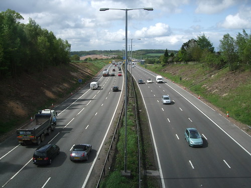
One of the most obvious and better-known features of that layer, and one of the most relevant to the walker, is the network of roads, with London as both the hub of the national system and the gateway to the mainland, the crossing point of the Thames for traffic to and from points north and the Channel, accessing the easy ferry crossing to Gaul from whence all roads led, of course, to Rome. Two millennia later, the routes have been modified and the scale is vaster: the big trucks are diverted round the M25 to cross the river at Dartford, rail passengers changing at St Pancras to the Eurostar cross even further downstream at Ebbsfleet, while millions of people a year transfer at the world's biggest international airport at Heathrow on their way to continents Casear never knew existed. But London's role as hub and gateway remains, and it's comforting to think you can still cross London Bridge, turn left at the Borough and follow the line of Watling Street to reach the ferries at Dover.
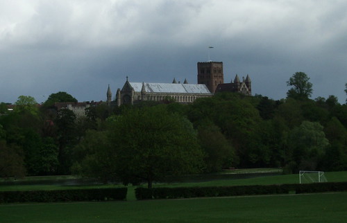
Today we think of our main radial roads starting and ending at London, an assumption reflected in their numbering, but Watling Street, the line of which predates the Romans, runs through and out the other side. We've already crossed it south of the Thames, very soon after the start of the walk on the edge of Gravesend. At London it turns northwest on its way to Wroxeter (Viroconium) in Shropshire. In Roman times, the first major settlement it reached north of the Thames, 40km out of London, was Verulamium, on the gentle slopes of a hill to the west of the river Ver. Originally the capital of the Catuvellauni, in the year 50 it was granted Munipicum status, and became one of the four biggest Roman cities in Britain. A mediaeval town known as St Albans, after the first Christian martyr in Britain, who lost his life there, grew up around an abbey on the opposite bank, eventually becoming a cathedral city. This is the destination of today's walk.
If the London Countryway had a "natural" course at this point, it would probably run some way south of St Albans, perhaps along something like the alignment chosen by the Hertfordshire Way, which shortly diverges from our route. But having entered the hinterland of St Albans, Keith Chesterton, the original deviser of the Countryway, found its gravitational pull irresistible, resulting in a considerable detour northeast and then southeast again. The resulting bump may be inelegant, but I'm fully in accord with the way it places the city as the northernmost extreme of London underfoot. To the Romans it was easily the most important settlement within easy reach of London and it's still the closest urban area with city status outside the Greater London boundary and the only city on the London Countryway.
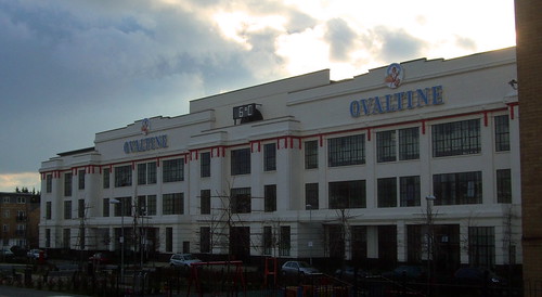
The start of the walk at Kings Langley seems a long way from ancient Rome, but it was itself originally a settlement on a more minor Roman radial road, from which modest paths would have run across the gently rolling countryside towards Watling Street and Verulamium, through what must then have been dense woodland. There's a more surprising and degraded echo of Latin, though, very soon after leaving the station. The route turns under the railway along Egg Farm Lane -- the egg farm in question is the old Ovaltine Egg Farm, the old Ovaltine factory is nearby, and the brand name Ovaltine partly derives from the Latin "ovum" meaning egg.
Ovaltine, a powdered drink for making up with hot milk, was invented in Switzerland in the 1860s by a Dr Georg Wander, and originally named Ovomaltine, reflecting its original formulation of eggs and malt. When introduced into the UK in 1909 the name was miscopied at the trade mark registry, gaining its familiar English language form. The Kings Langley factory was opened in 1913, and expanded in 1929 when the current imposing art deco-cum-Arts and Crafts building opened as a self-conscious showcase landmark, clearly visible to rail passengers on the West Coast main line.
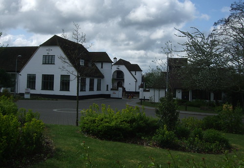
The company originally had a policy of self-sufficiency in supplies and about the same time as building the new factory bought two local farms. The one on the hillside on the opposite side of the railway became a model egg farm while the one in nearby Abbots Langley was turned into a dairy farm. Both were given showcase architecture on a more modest scale, inspired in part by Marie Antoninette's farm at Versailles -- not, you'd have thought, the most auspicious reference point, but it's a cute idea. I wonder how much it reflects on the dynamism and confidence of capitalism that the age of iconic company headquarters appears to be well and truly over -- most of them are now housed in anonymous boxes by the side of motorways that would not provide much scope to the label designer.
Demonstrating that the sophisticated understanding of brand value was around long before Soho creatives started blithering and brainstorming constantly about it in the 1980s, images of the factory and farms were used to promote the product, with building and packaging design and advertising all feeding into Ovaltine's image as homely, healthy product suitable for packing off well-behaved pyjama-clad children to bed with while mummy and daddy got ready for an evening around the wireless in their Metroland manse. Regular drinkers could sign up as Ovaltinies, with their own special song. Personally I always thought it tasted of old socks and sawdust dosed with sugar, but like Marmite it has its devoted fans.
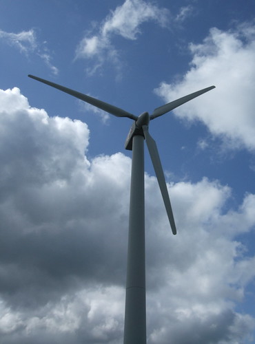
By the 1990s the farms had fallen into disuse, and in 2002 manufacturing operations in the UK also ceased, with the company, now linked to the Twinings tea group, moving production back to Switzerland. The listed factory building has been converted impressively for residential use -- the landmark façade remains, but behind it all has been rebuilt. The dairy farm had already gone over to flats, known as Antoninette Court, and in 2003 the egg farm, now known as Beaufort Court, became the headquarters of renewable energy company RES. Their wind turbine has become a new local landmark, and they also offer a visitor centre and guided tours. It's worth detouring from the route slightly by continuing along Station Road to look at the factory; the route itself then goes right past the egg farm, where there are fine views back down the Gade valley to the factory.
Just past the West Coast main line we've lost the Hertfordshire Way for a while: it takes a more roundabout route via the village of Bedmond, birthplace of Nicholas Breakspear (c1100-1159), later Adrian IV, so far the only English-born pope and a distant ancestor of the family that ran and later asset-stripped the Brakspear Brewery in Henley-on-Thames. Breakspear's father Robert became a monk at St Albans Abbey, the owner of Abbots Langley since 1045 when a Saxon thegn, Ethelwine, had split his territory of Langley into King's and Abbot's, granting the latter to the monks. Kings and abbots...the reason why Brakspear is usually now described as the only ever English pope is that since King Henry VIII refused to accept the authority of Rome, creating an Anglican church that may not be Roman Catholic but is still a long way from being Protestant, the likelihood of there being another English pope is relatively low. As to the abbot, that post too fell victim to monastery dissolving Henry, one of history's foremost asset strippers.
Continuing past the wind turbine a farm drive sweeps across the M25, finally bringing our route back within the orbital motorway for the first time since Merstham, at least for a while. Beyond this I walk through fields on the north edge of Abbots Langley where lots more paths not shown on the map as rights of way seem freely used by local people. Presumably the fields were once used for growing barley destined to satisfy Ovaltinies' craving for cloying maltiness, and are now part of RES's estate. After a brief dip into a corner of the built-up area of Abbots Langley we're back into fields and apparently heading straight for the M25 again, but a hedge interrupts us, deflecting us along a well-defined track along a field edge. The hedge here marks the district boundary: we're still just inside Three Rivers but the other side is already the City and District of St Albans.
The Hertfordshire Way converges again but only for a short distance along a lovely old bridleway that soon becomes a surfaced lane. As suggested above, the HW offers a more logical and direct route for this leg of our circumnavigation as its white waymarker arrows keep straight ahead. If you were following the route into London from the north mooted in previous sections, this would be the point at which you'd leave the Countryway and follow the Hertfordshire Way, the Watling Chase Trail, the London Loop and the Dollis Valley Greenwalk towards Hampstead Heath. It's by no means the last time we'll see those white arrows, but for the moment, having accepted Chesterton's argument for the detour, we leave them left on a footpath, plunging decisively into St Albans district and heading not just for one motorway but for two.
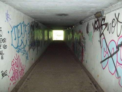
This was always the place where the Countryway crossed the M1, but I can imagine the groans among the early champions of the walking route when it was also chosen as the place where the new orbital motorway that became the M25 would cross the M1 too. The slightly dingy, heavily graffito'd tunnel through which I now walk is the first of a succession of motorway crossings on today's section and also the first and westernmost of a long series of encounters with various incarnations of Britain's big road north.
Given the shape of the island, you'd expect to start with a north-south spine road when drawing the surface transport network in broad strokes, perhaps followed by one down the southwest peninsula and another much shorter one from the Thames to the channel coast. But in prehistoric times the great highways yielded to the physical geography by following the lines of chalk ridges, which, as we've seen in the Chilterns, ran predominantly diagonally, southwest to northeast. Britain's geological north-south spine, the Pennine range, was too rugged and boggy to form a natural highway, though it's now the basis of a famous walking route, the Pennine Way, for those who appreciate a challenge. The Romans, with their more advanced technology, better disciplined labour force and centralising drive for military convenience and tax collecting efficiency, asserted human geography over physical and built networks of roads that prioritised linking major settlements directly rather than allowing natural features the upper hand in determining economic and cultural relationships. They built the first great roads from London north to link other important centres like York and Shrewsbury to the capital.
The Roman roads continued in use for millennia, though some of them became redundant as the places they linked declined in importance -- London, interestingly, remained an exception to this and is still the hub of the modern network. The Roman legacy wasn't really bettered until the 18th century when the inadequacies of road transport infrastructure became economically intolerable and the turnpikes began to supersede the deteriorating patchwork of highways maintained by parishes. But no subsequent road builders ever had the license of the Roman engineers to drive highways along alignments of their own choosing -- now there were hosts of vested interests to satisfy. Turnpikes generally covered only limited stretches of road, and were often improvements of existing routes rather than wholly new ones, sometimes buffeted off course by reluctant landowners. Travelling long distances still involved following a succession of shorter, more local routes, rather like many long distance walking routes today.
The new age of grand road building came in the 20th century -- it's tempting to say under pressure from the development of the motor car but this ignores the very active role of governments who decided to support and encourage that development by transforming the road network into a highway network for cars. The politicians adopted the enduring "predict and provide" policy, a self-reinforcing cycle in which new roads encouraged more cars which would in turn be used as the argument for still more roads. For the first time since the Roman occupation road building became a national, strategic matter backed by government clout, and a new network of trunk roads, and later motorways, began reaching out from London.
One result of this has been the creation of skeins of parallel roads all running roughly in the same direction. Sometimes capacity has been enhanced by widening a road on its existing alignment but this isn't always that easy and the advent of the bypass has seen major routes diverted out of towns and villages which in many cases owe their original existence to the road. One of the most dramatic examples of this bundling of new, detrunked and obsolete roads can be seen with the northerly routes out of London. Over the next couple of sections we'll cross, in succession, the M1 (to Leeds, and via the M6 to Birmingham, the northwest and Scotland, 1959); Watling Street (A5183, formerly A5, to Wroxeter and Shrewsbury, ancient and later Romanised); the A1081 (formerly A6, to Manchester and Carlisle, partly Roman, later turnpiked); the A1(M) (to Leeds, Newcastle, Edinburgh, 1979); the original Barnet bypass (formerly A1, 1927); the Great North Road (A1000, formerly A1, 1720s turnpike); Ermine Street (to Lincoln and York, Roman); the A10 (to Cambridge, Kings Lynn, 1970s) ; the Great Cambridge Road, also known as the Old North Road (A1170, formerly A10, turnpike connecting with Ermine Street); and the M11 (to Stansted Airport and Cambridge and connecting to the M1, 1977). There's a clear pattern here, with the main north road moving westwards over time.
The preponderance of 1's in these road numbers reflects the primacy with which this north-south axis was viewed when Britain's road numbering system was first established in 1923. Six major routes radiating from London were chosen to divide England and Wales into segments, and of these the Great North Road was quite literally picked as Britain's number 1 road and designated A1. The other five followed clockwise, and other roads were given numbers with first digits determined by the segment in which they began, with a similarly clockwise radial theme to many of the two-digit numbered roads. Scotland got 7, 8 and 9, radiating out from Edinburgh, but the A1 was too important for that and kept its number all the way to Princes Street in the Scottish capital, where it's still glowered over by the impressive bulk of the North British Hotel. The principal north-south motorway was quite logically given the number M1 but it's also primary in another sense, as when the first section between Watford and Crick near Rugby opened in 1959 it was Britain's first proper motorway, although the Preston bypass, now part of the M6, had predated it by a year.
The idea of a special class of road optimised for fast and continuous long distance motor travel had been around since at least the 1920s. Italy was first with its autostrade, a new generation of Roman roads: the first opened in 1921, just before Mussolini's rise to power, but the network underwent major expansion under his government. Then in the 1930s the idea was taken up in another fascist state now much more famously associated with it, with the launch of a programme of Autobahn building in Nazi Germany, self-consciously echoing the Roman military imperative. British politicians, still on speaking terms with Hitler, visited to see this programme in operation and were inspired to draw up their own plans, but developments were interrupted by World War II. Motorways soon came back onto the agenda in the postwar period, with the enabling legislation passed in 1949.
A recently released DVD collects the transport-themed instalments of the long running Look at Life series of short documentaries, made by Rank from 1959 to pad out cinema programmes. These films show a fascination for the way technological innovations in transport are changing our lives, and several of them deal with the new motorways. One shows the M1 under construction, not yet covered with blacktop, a thick gravel ribbon rolling across the Hertfordshire countryside like a bloated farm track. Another features overnight hauliers. "Not all drivers use M1", barks the commentary in clipped, plummy tones, the definite article having not yet become obligatory, "and some ban their drivers from using it." From an age where Stobart, Dentressangle and their colleagues are frequently jammed end to end on the M25, I'd like to ask these Teddy Boy era truckers what the issue was. Was it safety concerns, in the face of evidence that for drivers motorways are much safer than the fast but narrow and twisting A roads they superceded? Or was it simple neophobia, like those early 19th century opponents of rail travel who were firmly convinced the human body couldn't withstand such terrifying velocities as 50km/h?
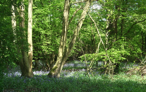
At first our footpath tunnelled beneath a two-lane highway, but since then it's been widened and in 1986 acquired a three level junction with the M25, itself now the subject of a widening scheme. The right of way has been maintained, threading through the junction like a wisp of cotton caught up in a couple of knotted tow ropes. On the map it looks complicated and unpromising, but on the ground it’s easy to follow and quite fascinating in its own way. It delivers an early surprise: through the subway you’re immediately into a corner of well-kept woodland, Winch Hill Wood, filling in the gap between roads. On my springtime visit it’s carpeted with bluebells. The traffic roar, though dulled, is inescapable but the quality of this little refuge is enhanced by its unexpectedness.
Winch Hill Wood also provides a welcome to Watling Chase Community Forest, one of the original pilots for a scheme originally championed by government agency the Countryside Commission, predecessor to Natural England, in 1990. The Community Forests are large areas on the rim of big towns and cities, where partnerships of local authorities and other agencies work to deliver social and economic benefits through environmental improvements, not only forestry but other conservation and public access initiatives. Though the term "forest" is slightly confusing in modern usage, it's a pleasing echo of the earlier meaning of a designated area, usually reserved for royal or aristocratic hunting, that included both woodland and more open space. There are two of them in the London area, both of them overlapping the Greater London boundary and both of them on the London Countryway -- Thames Chase is still to come.
Watling Chase is, of course, named after Watling Street, which it flanks -- our name for the Roman road is in fact Saxon, originally Wæcelinga Stræt, the Road of the Welsh, with its eventual destination in Holyhead. Chase, too, refers to land reserved for hunting. Its 18,840ha is in a rough square shape, with the M1 in the west, St Albans in the north, Hatfield and Potters Bar in the east and Barnet and Edgware in the south. Most of it falls within Hertfordshire, mainly in Hertsmere but also in St Albans, Three Rivers, Watford and Welwyn Hatfield, with bits spilling into the London boroughs of Barnet and Harrow. The core funding for the forests having long expired, the project seems to have declined in recent years, and is no longer listed on the Community Forests website, though it's still has a modest page on Hertfordshire County Council's information website. There's little evidence on the ground that you're in such a designated area, though in the next section we will encounter its Timberland Trail -- all the Forests have one of these promoted routes, originally sponsored by the footwear manufacturer.
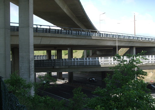
From the wood the path runs along and above the southbound carriageway of the M1 and then bends along the westbound M25, still high above the traffic, before climbing a bridge across the orbital with a view back to the interlacing concrete of the junction. Once again I’m struck by the feeling of moving in an entirely separate, if parallel, universe to the speeding traffic, through infrastructure specifically reserved for moving at a fraction of the speed. From the path you can see a sign on the M1 that announces "Services 17 miles". For a driver that's a mere 15 minutes or less before a loo break and an overpriced cup of tea. For me it's pretty much a day's walk.
I’m greeted by an elderly man who has installed himself on the bridge with binoculars and a thermos – perhaps there are birds to watch here but I’ve already powered past him when I think to stop and ask. One final bridge across a slip road and I’m back into fields, walking outside the ring of the M25 again.
It’s amazing how quickly the roar of traffic recedes. Only a few minutes later I’m passing idyllic old buildings at Holt Farm, site of an ancient moat, then wandering deserted Noke Lane between silent farms. My path from here is shown on the map as running on a farm drive but it’s been diverted through paddocks before you get to the farm and is easy to miss. This is clearly a longstanding situation, judging by the patient and polite but evidently well-practised way a driver I meet turning into the farm gate puts me right.
From here the route climbs to a surprisingly exposed ridge with the rather chilly name of Bone Hill, where I can see groups of people behind a fence, strolling around earthworks. The hill, just outside Chiswell Green, is the longstanding site of the Royal National Rose Society’s Gardens, generally known as the Garden of the Rose, which Chesterton rhapsodises about in his book. The path runs right past the garden entrance, but this rather genteel visitor attraction has recently been upstaged by another, much bigger, one next door, and the people I saw are patrons of the newer site.

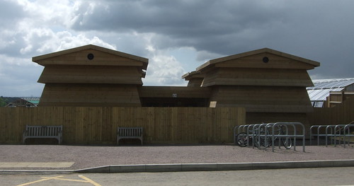
This is Butterfly World, a £27million project conceived by lepidopterist Clive Farrell to create “the biggest butterfly experience in the world.” Opened in 2009, so far it consists of a few smallish but unusual buildings – such as the beehive-shaped toilet block visible from the main entrance -- and a lake set in gardens laid out in the shape of a butterfly’s head, but 2011 should see the construction of a 17.5m high, 100m diameter “rainforest biome” with “Maya caves and ruins” populated by insects, spiders and hummingbirds. I assume it’s ended up sited here as the hilltop is also the HQ of the Royal Entomological Society.
I ponder whether interest in butterflies was widespread enought to sustain a multimillion pound theme park, but they do have a certain fascination, particularly in concentration. Butterfly houses in botanical gardens always arouse oohs and aahs. Some of the appeal is in the mythic narratives we build around their life cycles, those tales of astonishing metamorphosis from dowdy earthbound caterpillar to a brief but brilliant life as a spectacular winged creature. Though I didn’t go in, the place seemed busy for a bright but rather chilly spring day. The rose gardens, in contrast, seem to have declined. Though rebuilt in 2007, they’re currently only modestly promoted and open for only a limited season.
North of Bone Hill a new woodland is being created, with straight fenced paths running between saplings along a route more convenient than the one that appears on the map. Beyond this I round an older-established and bluebell rich woodland, Park Wood, with one more big road to cross. Until very recently this was one of Britain’s shortest motorways, the M10, a 5km spur between the M1 and the road now numbered A414. This latter was a legacy of an earlier pre-M25 scheme to encircle London with ringways, still known locally in places as the North Orbital Road, but the scheme was abandoned superseded by the M25 project in the mid-1970s. The M10, opened in 1959 at the same time as the main M1 as the main distributor road at the southern end of the new motorway, retained its motorway status even after the M25 opened in a bid to lure traffic between central and east Hertfordshire and the M1 away from the already congested orbital. As such it probably would have featured in my list above, but following various widening schemes, congestion is no longer such an issue (at least for the time being), and in 2009 the M10 was downgraded to become a mere extension of the A414
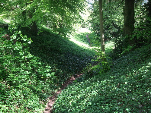
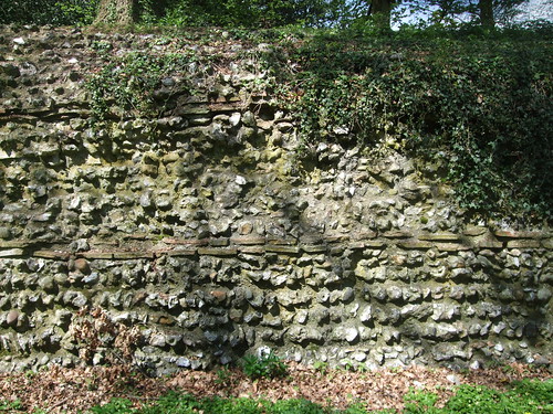
On the other side of the A414 the housing estates of St Albans lie before us at the bottom of the hill: reaching them, we leave the Community Forest for a while. An old path, preserved through the residential sprawl of Westfields as both street and alley, takes the route straight to the corner of Verulam Park, the modern day public park that now encompasses most of the site of old Verulamium. The London Countryway makes a fine entrance along one of the best preserved sections of Roman wall, on a path following the line of the flat berm which runs between the wall on the left and defensive ditch on the right, giving an excellent view of the city’s defences.
The current wall dates from the early 3rd century, but the ditch is older, and would have been overrun when Boudica’s Catuvellauni burnt the city to the ground.
Today it’s a pleasant, leafy place, well kept and well provided with council litter bins, difficult to imagine as the site of a bloody and ferocious assault.
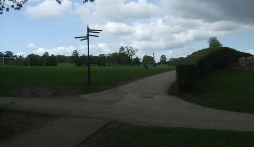
The path leads us to the edge of a large open green area, where a busy pedestrian fingerpost at a junction of paths is now the most prominent marker of the former London Gate, the city gate onto Watling Street in the London direction. Several sources claim that there are markers in the ground at this point indicating the extent of the gate, but I looked hard and couldn’t find anything conclusive. Much has been lost: the city was abandoned following the departure of the Romans and the masonry was eventually reused to build the abbey and the mediaeval town on the opposite bank of the Ver. The site became farmland, until it was donated to the council by the Earl of Verulam in 1929 as a public park. Excavations in the 1930s uncovered many of the remains visible today.
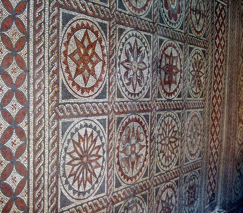
I won’t go into too much detail about the city and its remnants as it’s very easy to find information from more expert sources, including the Verulamium Museum, a little to the north of here. One of the biggest visible remains is the famous mosaic and hypocaust (underfloor central heating system) dating from around 160 that once formed part of a big, posh house on the shallow hillside to our left. To this day you can appreciate the delicate, pleasing abstract design, which should be symmetrical except that one of the roundels is at an angle 45° off what it should be. I’m not sure what the appropriate Latin or Celtic expletives would have been, but I imagine several were spoken when, having painstakingly laid down a few thousand tiny tesserae the wrong way, they finally spotted the error.
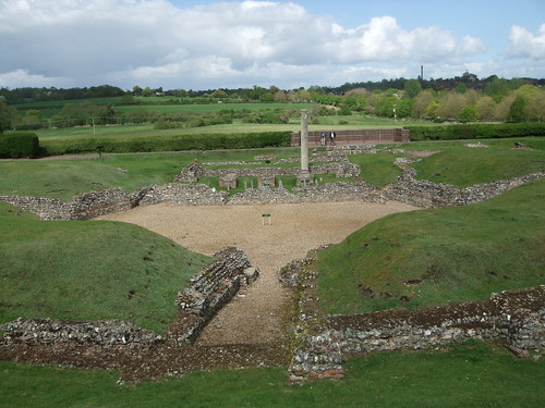
The other major survivor is the theatre, which now lies outside the park to the north. Here, sufficient masonry survives to give an idea of how the building might have been in its prime, though the prominent pillar by the stage is a modern addition intended to give an idea of scale. Within the theatre’s precincts, a set of rectangular foundations that once belonged to shops have been labelled rather poignantly: Fishmonger, Carpenter, Baker. Layers of ash found here attest to the vengeance of Boudica.
The theatre is still owned by Verulam, and Watling Street runs past it as a private drive, though there’s permissive access. The gravelly trackway has the look of a very old road but in its heyday it would have been paved. It didn’t run in a straight line through the city’s street grid but instead forked by a temple just beyond the London Gate. Its alignment through the park, along with pretty much all the rest of the original street pattern, has been lost to view: though known to archaeologists, for the casual visitor it’s obliterated by swathes of featureless mown grass and football pitches. Crossing these, I’m walking through ghost walls, crossing ghost kitchens, and paddling in ghost baths, trying hard to imagine the bustle of a once important city. I’d be grateful for a bit more on the ground to honour those vanished structures and the people whose lives they once shaped.
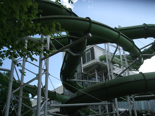
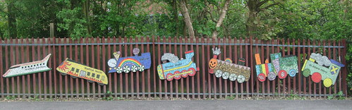
From the London Gate you could take the slow route back to by rail. A path roughly approximating Watling Street leads past the 1960s Westminster Lodge leisure centre with its peculiar exterior flumes, currently marked for redevelopment, and the Abbey Theatre, home of one of Britain's leading amateur theatre companies The Company of Ten, to St Stephens Hill (the A5183, of which more later) and St Albans Abbey station. This is now the smaller of the city’s two stations but was in fact the first, opening in 1858 as a branch from the London and North Western Railway (the West Coast Main Line) at Watford. In 1865 it was also linked to the Great Northern (the East Coast Main Line) at Hatfield, but this route closed to passengers in 1951 and to freight 18 years later. The station is now a mere single platform with a shelter, enlivened only by some cheerful murals by local schoolchildren depicting locomotives through the ages, installed to mark its 150th anniversary; its Abbey Line services to Watford are a curious appendage to London Midland’s outer suburban services. A poster was on display inviting users to contribute to a consultation on the future of the service, with one possibility being conversion to a tram line operated by the council.
Meanwhile the Hatfield link has found a new life as a footpath and cycleway known as the Alban Way, part of National Cycle Network route 61 from Maidenhead to Ware. This can be accessed a little southeast of the station, and provides another more direct alternative to the Countryway’s bell-shaped detour around the north of the city.
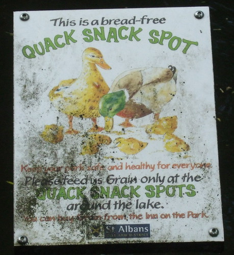
Sticking to Chesterton’s route brings you into a more formal part of the park, where the 1930s designers took advantage of the river Ver, and the former abbey fishponds, to create a fine collection of water features and a promenade that remains popular today. It now comes complete with a Quack Snack Spot for bread-free regulated duck feeding.
The river, which formerly powered numerous mills, rises at Markyate, to the north, from the edge of the Chiltern chalk, and Watling Street tracks its valley all the way to where it joins the Colne at Bricket Wood, its waters eventually feeding the Thames. Two other walking routes track it, joining us at the lake in Verulam Park. The Ver Valley Walk began life as the Ver-Colne Walk, championed from the 1970s by the Ver Valley Society: as shown on OS maps, it runs 24km from Watford to Redbourn but only the Ver section is now consistently waymarked. The Alban Trail, which isn’t consistently waymarked, starts at London Colney and ends 15km later at St Albans Abbey: it’s a later invention, also supported by the Ver Valley Society, linking sites connected to the history of the saint.
The Countryway shares the promenade with these two routes as well as with huge numbers of strollers who aren’t aware of any of these trails’ existence, then leaves the park to encounter another spike of the Hertfordshire Way, this time detouring down from the northern stretch of that wiggling circular route. We’re now in St Michaels, a village within the city and a gobsmackingly pretty one too, with some old inns and a wonderful Victorian school building lining a village street. One of the Ver mills, Kingsbury Mill, which has a claim to an entry in Domesday Book, is still working, though the building is currently operated as a waffle restaurant. Subsequent development has blocked the course of both Watling Street and the riverside walk straight ahead, but the London Countryway adopts a different solution to this than the other routes. We’ll consider this in the next section, as this one officially ends here in St Michaels on a street corner.

Reaching the big station on foot will take you deep into the mediaeval and modern city, which you wouldn’t want to miss anyway. You can either U-bend back from St Michaels along picturesque Fishpool Street, or drop out at the bridge, past one of the city’s most photographed sights, Ye Olde Fighting Cocks, with foundations dating from 793 and a superstructure that was installed here in 1539, currently the official Guinness record holder for the oldest pub in England, though not without its challengers, and head up Holywell Hill. By either route, you’ll come to the cathedral.
There are numerous variants of the story of Alban, the first British martyr, supposedly sacrificed by beheading to the Roman gods after he sheltered a persecuted Christian priest who converted him, perhaps in 209, 251 or 304. It was Bede who first claimed Alban lived in Verulamium, and was executed on the hill across the Ver where the cathedral now stands. Alban is credited with having parted the waters of the Ver on the way to his execution as the bridge was too crowded, and of carrying his head in his hands after it was chopped off. He’s been suggested as a replacement for St George as the patron saint of England.
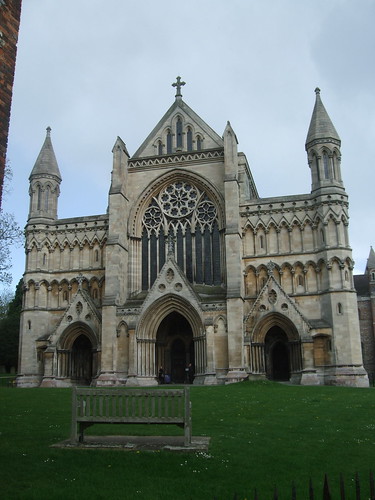
An abbey was founded on the alleged site of Alban’s execution at the behest of Mercian king Offa II in 793, though much of what we see of the abbey church today is a late 11th century rebuild. It’s big Gothic, with a massive crossing tower, but its lengthy 84m nave, the longest in England, gives it a slightly squat appearance. The Roman city isn’t the only long vanished structure here – in its glory days, the abbey’s buildings stretched over much of the Ver’s left bank, with outbuildings cascading down the now-grassed hillside, but as we know, Henry ended all that in 1539 and much of the site fell into decay. Besides the cathedral, only the chunky 1365 gatehouse still stands. The 19th century saw much restoration work to the church, much of it under the direction of the great George Gilbert Scott of St Pancras fame. The building was upgraded to cathedral status when St Albans was created a diocese in its own right in 1877. The main entrance is now through the Chapter House, a 1980s addition which I think achieves a good balance, fitting the context without resorting to slavish pastiche.
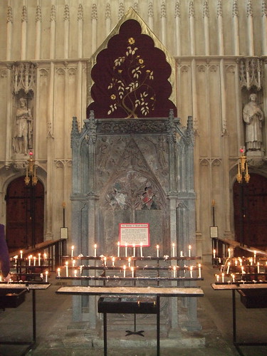
Anyone doubting my earlier questioning of the Protestant nature of the Anglican church should take a good look round St Albans Cathedral. The holy of holies, the saint’s shrine, is behind the high altar: it’s mainly 13th century work that was destroyed and discarded during the Reformation, then retrieved and rebuilt in Victorian times, and lovingly restored as late as 1993. In 2002 a rather grisly aspect of Christian tradition was upheld when an alleged piece of Alban’s corpse, a fragment of a shoulder blade, donated by St Pantaleon’s church in Köln, was placed in the shrine. Burning candles now surround it in an atmosphere that almost reaches Russian Orthodox levels of mystic.
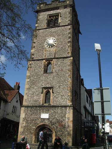
The route from here through the city centre also has much to gawp at, including secluded former vineyard and graveyard Vintry Garden, the early 15th century clock tower, pretty French Row with its corner where a sign prohibits what the French call “urine sauvage”, and the wonderful 1831 Palladian town hall, built on the site of the old Moot Hall. You cross two turnpiked north-south routes. The High Street is the later reworking of Watling Street, originally numbered A5, while St Peters Street is the Manchester road, originally numbered A6. To dissuade drivers from using them as through routes now that the motorways are opened, these sections of both have for several decades been renumbered A5183 and A1081 respectively.
A stretch of the legs down Victoria Street, past an ugly and blocky 1970s police station that's not really redeemed by the floral display outside it, brings you to the biggest and busiest station, St Albans City, usually called simply St Albans. This was opened in 1868 by the Midland Railway when it extended to Scott’s St Pancras, giving St Albans links to all three main lines north from London. The current building is now a rather dull 1960s affair but the services, now operated by First Capital Connect, are excellent: since the reopening of the Snow Hill tunnel in 1988 most trains have run through London as Thameslink services to Croydon, Gatwick Airport and Brighton.

Growing up in Hertford, St Albans was one of those day out places, one of the choices for major shopping and the nearest choice for sightseeing apart from London. I didn’t appreciate it properly at the time, and it was a delight to rediscover it on this walk. Chesterton says that if you find this section of the walk itself too short, you’ll find plenty in the city to occupy you, and I couldn’t disagree.
Download a route description PDF
View Google map
http://maps.google.com/maps/ms?ie=UTF8&hl=en&oe=UTF8&start=323&num=200&msa=0&msid=117966169375523396049.00046414d40d8252e7b70&ll=51.707134,-0.706859&spn=0.001599,0.00478&t=h&z=18
More information
- Hertfordshire County Councilhttp://www.hertsdirect.org
- Hertfordshire Tourist Information http://www.hertsdirect.org/comdirectory/comvol/infoad2y/intour3y/
- Hertfordshire countryside and rights of way http://www.hertsdirect.org/envroads/environment/countryside/
- Three Rivers District Council http://www.threerivers.gov.uk/
- Three Rivers Parks and Recreation http://www.threerivers.gov.uk/Default.aspx/Web/ParksRecreation
- Three Rivers Tourism http://www.threerivers.gov.uk/Default.aspx/Web/TourismTravel
- Abbots Langley Parish Council (including walks) http://www.abbotslangley-pc.gov.uk/
- West Coast Main Line (Wikipedia) http://en.wikipedia.org/wiki/West_Coast_Main_Line
- M25 motorway (Wikipedia) http://en.wikipedia.org/wiki/M25_motorway
- Friends of the Hertfordshire Way http://www.fhw.org.uk/
- Ovaltine http://www.ovaltine.co.uk/
- Ovaltine (Wikipedia) http://en.wikipedia.org/wiki/Ovaltine
- RES http://www.res-group.com/
- St Albans City and District Council http://www.stalbans.gov.uk/
- St Albans Parks and Open Spaces http://www.stalbans.gov.uk/environment-and-planning/land-and-premises/parks-and-open-spaces/
- St Albans Tourism and Travel http://www.stalbans.gov.uk/leisure-and-culture/tourism-and-travel/
- St Stephen Parish Council http://www.ststephenparishcouncil.gov.uk/
- M1 motorway (Wikipedia) http://en.wikipedia.org/wiki/M1_motorway
- Watling Chase Community Forest http://www.hertslink.org/cms/getactive/placestovisit/watlingchase
- Royal National Rose Society http://www.rnrs.org/
- Royal Entomological Society http://www.royensoc.co.uk
- Butterfly World http://www.butterflyworldproject.com/
- M10 motorway (Wikipedia) http://en.wikipedia.org/wiki/M10_motorway_%28Great_Britain%29
- Verulamium Park (St Albans council) http://www.stalbans.gov.uk/leisure-and-culture/parks-and-green-space/parks/Verulamium-Park/default.aspx
- Friends of Verulamium Park http://www.fvp.org.uk/
- VERVLAMIVM http://www.roman-britain.org/places/verulamium.htm
- Watling Street (Wikipedia) http://en.wikipedia.org/wiki/Watling_Street
- St Albans Museums http://www.stalbansmuseums.org.uk/
- Westminster Lodge Leisure Centre http://www.harpersfitness.co.uk/gyms/westminster-lodge-leisure-centre/
- Abbey Theatre http://www.abbeytheatre2.org.uk/
- A5 (A5183) (Wikipedia) http://en.wikipedia.org/wiki/A5_road_%28Great_Britain%29
- Alban Way (Sustrans) http://www.sustrans.org.uk/sustrans-near-you/east-of-england/easy-rides-in-the-east-of-england/alban-way
- Abbey Line (Wikipedia) http://en.wikipedia.org/wiki/Abbey_Line
- Ver Valley Society (Alban Trail, Ver Valley Walk) http://www.riverver.co.uk/
- Alban Trail map http://www.walkingbuddies.org.uk/alban.html
- St Albans Cathedral http://www.stalbanscathedral.org/
- A1081 (A6) (Wikipedia) http://en.wikipedia.org/wiki/A1081
- Midland Main Line http://en.wikipedia.org/wiki/Midland_main_line
- Roman Theatre of Verulamium http://www.romantheatre.co.uk/
- Kingsbury Watermill (Waffle House) http://www.wafflehouse.co.uk/st-albans.html


3 comments:
I enjoyed this section on Sunday 25th March 2018. A straightforward walk - some rather muddy paths but no problem with a good pair of boots. Only a few notes:
1. The graffiti on the M1 underpass has been covered with patches of grey paint. There is so much that one wonders why they didn't just paint the whole thing rather than leaving it with large grey patches.
2. On page 2 of the guide notes, the paragraph that begins "Take the footpath right, signed path 23 to Noke Lane ..." should read "Take the footpath left, ..." I think this is the third time that Des has had difficulty in telling his left hand from his right, but for such a fine guide we'll certainly forgive a few lapses!
3. The Royal National Rose Society has gone into administration. Their garden looks sadly neglected and a sign on the gate says that their land is being put up for sale. According to the BBC the Butterfly World sanctuary closed in 2015 because it failed to attract enough visitors to make a profit.
4. The sign in St Albans prohibiting “urine sauvage” needs to be repeated on the M25. On crossing the first bridge I saw a van parked illegally on the hard shoulder just long enough for a passenger to relive himself on the verge.
Great to be back on the London Country Way after a break to walk the Ridgeway and the explore the Loire Valley. A large field of linseed in flower was a fine sight in the sunshine. No mud at all at the moment. Just three comments to add to Leonard's notes:
(1) The Hertfordshire way has been re-routed and is now very well signed along the Country Way route all the way from Kings Langley to where it previously rejoined along a bridleway near Waterdale.
(2) The 'mini roundabout' on joining Bedmond Road is just a split in the drive, so not really a roundabout. Turning right to the bus stops, the safe place to cross is a bit beyond at the pedestrian crossing just before the true mini roundabout at the junction with the High Street. This crossing leads directly to Love Lane (well a very quick left-right).
(3) The sign and gate for the left turn approaching Noke Farm in June was thoroughly hidden by thick tree leaves and nettles - it was only when I turned back, having overshot - that I spotted them.
Once again, many thanks to Des for the excellent guidance.
Thanks both for these notes. Will review when I rewalk this section.
Post a Comment