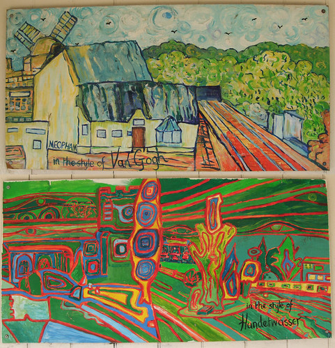
Today's walk is the last section of the Countryway in Kent, a county for which I've long felt an admittedly irrational connection. My mother was born in Dover and grew up in Eltham, which is historically in Kent, although the county never really figured in my youth. My sister inadvertantly re-established the connection years later by moving to Canterbury, and my parents gravitated back there too, later discovering several lost family members around Dover and Folkestone. When I first got my own flat in New Cross it was inside historic Kent by a couple of hundred metres, although I've since moved a similar distance over the historic Surrey side of the boundary. Kent is border country, only a few thousand years ago linked to the mainland of the European peninsula by that familiar chalky ledge, and now with what Wikipedia calls a "nominal" border with France halfway along the Channel Tunnel. Waves of immigration,invasion and influence have washed through the county -- Celts, Romans, Jutes, St Augustine and on. The name itself comes via Latin from a old Brythonic word meaning border or rim, land of the tribe named by Julius Caesar the Cantiaci.
Kent's northern boundary is also a natural one, the river Thames, although the historic boundary once peeped across the river to claim an enclave at North Woolwich, which we'll visit on the Capital Ring. The western, north-south side of the triangle, which once started along a stream running into the Thames just west of Deptford Strand and ended on the Channel Coast just west of Romney Marsh, is more history than geography, dating back to Norman times when the county was declared a near-Palatinate thanks to the ecclesiastical importancee of Canterbury. In 1889 a first scoop was taken out of the northwest corner with the creation of the London County Council, and London came back for more in 1964 with the coming of the GLC, though the inhabitants of Bromley and Bexley will still claim to live in Kent. The Medway Towns are in most people's minds still Kent, though officially they've been a self-contained Unitary Authority since 1998.
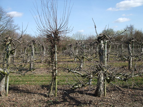
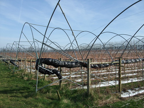
Within the county there's a further folk boundary along the Medway that divides Kentish Men in the west from Men of Kent in the east. Our walks are firmly in the -ish rather than the Men of zone, but we've still seen some of the county's significant landscape features -- the North Downs, the Greensand Ridge and the Weald. We've missed the marshy bits, but we'll find some of them on later journeys by the Thames. And there have been woodlands, orchards, ragstone buildings, plenty of oast houses, and roads and railways linked like arteries to London, as well as Paris and Brussels. By the time we reach Ebbsfleet on a notional extension of the Thames Path, Mark Wallinger may even have built his giant white horse, a modern day incarnation of Invicta, the emblem of the county.
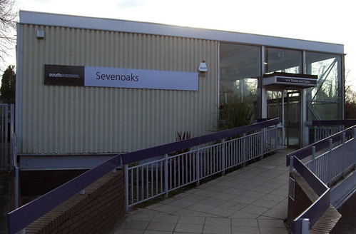
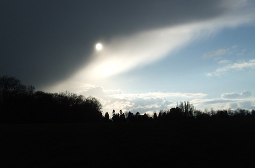
Today's walk is the longest so far, thanks to transport limitations at London Countryway creator Keith Chesterton's suggested break point of Ide Hill and my determination to get back into line with his divisions of the route. I'm also realising I need to increase my personal time estimates as stopping to take photos and make voice notes for this blog is slowing me down more than I expected. I've decided to get the bus from Sevenoaks to River Hill rather than trudge back on foot through Knole Park, and set off quite promptly but even so on this just post-equinox late March day I only just make it with half an hour of good light to spare. The weather is also the least sympathetic it's been so far, a paradigm case of what we inhabitants of temperate maritime climates ruefully refer to as "changeable". First it's dull and overcast, with a biting wind; then thankfully the wind drops, the sun comes out and all's well with the world; then it clouds over again and begins to hail, locking into a cycle of sunshine and hail for the rest of the day.
I realise on the bus that another possible break point, evening up the two sections a bit more, is Sevenoaks Weald, where the route passes right by a bus stop with a regular daily service. Otherwise there's no ideal break point on this long section, though if you were out on a summer Sunday when the buses run to Chartwell, arriving there with enough time to look round before catching the bus to Bromley would make a good day out, with the added attraction of a red London bus venturing out of its regular TfL territory to link you to London proper.
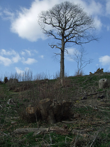
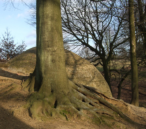
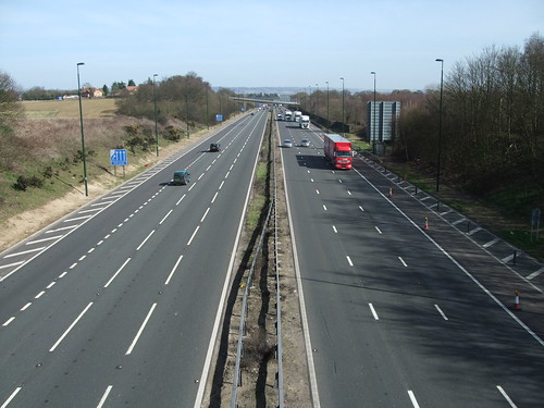
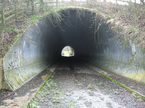
After a brisk walk up busy Riverhill from Morleys Roundabout (where the A21 Sevenoaks bypass becomes the Tonbridge bypass as well as forming a junction with the old turnpike route I'm now on), and the trickiest road crossing I've yet had to negotiate, I find myself back on the contour line on the edge of the wooded upper part of the Greensand ridge, with spring flowers brightening the woodland floor on the slopes above me and the bypass paralleling my progress below. Then the waymarks send me back down the ridge again along muddy field edges to find a well-concealed tunnel under the dual carriageway, no doubt bored through the embankment more for the convenience of the local farmer than for walkers when the road was build in the mid-1960s. Its industrially corrugated interior is gloomy and damp, but I still find little used pieces of infrastructure like this rather delightful.
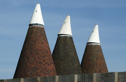
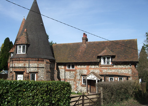
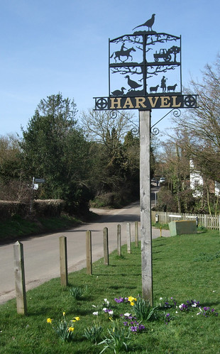
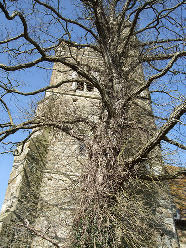
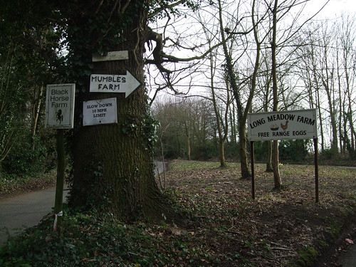
By now we're dangerously near the foot of the ridge and it's starting to get a bit flat and Wealden, so I'm pleased to find myself slowly climbing again through fields to emerge by St George's church and war memorial at the top of Sevenoaks Weald. This pretty little village was originally simply Weald, by which name the locals know it still: it has a Victorian feel, and the church dates from 1821, with a rather unsympathetic extension that's just been opened. Vita Sackville-West lived and entertained various bright young things in Long Barn, to the south of the village, including Charles Lindbergh, the aviator who gave his name to the Lindy Hop. More field walking, still uphill, brings me to a cluster of attractive farm buildings including an oast house, with a figure of a horse rider decorating the cowl, but all appears converted to residential, with some seriously posh cars in the car port.

From here an easy to follow path leads over a series of stiles and hedgerow gaps across fields to Wickhurst Manor, an attractive cluster of buildings centred on a part-13th century house that retains the layout of a mediaeval agricultural centre. Unfortunately this is where I encounter for the first time on the Countryway the bane of my rural walking -- dogs, or rather dog owners who seem unable to control their dogs in a responsible and considerate manner. Dog owners, in my experience, often anthropomorphise and sentimentalise their pets without understanding that dogs are, at base, territorial carnivores programmed to hunt in packs, normally affectionate and submissive to those they regard as their peers or superiors, but capable of vicious aggression to anyone else. The owner, seeing only the soppy mutt that rolls on its back to have its tummy tickled, rarely appreciates its nasty side. But even so, most of them at least have the decency to apologise when their dogs menace innocent bystanders. The dog owner I meet next does not belong in this category.
A sheepdog has already come after me as I crossed a stile, standing growling on the other side as if to dare me to return that way. Next, a field full of ewes with lambs decide to have a go at me vocally, heckling with loud and angry bleats as I pass through their field. Then, just as I'm leaving the area of the manor on a well-defined field edge path, still on the Greensand Way, a small but extremely aggressive white terrier, no doubt alerted by the sheep chorus, hurtles at me with ballistic speed from the last house on the path, yapping and snarling, a tiny thing but perfectly capable of ruining my day by attempting to make a meal of my ankles. A show of strength doesn't deter it, so I persist ahead in the hope that it'll soon be satisfied I've left its territory, but it keeps in pursuit, circling ever closer to my vulnerable ankles. This goes on for some time and I'm amazed that no-one has emerged to find out what all the fuss is about. In the end I simply stand still and shout at the house -- where the windows stand open -- "Call off this dog!"
Eventually a balding man saunters casually out of the house into the garden, now some distance off, seemingly amused at my distress. "Good afternoon," he says, with barely concealed sarcasm.
"Please call your dog off," I shout.
"What's the matter?" he says, chuckling. "Look at the size of her and look at the size of you."
"She might be small, but she's prepared to sink her teeth into me, and I'm certainly not prepared to sink my teeth into her. Call her off."
"Doris," he calls halfheartedly. Doris glances over her shoulder but soon decides that continuing to circle me while yapping and growling is more important. I try walking on again but she still follows me. I turn and try to chase her off but she just returns even closer. "See what I mean?" I shout.
"That's right," the appalling man shouts. "Give her a kick."
I'm astonished. I should be reporting him to the RSPCA as well as the police. "What?" I shout. "The last thing I want to do is hurt her. Call her off! This is a public footpath!"
"I know that," he replies, in an voice approaching a sneer. "We have lived here for 30 years." Three glorious decades of public nuisance. "Doris. Doris!" Finally the stupid beast responds to his call and I start to walk on. "Have a nice day," is his final sarcastic parting shot.
"No thanks to you and your bloody dog," is the best riposte I can manage.
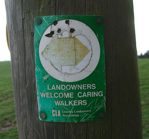
I try to put this unpleasantness behind me as I regain the upper reaches of the ridge across verdant, rolling fields, with forbidding dark clouds gathering in the south like bruises -- and a Country Land and Business Association waymark proclaiming that landowners welcome careful walkers. I guess that means me.
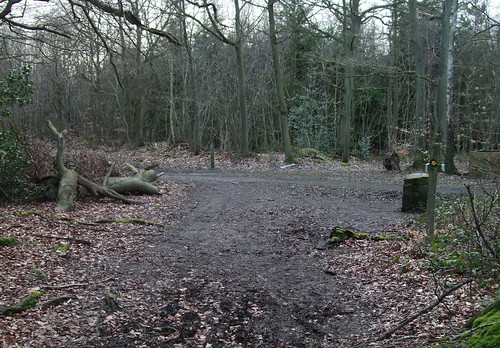
I'm soon back in mixed and partially coppiced woodlands managed for public access, this time Sevenoaks District Council's woods at Hanging Bank -- so named as they hang on the edge of the hill, though they're also known as Stubbs Copse, and are also a Site of Special Scientific Interest (SSSI).
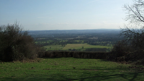
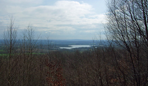
Unexpectedly, the sun comes out, and turning a path corner I pass a man with three dogs, all of whom he's putting on leads, having heard my approach. "Good afternoon," he says, with sincere cheerfulness. "Turned out to be a nice day, hasn't it?" Redemption is at hand. To the left, across the Weald, there's now a clear view of Bough Beech Reservoir, one of the few very big reservoirs in the southeast, created by flooding farmland in the 1960s and now managed as an important nature reserve. A memorial bench to Tom Emery who led walks for Enbro -- Enbro is short for Environment Bromley, reminding me that out here in leafy Sevenoaks we're still within walking distance of a London borough.
I once walked the area around Bough Beech with a friend I've since lost touch with -- let's call him Jonathan. He was a birder, an enthusiastic RSPB member, and every few minutes he'd stop, grab his binoculars and point out to me a coot or a reed warbler. I found this rather curious, and eventually a little frustrating. I've never been a great naturalist and, other than the obvious ones like swans, pigeons or robins, a bird to me is an animal that flies but isn't an insect or a bat. I'm aware that for many people spotting wildlife is one of the motivations for walking in green surroundings, and judging by the questions I get asked but can't answer, this sort of knowledge seems to be expected of walking writers and walk leaders, so I guess I'm deficient, but I find geology, the built environment and human culture more interesting. The Dutch composer Louis Andriessen says nature is boring because it's always beautiful, a view with which I have some sympathy.
Besides ornithology, Jonathan's interests included tattoos, piercings and body modification: beneath the veneer of a respectable Bromley schoolteacher was a gallery of body art and some DIY modifications of the sort that some find painful to look at. He and a similarly decorated friend sometimes went for early morning walks around Bromley Common wearing nothing but boots, though we explored Bough Beech fully clothed.
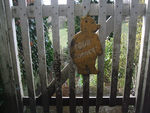
On that same trip we ended up at Toys Hill, which is wear I head next -- Chesterton's chosen end point for this section of the walk, descending from Hanging Bank past a house called Pooh Corner with a gate decorated with some rather battered wooden cutouts of Pooh and Piglet -- actually Pooh Corner is some way south, in Ashdown Forest in the middle of the Weald and way off our route, but it's a nice thought.
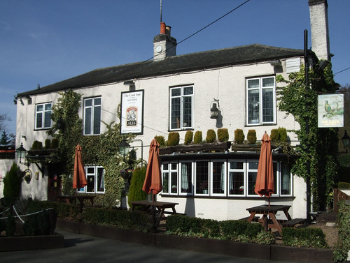
Ide Hill is a pretty little place that once had an excellent tea room, now sadly closed, but it does have a friendly pub, a village green and an odd little shelter measled with memorial plaques. Once my partner Ian and I drove out to Ide Hill hoping for lunch in the Cock Inn, to find it offered only sandwiches. When I asked if there was anywhere nearby offering anything more substantial, I was told there was a big pub just down the road, "of the sort frequented by townies."
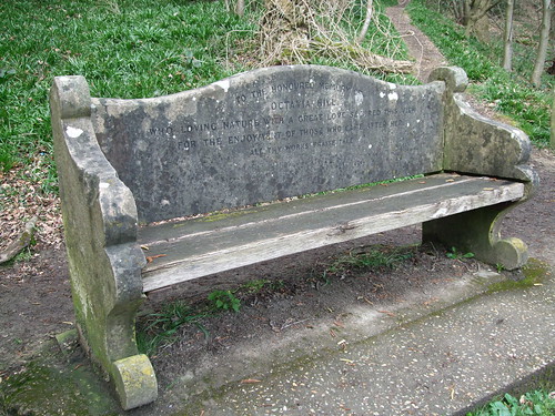
The National Trust owns some land here, including a spectacular viewpoint perched on wooded steep outcrop with wide views over the reservoir and the Weald, and there are numerous connections to the Trust's co-founder Octavia Hill, who's buried not far away in Crockham Hill church. There's a stone memorial bench to Hill at the viewpoint, and here I meet two women who regularly walk together, one of whom travels from Folkestone to walk in the countryside round London.
"Are you doing the Greensand Way?" they ask. "No, actually I'm doing an unofficial route called the London Countryway," I reply. "Oh," they say, "we've done that one, but where on earth did you get a copy of that old book?" We chat about the way the route has changed and they tell me that in their opinion this and the Chilterns are the best bits. As we talk, the skies cloud again and hail begins to fall. Golden sunshine will alternate with ice pellets from the skies for the rest of the day.
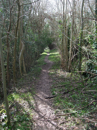
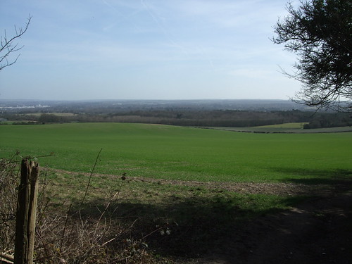
Since joining the Greensand Way at Ightham Mote the Countryway has followed the same route to the letter, but chooses a different way of looping round Ide Hill which involves at one point walking part of the Greensand Way in the "wrong" direction, and from now on, as with the Wealdway, our relationship with the signed route will become rather flighty and coquettish. We meet up with the GW for a while on the other side of the hill for a fine field edge path that dips into a valley and crosses a parish boundary, through countryside with a near-upland character, before climbing the ridge again to a larger area (81ha) of National Trust woodland at Toys Hill, also an SSSI. As the interpretation boards will tell you, these strips of wooded hillside were among the worst areas affected by the Great Storm of October 1987, the one which the Met Office famously failed to predict (and which I contrived to sleep through). But the regeneration since has actually increased biodiversity, perhaps a sign that the ecosystem is more resilient than some people think to extreme climate events. By now I'd actually appreciate a thinning of the cover in what is becoming a lengthy succession of woods -- too much woodland walking can start to feel a little oppressive, even in early spring when leaves aren't yet blocking off the views completely.
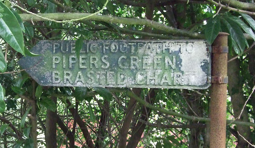
Toys Hill Woods have a more park like character, less dense, with rhodedendrons. Here the Countryway leaves the Greensand Way to take a more northerly route, following a bridleway. There are several other waymarked routes through the woods, with leaflets available from Chartwell and Ightham Mote, including one called the Weardale Walk -- which sounds more like a hike through the hills and vales of northeast England but is in fact a shortish route linking the National Trust properties in the area, including nearby Emmetts Garden, which also has a tea shop and information. The path we're on passes the backs of the southernmost houses strung out along Chart Lane as part of the settlement of Brasted Chart, crosses another valley and climbs to the hamlet of French Street. Looking to the right I can see the familiar slopes of the North Downs ahead, although it will be some time before we reach them on this route. I emerge by an old footpath fingerpost from the days when these showed destinations -- I'm not quite clear why this useful practice has gone out of fashion when in many other respects signing of footpaths has improved so much.
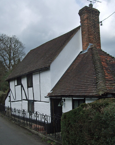
Passing some classic chocolate box cottages, including the half-timbered whitewashed April Cottage (above), I rejoin the Greensand Way on the edge of Hosey Common, another council-managed wooded space, and am soon walking along the edge of the Chartwell estate. I've visited Chartwell before so don't linger now -- it's one of National Trust's biggest attractions in the area, less for the pretty country house and grounds and more for its connection to politician and wartime leader Winston Churchill (1874-1965), whose personal home it was from 1924 until his death. I've always felt ambivalent to Churchill, an arch conservative and establishment patriot, with a sometimes cruel wit, at first sympathetic to Mussolini, who nevertheless understood the threat of Nazism, was instrumental in defeating it and in shaping the international order that emerged from that defeat and seemed, when I was growing up, immutable. Strangely, like his arch opponent Adolf Hitler he was also an amateur painter, using painting to counter fits of depression. His paintings, mainly vaguely impressionist landscape watercolours, are perhaps the most interesting curiosity on display here -- though it must be said that if his statesmanship and grasp of military strategy had been at a similar level to his skill as an artist, 20th century world history may have turned out rather differently.
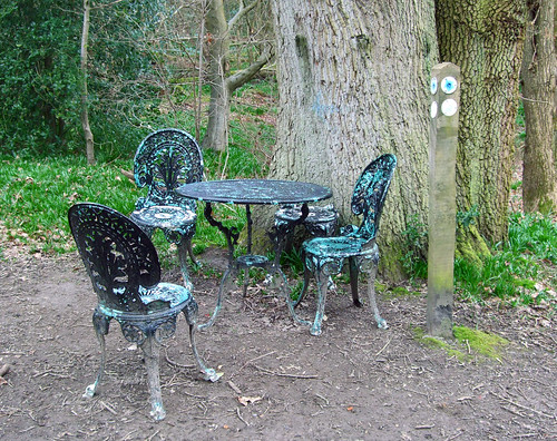
More wooded commons follow, these managed by Sevenoaks council, and just crossing Hosey Common Road and entering the Natinal Trust's Mariners Hill I see someone has kindly left some white-painted metal garden furniture under a tree, which seems as good a place as any to have my lunch.
Again we're off the Greensand Way on a woodland path that comes out at Kent Hatch Lodge -- a sign we're walking our last few hundred metres in the county. Then it's back on the Greensand Way on an enclosed path between houses that takes us to Surrey.
I'm not disappointed with the boundary. A couple of weeks earlier I'd walked across the border of the Netherlands and Belgium between Bergen op Zoom and Antwerpen, just below the Brabantse Wal, and it was barely detectable, a muddy ditch in a muddy field with only a 19th century border post indicating its significance. West of Kent Hatch, I emerge at the boundary from a fenced path into a tranquil clearing in woodlands that look quite different to the ones we've just left, less dense and with a proliferation of conifers, giving that characteristically cushioned woodland floor. A low bank marks the boundary itself and the Greensand Way signing changes from the Kent oast house to simple GW lettering or path names. What I at first guess is a boundary stone turns out to be a Greensand Way marker, indicating it's exactly 55 miles (88km) from here to both Ham Street and Haslemere, the two termini of the route: how convenient that exactly half should fall into each county.
Here the Greensand Way goes half left, while another route, the Tandridge Border Path, which circles the edge of Surrey's Tandridge Borough, follows the boundary left and right along a bridleway. We're now also in a different Area of Outstanding Natural Beauty, the Surrey Hills, although you'll often see it lumped together with the Kent Downs as simply the North Downs. The Countryway appears to go half right but I lose track of the path and end up taking a slightly different route to the common at Moorhouse Bank. The woods here are also open for recreation, though they're in private hands -- this is the southernmost reach of the Titsey Estate, centred on a 16th century country house on the North Downs ridge to the north of here, and now owned by a trust controlled by the Innes family. The trust bought back the leases on the woods in 1996 when the leaseholders threatened to redevelop them and have subsequently improved public access.
Rounding an open common used for cricket, I join another clear bridleway that runs along a series of woodland edges, now walking in the rich light of the lowering sun. I cross the alignment of the old Roman road from London to Lewes, which starts near Asylum Road in Peckham, about 15 minutes walk from my flat -- but there's no obvious evidence on the ground here. A little further on and more obvious, though sadly with vandalised waymarks, is the route of the Vanguard Way, from East Croydon to Newhaven on the South Coast, which I'll be exploring here when I finally get round to north-south routes across London.
A short path down the side of a golf course -- the first and only one today -- brings me to the edge of Limpsfield Common, which a commemorative stone records was given by the lord of the manor to the National Trust in 1972. It's a common misunderstanding about commons that they have always been public land -- in fact they date back to the feudal system and to a very different system of rural economics, where a single landowner controlled both the land and the people on it, commanding them to work for him and in return giving them certain rights of subsistence, such as grazing or gathering firewood. Commons technically are areas where local people retain these common rights, but with the feudal system abolished, most of them ended up in the private hands of the successors to the old feudal lords, many of whom from the 18th century onwards took to enclosing and developing them in accordance with the new economic order. The ones that still exist today generally do so as the result of local struggles and legal challenges and often involved them being acquired by institutions like councils and trusts that made them available for different kinds of public use.
Crossing the B269 from the golf course to the common, I leave the AONB, though the land still enjoys a lesser landscape designation, that of Area of Great Landscape Value (AGLV), a designation now threatened by a government review. Local councils have long asked for the AONB boundaries, which date back to 1958 (it was one of the earliest AONBs), to include the current AGLV, but have been told there is no funding for this process, so are currently pressuring to keep the lesser designation. I see their point -- it makes a nonsense of officially sanctioned definitions of Natural Beauty as there's no obvious drop in landscape character on the common. If anything, its more open landscape adds a little variety, and it's clearly well used by local people.
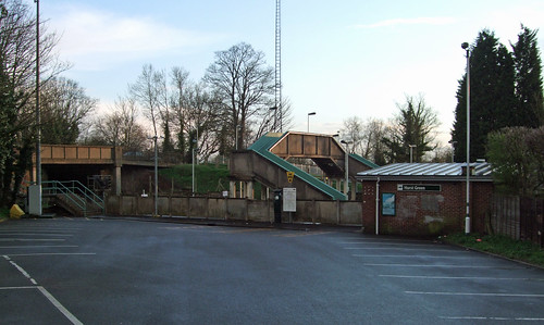
Finally, after rejoining the Greensand Way and following a track past some very big houses, I'm out of the AGLV and into suburbia and the posh edges of Oxted. I finish the walk at Hurst Green station on the Oxted line. The line was opened as the Croydon, Oxted & East Grinstead Railway in 1884, a joint venture between the South Eastern and the London and Brighton, but there was no stop here until 1907 when a halt was opened just to the south of the road bridge here. In 1961, reflecting the development of housing in the area, it was replaced with the current station. And just to underline that we've crossed a boundary, services from here are operated by the modern Southern Railway rather than the South Eastern, whose trains are found in Kent. Actually both companies are owned by the same large group, GoVia, and have only a tenous link to the previous companines that bore their names, operating some of the same trains on some of the same track, but the changing liveries of the various operators on the radial routes around London are another way to chart my progress. With the sun now dipping below the houses, it's a convenient place to end a lengthy walk.
View a map http://maps.google.co.uk/maps/ms?ie=UTF8&hl=en&msa=0&msid=117966169375523396049.00046414d40d8252e7b70&ll=51.414197,0.368729&spn=0.106206,0.219727&t=h&z=12
Route description pdf
More information
- Kent County Council http://www.kent.gov.uk/
- Kent County Council walking http://www.kent.gov.uk/leisure-and-culture/explore-kent/walking/
- Kent (Wikipedia) http://en.wikipedia.org/wiki/Kent
- Visit Kent http://www.visitkent.co.uk/
- Kent Geology (Kent RIGS) http://www.kentrigs.org.uk/kentgeo.html
- K-LIS (Kent Landscape Information System) http://www.kent.gov.uk/klis
- Greensand (Encyclopaedia Britannica) http://www.1911encyclopedia.org/Greensand
- Greensand (Wikipedia) http://en.wikipedia.org/wiki/Greensand
- Greensand Way http://www.kent.gov.uk/leisure-and-culture/explore-kent/walking/greensand-way-walk.htm
- Weald (Wikipedia) http://en.wikipedia.org/wiki/Weald
- High Weald AONB http://www.highweald.org/
- National Trust http://www.nationaltrust.org.uk/
- Tonbridge & Malling Borough Council http://www.tmbc.gov.uk/
- Visit Heart of Kent http://www.visitheartofkent.com/
- Kent Downs AONB http://www.kentdowns.org.uk/
- Sevenoaks District Council http://www.sevenoaks.gov.uk/
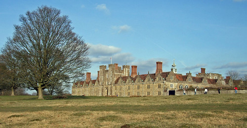
- Knole (National Trust) http://www.nationaltrust.org.uk/knole
- Riverhill Gardens http://www.riverhillgardens.co.uk/
- A225 (Wikipedia) http://en.wikipedia.org/wiki/A225_road
- A21 (Wikipedia) http://en.wikipedia.org/wiki/A21_road
- Hildenborough Parish http://www.thisishildenborough.co.uk/
- Sevenoaks Town Council http://www.sevenoakstown.gov.uk/
- Sevenoaks Tourist Information http://www.sevenoakstown.gov.uk/Tic.asp
- Sevenoaks (Wikipedia) http://en.wikipedia.org/wiki/Sevenoaks
- South Eastern Main Line http://en.wikipedia.org/wiki/South_Eastern_Main_Line
- Weald Parish Council http://www.sevenoakswealdpc.kentparishes.gov.uk/
- St George's Church, Weald http://www.stgeorgesweald.com/
- Sevenoaks Countryside (Hanging Bank, Hosey / Westerham Commons) http://www.sevenoaks.gov.uk/leisure__culture/261.asp
- Bough Beech Reservoir (Kent Wildlife Trust) http://www.kentwildlifetrust.org.uk/reserves/bough-beech/
- Sutton and East Surrey Water http://www.waterplc.com/
- Ide Hill and Crockham Hill (National Trust) http://www.nationaltrust.org.uk/main/w-global/w-localtoyou/w-south_east/w-south_east-countryside/w-south_east-places-north_kent/w-south_east-places-north_kent-crockham_ide_hill.htm
- Sundridge with Ide Hill Parish Council http://www.sundridgewithidehillpc.kentparishes.gov.uk/
- Toys Hill and Outridge (National Trust) http://www.nationaltrust.org.uk/main/w-global/w-localtoyou/w-south_east/w-south_east-countryside/w-south_east-places-north_kent/w-south_east-places-north_kent-toys_hill_outridge.htm
- Emmetts Garden (National Trust) http://www.nationaltrust.org.uk/main/w-emmettsgarden
- Brasted Village http://brasted.co.uk/
- Westerham Parish Council http://www.westerhampc.kentparishes.gov.uk/
- Chartwell (National Trust) http://www.nationaltrust.org.uk/chartwell
- Surrey County Council http://www.surrey.gov.uk/
- Surrey Countryside http://www.surreycc.gov.uk/countryside
- Surrey Walking (John Harris) http://www.walkinginsurrey.co.uk/
- Visit Surrey http://www.visitsurrey.com/
- Surrey Hills AONB http://www.surreyhills.org/
- Tandridge District Council http://www.tandridge.gov.uk/
- Visit Tandridge http://www.tandridge.gov.uk/LifeinTandridge/Tourism/default.htm
- Tandridge Border Path http://www.tandridge.gov.uk/LifeinTandridge/Leisure/Walks/tandridge_border_path.htm
- Limpsfield Parish Council http://www.surreycommunity.info/limpsfieldparishcouncil/
- Titsey Place (including Titsey Woodlands) http://www.titsey.org/
- Limpsfield and Limpsfield Chart (Tandridge Council) http://www.tandridge.gov.uk/LifeinTandridge/Tourism/Townsandvillages/limpsfield_and_limpsfield_chart.htm
- London to Lewes Roman Road (Wikipedia) http://en.wikipedia.org/wiki/London_to_Lewes_Way_(Roman_road)
- Limpsfield Common (National Trust) http://www.nationaltrust.org.uk/main/w-global/w-localtoyou/w-south_east/w-south_east-countryside/w-south_east-places-north_downs/w-south_east-places-north_downs-limpsfield_harewoods.htm
- Oxted Parish Council http://www.oxted-pc.org.uk/
- Oxted Line (Wikipedia) http://en.wikipedia.org/wiki/Oxted_Line