Today the London Countryway launches into its second and final semi-circle and once again switches scenery as it enters the Chilterns, the last of its three Areas of Outstanding Natural Beauty. Like the previous AONBs, the Kent Downs and adjoining Surrey Hills, this one is centred on a chalk ridge, another ragged edge of the same chalk shelf, the debris of unimaginably old algae fossils, now emerging on the other side of the London basin.
Though there's a satisfying circularity to linking the two main chalk zones cradling the capital, the landscapes straddling the Countryway's course through them are markedly different. To the south we paralleled or walked astride the main chalk ridge itself for some time, enjoying wide views with their geology drawn in broad strokes, and the sense that we were tracing a wall. The Chilterns, by contrast, are more sprawling and less linear.
There is indeed a main ridge with a scarp slope and open downland looking over the Vale of Aylesbury, also traced by a National Trail, the Ridgeway, based on a prehistoric ridgetop trackway. One of Countryway inventor Keith Chesterton's first ideas was to link this with the North Downs Way along the southern ridge, but it runs further from London and he decided reaching it would take his route too far out. Instead, over the next four sections the Countryway traces a route some way southeast of the main ridge, cutting against the grain of several gentler and more rounded subsidiary ridges that run roughly perpendicular to the main one. So there's a series of ups and downs through a rolling agricultural landscape that's more intimate and enclosed than the drama of the North Downs, with more restricted views.
The AONB was designated in 1965 and covers 833 km2, running from the Goring Gap, where the Thames cuts through the chalk on the ancient boundary of Oxfordshire and Berkshire, in a 75km diagonal northeast to Hitchin, interrupted near the end by a gap to accommodate the urban area of Luton. Since 2005 it's been managed by a conservation board bringing all the councils together, but there's also a very active user group, the Chiltern Society, who help protect the AONB but also promote its enjoyment. They've been very active in maintaining the footpaths, producing maps and creating a number of longer walking routes, some of which we'll encounter. Buckinghamshire county council, in whose territory most of our route falls, also have a well-established network of routes, and between the council, the society and the AONB you won't be short of alternative suggestions for walks. There's even a cool interactive map of local routes on the AONB website.
Though the Chilterns claims to be the closest AONB to central London, rather than tracing the outer limits of the city, you now feel you're venturing far beyond it, with few obvious visual connections to the capital. I thought at first this might just be my lack of familiarity with the area -- though I already knew the North Downs relatively well, researching this walk is the first time I've explored the Chilterns. But outside the bigger towns on the main radial roads and railways, this really is very deep countryside.
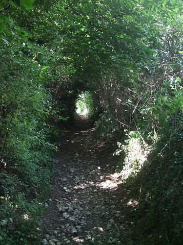
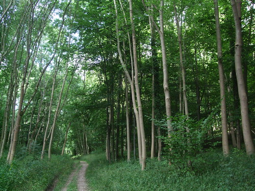
Mostly it's attractive but unspectacular, low on major heritage sites, visitor attractions and features of interest, rich in wildlife. There are plenty of woods -- mainly beech and oak -- but they're patchy and dappled rather than the thick gnarled forests that cling to the scarp of the Downs. Elsewhere the land is arable farmed or used for horses, with the occasional common. Lots of footpaths start by climbing uphill through fields to woodlands at the top, emerging into one-street hamlets with cottages -- flint lined with brick, or sometimes whitewashed with red-tiled roofs -- strung along the roads that trace the ridgetops, before another footpath rollercoasters down and up to the next ridge. Good drainage through the chalk ensures the valleys are usually dry, so streams and rivers are few.
If you're after a classic country walk, these are excellent surroundings, mainly quiet and peaceful, with long stretches away from busy roads, the climbs exercising but not challengingly steep or long, the footpaths well-maintained and well-signed and surprisingly underused by visitors. But in some respects these are the least interesting sections of the Countryway so far, and certainly stretch the city walking remit of this blog.
The walk starts in surroundings that are urban enough, just outside the AONB boundary and just inside Buckinghamshire, in pretty Marlow by the Thames, the town where Mary Shelley wrote Frankenstein. The Countryway follows Pound Lane past Green Flag-accredited Higginson Park, an excellent and popular example of a traditional urban park created from an 18th century private garden in the 1920s, which sweeps down to the riverside.
You'll spot the sign that indicates one of the county council's circular walks passes this way. More sporadically signed is the Shakespeare's Way, which has joined us here from the Thames Path. Created by the people behind the Macmillan Way network of cross-country footpaths, this 235km path links William Shakespeare's birthplace at Stratford-upon-Avon with London and the Globe Theatre, a journey the writer himself must have undertaken on foot, although not necessarily on the same route. East of Marlow it follows pre-existing routes: the Thames Path to Cookham, then the Beeches Way (mentioned in the last section), the Grand Union Canal Walk and finally the Thames Path from Brentford to the Globe. This is just a brief encounter with Will's wandering ghost as we'll be seeing more of him in future walks.
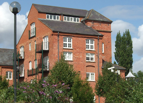
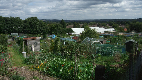
The Countryway soon leaves these routes just past a red brick maltings now converted into flats, heading up a good urban footpath to busy West Street with its pubs and restaurants. Continuing northwest up Oxford Road, though, you soon start to get the feel of a village street, leafy, quiet and lined with 18th century houses, though the United Reform Church looks more like an office building. Dodging down Queens Road we pick up a footpath beside the Duke of Cambridge pub that climbs uphill past allotments. Where the allotments end we're into the AONB and rising up above the Thames Valley with its wooded ridge beyond -- it's our last sight of the valley until near the end of the Countryway. Already there are chalk and flints underfoot, and a rich hedgerow to the side.
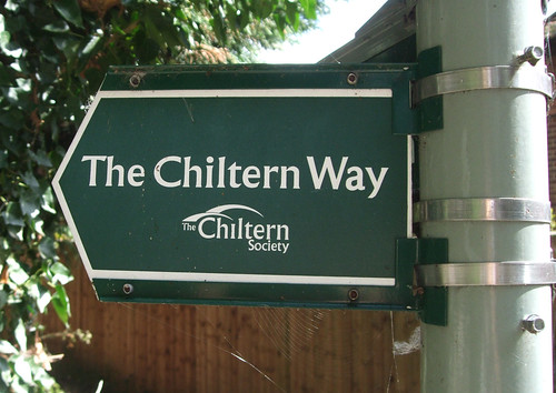
This fine path leads to a track just by the satellite hamlet of Bovingdon Green where for a short while we pick up the Chiltern Society's flagship walking route, the Chiltern Way. Originally created as the Society's millennium project, it's an expansive 200km circular walk exploring the length and breadth of the AONB, with two additional smaller loops linking to the Thames Path in the south and the Icknield Way in the north, another 94km in total.
Heading east from here will take you to Goring, cutting off a big southward meander of the Thames and linking to the Ridgeway, which you could if you wished follow southwest along the chalk towards Avebury and along the Wessex Ridgeway to Lyme Regis where fossil-rich cliffs mark the interface between chalk and sea. But our track runs east past a pretty farm and into our first Chiltern woodland, Blounts Wood, then the first hint of a rollercoaster down and up along field edges to End Farm.
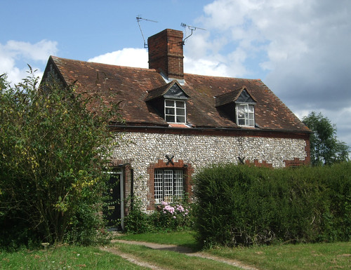
Here the Chiltern Way forks off, heading for Wendover and the northeast trajectory of the Ridgeway -- the National Trail ends at Ivinghoe where the trackway route continues via the Icknield Way and Pedders Way via Thetford to Hunstanton. Meanwhile the Countryway keeps roughly north on a bridleway uphill again and along the edge of another woodland, Highruse Wood. This picks up a lane to Copy Green, where an isolated flint cottage stands exposed by a small triangle of grass on a ridgetop plateau of farmland, possibly the loneliest place we've yet encountered on the Countryway. With old fashioned leaded windows, English roses growing by the window and cart tracks leading to the front door, it looks from the outside as if little has changed here for a century or so, except for the TV antennae on the chimney.
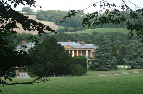
More good bridleways now lead across fields west and then north alongside Shillingridge Wood, another rich beech woodland. The path emerges into a secluded valley, following a line a few metres up from the valley floor, and below us is the curiosity of Bluey's Farm. This is a neat and pretty group of buildings -- whitewashed and thatched cottages, a matching terrace of stables, and a wooden-framed brick house -- which back in the late 1970s intrigued Keith Chesterton with its "unreal and dreamlike" atmosphere.
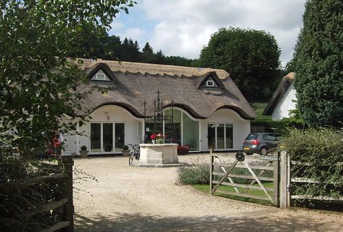
He discovered that all the buildings apart from the old brick house were built around 1960 as the private retreat of a Greek ship owner, a Mr Mavroleon, originally as a stud farm. I guess this was Basil Mavroleon, who married an Englishwoman and lived in Britain; or his son and heir Manuel Basil, who was nicknamed Bluey. The latter died in 2009, and the Daily Telegraph obituary recounts that "his son Carlos, a journalist working for CBS who had converted to Islam, died in mysterious circumstances in a hotel room in Peshawar, Pakistan, in 1998." The buildings have since been converted into a number of impressive private homes, the old half-doors of the stable stalls now replaced with picture windows, and it no longer seems such a lonely place as it must have done when Chesterton wrote about it, but there's still a trace of the "unreal and dreamlike".
The valley is still lovely, half coated with long stripes of trees -- a few leaves already turning bronze in late August -- and beyond the farm the path winds down to the bottom and enters another wood, Moor Wood, on a fine broad bridleway. The trees hear grow tall and straight, with little foliage on their lower branches -- the word 'cathedral' comes to mind.
The track eventually emerges on the Marlow Road, a well-used B-road, about a kilometre short of the village of Lane End. There's a short stretch along the road, with no footway but at least a little verge, and before the village the route heads off uphill across a field and towards a wood.
A search for peace and quiet round here is compromised by the constant buzz of light aircraft from Wycombe Air Park which is a short way to the east. Originally named Booker Airfield, it was built in 1939 as a civilian air training facility, but was not immediately used as such due to the outbreak of World War II. It finally began providing basic training to volunteer flyers and military glider pilots in 1941, still under civilian auspices. In the 1960s it became the base for the flying clubs of then national carriers BEA and BOAC, the ancestors of British Airways. The connection remains as the now-privatised BA operates it through a subsidiary as a base for training, gliders and light aircraft, so you might spot little Piper Dakotas with tails displaying BA's distinctive wavy red white and blue device, a livery more familiarly applied to Boeing 747s and Airbuses. The noise of aircraft is soon joined by the noise of shooting: adjacent to the air park is a shooting ground operated by EJ Churchill, the London-based gunmakers, claiming to be "the most prestigious shooting ground in the country".
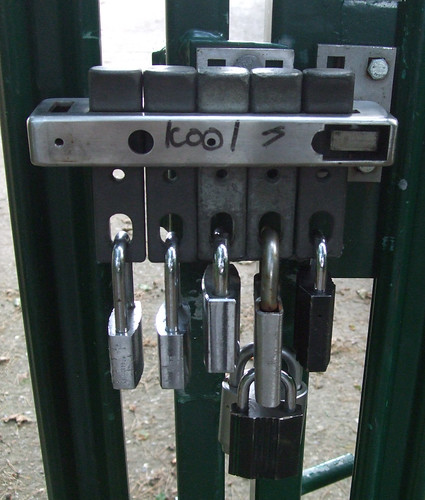
Widdenton Park Wood is part of a former mediaeval estate and a Site of Special Scientific Interest (SSSI) thanks to its unusual combination of a typical Chilterns beech-oak woodland and wetter boggy areas fed by springs, with willow, birch and marshy grassland and a number of rare plants. On the top of the hill is an enclosed reservoir fed by springs, another dream-like place surrounded by neat green railings. The Countryway follows the fence and passes the main gate where no less than seven padlocks indicate the water company takes its security seriously.
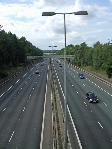
Our route out of the wood emerges on the drive to Churchill's shooting ground just short of a lane that crosses the M40 motorway. The motorway is the latest incarnation of the key highway link between London and Oxford, and continues beyond as a more pleasant and less congested alternative western route to the M1 and M6 between London and Birmingham. When it was completed in 1990 it was supposed to be the last major motorway scheme in the UK but successive governments have failed to withdraw successfully from their road building addiction and there have been several schemes since. It is, however, the newest of the major radial motorways encountered on this walk. For many years it was the only major motorway without any service areas, allegedly apart from some portaloos at Cherwell Valley in Oxfordshire, though this has now changed. This section, the High Wycombe bypass, was in fact the earliest to open, in 1967. Like much of the route through the Chilterns it's in a wooded cutting in an effort to minimise its impact on the environment, and is known as one of the more accident-prone stretches of the M40, as high speed commuter traffic shuffles with long distance goods vehicles.
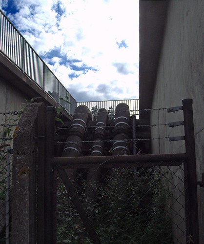
On the other side of the motorway a farm track runs parallel to it for a while, and what might have been a footbridge ahead turns out to be a service conduit carrying several serious looking pipes across the roaring traffic.
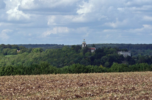
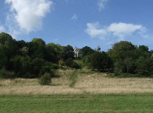
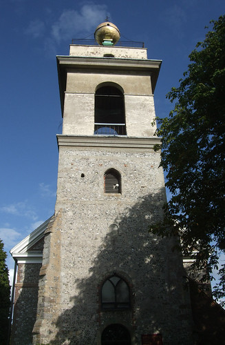
Then the track bends away past a farm and through another woodland and, earlier than expected, our destination is in sight -- the tower of St Lawrence's Church, West Wycombe, topped by a golden ball copied from the Palla d'Oro on the Punta della Dogana in Venice, rises from the trees over to the left. Soon we're descending on a lane alongside the wall that encloses the extensive parkland of the West Wycombe estate, into the valley of one of Britain's several rivers named Wye. This rises from the Chiltern chalk a little to the north, at Bradenham, and flows for 14km to the Thames at Bourne End between Cookham and Marlow: we passed close to this spot on the last walk. Wycombe is named for its once well-wooded valley -- Wye-Coombe -- and this geography will dominate our view for the rest of the walk. Near the valley's head, at this western end of the village, is the promontory of Wycombe Hill, with that distinctive church tower commanding the surroundings.
Along the valley floor between High Wycombe and West Wycombe runs the A40 road, which crosses the Wye nearby the point where our lane joins it at a T-junction. Although superceded by the M40, for centuries the road was one of London's vital radial routes, connecting the capital with the university city of Oxford. At the London end it forms one of the major east-west road alignments, from St Paul's via Holborn and Oxford Street. In parts, including at Wycombe, it follows much older routes that date back at least to Romano-British times. The dead straight alignment between West Wycombe and High Wycombe, however, isn't evidence of Roman engineering -- originally the road ran to the south of the river, until the current route was laid out as a grand avenue by local landowners the Dashwood family in the late 18th century using spoil excavated from the famous Hell-Fire Caves under Wycombe Hill.
The best known of the Dashwoods is the second baronet, Francis (1708-81), sometime MP, Postmaster General and Chancellor of the Exchequer, whose father, also Francis, had first bought the extensive estate -- some 20km2 -- in 1698. When mentioning Francis Dashwood it's customary to reach for the adjective 'notorious' for his association with the Hell-Fire Club, which met in the Caves and, allegedly, in the church's golden ball, as well as at Medmenham Abbey, not far away on the Thames. The built and landscaped heritage we see today is largely Francis' vision, inspired by a taste for Renaissance Italy then considered essential among English aristocrats raised on the Grand Tour, and indeed Francis' other social achievement was to found the Dilettanti Society, a dining club for those of his contemporaries who were equally admiring of Italian style.
There's a dramatic pedimented and double-collonaded mansion set within a Palladian park scattered with temples and follies; a preserved rustic village street; and over it all the hill, topped with its distinctive church and an octagonal mausoleum. There's an extravagance about it which belies English reserve, but tempered with good taste. In the 20th century the village and hill, and then the house through the donation of a particularly generous Dashwood, came into the hands of the National Trust. Family members still live in the house, however, and although it's partially open to the public as a stately home, it's also used as an events venue and for functions and corporate entertainment.
The Countryway doesn't run through the village itself but it's a very short and worthwhile diversion -- a collection of old inns, shops and cottages strung out along the A40, including a timbered-framed group at the east end that dates from the late 15th and early 16th centuries with delightfully sagging and overhanging upper stories. One of these is a traditional sweet shop and apparently none of them have foundations.
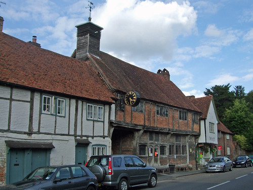
There's a kind of group harmony about the village that's difficult to convey in a single photo. The buildings set back from the road around the village hall also make an attractive little enclave.
The route sends me straight up the hillside towards the mausoleum, the last few metres a bit of a scramble up eroded chalk. Perhaps unfairly, the deliberate domineering use of scale, place, severe Portland stone and classical pastiche reminds me of some of the pretentious Nazi architecture I've recently seen at Luitpoldshain in Nürnberg. Among the urns is one containing Francis' ashes.
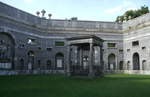
The church, behind it, is a much more pleasing building. Both occupy the former site of an iron age hillfort that would have overlooked the ancient highway.
I leave the hillside on a path that turns out to precede the one intended by Chesterton, and end up walking past the entrance to the Hell-Fire Caves, one of the supposed venues for Francis and friends' "notorious" behaviour, including alleged sacrifices and black masses. In fact there had been an earlier Hell-Fire club before the one Dashwood co-founded, and the name isn't of the members' choosing: they preferred to be known as the Knights of St Francis. Sex quite likely did play a role in some of club's activities; however its undocumented but enduring reputation for Satanism is most likely the result of a smear campaign conducted by the political enemies of Dashwood and his friends. Though a Tory, Francis was a reformer -- the caves were excavated partly to create work for unemployed labourers during a time of economic difficulty. His fellow members included the radical John Wilkes, satirical artist William Hogarth, and American Founding Father Benjamin Franklin.
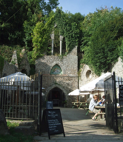
I'm not sure quite how interested the current management are in setting the record straight on Dashwood. They run the Caves as a visitor attraction with much use of the word "notorious" in the publicity and flaming lighting effects playing in the lobby. Still, it looks like the outdoor café does a notoriously wicked cream tea.
The Countryway offers a choice at West Wycombe. This section officially ends a stretch of field path east of hill, which emerges by Flinthill Farm on the A4010 Bradenham Road, a little north of the Pedestal Roundabout that marks the eastern end of the village. The nearest major transport interchange is High Wycombe, 5km eastwards down the A40, rather too busy with traffic for most walkers. There's a decent bus service, so you could either finish your tour in the village or complete the whole section and catch the bus from the Pedestal Roundabout. The other walking option is along what Chesterton describes as "difficult paths on the left hand hill" -- that is, the north side of the Wye valley, on the left as you look east from Wycombe Hill. The difficulties, he explains, result from building work on a housing estate, with parks being blocked by rubble.
Keen to walk as much of the route as possible, I pick out the likely paths on the map and take a guess that in the near three decades since the guide was compiled, the difficulties have been resolved. I cut across a recreation ground, turn down a lane that takes me under the Chiltern Main Line railway (more of which later) and pick up the first of the paths, which starts out in a fashion that's fast becoming familiar -- up a hill towards a wood. The well used paths testify that we're getting close to a residential area, and I soon emerge on an open grassy slope where people are walking dogs and canoodling in the sunshine, with a good view over the valley below. Then we're out of the AONB and onto a residential street on the edge of Downley, once a separate village but now essentially a suburb of High Wycombe.
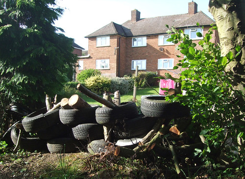
My guess turns out to be correct -- the path that now snake between fences through this massive area of what looks like 197os social housing development is clear and well-signed. It's clearly an old path, leafy and away from roads, now providing welcome permeability to some rather ordinary streets. One of the houses backing on to it has dispensed with its wooden back fence and replaced it with piles of old tyres.
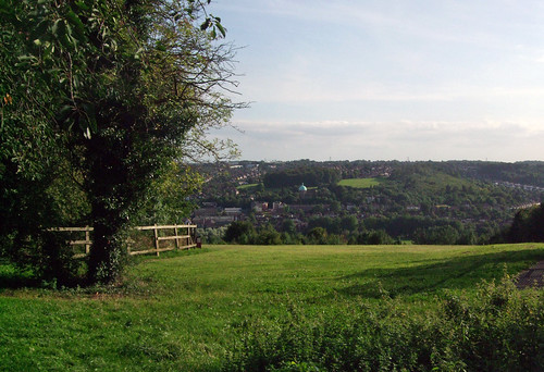
Later, the path runs along the top of a remaining patch of open hillside that's now managed as a public park, Plomer Hill Open Space. The view here sweeps down to road and river, revealing the impressive size of the built-up area and the outlines of its geography.
The town has its own importance, independent of its role as a waypoint on the transport links between London and Oxford. Once a Roman settlement, it first appears on record under something like its current name in the 10th century, and was a market town from the 12th century. Industry has also played a major role, first mills, then furniture making. The latter is the traditional industry of the Cotswolds, where the artisans who turned the straight trunks and branches of the local beeches into chairs were known as "bodgers", a term that has taken on an unflattering meaning in everyday English, though there's nothing to suggest the original Chiltern variety were anything less than skilled and conscientious craftspeople. Today, the town has a population of just under 100,000, making it the biggest in the county, and an urban industrial character that's unexpected for a commuter town in the otherwise prosperous Home Counties, with some seriously deprived areas. Some local paper headlines -- such as the shooting of a woman at point blank range on a nightclub dancefloor -- could be straight out of Peckham or Haringey.
At the other end of the open space the route has been buried under housing. Cascading down the hill is a warren-like 1960s estate, crossed by a web of little paths that are intended more as short links between homes than sensible through routes, so I stick to the roads. I'm actually quite enjoying this walk as a contrast to the rural character of much of the route. It's fresh up here, with occasional glimpses down the hill -- the relief is steep enough to remain visible through the street pattern, demanding the little council houses respect its contours, and you can imagine what an airy ridge this must have been before the town claimed the hillside. Eventually I start to wind downhill, passing some flats in Garratts Way that for some reason resemble modern church buildings, and find an unmapped path that descends by the side of the railway line, emerging just shy of the town centre on Parker Knoll Way with its furniture-themed name, opposite a big Morrisons supermarket.
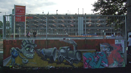
The route into town takes me under a magnificent viaduct carrying the Chiltern main line. Just on the other side of this, on the west side of Archway, is a skateboard park with a large piece of railway-themed grafitti art.
Unfortunately having admired this I'm forced to backtrack as the crossing arrangements at this busy road junction are frustratingly limited and the pedestrian routes not obvious. The crossings look relatively new but the area still needs a rethink from the point of view of the walker.
I suspect that once it was even worse, as in the 1960s High Wycombe's was one of those historic town centres comprehensively vandalised in the name of modernism and the motor car. The Wye was covered over, and swathes of 18th and 19th century buildings were bulldozed in favour of concrete shopping precincts and car parks knotted within impenetrable highways, on the model then being imposed on a larger scale in Birmingham. Recently there have been some efforts to put things right, under the banner of the "Eden Project" -- the deliberate namedropping of Tim Smits' eco theme park near St Austell is stretching things a bit. Sadly an early proposal to open up the river again was dropped, but the new shopping centre is fine as these places go and pedestrianisation and "public realm" improvements have made what remains of the mediaeval street pattern more walkable.
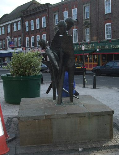
My approach to the centre is pleasant enough. Frogmoor extends out right to create a pleasant open space with a curious sculpture depicting a stylised family.
Historically this was the location for landmark fountains -- the current incumbent is a "holes in the ground" job that barely functions, though there are plans to build a new one based on the Arch of Chairs that was created to welcome Queen Victoria in 1877. A fingerpost points to the twin town of Kelkheim, in the Taurus mountains near Frankfurt am Main.
My route bends down to the impressive All Saints Church, dating back to the late 12th century and rebuilt several times since, still with Roman stones in the masonry. From here you can catch sight of one of the most interesting historic buildings, the 18th century Market Hall, which owes its present colonnaded form to a rebuild by Robert Adam.

I follow Castle Street past a pleasant memorial gardens: just uphill from this is the Wycombe Museum, which predictably has a fine collection of furniture as well as social history and art exhibits. The street ends right opposite the station, by a pub called, for obvious reasons when you see it, the Flint House.
The railway takes us back to London both literally and metaphorically, as it played a role in the history of one of the organisations that most shaped the modern capital, the Metropolitan Railway, one of the most important direct commercial ancestors of today's Transport for London.
The station was originally built by Isambard Kingdom Brunel in 1854 as the terminus of a branch of the Great Western Railway from Maidenhead -- the northern part of this was closed in 1970 while the southern section from Bourne End to Maidenhead, with its later spur to Marlow, remains as the "Marlow Donkey" line that we encountered on the last walk. In the 1870s the line was extended from High Wycombe to meet the Great Western's main line between Oxford and Didcot, with a branch from Princes Risborough to Aylesbury, though the northern section of this, too, was lost in the 1960s. At the turn of the last century, sections of the line featured in the Met's ambitions to reach beyond its urban origins and create a genuine main line. The Met paired up with the Midlands-based Great Central Railway, which had its own ambitions for a London extension. The GCR and GWR teamed up to create a line from the GCR near Bicester, joining the Wycombe line at Princes Risborough and then continuing direct to London via Denham and Ruislip, with the original intention of linking with the Met. But the GCR and the Met fell out, and the GCR built its own terminus at Marylebone in 1899, though substantial sections of the southern part of the GCR line ran on parallel tracks.
There will be more to discuss on the hinterland of the Met on later walks, but for the moment it's pleasing to note that the route, though still not one of the great radial main lines, is currently enjoying much more of a main line type service than it's had in years. Chiltern Railways, who currently hold the franchise on this group of National Rail lines, run services from Marylebone to Stratford-upon-Avon (Shakespeare again) and Birmingham, a much more pleasant way to reach the latter from London than Virgin's only slightly faster service from Euston, and since 2008 the trains of "open access" operator Wrexham & Shropshire have run through, though without stopping, on their way to and from North Wales.
As well as retaining the curious ceremony of annually weighing the Mayor to see if s/he has got fat at taxpayers' expense, Wycombe has numerous celebrity connections -- Benjamin Disraeli was a local MP; Dusty Springfield, Ian Dury and philosopher Karl Popper lived here; former Doctor Who star Colin Baker is a prominent local resident and a columnist on the local paper. But perhaps the most intriguing recent celebrity connection is that surrealist comedy team The Mighty Boosh first teamed up here when two of them were attending Bucks New University. Those council pebbledash units tumbling down the chalk hillsides towards the Wye might conceivably provide a backdrop to the antics of Bubblegum Charlie, or the Crack Fox.
Download a route description PDF
View a Google map http://maps.google.co.uk/maps/ms?ie=UTF8&hl=en&oe=UTF8&num=200&start=219&msa=0&msid=117966169375523396049.00046414d40d8252e7b70&ll=51.550605,-0.714111&spn=0.191284,0.441513&t=h&z=11
More information
Visit Buckinghamshire http://www.visitbuckinghamshire.org/


