I apologise for the temporary lack of photos on this post. This was due to bad file management, but it does at least give me an excuse to do the walk again.
One way of looking at the London Countryway is as an exploration, and even a celebration, of the Metropolitan Green Belt, one of the package of post-World War II planning innovations that shaped contemporary England. The Green Belt, more than any other measure, has locked London within the physical limits it had reached by the outbreak of war in 1939. Until then, growth of urban areas in Britain was largely unconstrained, driven by individual landowners and developers, spreading out from the centre to engulf formerly separate towns and villages and then shooting out tendrils of "ribbon development" along lines of communication into the countryside of surrounding counties. This unchecked tumour-like development continued into an era in which comparable European countries had long reined in such tendencies through planning controls to create more rational cities -- the resulting difference in character is obvious today.
The idea of a green belt around London goes back to at least the 17th century, when it could have run a mere 3km out from the centre, and was also championed in the early 20th century by members of the Garden City movement and the Council for the Protection of Rural England (CPRE, now the Campaign to Protect Rural England). The then London County Council adopted a tentative scheme in the 1930s, but it was following 1944's Greater London Plan and the inclusion of green belts in the 1948 Town and Country Planning Act that they became established as a key planning tool not just for London but for other British cities. Subsequent legislation has refined and strengthened Green Belt principles and they have been extended not only to the other big conurbations like Birmingham and Glasgow but to smaller historic cities like Oxford and York.
Green Belts are an apparently simple idea that have captured the public imagination -- they probably enjoy the widest public awareness of any planning tool, but they're also widely misunderstood. Ask most people what they know about Green Belts and they will probably say something about protecting countryside around cities, and perhaps mention something about "green lungs" or conservation and recreation. But the original and still the first purpose of Green Belts is much more about the shape and form of the cities they encircle than the inherent value of the land they enclose. As stated in the current government planning advice to local councils, Green Belts have five purposes:
The purpose of safeguarding countryside was a late addition, added in 1988. From the start, Green Belts were much more about "shaping the expansion of a city on a regional scale", as a government planning leaflet put it in 1962, initially in line with a model that envisaged limiting further development of big cities within existing bounds on the expectation that populations would disperse to those New Towns beyond the Green Belt which, as I remarked when we first entered Hertfordshire, the Countryway has so studiously avoided. The urban regeneration purpose, another addition from a later era that witnessed the decline of city-based heavy industry, reflects an often unfulfilled hope that developers prevented from building in the Green Belt will turn instead to brownfield post-industrial sites within the city itself.One way of looking at the London Countryway is as an exploration, and even a celebration, of the Metropolitan Green Belt, one of the package of post-World War II planning innovations that shaped contemporary England. The Green Belt, more than any other measure, has locked London within the physical limits it had reached by the outbreak of war in 1939. Until then, growth of urban areas in Britain was largely unconstrained, driven by individual landowners and developers, spreading out from the centre to engulf formerly separate towns and villages and then shooting out tendrils of "ribbon development" along lines of communication into the countryside of surrounding counties. This unchecked tumour-like development continued into an era in which comparable European countries had long reined in such tendencies through planning controls to create more rational cities -- the resulting difference in character is obvious today.
The idea of a green belt around London goes back to at least the 17th century, when it could have run a mere 3km out from the centre, and was also championed in the early 20th century by members of the Garden City movement and the Council for the Protection of Rural England (CPRE, now the Campaign to Protect Rural England). The then London County Council adopted a tentative scheme in the 1930s, but it was following 1944's Greater London Plan and the inclusion of green belts in the 1948 Town and Country Planning Act that they became established as a key planning tool not just for London but for other British cities. Subsequent legislation has refined and strengthened Green Belt principles and they have been extended not only to the other big conurbations like Birmingham and Glasgow but to smaller historic cities like Oxford and York.
Green Belts are an apparently simple idea that have captured the public imagination -- they probably enjoy the widest public awareness of any planning tool, but they're also widely misunderstood. Ask most people what they know about Green Belts and they will probably say something about protecting countryside around cities, and perhaps mention something about "green lungs" or conservation and recreation. But the original and still the first purpose of Green Belts is much more about the shape and form of the cities they encircle than the inherent value of the land they enclose. As stated in the current government planning advice to local councils, Green Belts have five purposes:
- to check the unrestricted sprawl of large built-up areas;
- to prevent neighbouring towns from merging into one another;
- to assist in safeguarding the countryside from encroachment;
- to preserve the setting and special character of historic towns;
- to assist in urban regeneration, by encouraging the recycling of derelict and other urban land.
So no matter what the public might think, the planning philosophy behind the Green Belt is one that has little positive to say about green belt land as such, only that it's open and rural, probably agricultural and not put to "urban" uses. The principle virtue of designated land is that it's non-urban, a thick boundary of "un-city" defining the form of the city it encloses with the certainty and clarity of a fat green highlighter pen. The compelling need to define that urban boundary with such certainty seems as much an aesthetic and psychological need as a practical planning one -- towns and cities become what they are through their boundaries, and a city like London has splurged too far, leading us to agonise over which bit is London and which bit is not. This reaches a new level in the "setting and character of historic towns" purpose, written for the likes of Oxford and York, where the surrounding countryside is reduced almost to a painted backdrop, offsetting a city forever fixed as a composition in built heritage.
Note there is no mention in the purposes of recreation, biodiversity, public health or other potential benefits of Green Belt land in itself. There have been various proposals to extend the guidance -- in the early 1990s, for example, then Environment Secretary Michael Heseltine suggested including supporting quiet recreation and enhancing the natural beauty of the countryside, but this was rejected. There's no argument that in practice the Green Belt has protected huge swathes of land, including pretty much everything we've enjoyed on the London Countryway, which otherwise would undoubtedly have been inundated with ugly suburban sprawl. This in turn has supported city dwellers' access to the benefits of green space, as I'm encouraging you to exercise on this walk. But these outcomes are almost incidental to a process that's more focused on establishing city boundaries.
At worst, the Green Belt could encourage vacuous bands of bland and unwelcoming countryside that's minimally open and green, a tendency exacerbated by changes in agriculture and the rural economy that has seen the emergence of large and intensive farms owned by big commercial groups and tended by only a handful of workers. This has resulted not only in depopulation but in big demographic changes which are immediately obvious when walking the route -- the farmhouses, farm workers' cottages and even many former commercial buildings such as pubs and shops have mutated into luxury homes guarded by 4x4's and, too often, nasty dogs, with inhabitants that spend most of their working day in London. Big stretches of farmland have been converted to serve this market, becoming stables and -- worse -- that ultimate suburbanised countryside, the golf course, the most intensive of land uses permitted by Green Belt policy. The best-looking villages have been preserved not as vibrant mixed communities but as monuments to be admired by the sort of well-heeled, cut-glass-accented nimby that stereotypically supports the CPRE. The public transport network has withered, especially since privatisation in the 1980s. The descendants of farm labourers have been squeezed by declining social housing, rocketing propery prices and lack of work: most have moved to the city, while those that remain, are squeezed into "pockets of rural deprivation" on crumbling old council estates, looking forward to the twice-weekly bus.
It's been left largely to other projects to put green belt land to more positive and human use in the interests both of recreation and conservation: the Areas of Outstanding Natural Beauty, the Community Forests, the Regional Parks and various nature reserves, Country Parks, Environmental Stewardship schemes and National Trust and Woodland Trust properties. Of course there are those that insist the countryside is a workplace, not a giant park for gawping townies -- but their assumptions are the best part of a century out of date. 90% of us now live in towns and cities, and the countryside immediately adjoining them simply wouldn't be here today if it hadn't been for planning policies that blocked development. What countryside remains, in common with all the other agricultural land in Britain, has long been subsidised to the hilt with both direct payments and tax breaks, even before the UK signed up to the European Union's Common Agricultural Policy. I'm personally of the view that private land ownership is something of an ethical obscenity, but even a staunch Daily Telegraph reader would find difficulty resisting the argument that the average taxpayer has paid their admission charge many times over. And I'm not saying I'd want all of it to look as managed and interpreted for the public as, say, the Lea Valley Park, which we'll be traversing in a couple of section's time, but the remaining bland and unwelcoming bits do enrage me.
The Green Belt has also been criticised for being ineffective in reinforcing rational development within the urban area. Rather than redeveloping urban sites, some developers have preferred to leapfrog the Green Belt and create dispersed, car-dependent communities beyond it. There have long been calls for a more rational and integrated planning policy, but it's more likely to come under attack by piecemeal attrition. The latest proposals by the current Coalition government are to allow small developments within the Green Belt without a planning enquiry if they are supported by 80% of a local community -- which sounds a good idea, and might result in some increase in affordable rural housing, better local services and economic sustainability, but commercial vultures with their eye on the executive commuter market will also be circling.
The fetish for a clear division between urban and rural zones, the yearning for a city outline seen so clearly in Green Belt policy, also deserves some examining. I suspect it has helped delay and muffle the realisation that cities too can and should be green and liveable places, and has contributed to the appalling record on looking after and investing in urban green space and parks. We have a poor record of making good use of space in cities. Postwar development plans, written when the stench of atrocious slums had only just been covered by dust raised by the Luftwaffe's bombs, start from the premise that urban "overcrowding" is a problem in itself and envision displacing populations to garden cities with much lower densities, not realising how this in itself fed social dislocation and, eventually, car dependency. In recent years the realisation has finally dawned that dense mixed use neighbourhoods provide some of the vital qualities of city living, so long as the quality and amenities are high. But there's still plenty of wasted space. In an ideal world I would like to see much more mingling of urban and rural and a blurring of those lines, with large and even farmed green spaces within historic cities, and denser and better connected development in rural areas. London isn't a city with mountains in the middle of it, like Edinburgh or Hong Kong, but still the occasional discovery of a fragment of countryside within the urban space itself will provide one of the highlights of future walks.
The London Countryway's creator Keith Chesterton chose to navigate St Albans by relentlessly tracking the Green Belt: the route approaches through Verulamium Park, clips the edge of the built up area and tracks a roughly bell shaped curve through the Green Belt around the north and east of the city, avoiding the centre. There are more direct possibilities including crossing the historic centre on a street-based route, or picking up the Alban Way, the disused railway line that starts near St Albans Abbey station and meets Chesterton's route again at Smallford. Here I've stayed faithful to Chesterton's decisions, with a note to return to explore the Alban Way some other time. As we shall shortly see, besides its Green Belt logic there is now a further major attraction on the published London Countryway route, established only recently and set to become even more important in years to come.
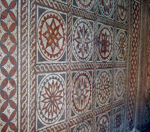
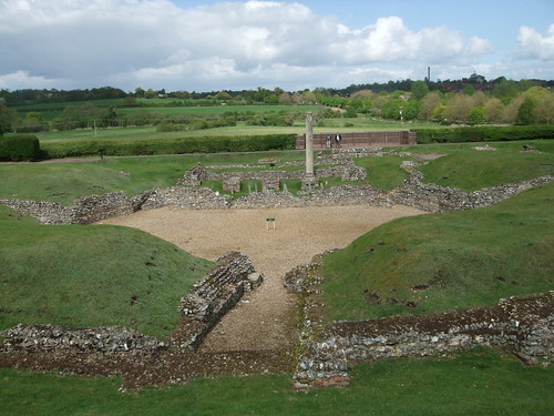
From pretty St Michaels the route climbs slightly from the Ver along residential Branch Road, with some interesting art deco houses and wooden barns on the left, to an encounter with the next of the series of northbound roads mentioned in the previous section, although it's one users of the station links will already have crossed. Verulam Road is part of the old turnpiked section of the A5 Shrewsbury road, here numbered A5183 in an effort to discourage through traffic, and lined with housing estates. A little way along it, Down Edge Open Space, a small and modest green rectangle with a play area doubtless much appreciated locally, provides a convenient cut corner to Batchwood Drive, marking the western boundary of development. Across it we're into fields along an old lane, also used by the Hertfordshire Way, from where, looking left and back, the valley slopes gently down to the A5183, Watling Street and the river. In the distance, on the opposite bank, you can see the remains of the Roman theatre, which was once in the heart of the city -- it's difficult to imagine the now quiet fields of Lord Verulam's estate covered with fine villas and temples.
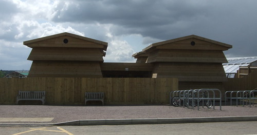
A little further on the route reaches one of those classic Green Belt developments, a golf course, although this is a council-owned one now operated under contract, the Batchwood Golf and Tennis Centre, which makes me more kindly disposed towards it. The mansion of the old Batchwood Estate at the centre of the course now also functions as an 'exclusive niteclub' featuring retro disco nights and A-level results parties on its programme. The path that crosses the course is well waymarked and several lengths of old hedgerow have been preserved. It takes us to another small green patch on the edge of New Greens, one of the city's outlying housing estates that date from before the early 1970s, when the London Green Belt was extended to include almost all of Hertfordshire. From here the route runs along the edge of the old coppiced woodland of Batch Wood or Batchwood, a surviving fragment of what in Roman times would have been a much bigger wood, the location of the original Catuvellauni settlement and of a long vanished mediaeval manor.
The path then tacks around the edges of playing fields and woodlands and across a field of fruit canes to the south of the hamlet of Childwickbury to emerge at Hawkswick Lodge Farm, on another important road. Harpenden Road is part of another turnpike route north, linking London with Manchester and Carlisle, generally designated A6 but , similarly to the A5, renumbered A1081 at this point to encourage through traffic to use the motorway. Here we rejoin the Hertfordshire Way, which left us at the golf course to follow a slightly less direct route via Childwick Bury. Across the main road we pick up a good farm track through rollling fields which in turn takes us over yet another key transport route, the Midland Main Line, on Cheapside Bridge, a lovely old brick bridge which presumably dates from the 1860s when the line was first opened – its history has already been considered briefly at St Albans City Station in the previous section.
Over the railway, a fine track continues ahead, now on high airy farmland with wide views towards the Colne valley. To the north of the track is the slowly developing major attraction alluded to earlier. The fields to the north of the path, and the patches of ancient woodland they surround, are part of the 347ha site of Heartwood Forest, a Woodland Trust project to create “the largest new native forest in England”, with plans to plant over 600,000 trees, alongside creating new wildflower meadows, open spaces and paths, eventually encircling all of the north of Sandridge to create a new public space bigger than the post-Games Olympic Park planned for Stratford, and still only 40km from central London. It’s the Trust’s biggest project in England, the flagship of their current tree planting programme.
Currently much of the site is still farmland and they’re busy raising the money to plant it, but there are already some public areas – the biggest one is accessed via a wooden gate from our path – and a busy programme of events including an impressive array of community and arts-related projects. The name, incidentally, is a multiple pun arrived at following a competition among staff, referencing Hertfordshire, the heart-shaped leaves of the small-leafed lime trees found in the wood, the “heartwood” found at the centre of the trunks of broadleaved trees and the connection with individual, social and environmental health.
As a land management and conservation charity, the Woodland Trust is a relative newcomer, dating only from 1972, when it was created by a Dorset farmer to protect small local woods. Clearly its aims and approach resonated – there’s something reassuringly long term about woods and trees which encourages people to invest for the future. The Trust has grown rapidly into a major organisation with 200,000 members, over 200 staff, an annual income of over £25m and 20,000ha of property. It’s been canny with its brands, partnering with supermarkets, and exemplary in its community work, encouraging local people into its woods – one of the best examples of how people can be encouraged to care about environments they have access to. I wish it luck with its project at Heartwood, and look forward to viewing the site in a decade or so’s time.
Sandridge is a relatively large village, today barely separate from the city's sprawl, supporting several pubs, shops and even a football team, straddling another old northbound road, this one a relatively minor one linking St Albans to Wheathampstead and the upper Lea valley. Further downstream, the river Lea and its valley have played a key role in shaping the growth of London as well as forming star attractions in its walking network, as we'll see both further along the London Countryway and on other London underfoot walks. The Lea is only 4km or s0 from Sandridge Church here along the village high street, but we now travelled to the furthest point north of the Countryway and here, on the watershed of the Lea and the Colne, we'll start to work our way back south again.
Although some way outside the village, the river was long a key feature of the old Sandridge Manor, which included mills strung along it. The name wears its etymology on its sleeve: a sandy, or rather gravelly, ridge between the Lea and the Ver. Unsurprisingly the village's history is closely connected to St Albans Abbey -- on the death of the abbey's founder King Offa in 796, his son Egfrid gave the extensive manor of Sandridge to the abbots. It remained ecclesiastical property until Henry VIII's dissolution of the monasteries in the 16th century, when it was sold to a London banker for £400. Eventually it passed to the Spencer family who finally auctioned it off to smaller landowners in 1951, retaining only Nomansland Common, a strip which now abuts the northern boundary of Heartwood Forest west of the road -- this is now leased to the council as a public space. The most famous Spencer is of course Diana Princess of Wales (1961-97) whom we've encountered before on the walk -- her brother Charles (b1964), the current Earl Spencer, is still officially Lord of the Manor.
The route takes us right to the front of pretty St Leonards Church, mainly dating from around 1119 but with masonry thought to be older -- there was no doubt a wooden church on this site since shortly after the manor was handed to the abbey. Like most churches it's been subject to numerous additions and rebuildings and the current appearance is largely down to a major restoration in 1887 -- the current bells, popular with bell ringers, date from 1890. The Hertfordshire Way forks left of the church, leaving us for a while -- we'll encounter those white waymark arrows again in the next section, just outside Newgate Street. On this occasion, however, it doesn't offer a more direct route, instead travelling via a long inverted U into the far northeast of the county via Royston, Bishops Stortford and Hertford.
The Countryway meanwhile tracks the edge of a pleasant green and cuts through residential streets to run out of Sandridge along a lane. Here there's the more pleasant option of walking along the generous field headland parallel to the lane on the other side of the hedge, to which there is informal access. Although clearly appreciated by local walkers, I suspect this feature is primarily for the benefit of owls. These birds tend to hunt along roadside verges, flying low and parallel with the hedgerow to avoid the wind, and consequently are often killed in collisions on narrow but fast country roads. A broad headland attracts similar wildlife to a verge and provides the owls with an alternative hunting ground, safe from traffic.
An old track, in places a charming sunken green lane, then takes the route further south. Looking to the right, you'll see the edge of the large housing estates on St Alban's eastern flank. The core of this residential sprawl is Marshalswick, once an historic country estate and park with a history dating back to the 1100s, but developed for housing from the 1920s. In the 1970s the housing spilled over further into the farmland of Jersey Farm and it's these houses we see from the trail. Here is the Green Belt in action, the limits of development clearly dileneated by the enclosing fields.
Approaching pretty Oak Farm I encounter a path problem, the first notable one on my whole walk so far. Chesterton's route follows a bridleway forking off southeast across a field, away from the farm, but though this is clearly shown on the OS map and actually waymarked on the ground, the field is solid with crops, and no sign of any line along the right of way. So I continue on the clear path which rounds the front of the farm and joins the farm drive to reach Coopers Green Lane. Here the map shows a more direct bridleway ahead towards Smallford, but Chesterton has chosen a footpath further east to minimise disruption from gravel workings. So far the previous problems he mentions have been solved in the intervening decades since the last edition of his guidebook was published in 1981, so I investigate this more direct route, but end up struggling along a rugged and unwelcoming field edge with no obvious way ahead, and a gravel pit clearly still in operation, so I backtrack and catch up again with the recommended route. If you're walking the route from my directions, don't worry about any of this, as I've taken account of it all in outlining a hopefully seamless walking experience.
On the other side of Coopers Green Lane the route re-enters Watling Chase Community Forest, as discussed in the previous section, although there's nothing to mark the fact. The ground now traversed does indeed show signs of past and present gravel workings -- the inevitable side-effect of development, with demand from construction fuelling the excavation of vast swathes of Home Counties farmland, particularly in Hertfordshire, for the pebbly subsoil deposited by past rivers. But the path isn't unpleasant: it's well-defined and easily walkable and the roughly restored land surrounding it has something of the wildness of a heath. A young oak tree just before an aluminum gate commemorates the aggregates company's forestry officer, Roger Mould, who died in 1996. Unexpectedly, the route crosses a conveyor, a ribbon of machinery stretched across the fields, though sadly not in operation during my walk.
A long, straight path ends in a pair of old gates that hang open, revealing another apparently derelict green space ahead. This is actually a key site in the history of aviation: a couple of decades ago these gates would have been firmly shut with good reason, for anyone walking ahead would find themselves on the western end of the runway of Hatfield Airfield. The pioneer aircraft maker Geoffrey DeHavilland, seeking an undeveloped rural site within easy reach of his existing factory in rapidly urbanising Edgware, bought some farmland here in 1930, converting it into what was originally known as Hatfield Aerodrome. Art deco factories were developed at the opposite end of the extensive site, and such was their importance in their prime that a whole suburb, Hatfield Garden Village, was created to house their workers. The site saw the launch of the world's first commercial jet airliner, the celebrated Comet, in 1949. The company became part of Hawker Siddeley in 1970 and was in turn absorbed into British Aerospace when that then-nationalised company was created in 1978 in an attempt to perpetuate the flagging UK aerospace industry. BAe finally quit Hatfield in 1993, and much of it has been redeveloped, as well as being used for films. The devastated French town of Ramelle was famously recreated here in Steven Spielberg's Saving Private Ryan (1998).
Currently this end of the field is a piece of waste ground on which locals walk their dogs unhindered, but the official route turns with the field edge and cuts between fences by Notcutts Garden Centre to reach Hatfield Road at Smallford. Notcutts are one of the biggest garden centre chains, developing from a nursery established at Woodbridge, Suffolk, in 1749. The big centres started to evolve in the late 1950s, benefitting from increased prosperity, more houses with gardens and increased car use making it possible to shop for bulky items at out-of-town sites; the company's official history also attributes its growth to early 1970s postal strikes that decreased the popularity of mail order. It's a curious feature of suburban England that what are essentially garden shops have become visitor attractions in their own right, a weekend trip with fun for all the family in a controlled environment, complete with children's play area, displays, exhibitions and catering. You might be grateful for the refreshment opportunities -- the cream teas pictured on the website look very alluring.
There was indeed a small ford at Smallford, on a stream west along the Hatfield Road. Today it's one of a number of scattered clusters of housing estates and services in between St Albans and Hatfield. Across the Hatfield Road, down the side of a bean field and through a few residential streets there's another improvement to the route, Peggy's Path, running alongside but segregated from the busy but narrow Station Road. Peggy Hughes was a former director of St Albans Centre for Voluntary Service, a keen community campaigner and sometime district councillor and the path is here thanks largely to her work.
The path brings us to a junction with the Alban Way, the former route of the St Albans branch of the Great Northern Railway, built in 1865, closed to passengers in 1951 and finally dismantled closed and dismantled in 1969. A few metres to the right along the Way, under the railway bridge, you'll find the platform of the old Smallford station, originally known as Springfield; a derelict ticket office is adjacent. Subsequently the trackbed, now owned by the council, became an informal off-road route, the eastern part of which was formerly known as the Smallford Trail, but over the last decade the whole route has been improved and named the Alban Way throughout as part of National Cycle Network route 61 from Maidenhead to Hoddesdon.
Following the Alban Way from St Albans Abbey station to here would be an obvious way of cutting off the hump in the trail around the north of St Albans if you preferred, and in the other direction the Way provides the obvious route to Hatfield, about 4km east. The route takes you past the new town centre and straight to Old Hatfield and the station. This is just across the road from the entrance to Hatfield House, an extensive and handsome Jacobean mansion set in grand parkland, and the adjoining late 15th century Old Palace where the young Elizabeth Tudor was living when she was told she'd become Queen in 1558. Still the residence of the Cecil family, it's long been open as a popular visitor attraction, and Chesterton goes into some detail about it in his book, but in my view it's too far off route for a visit.
The route now finds its way between a couple of other scattered settlements in the slice of Green Belt between St Albans and Hatfield, all part of the parish of Colney Heath, relatively flat countryside straddling the very upper reaches of the river Colne. Approaching the edge of Sleapshyde across fields, there's a rare overt sign of the Community Forest as the Countryway joins for a short time the Watling Chase Trail. When this was first developed in the 1990s it was known as the Watling Chase Timberland Trail, as footwear manufacturer Timberland sponsored trails in all the Community Forests. The sponsorship has now ended but cannily the company had their distinctive tree logo used as a waymarking device which is still visible. The trail runs north to south through the centre of the Forest area. We encounter very near its northern end, at Wilkins Green a couple of kilometres north of here and also on the Alban Way; to the south it stretches to Elstree where it links with the London Loop, giving the most direct link in some time between the Countryway and the Loop, and you could continue south along the Dollis Valley Green Walk and through Hampstead Heath and Regents Park to central London, as suggested in previous postings. We'll be returning to this route in a future London underfoot.
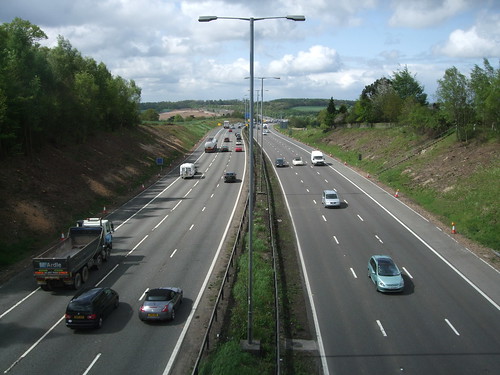
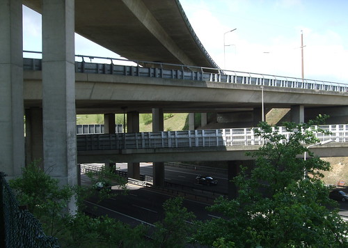
Sleapshyde boasts a village pump and its southern side is lopped off by the A414 North Orbital Road. Built by the Ministry of Transport in the 1930s as a result of some of the earliest plans to rationalise and expand Britain's trunk road network, and originally numered A405, as its name suggests it was originally envisaged as part of an orbital highway route round London, a grand plan interrupted by war. Over the decades a whole succession of planners set about drawing successive concentric circles round the capital in an effort to meet the challenge of increasing motor vehicle use, and the road formed a part of several of these. Patrick Abercrombie's 1944 Greater London Plan envisaged it as one section of the "E Ring", the outermost of five ring roads which together with the Green Belt would help define that all important edge of the capital. Interestingly Abercrombie didn't see the E Ring as primarily a fast traffic route but as a "Parkway", including "a strip of open space which gives it a positive amenity value...at once part of the communications and part of the park system." His grand plan for postwar London soon stumbled on severe lack of funds but the vision of concentric ring roads persisted and the North Orbital was even extended west to meet the M1's M10 spur, now the A414 and crossed in the last section, in 1960 shortly after the M1 opened.
In the 1960s the London County Council, its successor the Greater London Council, and the Ministry of (now the Department for) Transport produced radical and sometimes conflicting plans for further circular and orbital routes. Under these, Abercrombie's E Ring was redubbed Ringway 4, but this time public horror as well as underfunding and internal politics scuppered the plans. Instead we got the M25, opened between 1975 and 1986, and while some sections of the motorway do follow planned alignments of the North Orbital, here the completed ring runs some way to the south. The old orbital was left as an isolated length of road which was then renumbered A414 in an effort to discourage longer distance traffic. Even so it remains a busy road which the Countryway is now obliged to cross via a very minimally formal crossing point. As you dodge through dual lanes of fast cars to zigzag around the gap in the crash barriers on the central strip, try to imagine Abercrombie's positive amenity value.
Woodland and field paths lead through to Roestock, a hamlet in the triangle of an old road junction, where our path winds through houses to reach Tollgate Road, taking us towards North Mymms. Where the houses of Roestock end the Countryway leaves St Albans district and enters the borough of Welwyn Hatfield, although the boundary, which appears to go right through the middle of a house, is a relatively new one, dating from an extension to the boundaries of St Albans in 1913. Tollgate Road is one of the least satisfactory stretches of the route so far: the footway soon runs out and the traffic is relatively frequent and fast, so it's a case of walking determinedly on the right of the carriageway and staring out the drivers.
Thankfully it's not too long before we reach the grazed parkland of North Mymms Park. This is the core of the ancient Manor of North Mymms (or Mimms) which dates back to pre-Conquest times and was once much bigger than the still extensive park of almost 50ha which survives today. It's recorded in Domesday as belonging to the See of Chester but over the centuries it's seen numerous changes of ownership. In 1599 the then owner, Ralph Coningsby, built the impressive Jacobean mansion you can glimpse through the trees, allegedly in anticipation of a visit by Queen Elizabeth that never happened. Among its important features is an early 17th century mural on the traditional theme of the "Nine Worthies" -- Hector, Alexander, Caesar, Joshua, David, Judas Maccabeus, Arthur, Charlemagne and Godfrey of Bouillon. Coningsby's son Thomas retained his father's royal-pleasing tendencies: he was arrested and imprisoned for raising an army against Oliver Cromwell in 1642, and the house was sequestrated. The last private owner, Major General Sir George Burns, sold the house in 1979 to an overseas corporate investor. It's now owned by the drug company Glaxo, but the Burns family still retain the park which they rent out for events.
As often in this sort of environment the line of the right of way is a little unclear. As I'm standing puzzling over the map to work out whether to go left or right of a stand of trees, I notice movement off to the side. Turning, I notice that a herd of bullocks, about 20 of them, are standing a few metres away looking at me curiously. As I start to walk, they follow, getting closer behind me each time. I start to feel rather uncomfortable. Remembering the advice for dealing with cattle, I stop, turn round and wave my arms at them, trying to look firm. They stop too and back off a bit, but of course as soon as I turn around and continue walking they're behind me again. Several attempts to wave them off achieve the same unsatisfactory result. Spotting the gate on the opposite side of the field I foolishly attempt to run, but they just speed up too, and this time they're getting closer. This time when I turn and wave, they look more restless and aggressive -- some are even salivating. A stretch of hummocky ground gives me an advantage, but the whole herd goes round the side and is catching up with me again as, with some relief, I get through the kissing gate. While it's unlikely if I'd stood my ground they would have trampled me, it's still an unnerving experience for an adult on their own, and would have been very worrying had I had young children with me, or a dog. It's a difficult balance -- livestock fully deserve their place in the working countryside, but when they behave like this they certainly reduce the amenity of public paths. A report about the incident, and about the path problem mentioned above, to Hertfordshire's public rights of way office has not yet received a response.
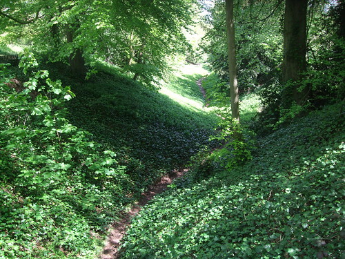
I'm so relieved to leave the field that I barely notice the dry ditch the path croses on the other side of the hedge. This is actually the line of the river Colne, just a short distance from its source, and these days almost always dry. The Colne is one of the larger tributaries of the river Thames, which it joins at Staines, having gathered waters from several tributaries of its own, including the Ver, and tangled for some distance with the Grand Union Canal. In this lower section, the Colne forms something of a bookend to west London, complimented in the east by an even more important tributary, the river Lea. Both rivers are now the basis for Regional Parks and signed trails and the Lea's will play a significant role in the section after next; the Countryway misses the Colne Valley Park and Path but it'll be explored on a later London underfoot walk.
The location of St Mary's Church, North Mymms, reaffirms the importance of the manor -- it's one of those churches in the heart of the parkland rather than in a village, as if it's primarily intended for the squire's private worship, and indeed it includes a separate chapel for the Lord's use, where the Coningsbys are now interred. The first parish priest is recorded in 1237 but the core of the stone church standing today was built by then Lord of the Manor Simon Swanland in the 1330s. There were extensive restorations in 1859, 1871 and 1992. In 1998 a new octagonal "parish room" was bolted on which frankly looks rather tacky.
Beyond the church and some pretty cottages a path strides through fields to cross another in the succession of major roads north, the A1(M) to Peterborough, York, Newcastle and Edinburgh. I discussed the A1 in the previous section in connection with the M1 and M6, which now provide between them the route of choice from London to most of industrial Yorkshire and Scotland, but the line of the A1 itself is still a major link in its own right. Since the 1930s there have been plans to upgrade it all to motorway standards but while never fully realised, significant sections now bear the affixed bracketed M, including this one which was opened in 1979. Descending from the footbridge to Water End, you'll immediately encounter a parallel road, Swanland Road, notably broad and straight but now strangely quiet. This is one of the original improvements to the A1 in the modern era of motor transport, part of the Barnet and Hatfield bypasses built by the Ministry of Transport in 1928. Shortly into the next section we'll encounter the road it replaced.
Running along the old road now is the Great North Way, part of National Cycle Network route 12 which will eventually link London and Grimsby. This section runs from Hadley Wood to Stotfold on the Bedfordshire border and although it's mainly intended as a cycle route with some significant road-based sections, there are also enough off-road sections to keep the dedicated walker intrigued. Amazingly, the little transport café at Water End has managed to survive despite being robbed of its motorists' landmark status by the A1(M). Past some vintage traffic bollards a concealed path leads behind the cafe: behind it is a forest of lifting platforms making for a rather surreal sight.
The water that ends at Water End is the river Colne. In the little meadow behind the café there's a cluster of swallow holes or sinkholes, where an outcrop of underlying chalk meets the London clay and water circulating below has eroded the chalk -- uniquely they are the only major permanent sink holes of this kind. The place is now a Site of Special Scientific Interest managed by the Country Trust, an educational charity. One of the sinkholes is right by the path and quite a curiosity it is too; the surrounding woodland, rough ground, an overgrown stream called the Mymmes Brook and rich hedgerows also make for a pleasant walk.
Field paths well used by local walkers now head up to the overgrown village of Welham Green, originally a tiny Hertfordshire hamlet just off the Great North Road but now really a southern extension of Hatfield, linked by light industrial sprawl. It's a plain looking place dominated by 20th century residential development. The Countryway route misses the village centre, but if you walk up Station Road and Dellsome Lane you'll find plenty of shops, and a memorial marking the site of the first landing of the first passenger hydrogen balloon flown in England, piloted by Vincenzo Londardi in 1784. Londardi had a dog, a cat and a pigeon with him when he took off from Moorfields, London, but the cat got badly airsick, so he landed in Welham Green and handed it into the care of the locals. The flight finally terminated at Thundridge near Ware, off to the northeast.
I've decided to make a diversion here from Chesterton's 1981 route, which finishes at Brookmans Park station. Since then, not only has a path been diverted inconveniently to avoid a stopped up railway crossing, but an entire new station has opened much closer to the route. In 1850 the Great Northern Railway opened the London to Peterborough section of its planned main line from Kings Cross to York, built under the direction of the great civil engineer William Cubitt (not to be confused with the near contemporary politician William Cubitt who built Cubitt Town on the Isle of Dogs). The line ran from Potters Bar to Hatfield on an alignment roughly parallel with but to the west of the Great North Road, originally with no intermediate stops. Eventually the line extended to Edinburgh and points north, in partnership with other railway companies that merged to form the London and North Eastern Railway (LNER) as part of the government sponsored Grouping in 1923. It was the LNER that added the station at Brookmans Park in 1926, in response to suburban development, but Welham Green only got its station in 1986. Originally I recall it had wooden platforms; it's now a little more substantial but still modest, with a simple ticket office.
The line remains one of Britain's busiest and most important. The East Coast expresses whizz through, of course, while 1970s electric multiple units provide the local services to Kings Cross, Moorgate and Welwyn Garden City. A lot of metal has passed under the railway bridge since the Grouping and Welham Green is just 2.5km south of a site that played a major, if tragic, role in that story. After the war the Grouping evolved into the full nationalisation of what became known as British Rail, which survived until privatisation mania in the 1980s. In 1994, a private company, Railtrack, took over ownership and maintenance of the former British Rail infrastructure as part of a complex system involving numerous privatised operators and rolling stock companies. The company was always controversial, still subsidised by government but paying huge shareholder dividends while performance dragged and safety got sloppier. Then, at 1223 on 17 October 2000, a Leeds-bound express travelling at 185km/h derailed due to poor track maintenance in between Welham Green and Hatfield, killing four passengers. The subsequent fallout led to Railtrack being placed into administration and to the renationalisation of railway infrastructure under the not-for-profit company known as Network Rail.

Download a route description PDF
View Google map
http://maps.google.com/maps/ms?ie=UTF8&hl=en&oe=UTF8&start=323&num=200&msa=0&msid=117966169375523396049.00046414d40d8252e7b70&ll=51.707134,-0.706859&spn=0.001599,0.00478&t=h&z=18
More information
The water that ends at Water End is the river Colne. In the little meadow behind the café there's a cluster of swallow holes or sinkholes, where an outcrop of underlying chalk meets the London clay and water circulating below has eroded the chalk -- uniquely they are the only major permanent sink holes of this kind. The place is now a Site of Special Scientific Interest managed by the Country Trust, an educational charity. One of the sinkholes is right by the path and quite a curiosity it is too; the surrounding woodland, rough ground, an overgrown stream called the Mymmes Brook and rich hedgerows also make for a pleasant walk.
Field paths well used by local walkers now head up to the overgrown village of Welham Green, originally a tiny Hertfordshire hamlet just off the Great North Road but now really a southern extension of Hatfield, linked by light industrial sprawl. It's a plain looking place dominated by 20th century residential development. The Countryway route misses the village centre, but if you walk up Station Road and Dellsome Lane you'll find plenty of shops, and a memorial marking the site of the first landing of the first passenger hydrogen balloon flown in England, piloted by Vincenzo Londardi in 1784. Londardi had a dog, a cat and a pigeon with him when he took off from Moorfields, London, but the cat got badly airsick, so he landed in Welham Green and handed it into the care of the locals. The flight finally terminated at Thundridge near Ware, off to the northeast.
I've decided to make a diversion here from Chesterton's 1981 route, which finishes at Brookmans Park station. Since then, not only has a path been diverted inconveniently to avoid a stopped up railway crossing, but an entire new station has opened much closer to the route. In 1850 the Great Northern Railway opened the London to Peterborough section of its planned main line from Kings Cross to York, built under the direction of the great civil engineer William Cubitt (not to be confused with the near contemporary politician William Cubitt who built Cubitt Town on the Isle of Dogs). The line ran from Potters Bar to Hatfield on an alignment roughly parallel with but to the west of the Great North Road, originally with no intermediate stops. Eventually the line extended to Edinburgh and points north, in partnership with other railway companies that merged to form the London and North Eastern Railway (LNER) as part of the government sponsored Grouping in 1923. It was the LNER that added the station at Brookmans Park in 1926, in response to suburban development, but Welham Green only got its station in 1986. Originally I recall it had wooden platforms; it's now a little more substantial but still modest, with a simple ticket office.
The line remains one of Britain's busiest and most important. The East Coast expresses whizz through, of course, while 1970s electric multiple units provide the local services to Kings Cross, Moorgate and Welwyn Garden City. A lot of metal has passed under the railway bridge since the Grouping and Welham Green is just 2.5km south of a site that played a major, if tragic, role in that story. After the war the Grouping evolved into the full nationalisation of what became known as British Rail, which survived until privatisation mania in the 1980s. In 1994, a private company, Railtrack, took over ownership and maintenance of the former British Rail infrastructure as part of a complex system involving numerous privatised operators and rolling stock companies. The company was always controversial, still subsidised by government but paying huge shareholder dividends while performance dragged and safety got sloppier. Then, at 1223 on 17 October 2000, a Leeds-bound express travelling at 185km/h derailed due to poor track maintenance in between Welham Green and Hatfield, killing four passengers. The subsequent fallout led to Railtrack being placed into administration and to the renationalisation of railway infrastructure under the not-for-profit company known as Network Rail.
Download a route description PDF
View Google map
http://maps.google.com/maps/ms?ie=UTF8&hl=en&oe=UTF8&start=323&num=200&msa=0&msid=117966169375523396049.00046414d40d8252e7b70&ll=51.707134,-0.706859&spn=0.001599,0.00478&t=h&z=18
More information
- Hertfordshire County Council http://www.hertsdirect.org/
- Hertfordshire Tourist Information http://www.hertsdirect.org/comdirectory/comvol/infoad2y/intour3y/
- Hertfordshire countryside and rights of way http://www.hertsdirect.org/envroads/environment/countryside/
- Friends of the Hertfordshire Way http://www.fhw.org.uk/
- St Albans City and District Council http://www.stalbans.gov.uk/
- St Albans Parks and Open Spaces http://www.stalbans.gov.uk/environment-and-planning/land-and-premises/parks-and-open-spaces/
- St Albans Tourism and Travel http://www.stalbans.gov.uk/leisure-and-culture/tourism-and-travel/
- Abbey Line (Wikipedia) http://en.wikipedia.org/wiki/Abbey_Line
- A1081 (A6) (Wikipedia) http://en.wikipedia.org/wiki/A1081
- Alban Way map http://www.stacc.org.uk/albanway/
- Alban Way (Sustrans) http://www.sustrans.org.uk/sustrans-near-you/east-of-england/easy-rides-in-the-east-of-england/alban-way
- Verulamium Park (St Albans council) http://www.stalbans.gov.uk/leisure-and-culture/parks-and-green-space/parks/Verulamium-Park/default.aspx
- Friends of Verulamium Park http://www.fvp.org.uk/
- VERVLAMIVM http://www.roman-britain.org/places/verulamium.htm
- Westminster Lodge Leisure Centre http://www.harpersfitness.co.uk/gyms/westminster-lodge-leisure-centre/
- Abbey Theatre http://www.abbeytheatre2.org.uk/
- Watling Street (Wikipedia) http://en.wikipedia.org/wiki/Watling_Street
- Ver Valley Society (Alban Trail, Ver Valley Walk) http://www.riverver.co.uk/
- Alban Trail map http://www.walkingbuddies.org.uk/alban.html
- Midland Main Line http://en.wikipedia.org/wiki/Midland_main_line
- A5 (A5183) (Wikipedia) http://en.wikipedia.org/wiki/A5_road_%28Great_Britain%29
- St Albans Cathedral http://www.stalbanscathedral.org/
- Sandridge Parish Council http://www.sandridgeparishcouncil.org/
- Batchwood Golf and Tennis Centre http://www.harpersfitness.co.uk/gyms/batchwood-golf---tennis-centre/
- Heartwood Forest (Woodland Trust) http://www.woodlandtrust.org.uk/en/our-woods/Pages/wood-details.aspx?wood=5622&site=Heartwood-Forest
- St Leonards Church Sandridge http://www.achurchnearyou.com/sandridge/
- Colney Heath Parish http://colneyheath.org.uk/
- Watling Chase Community Forest http://www.hertslink.org/cms/getactive/placestovisit/watlingchase
- Hatfield Aerodrome (Wikipedia) http://en.wikipedia.org/wiki/Hatfield_Aerodrome
- DeHavilland Aircraft Heritage Centre http://www.dehavillandmuseum.co.uk/
- Notcutts Garden Centre St Albans http://www.notcutts.co.uk/Content/Information/Garden-Centres/St-Albans/
- Watling Chase Timberland Trail http://www.hertslink.org/cms/content/15474094/15488274/15488278/timberlandw.pdf
- Ringways (cbrd) http://www.cbrd.co.uk/histories/ringways/
- A414 (Wikipedia) http://en.wikipedia.org/wiki/A414_road
- Welwyn Hatfield Council http://www.welhat.gov.uk
- Welwyn Hatfield Cycling and Walking http://www.welhat.gov.uk/index.aspx?articleid=331
- Welwyn Hatfield Landscapes and Countryside http://www.welhat.gov.uk/index.aspx?articleid=1025
- Welwyn Hatfield Tourism and Travel http://www.welhat.gov.uk/index.aspx?articleid=320
- North Mymms Parish Council http://www.northmymmspc.org.uk/
- North Mymms Park http://northmymmspark.com/
- St Marys Church North Mymms http://www.stmarysnorthmymms.org.uk/
- A1 (Wikipedia) http://en.wikipedia.org/wiki/A1_road_%28Great_Britain%29
- Great North Way http://www.greatnorthway.org.uk
- Water End Swallow Holes SSSI http://www.naturalengland.org.uk/ourwork/conservation/geodiversity/englands/sites/local_ID42.aspx
- Country Trust http://www.countrytrust.org.uk
- Brookmans Park http://www.brookmans.com
- Welham Green http://www.welhamgreen.com
- East Coast main line (Wikipedia) http://en.wikipedia.org/wiki/East_Coast_Main_Line