 |
| Megalosaurus, one of the stars of the Crystal Palace Dinosaur Park -- though it's now thought the animal walked upright on its hind legs and didn't have a hump. |
The river Ravensbourne and its tributaries have
shaped the geography of this section of the Capital Ring. After crossing the
Quaggy right at the start, the trail follows a hidden woodland strip threading
through a huge 1920s social housing estate then explores one of southeast
London’s most splendid parks, Beckenham Place Park, with its mansion crowning
the high ground between the Ravensbourne and the Pool valleys. There’s quite a
bit of street-bound walking after this, with a scattering of smaller green
spaces, then Crystal Palace Park at the end: one of the trail’s highlights with
its dinosaur sculptures, handsome Victorian station and the empty terraces
where the Crystal Palace itself once stood.
This is the longest single section of the Capital Ring so
unlike the others I haven’t combined it with another section. It’s much easier
going than the previous section, with the most rugged paths in Beckenham Place
Park. But with no less than 10 stations on or near the route, and numerous bus
stops, it’s also one of the easiest to split into smaller chunks if needed.
Note. This section of the Capital Ring almost entirely duplicates the Green Chain Walk. The corresponding GCW sections are 8 from Grove Park to New Beckenham and 10 to Crystal Palace Park.
From Grove Park
 |
| Grove Park Nature Reserve, once part of Edith Nesbit's garden. |
Section 2 of the Capital Ring ends, and section 3
begins, on the east bank of the river Quaggy where it crosses Marvels Lane in
Grove Park: I’ve said more about all three in the previous section. If you’re
starting from Grove Park station, following the official link back to the trail
creates a bit of a dogleg, and as the first stretch of section 3 is along
streets, you may decide to cut some of this out by simply heading north up
Baring Road to meet the Ring a little further along at the junction of Coopers
Lane. But there are a few features of interest along the official route that
you’ll miss by doing this.
Just over the river and easy to miss between two house
terraces is a track known as Alice Thompson Close which gives access to
Sydenham Cottages Nature Reserve. As you’ll have noticed on the previous
section, the Quaggy runs through this area in a concrete culvert, but this is relatively
recent, dating from a late 1960s flood alleviation scheme. The river once formed an ox-bow curve through a former hay meadow just northeast of the road here,
which was cut off when the new course was dug, subsequently silting up and
almost completely disappearing.
The area now forms a small but pleasant green
space, with patches of woodland and grassland, and a fragment of ancient
hedgerow lining the ditch that marks the river’s former course. This is the
only site in Lewisham where the relatively rare plant Hairy St John’s Wort has
been spotted. The mid-19th century cottages after which the reserve
is named stand on the close.
Further along is the former site of Grove Park Hospital, built
as a workhouse on a field known as Spicers Meadow by the Greenwich Poor Law
Union in 1896 as an overspill facility for its main workhouse on Vanburgh Hill
in Greenwich. Back then, part of the land was within Mottingham Parish which,
as mentioned in the previous section, was originally attached to Woolwich and
fell into the Greenwich Union’s territory (while most of Mottingham itself has
since been transferred to the London Borough of Bromley, the hospital site has
been allocated to Lewisham).
Unfortunately for the Union’s trustees, the new workhouse was
completed just when a change in the law reduced the need for such institutions,
with policy shifting towards supporting the very poor to live in their own
homes. The site stood empty for several years, resulting in much scoffing in
the press, then as now keen to pontificate about the supposedly cushy treatment
available to those they regarded as society's least deserving members. The Illustrated London News described it as a luxurious facility, with
“mosaic flooring, beautiful panelling, a dining hall fit for royalty, and a
church which any rector would envy.”
The workhouse eventually began admitting inmates in 1904,
but at the outbreak of World War I ten years later, it was taken over by the
Army as a training barracks for new recruits. In 1919 the site was sold to the
Metropolitan Asylums Board for use as an isolation hospital for tuberculosis
patients, but these plans stalled as the location proved too remote to recruit
sufficient staff. It finally opened as a TB hospital in 1926, and after World
War II evolved into a specialist chest hospital within the NHS, with almost 400
beds at its peak.
In 1977 it became a home for people with mental disability
but with the shift towards ‘care in the community’ the number of inmates
declined again, and the site was closed in 1994. It’s since been redeveloped for
residential use, with many of the historic buildings demolished, though the
layout of this walled site and the buildings that remain continue to lend it a
distinctive and rather forbidding look that recalls its origins. The main
gateway with its hexagonal gatehouses and the administration block beyond are
from workhouse days, while the lodge-like single storey buildings either side
of the gatehouses were added in the interwar hospital era.
The squat single-storey library on the corner of Marvels
Lane and Burnt Ash Hill has a temporary look, but it’s stood for decades. It’s
now one of numerous Lewisham public libraries closed for cost-cutting reasons
and reopened as community libraries, run by a charity called Eco Communities using
volunteers and inevitably open limited hours, but at least it still functions
as a library. Further on, at the junction of Coopers Lane and Baring Road, is a
rather battered Victorian pillar box.
The challenge of attracting medical staff to Grove Park in
the 1920s, mentioned above, and the fact that it was considered a suitable site
for an isolation hospital, are further evidence of how recently this part of London
was intensively developed. In the 1890s, when author and poet Edith Nesbit
(1858-1924) lived in Baring Road, it was still semi-rural, although already
nothing like the country retreat depicted in her most famous children’s novel The Railway Children (1906).
Halstead, Kent, where Nesbit lived as a teenager, is
widely thought to be the inspiration for the station in the novel, which was
written after the author had left Grove Park in 1899 and settled at Well Hall
in Eltham, passed in the last section. But the busy South Eastern Main Line ran
past the bottom of her Baring Road garden, and it’s said that Albert Perks, the
station porter who befriends the displaced children, was modelled on a member
of staff at Grove Park station, so the area can claim some links to the book. Nesbit’s
house, Three Gables, was one of the big Victorian houses typical of what was
then a middle class outer suburb. It’s since been demolished, but you pass the
site of it as you turn north along Baring Road: it was on the left just past
the Ringway Community Centre.
The superficially well-ordered Edwardian childhood world
of The Railway Children (especially
as presented in the familiar 1970 film adaptation directed by Lionel Jeffries)
might give a rather stuffy impression of its author. But then there’s the
novel’s gently feminist subtext and its hints that there are deeper issues
hidden from the youthful main characters. In fact, despite her relatively
privileged background, Nesbit was a socialist and political activist, a follower
of William Morris and a co-founder of the Fabian Society.
Her tempestuous first
marriage, to bank clerk Hubert Bland, turned out to be a ménage à trois with their housekeeper Alice Hoatson, Bland’s lover
with whom he fathered two children. In 1917, three years after Hubert’s death,
Edith was remarried to the captain of the Woolwich Ferry. A long-time chain
smoker, she died of lung cancer in New Romney, Kent, and is buried at St Mary
in the Marsh nearby.
The trail turns off along a path named Railway Children
Walk, passing Grove Park Nature Reserve. Part of this pleasant oasis was once
included in the large garden of Three Gables, while the rest was owned by the
South Eastern Railway and later British Rail, reserved for potential railway
use. For much of the 20th century it was used as allotments. Leased
by Lewisham council in 1984 as a nature reserve, it was initially closed off,
but the fences were repeatedly broken by local people who valued it for
recreational use, and when the council bought the land outright in 1987 it was officially
opened to the public. Today it’s a popular site for local schools, with a mix
of woodland and slightly chalky grassland rare in the area. The bank on the extreme
western edge of the reserve was left when the railway cutting was dug in the 1860s
and has remained undisturbed ever since.
Downham and the Woodland Walk
 |
| The Downham Woodland Walk: a hidden thread through a 1920s social housing estate. |
Across the railway line (covered in more detail at
the end of section 2) you pass Hither Green Cemetery on the right. The oldest
part, to the north, was opened as Lee Cemetery in 1873, but the section
adjacent to the trail is a much larger 1950s expansion. In Nesbit’s time there
were fields here attached to Shroffold’s Farm, but by the 1930s they’d been
converted to allotments. Just after you join Reigate Road are brand new flats
on the right: completed late in 2017, these replaced Downham Fire Station,
closed amid some controversy a couple of years previously. The doors of the new
buildings are painted bright red in a rather begrudging homage to the site’s
former use.
All this infrastructure – fire stations, cemeteries,
allotments, community centres – was prompted in the early 20th
century by an initiative that transformed the area from a green and genteel
Victorian suburb to a densely populated outgrowth of the inner city. You’re now
standing amid the Downham Estate, which at almost 2.5 km2 is still the largest
single housing development ever in southeast London.
Between 1924 and 1930, 7,000
new homes were built here on the former fields of Shroffold’s Farm and Holloway
Farm as social housing by the London County Council, with materials delivered
via a specially-built spur from the main line railway. This was the third-biggest
of several LCC ‘cottage’ estates around what was then the edge of the
metropolis, their construction facilitated by the government, which made
subsidies available to local authorities for such purposes following World War
I.
The usual tagline for this housebuilding movement is
‘Homes fit for Heroes’ but that’s something of a patriotic and poppy-tinted spin
on an initiative that was prompted at least partly by fear of the mob. The
immediate post-war years were a time of great social unrest among the urban
poor, intensified by bitterness over the hardships and sacrifice of the war and
inspired by the example of the Russian Revolution in 1917, culminating in the
General Strike of 1926.
The appalling conditions of privately-owned slums in
big cities like London had long been a deserved target of social reformers, but
now there was a genuine fear among the government that they could be a fertile breeding
ground for the violent revolt of a generation newly trained in modern combat
and firearms skills. Dispersing the urban working classes to peripheral and
less densely-concentrated new estates where improved living conditions would
help mitigate resentment was one strategy for dealing with this.
The Docklands boroughs of Bermondsey and Deptford, where the
problem of poor housing was particularly acute, first identified the land
between Southend on the Bromley road and the South Eastern Main Line as a
potential site for an estate. But as it was outside their territory, they
couldn’t build there, so instead the LCC led the project. By the time
construction commenced, anxiety about revolution had dimmed a little and the
more generous subsidies had been withdrawn, so the new estate was built to a
lower standard than those begun a few years earlier, such as the Becontree
Estate in Barking & Dagenham, the biggest of the LCC estates. Even so, the
conditions and facilities were an unimaginable improvement on the slums.
The name ‘Downham’ was chosen not because of any local
significance but after Lord Downham, chair of the LCC between 1919-20. One
advantage of the location was its proximity to Grove Park station, where annual
ticket sales increased from just over 71,000 in 1924 to approaching a million
ten years later. But the station was on the eastern edge of the site, over 2 km
away from some of the housing, so the tramline to Catford was also
progressively extended along the Bromley Road on the western side and through
the estate itself.
It’s not clear to what extent the objective of rehousing
the slum dwellers of Bermondsey and Deptford was achieved. Certainly, some
early residents were from those boroughs, but others were from all over London.
In any case, the rents were unaffordable to the poorest members of the
population, ironically the very underclass the Establishment most feared, so
tenants tended to be skilled or office workers. Significant numbers drifted back
to the inner city, for financial reasons – “the ‘moonlight flit’ was not
uncommon,” historian Alastair Black drily observes – or to avoid long commutes
or because the less close-knit community with its more dispersed pubs and shops
turned out to be less attractive than the denser environments in which residents
grew up. Black quotes a scathing critique from 1949:
Twenty years after its construction this much heralded scheme looks as outmoded as the dodo. Strung together in rows, little street leading into little street, dun-coloured, mouselike, humble, the estate is the most colourless collection of box dwellings that one could find. Each house is in itself a very long way from the slums of Bermondsey, but in view of the opportunity offered by such a scheme, the place is a crushing disappointment.
The snobbish residents of the new private estate to the
south, over the boundary with Bromley borough, were no fans of the scheme
either. They commissioned the construction in 1926 of a two-metre high ‘class
wall’ topped with broken glass across Valeswood Road at its junction with
Alexandra Crescent, to shield them from the council tenants and, more
specifically, to stop the latter using the local streets as a walking route to
Bromley town centre. Although the wall had not been granted planning permission
and obstructed what was arguably a public right of way, Bromley council
resisted calls to demolish it, and it remained until 1950 when it was dismantled
primarily for fire safety reasons.
The character of Downham has evolved greatly in the
decades since, and its social distinction from surrounding streets eroded by the
creep of privatisation and outsourcing. Following the 1980s Thatcher
government’s right-to-buy provisions, many of the houses are now
owner-occupied, the rented properties are managed by a housing association and
a massive new ‘lifestyle centre’ incorporating swimming pool, gym, library and
GP surgeries was built in 2007 under a Private Finance Initiative. But the
place still has an overwhelming uniformity which isn’t entirely attractive,
lacking the interesting touches of some other cottage estates and genuine
garden cities.
One thing it suffers from is an overall lack of green space, with a scattering of honourable exceptions, including one particularly remarkable example which the Ring uses to full advantage. An imaginative architect saw fit to leave some of woodland on the site untouched as a green strip folding through the housing, presumably because it was more economical to retain a single strip of greenery than build round numerous individual patches. Today, it’s known as the Downham Woodland Walk, and most of it has been a designated Local Nature Reserve since 2005. This 1.7 km-long strip has something of the hidden geography of a canal or disused railway.
 |
| The tea in Downham tasted rather woody. |
West of Moorside Road, the Walk becomes a well-defined linear park, up to 40 m wide, running between housing on the left and the open grass of Whitefoot Recreation Ground on the right. This is the most biologically diverse and attractive stretch, a hidden treasure with a genuine woodland feel. It’s almost certainly ancient woodland, with bluebells, wood anemone, two wild service trees and a dense shrub layer with a population of nationally rare gem beetles. Dotted all along the walk are sculptures of wildlife carved from dead wood and even a ring of fairy teacups, all of which add interest.
The section on the other side of Downderry Road is a remnant of a more recent woodland, probably a plantation from the first half of the 19th century: it’s narrower and less diverse but retains the appeal of a hidden pathway. From nature trail post 8 it roughly follows the Greenwich Meridian Line, crossing and recrossing it. Once you’ve crossed Oakshade Road, rounded the right-hand bend and passed the buildings of Bonus Pastor Catholic College Secondary School to your right, you’re decisively in the Western hemisphere: there’s a plaque in the school playground though it’s not accessible to the public. The Woodland Walk ends at a patch of grass set just back from the Bromley Road, where a model stream train made from logs recalls the role of the railway in the creation of the suburb.
The busy road is part of the A21, the modern incarnation of a route from London and Bermondsey via Lewisham to Hastings dating back at least to mediaeval times which was turnpiked in the mid-18th century. Until the early 20th century the nearest significant settlement was the hamlet of Southend, about 500 m back up the road towards Catford and Lewisham at the junction with Beckenham Hill, but this appears only intermittently on modern maps and even people who live there might not recognise the name. Originally the road bent more sharply at the point where the Ring encounters it, until in the 1930s the stretch to your left was laid out along an old field path which smoothed out the curve, and lined with a parade of shops to serve the growing community. On the other side, the trail follows the former alignment, informatively named Old Bromley Road.
I commented on the discrepancies between the various systems for subdividing London when walking through Sewardstone on London Loop 18, the only place outside Greater London but within the London Postal District. Downham is a comparable anomaly: it’s one of the few places within Inner London – the former LCC area – but outside the postal district. Much of it has a Bromley postcode, BR1, despite being in the London Borough of Lewisham.
Beckenham Place Park
 |
| Capital Ring and Green Chain Walk signing in Beckenham Place Park's ancient woodland. |
The park is an 18th century creation stitched
together from land in two mediaeval parishes. Despite its name, not all of it
is historically in Beckenham, which was in Kent’s Bromley Hundred and Sutton
lathe. Most of the northern part of the park was attached to Southend, part of
the parish of Lewisham, in Blackheath Hundred. Today, the whole park falls
within Lewisham borough.
The historic village of Beckenham lies to the south, at the junction of the Southend road and the east-west route from Bromley to Penge. The 12th century church and the village green can still be seen here, though the original manor house is gone. The manor and parish first appear in the written record in 862. Following the Norman invasion, the manor was yet another of Bishop Odo’s holdings but by the Domesday survey it had been leased to someone called Eskil. To the northeast of the village but still within the parish was a separate manor, essentially a large farm, named Foxgrove after a family that once owned it.
The name was long assumed to derive from ‘beck’ meaning ‘stream’, but more likely the name of the local stream known as the Beck, which the Ring crosses later in Cator Park, was taken from the village name by ‘back formation’ and not vice versa. The etymology is now thought to be from a personal name: ‘Beohha’s homestead’.
Both manors changed hands many times over the centuries until
they fell into the hands of the Cator family, who are largely responsible for
changing the face of the district. John Cator (1728-1806), the first of the
family to hold the manor, wasn’t an old school aristocrat but an entrepreneur, the
son of a Quaker timber merchant from Herefordshire who had branched out into London.
His yard, at Mould Wharf, Bankside, on the site of the power station that’s now
the Tate Modern, did well by supplying materials for the expansion of London
and Cator went into property himself. He became one of the first
millionaires, which in those days meant he was fabulously rich.
Cator’s first purchase in the area was in 1757: a patch of land on Stumps Hill on the Lewisham side. Two years later he gained part of the adjacent Foxgrove manor, on the Beckenham side, through a land exchange deal, and between 1760-62 built the Beckenham Place mansion at the top of the hill, just within Foxgrove. A keen botanist, he not only landscaped the grounds but introduced numerous exotic flora – today there are more than 60 tree species in the park. In 1773, while MP for Wallingford in Oxfordshire, Cator bought the manor of Beckenham from Lord Bolingbroke. In the years that followed, he continued to acquire land in the area, including the rest of Foxgrove, consolidating it into one large estate, parts of which were used to build upmarket houses. He was also responsible for beginning the development of Blackheath, building the celebrated Paragon Crescent.
Cator’s successors continued to see Beckenham through property developers’ eyes, as a potential country retreat for the wealthy with good road links to London. In the 1820s they began building an Indian colonial-style town with big villas on extensive plots clustered around the village centre. The arrival of the railway in 1857 spurred a more suburban approach with smaller middle-class housing, and by the end of the 19th century much of the Cator estate was densely built-up. Beckenham became an Urban District of Kent in 1894, then a municipal borough in 1935 following continuing population growth. Ultimately this was merged into the London Borough of Bromley in 1965.
The mansion and grounds were preserved but from 1829 rented out to tenants. In 1902, the house became a college, then from 1905 a sanatorium, with much of the grounds remodelled as a private golf club. In 1927, with a growing need for local green space to serve the new housing estate at Downham, the London County Council (LCC) bought Beckenham Place to protect it from development, and in 1929 the golf course became the first such municipally-managed facility in England. The rest has been a public park ever since, except for a stint during World War II as an Italian Prisoner of War camp.
The LCC was succeeded as owner by the Greater London Council (GLC), and after this was dissolved in 1986, David Lloyd Leisure attempted to buy the whole park and turn it into a private facility. Thankfully this proposal was rejected by a public inquiry in 1992 and ownership passed to Lewisham. Over the years the mansion, partly used as a golf course clubhouse, was badly neglected and the nearby stable block was destroyed by fire in 2011. Then in 2016 the council decided to close the golf course as no longer financially viable. Following a successful bid to the Heritage Lottery Fund in 2017, things are looking up and the park is undergoing a long-term regeneration programme, supported by a keen Friends Group.
 |
| River Ravensbourne in Beckenham Place Park. |
Soon after entering the park, the Ring crosses the river
Ravensbourne. If you’ve walked London Loop section 3, you’ve passed the source
of this at Keston Ponds: it runs roughly south-north for 17 km via Catford and
Lewisham to join the Thames as Deptford Creek. Alongside it here is a cycling
and walking trail called the Ravensbourne Green Way which isn’t continuous
along the length of the river but provides a useful link to Bromley. The grassy
area beyond is known as the Common, though most of it is a restored landfill
site.
Where the main trail cuts off across the Common, a signed
link keeps ahead to Beckenham Hill station. This is on the Catford Loop
Line, opened by the London, Chatham and Dover Railway (LC&DR) as the
Shortlands and Nunhead Railway in 1892. It was intended not only to provide commuter
services to a growing area but also as a relief line for the company’s main
Chatham Main Line from Victoria to Chatham and Dover, completing an alternative
route between Brixton and Shortlands. The line crosses the park in a deep
cutting, chopping the green space in half, and the Ring uses the only bridge
connecting the two sides within the park boundary, with its sturdy red brick
late Victorian parapet.
The patch of largely ancient woodland on the other side of the railway long predates the creation of the park. It was once known as Langstead Wood, but the northern part is now named the Ash Plantation following a deliberate planting policy in John Cator’s time. Cator’s remodelling also included an artificial lake, much of which has since been drained, though the current regeneration plans include its restoration. The path crosses an old dam across the lake and follows what would have been the southeastern lakeside, then ventures deeper into the wood, here known as Summerhouse Hill Wood, though the summerhouse itself is long gone.
A fingerpost inside the wood marks another junction with one of the many Green Chain Walk branches, this one from Chislehurst with a link to Chinbrook Meadows close to the start of this Ring section. There’s also a link from here to Ravensbourne station on the Catford Loop. The Ring then follows an old track that connected Foxgrove Farm to Stumps Hill, linking two key parts of the site. To the left is the former golf course, still recognisable with its greens, tees and bunkers. This is valuable acid grassland over well-drained gravelly Blackheath beds rather than sticky London clay, and should be transformed dramatically now it’s being managed for wildlife value rather than golf.
At the top of the slope, the path curves left with the mansion now clearly visible ahead. On the right here is an area known as the Homestead which is worth a closer look. The squirrel sculpture is one of the park’s most popular family-friendly features but not much is recorded about it: it was the work of an anonymous postgraduate art student at Goldsmith’s College in the early 2000s and was originally plain white but has recently been repainted in a colour scheme chosen in an online poll. Behind it are terrace gardens, including a community gardening project, and behind them the fire-damaged stable block, due to be rebuilt as a café, and visitor and education centre overlooking a new ‘pleasure ground’.
 |
| Beckenham Place Park mansion: still at risk. |
The trail twists to pass the main mansion entrance. The
architect isn’t recorded but the similarity to Danson Park in Welling points to
the latter’s designer Robert Taylor. The imposing neo-classical building has a
compact, squarish footprint which emphasises its height and hilltop presence. The
massive portico at the front, with its flanking statues and the arms and motto
of the Cators (Nihil sine labore,
‘nothing without effort’, a pointed sentiment given the family’s wealth was
originally self-made) was originally at another family home, Wricklemarsh House
in Blackheath, but was moved here in 1787. Unfortunately, the Heritage Lottery
funding hasn’t resolved the status of the house, which is still on Historic
England’s At-risk register. It’s currently leased to a property company as a
wedding and meeting venue, but you can usually get a glimpse inside the domed
entrance hall, and there’s a public café at the back overlooking the park.
The house was always just in Beckenham: the boundary ran alongside the northeast wall, so as you look at the portico, Lewisham was on the left, Beckenham on the right. Between 1889 and 1965 this was also the boundary of London and Kent. Although Lewisham council owned the entire park from 1972, the southern part of the site was officially in Bromley until 1992 when the boundary was shifted to reflect the management arrangements.
The Southend road once ran right in front of the house but Cator was rich and powerful enough not to have to put up with the public passing his doorstep. In 1785 he had the road diverted along a new route, originally known as Great Stumpshill Road, now Beckenham Hill Road and Southend Road (A2015). A glance at the map confirms that the drives within the park provide the more direct route, while the public highway bows out to the west. The Ring now crosses the area included in that arc to leave the park, in the process leaving Lewisham and re-entering Bromley.
New Beckenham
 |
| For some people, Beckenham is forever Kent... |
Cator’s successors initially planned New Beckenham as an area of big houses surrounded by plentiful space, but much of it was redeveloped with smaller houses and flats in the second half of the 20th century. As the only remaining large areas of open space became private sports grounds, this section is a bit of a suburban trudge, but there are some features of interest.
 |
| Rare Edward VIII pillar box in New Beckenham. |
From the post box you can retrace your steps, cut back to the trail along Brackley Road or drop out by continuing towards Beckenham’s historic centre and Beckenham Junction station. The station was plain Beckenham when opened in 1857 as the initial terminus of the Mid-Kent Railway, linking Lewisham, on the South Eastern Railway, with Croydon. The original station building is still in use. It acquired its junction status a year later when the West End of London and Crystal Palace Railway was extended from Crystal Palace via Birkbeck and Beckenham to the East Kent Railway at Bromley South, becoming part of the London Chatham and Dover Railway (LC&DR).
By 1860, trains from Beckenham were continuing to the new
London Victoria terminus. As this required the LC&DR using the tracks of
one of its rivals, the London Brighton and South Coast Railway (LB&SCR), in
1863 it opened another line from here to Herne Hill, now part of the Chatham
Main Line from London to Dover via Chatham. Since 2000, the station has also
been a terminus for London Trams Line 2, with trams from Croydon using one side
of the line from Birkbeck.
Back on the official trail (and missed if you skip from
the Edward VIII pillar box back to the Ring), you cross the line of the Roman road
to Lewes about two-fifths of the way along Stumps Hill Lane, by the junction
with Stevenson Close, though there’s nothing to see on the ground. I’ve said a
bit more about this road at West Wickham on Loop 4. Further on is a reminder
that Beckenham is still regarded as Kent for most sporting purposes. Along Worsley
Bridge Road is the Kent County Cricket Ground, identified by decorative fencing
that includes cricket motifs and the white horse Invicta. Previously the Lloyds
Bank staff sports ground, it’s been a permanent ‘outground’ for the Canterbury-based
club since 2002. Following a 2014 rebuild it now hosts other sports too.
The Ring follows Brackley Road, named after a field on the former farm, passing St Paul’s Church, built by the Cators to serve the new estate between 1863-73. Then follows a stretch of Copers Cope Road where several of the original big villas have survived, largely semi-detached on the west (right) of the street, detached on the east. The yellow brick houses were built in 1866, the red brick examples added later, in the 1890s. This little cluster gives an idea of how the whole neighbourhood might once have looked and is now a Conservation Area.
The trail runs though a subway under another of the tangle of railways in the area, the legacy of the irrational and wastefully competitive development of the network by private companies in the 19th century. This is the 1857 Mid-Kent Railway from Lewisham to Beckenham mentioned above. Originally trains didn’t stop here: New Beckenham station was added in 1864 to serve the growing estate and a new branch from here towards Addiscombe, with the intention of reaching Croydon. From Elmers End, this line has been taken over by London Trams. The first station was a little further south: the current station replaced it in 1866. In 1882, by which time the line had become part of the South Eastern Railway, a new branch was opened between Elmers End and Hayes and the station is now on what’s known as the Hayes Line.
Numerous proposals over the years to create a more easily navigable network in this part of London have been stymied by well-heeled commuters who jealously guard their direct trains to the City terminals. The Hayes Line was among those slated for transferring to Transport for London’s London Overground network in 2016 but instead the government opted to keep it within the National Rail system, franchised to a private operator. Another longstanding proposal to incorporate it into a further extension of the London Underground Bakerloo Line, currently expected to continue to Lewisham by the late 2020s, has also made little progress, although it’s among the aspirations of the current Mayor.
Cator Park and Kent House
 |
| Cator Park: subscription no longer needed. |
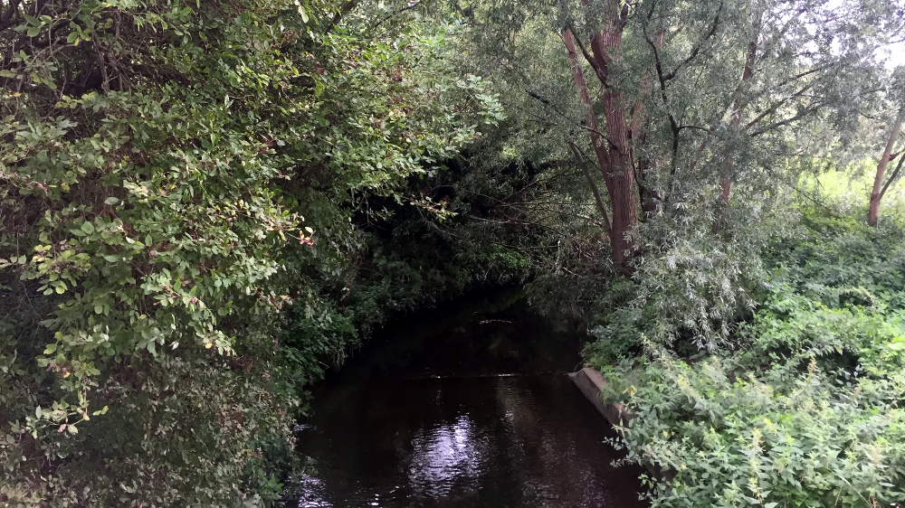
On the other side of the Hayes Line, the Capital Ring finds its way into Cator Park, passing sports pitches and overgrown areas. In quick succession the trail crosses two streams. First the river Beck mentioned above, which flows 6 km from Spring Park near West Wickham to the southeast where it rises just below the London Loop. Then, the Chaffinch Brook which runs from the southwest, about 3 km from South Norwood Country Park, with another branch from Monks Orchard. These combine within the park, just off the Ring, to form the river Pool, which flows roughly north for just over 5 km before joining the Ravensbourne at Catford. A third, lesser-known waterway joins the Pool within the park, just north of the Beck/Chaffinch confluence: the river Willmore rises not far from the Chaffinch Brook in South Norwood Country Park but now flows entirely in underground culverts.
 |
| You can just spot the river Beck, which didn't give its name to Beckenham, through the undergrowth. |
Over the Chaffinch Brook the trail enters the more formal
area of the park. In mediaeval times this was a damp flood meadow known as
Aldersmead, part of the open land linked to Penge Common although in Beckenham,
but was drained farmland when it became part of the Cator estate. There’s some
irony in the most significant public space in the area being named today after
the family who developed the surrounding estates. This area was kept as a green
space but, in line with their ruthlessly commercial approach, it was never
intended as a public park. Instead it was a private space, Kent House Pleasure
Gardens, which locals had to pay an annual subscription to access. In 1931, it
was bought by Beckenham Borough Council and opened to the public the following
year.
Today much of the park is mowed grass and sports pitches
but there are pleasant areas with shrubs and specimen trees, and the rivers,
though culverted, add extra interest. Here the Ring meets the Waterlink Way, a
signed walking and cycling route from Greenwich that first follows the
Ravensbourne, then the Pool, part of National Cycle Network Route 21. South of
Cator Park the Waterlink signing peters out but there’s a pleasant onward walk
to South Norwood Country Park and NCN21 continues south all the way to the
south coast and Eastbourne. Two stations are within easy reach of the south of
the park. Clock House on the Hayes Line opened in 1890 when the southern part
of the Cator estate was being developed. Closer by is Kent House on the Chatham
Main Line, opened in 1884.
The Ring has to wiggle about to link the scattered green
spaces, and now loops north again along the edge of the park, crossing the
unseen river Willmore just before the Waterlink Way turns right. Leaving the park,
the trail passes the Harris Girls’ Academy, founded in 1919 and previously the
Cator Park School for Girls: note another white horse of Kent displayed on the building.
The 1960s houses on the right of Kent House Road, between the bus stop and Beckett Walk, occupy the former site of Kent House itself, demolished in 1957. With records showing a house on the site as far back as 1240, this is one of the oldest known continuously occupied sites in Kent. Originally a farmhouse, it became a landmark local mansion. In the 1780s it was owned by prominent Russian-born businessman and Lloyds underwriter John Julius Angerstein (1732-1823), an art connoisseur whose personal collection formed the core of what became the National Gallery, though he’s better known for his connections to Greenwich and Blackheath.
The 1960s houses on the right of Kent House Road, between the bus stop and Beckett Walk, occupy the former site of Kent House itself, demolished in 1957. With records showing a house on the site as far back as 1240, this is one of the oldest known continuously occupied sites in Kent. Originally a farmhouse, it became a landmark local mansion. In the 1780s it was owned by prominent Russian-born businessman and Lloyds underwriter John Julius Angerstein (1732-1823), an art connoisseur whose personal collection formed the core of what became the National Gallery, though he’s better known for his connections to Greenwich and Blackheath.
Numerous sources state the house got its name from being the first house in Kent on the way from London – but as London was only extended to Sydenham, the next parish north, in 1885 and the name has been around for centuries longer, this is clearly untrue. Rather, it was the first house in Kent on the way from Penge, which was historically in Surrey, as discussed below. So close was the house to the boundary that its residents exercised commoners’ rights on Penge Common.
The false assumption is understandable as the boundary between Bromley and Lewisham, which between 1885 and 1965 was indeed the boundary between Kent and London, is also not far away, to the north. Passing several ‘stink poles’ venting sewers beneath the pavements, following an old field path that’s now a fenced footpath between school playing fields, the trail approaches Lewisham again past some modestly pretty Victorian houses. The drive to Alexandra Playing Fields is just on the Lewisham side, but the trail then leaves that borough for the last time when it enters the park. Though the line has been adjusted in various places for administrative convenience, it essentially follows the historic boundary between Beckenham and the old manor of Sydenham, part of Lewisham parish and held before the Dissolution by St Andrew’s Priory in Rochester.
Alexandra Recreation Ground, where the trail loops south again, was pasture until the 1880s when it was acquired by the Urban District Council for public use, opening in 1891. It was named after Alexandra, wife of the then-Prince of Wales, later Edward VII. It’s been noted in particularly as a cricket venue and for its bowling green, which is still used. Currently it’s something of a bland grassy space although there are mature trees and work is ongoing to improve it, thanks in part to an active Friends Group that looks after both this and Cator Park. The section alongside Maitland Road was added to the park in the first decade of the 20th century.
Past this, you’re back on Lennard Road again. Alexandra
also gave her name to what’s now a small but distinctive Conservation Area opposite
and to the left along Hardings Lane: the Alexandra Cottages, built after 1866
on the former Porcupine Field by the Metropolitan Association for Improving the
Dwellings of the Industrious Classes. Our way, though, is right towards Penge
East station. Due to the station’s closeness, most people round here think of
themselves in Penge, though the boundaries of that location are problematic, as
we shall see.
Penge
 |
| The crossing and the wall on the right mark the site of Penge Bridge, where the Croydon Canal crossed this road between what are now two railway bridges by Penge West station. |
In 957, the king of Saxon England, Eadwig or Edwy the All-Fair, granted Battersea manor to one of his ministers, including an area of swine pasture at Penge. The latter thus became a ‘detached part’ of Battersea parish, some 8 km away, which placed it in Surrey rather than Kent. The now-buried river Willmore mentioned above formed part of the boundary, which explains its alternative names the Boundary Stream and the Shire Ditch.
A series of 19th century developments prompted the urbanisation of Penge. The first was the opening of the Croydon canal in 1809, which brought day trippers from London. Encroachments had already begun by 1827 when local landowners were successful in extinguishing commoners’ rights and inclosing the whole common, with some of it parcelled off for building land. The first house was built by a Scottish silk manufacturer, William Sanderson, who reputedly named it ‘Annerley’ as it was the ‘annerley’ (only) house on the common.
When the canal was converted to a railway in 1839, Sanderson allowed some of his land to be used by the rail company on the condition a station was built nearby. The surrounding area was subsequently developed as housing and today the south of Penge is generally known as Anerley. The conversion of much of the rest of the common into a new home for the Crystal Palace in 1853 spurred further growth, much of it in the form of smaller, denser and more modest homes than in neighbouring Beckenham. As a result, the population of Penge increased from 270 in 1841 to around 22,500 at the beginning of the 20th century.
By then, Penge had been a part of Surrey, London and Kent. It was included in the area covered by the Metropolitan Board of Works, a predecessor of the London County Council (LCC) with limited powers, in 1855, but remained formally a part of Battersea until becoming a parish in its own right in 1866. Then when the LCC was created in 1885 it became part of London.
But on the creation of the Metropolitan Boroughs in 1900, it was decided for some reason not to attach it to Camberwell or Lewisham, but to take it out of London entirely. By then, Croydon, to the south, was a self-governing borough only ceremonially within Surrey, so putting Penge back into its original county would have meant it was physically detached from other areas administered by the county council. So instead it was turned into an urban district and placed into Kent. This explains why it became part of the London Borough of Bromley when Greater London was created in 1965.
There are further anomalies. Penge East station, which the Ring now passes, was originally known simply as Penge station when it was opened in 1863 on the Chatham Main Line, though it wasn’t technically in Penge but in Beckenham, a tongue of which stretched west. The modern houses on the left at 52 and 54 Kingwood Road are squeezed into what was once a gap in the Victorian terraces which accommodated the boundary, so passing them marks the Ring’s entry into historic Surrey. I’ve said a little more about the history of the county on London Loop 4.
Reaching Penge High Street, most of the historic buildings of interest are to the left, including the 1847 Church of St John the Evangelist, which is mentioned by Nikolaus Pevsner, and the 1839 Royal Waterman’s and Lighterman’s almshouses. But the Ring turns right towards yet another station, Penge West. The name of the Bridge House Tavern doesn’t refer to the railway bridges ahead but to Penge Bridge, the former road bridge over the Croydon Canal.
Dug in 1809, the canal linked the Grand Surrey Canal at New Cross, with its connection to the Surrey Commercial Docks and the Thames, to West Croydon via Forest Hill and Penge, a distance of around 15 km. The canal was part of a chain of transport infrastructure including the Surrey Iron Railway, a horse-drawn plateway which linked Croydon with stone quarries at Merstham: you can read a little more about it on London Countryway 21. The Iron Railway’s London terminus was at Wandsworth, where the Thames was narrower and less accessible to larger vessels, so the idea was to create a more convenient connection for goods with the Docklands in the east.
In the event, the canal wasn’t a commercial success, and was used more for transporting timber from the docks rather than stone from Merstham. A planned extension to Epsom was put on permanent hold and in 1836 the canal company sold out to the London & Croydon Railway (L&CDR). Most of the waterway was filled in and in 1839 one of London’s earliest urban railways opened along the same route, linking in the north with the London & Greenwich Railway into London Bridge.
With various later extensions, this eventually became part of the London Brighton and South Coast Railway (LB&SCR) and the Brighton Main Line, though it’s still used for local trains too, including, since 2010, the London Overground. Like Penge East, Penge West was opened simply as Penge, and the two weren’t distinguished until 1923. Some of the original 1836 station building still stands though it was badly damaged in an arson attack in 2005 and has been reconstructed.
Some people assume the railway simply follows the old canal bed but in truth it weaves around the original alignment. Penge Bridge itself was in between the current rail bridges, a little to the west of the successor railway. To the north (right) was Penge Wharf with a canal basin. Almost all trace of the canal has been obliterated: one exception is a little to the south in Betts Park, Anerley, formerly the site of a popular canalside tea gardens, where the waterway survives as a concrete-lined ditch. The second bridge carries the LB&SCR branch line from Sydenham to Crystal Palace which I’ll say more about at the end of the section when the Ring reaches Crystal Palace station.
Crystal Palace Park
 |
| The Crystal Palace at its new Sydenham home in the 1850s, viewed from the Italian terrace in a photo by Philip Henry Delamotte. The south water tower where John Logie Baird later installed an experimental transmitter is visible left. The arched terraces and flights of steps are still visible on the site. Public domain. |
Queen Victoria’s husband, Prince Albert of Saxe-Coburg and Gotha, is usually credited as the man behind the Great Exhibition, but it was more likely the idea of Henry Cole, a senior civil servant and member of the Royal Society for the Arts (RSA) with a keen interest in improving industrial design. Cole was inspired by the Exposition des produits de l'industrie française, held in Paris in 1844, and imagined a similar exhibition showcasing not only British products but international ones too. The prince was RSA president at the time, though, and was actively involved in piecing the event together. Taking place between May and October 1851 in Hyde Park, the Great Exhibition of the Works of Industry of All Nations was an overwhelming success, with over 6 million visitors and a profit of £186,000, used for founding the South Kensington museums.
The event was judiciously timed. The disruption and immiseration unleashed by the rapacious advance of industrial capitalism over the previous decades had inevitably prompted resistance. The Communist Manifesto was published in 1848, just as a succession of revolutions began in mainland Europe. Though the UK avoided a full-scale revolution, mass demonstrations and strikes throughout the 1840s, many of them mobilised around the Chartist movement, seriously unsettled the authorities, who often responded with violent repression. But as the 1850s began, rebellion was in retreat: as Albert observed in a letter to his cousin Friedrich Wilhelm IV, King of Prussia: “We have no fear here either of an uprising or an assassination.”
The window was therefore open for initiatives that attempted to head off future rebellion by suggesting that ordinary people had a stake in the system too and that the Victorian blend of capitalism and imperialism could deliver scientific and technological progress and prosperity for all. And while, unlike its Parisian inspiration, the Exhibition boasted substantial contributions from overseas among its more than 14,000 exhibits, no opportunity was missed to push home the message that British was best.
Such a spectacular event demanded a spectacular venue which itself embodied cutting edge technology. After a competition failed to produce a suitable design, Cole brought in greenhouse architect Henry Paxton, who proposed a prefabricated building which could be constructed quickly. The result was the Crystal Palace, built in a mere nine months from cast iron pillars and girders supporting 300,000 of the largest glass panels yet made, a staggering total of almost 10 million m2 of glass held in place by 40 km of guttering. The building was 564 m long, with a central arch soaring 39 m overhead, and enough room in its transepts to enclose a row of mature elm trees already growing on the site. The total exhibition space was 92,000 m2, just under half the entire total of today’s National Exhibition Centre in Birmingham.
The Great Exhibition committee weren’t the first organisers of a large-scale event to face the issue of what to do with the infrastructure after the crowds have gone. Paxton favoured retaining the building in Hyde Park, but the government was reluctant. His friend Leo Schuster, a board member of the LB&SCR, suggested a site he had bought known as Penge Place, part of the old common. Schuster helped form a new Crystal Palace Company to buy further land and relocate the building to a lofty site at the pinnacle of Sydenham Hill, overlooking a newly landscaped park and pleasure grounds packed with additional attractions.
More money was spent landscaping the park than rebuilding the palace, including the construction of a remarkable system of lakes, cascades and fountains, the tallest of which shot a jet 76 m high. The first water tanks collapsed from the sheer weight of water needed to feed it all, and Isambard Kingdom Brunel was brought in to design two massive water towers flanking the palace. The building itself wasn’t simply reconstructed but redesigned, and enlarged still further, its impressiveness heightened by a series of terraces decked with statuary and neo-classical architectural features. Elsewhere were Italian and English gardens, a Great Maze and several sports grounds, including a stadium which was the venue for the FA Cup Final between 1895 and 1914 and the birthplace of Crystal Palace Football Club, now in the Premier League, in 1905.
Although the Palace itself was in Penge, the park encompassed land in both that parish and the tongue of Beckenham that stretched west across the hill, though the boundary was later redrawn to place the whole park in the London Borough of Bromley. Not only the county boundaries but also several historic parish boundaries converged in this part of London, and today you can visit Bromley, Croydon, Lambeth, Lewisham and Southwark boroughs on a short walk from the old palace site.
The new, improved Crystal Palace opened in 1857, but though it rapidly became a famous attraction was never successful in recouping the initial investment. It didn’t help that until 1860 Sunday opening was blocked by religious objectors, when Sunday was the only day off most potential visitors had. The owners struggled to cover the high maintenance costs and by the 1890s parts of the site had visibly deteriorated, further undermining its appeal. The company went bankrupt in 1911, and the complex was brought into public ownership under the Ministry of Education with funds raised by public subscription. Following World War I when the Royal Navy operated a shore station here, management was passed to a charitable trust which began restoration work, launched an imaginative events programme and, in 1928, added a speedway track, all of which helped bring in a modest profit.
Then, one evening in November 1936, when the Palace was closed to the public, a small fire in an office area grew into a massive conflagration which, despite the efforts of 438 firemen with 88 fire engines, destroyed the building overnight, except for the water towers. The powerful draughts created by the fire rushed through the pipes of the palace's giant pipe organ, creating a discordant noise as if the building was moaning in its death throes. The glow could be seen all over London: my mother, who grew up in Eltham, has an early childhood memory of it. Winston Churchill was among the spectators and commented that “this was the end of an age.” The cause of the fire has never been determined: given the building’s mixed fortunes, there were rumours of arson, though these have never been substantiated, and an accidental explanation is more likely.
The military reoccupied the site during World War II, demolishing the water towers to prevent their use as navigation aids by German bomber pilots. The Trust took over again after the war, then in 1951 the site was passed to the London County Council. It was inherited through the Greater London Council by the London Borough of Bromley, which manages it today as the largest park in the borough. It’s still a remarkable space, and splendid in parts, but its fortunes have continued to be somewhat mixed.
In the late 1950s, the park became the home of the National Sports Centre, covering and extending beyond the footprint of the football stadium. As well as unsympathetically disrupting the line of the former Grand Central Walk from the palace terraces down the hill to the Penge entrance, its design hasn’t worn well, and parts of it also now look neglected. It had something of a makeover for the 2012 London Olympic and Paralympic Games when it was a training venue for the Brazilian team. It’s now owned by the London Development Agency with a view to redevelopment but there are no firm plans: a proposal by Crystal Palace FC to turn it into their home stadium seems to have been abandoned.
Palace and park played a key role in the history of television. In 1933, Scottish-born pioneer John Logie Baird, who lived nearby, took advantage of the elevation by using the south water tower for test transmissions. Following the 1936 fire, he relocated to Alexandra Palace in north London, from where the first public service began the same year. Baird was back in the tower in the early part of World War II, before it was demolished, working on secret military technology.
The television connection was revived in 1956 with the commissioning of the BBC’s Crystal Palace transmission tower, now privatised and mainly used for radio under the name Arqiva Crystal Palace, on the site of the old aquarium not far from the opposite, northern water tower. At 219 m, this was the tallest structure in London until the building of the first Canary Wharf tower at One Canada Square, and is now the fifth tallest, dominating the view of much of this section of the Ring.
Through the Penge gate, the trail starts along the broad avenue of the Grand Central Walk, which once ran 811 m from here to the palace. There’s a visitor centre nearby, and various alternative routes around the park, including a signed Green Chain Walk link that passes close to the Royal Naval Volunteer Reserve memorial, one of the surviving lakes, the maze and the concert bowl before connecting with the Green Chain branch to Nunhead via Dulwich. The Green London Way meanwhile rejoins us from the right, having used parts of that Green Chain branch and other paths from Thames Barrier Gardens in the last section.
But the Ring dodges off left, passing the park café which at the time of writing was closed for rebuilding. It passes the LCC-commissioned 1961 sculpture Gorilla in polished black Belgian marble by David Wynne (1926-2014), modelled on western lowland gorilla Guy, a famous resident of London Zoo. Wynne said he wanted to convey his awe and terror of the animal, while creating something appropriate for children to climb on.
Many more zoological representations, though of a different kind, lie ahead in the Dinosaur Park, the best-known and most extensive remnant of the 1850s pleasure gardens. Distributed on a scattering of islands in an irregularly shaped lake that was once the main reservoir for the water features are 33 individual life-sized sculptures of ‘prehistoric monsters’, comprising a virtual Victorian version of Jurassic Park. They were created in 1854 by natural history artist Benjamin Waterhouse Hawkins (1807-94) with the help of palaeontologist Richard Owen (1804-92), the man who coined the word ‘dinosaur’.
Based on fossils kept at the British Museum, they reflect the best scientific knowledge of the time: some of them are now thought to be inaccurate but they’re still impressive and hugely popular, providing one of the highlights of the Ring. As Scientific American columnist Darren Naish says, they are “an outstanding example – perhaps the ultimate example – of an exciting, world-changing, public outreach campaign involving innovation, novelty, pluck and clever design on a scale not seen before, or indeed since.” Nearly all the original sculptures have been preserved and were recently carefully restored, though some other features of the area including the waterline were changed in a less sympathetic 1960s renovation.
Dinomania is nothing new and the big reptiles have long drawn the greatest visitor interest, but the park is laid out to provide a more rounded and educational view of prehistoric wildlife: the plants chosen are as far as possible appropriate to the time periods. The first beasts you’ll see are extinct mammals: giant Irish elk on the Quaternary Island. Next along is Bird Island, which was originally intended to house a statue of a Moa, but this was cancelled as funds ran low and the island is still empty. Tertiary Island also has mammals including a rather terrifying giant ground sloth climbing a tree, and opposite the lakes is a ‘geological illustration’ showing layers of rock and coal deposits.
The reptiles are next, and you’ll need to divert a little from the trail and closer to the lakesides to see them all. The Secondary Island has iguanadon, megalosaurus, hylaeosaurus and a scattering of pterodactyls, and then there’s a lazy-looking marine scene with Jurassic animals like plesiosaurus, ichthyosaurus and teleosaurus: originally all of them were beached but some now lie half-in the water. Finally, Primary Island at the far end has dicynodon and labyrinthodon. I’m particularly fond of the ichthyosaurus with its curiously plated eyes, although it’s now regarded as one of the least accurate reconstructions: the animal was likely much more fish-like, aquatic rather than amphibious and with a dorsal fin. There’s much more information on the Friends of Crystal Palace Dinosaurs website, and the main park also has a Friends Group.
There are live animals rather than sculptures at the Children’s Farm, which the trail passes just after it leaves the dinosaur park, including sheep, goats, alpacas, exotic lizards and guinea pigs. Since 2008, this has been run by Capel Manor College, a specialist horticultural and agricultural further education college based in Enfield, as both a training facility and a visitor attraction, open most afternoons with free admission. It’s worth a look, and some of the animal pens are visible from the trail itself.
A cheerful mural of cartoon dinosaurs in a train indicates you’re nearly at Crystal Palace station. As mentioned above, board members of the London, Brighton & South Coast Railway (LB&SCR) were instrumental in setting up the Crystal Palace project, so it’s no surprise that this, the first of two stations to serve the site, was operated by the LB&SCR when it opened in 1854.
At first, it was the terminus of a branch from Sydenham, crossed by the Ring when it passes under the second bridge after Penge West. Today, a branch of the London Overground East London Line uses the terminal platforms. In 1856 it became a through station with trains continuing to Norwood and Streatham, and later to Victoria, via a 690 m tunnel through the hill which passed right under the south water tower. Two years later it was linked to Beckenham via the Crystal Palace and West End of London extension mentioned above.
Built to resemble a French château, with a grand and gloomy partly vaulted interior described by numerous commentators over the centuries as cathedral-like, the station is now just a little out-of-scale with current levels of its use. Large parts of it were shut off in the 1980s when a glazed ticket hall designed in imitation of the palace was bolted on to the south side. This went in 2012 when the original booking hall was reopened as part of the Overground improvement work, and the venerable Grade II-listed edifice is at last getting something like the care it deserves. I used to think of it in the same way as Windsor and Eton Central, visited on London Countryway 5, another elaborate Victorian station built to accommodate a much more intensive service than it currently offers. But though Crystal Palace is no longer welcoming the huge crowds it was intended for, thanks largely to the Overground its cavernous spaces are more populated than they’ve been in decades.
There are other route options at the station. The Green Chain Walk Southwark branch ends there, and the Green London Way parts company from the Ring again, taking an alternative route to Norwood Grove where we’ll meet it again in the next section. Following either from here will take you close to the terraces and the site of the palace itself, and the Way runs close to the small and independently-run Crystal Palace Museum, open on Sundays in an 1880 building that was formerly part of the on-site School of Practical Engineering.
If you’ve never been to the terraces, they’re well worth a visit. In 1953, the US poet and experimental film-maker James Broughton shot a short film, The Pleasure Garden, here. An allegory of desire and repression unexpectedly starring comic actors Hattie Jacques and her husband John Le Mesurier, it unfolds in a much more lush and overgrown setting than you’ll find today, something of a magic garden dotted with Victorian statuary. Most of this has gone, but two sphinxes still flank a stairway, a couple of badly-damaged statues rise from plinths, and a long line of narrow arches provides shoulders to support the upper terraces. Further down the hill, an 1889 bust of Paxton by William F Woodington glowers over the concrete mess of the sports centre.
The palace site itself is partly an open grass space, partly recolonised by woodland. Behind it, beside a driveway that leads to Crystal Palace Parade, is a lone fragment of white-painted cast iron from the original building. A further treasure lies beneath your feet here: an arched subway under the Parade, supported by graceful pillars clad in decorative tiling.
This once connected the palace with a second station, Crystal Palace High Level, opened in 1865 at the end of a new branch line from the London, Chatham and Dover Railway at Nunhead to compete with the LB&SCR. The line closed in 1954: some of it is now a footpath used by the Green Chain Walk Southwark branch. The station was demolished in 1961 though the subway survived and has been used intermittently since as both as an official and unofficial events venue. It’s currently closed for safety reasons but has an active Friends Group who hope to open it regularly.
The years since World War II have witnessed a succession of proposals for the crest of the hill, none of which have so far been realised. A plan for a new exhibition hall was abandoned in 1968, then a mid-1990s scheme for an entertainment complex with events venues, cinemas, restaurants and bars collapsed in 2001 after vociferous local protests, particularly over the loss of green space and woodland.
A revised London Development Agency plan was approved following a public inquiry in 2010 but cancelled after funding was withdrawn. Most recently, a Chinese developer submitted a proposal to build an accurate reconstruction of the palace, which sounded too good to be true and was duly withdrawn in 2015. So, the former home of this Victorian wonder remains a ghost site which, surrounded by the remaining paraphernalia of the terraces, looks like the long-abandoned stage of some giant theatre.
 |
| Dinosaurs on a train: someone should have snapped up the film rights. Crystal Palace station. |
- Ramblers Capital Ring guides. These are currently the most up-to-date detailed walking guides and maps. Check this page too for current diversions and problems.
- Google Map
- My original Route description (PDF), not recently updated and included here for completeness.


