Once there was the wildwood. Around 18,000-20,000 years ago, the world's last glacial period, the Devensian glaciation, reached its peak, with the polar ice sheets reaching as far south as modern Birmingham. This period is often known colloquially as the last "ice age" but geologically speaking we're still in an ice age, just a warmer episode of one. Early humans had already arrived in Britain during the next last warm period about 30,000 years ago but had soon retreated to southern Europe as the land cooled. Now, as the ice sheets receded again, richer vegetation spread northwards, advancing like an animated campaign map across the land bridge of Doggerland that still linked the British peninsula to Flanders and Denmark. Tundra turned to forest, with endless expanses of broadleaf (deciduous) trees -- ash, beech, birch, lime, oak -- carpeting a landscape sculpted by retreating glaciers. These broadleaf forests would have covered nearly all of England, Wales and southern Scotland, with conifers such as Scots Pine taking over in the cooler far north.
The spread of woodland brought not only trees but other species that flourished beneath their shade. Large game animals such as boar, wild cattle and deer, as well as predators such as wolves and bears, spread northwards in the rear of the forest's advance, and close on their tail the hungry humans returned. Then, about 6500BCE, the sea level rose from the melting ice and the old south-facing estuary of the Thames and Rhine cut northwards across Doggerland to the North Sea, marooning an ecosystem that was about to change irrevocably. It's this inundation of the land bridge that defines the biological term "native species" with respect to Britain -- anything that got across before Britain (once more) became an island is counted as native.
From a human point of view, natural woodland is not completely unproductive. Its richness as a source of game was what attracted us to it in the first place, and it also provided grazing for early livestock, with domestic pigs, for example, continuing to forage on the forest floor much as their feral ancesters had done. Obviously it's also a source of timber and firewood, as well as edible wild plants. When early political economists speak of the origin of value and property in humans "mixing their labour" with the fruits of the earth, the imagination likely conjures a hunter-gatherer plundering a tree for a handful of berries or the makings of a spear. But as the technical innovations of organised agriculture began to drive the development of human society, the endless hectares of thick and thorny forest became a barrier to progress.
The conquest of the forest is connected with the very beginnings of industry. The earliest factories known in Britain date from the Neolithic period around 3500BCE. They are located close to sources of workable stone like flint and volcanic tuff, in places like Great Langdale, Cumbria, and the Llŷn peninsula in northwest Wales. A more local site was at Stoke Newington, which we'll later explore on the Capital Ring. Their principal products were fine stone axes, which in some cases were prized far beyond their home territory: stone worked in north Wales found its way as far as Lands End and the south coast. And the principal purpose of a stone axe was to clear woodland for settlement and agriculture.
The various cultures that rose and fell in Britain as the Stone Age gave way to the Bronze and Iron Ages -- Beaker, Celtic and Belgic -- have left marks on the landscape in the outlines of cultivated fields, some of which we'll encounter on future walks. Often farming on high slopes with sometimes poor soils for the benefit of a vantage point over hostile wildlife and human rivals, and not understanding the science of soil fertility, these ancient farmers would simply clear more fields when the old ones became exhausted. By the Roman conquest in 43CE, the landscape of southern England was already shifting from a scattering of villages and farms in occasional forest clearings to something like the agricultural patchwork we know today, where woodland remnants have been reduced to narrow strips separating fields.
When the conquering Norman armies arrived in 1066, woodland cover in England is estimated already to have reduced from near total to a mere 15%. By 1900 it was as low as 6%, and has since increased a little to 8%. In contrast, the European average is 44%. And it shows: Berlin still looks, as it should, like a city cleared from the forest, into which the forest still intrudes, but London still looks far too much like an expanse of concrete and grass dotted with a street tree here and there by an architect that's good at Photoshop.
The term "ancient woodland" is used in Britain for areas known to have been continuously wooded since at least 1600. This might not seem very ancient in terms of human history, let alone geological time, but it marks a watershed in woodland management practice. Prior to this, people worked with naturally occurring woodland; from 1600, deliberate planting of selected species became more common. Most ancient woods therefore date back much further than 1600, and a good few may even be surviving fragments of the original wildwood, their trees the direct descendants of those that spread across the land bridge as the ice sheets receded many millennia ago.
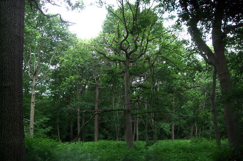
Only 2.45% of England's land surface is "ancient semi-natural woodland" -- only semi-natural since of course it has been managed, even if by relatively benign techniques such as traditional coppicing and pollarding. The rest is planted woodland. This includes a number of ancient woodland sites that have been replanted with other species, notably fast growing conifers, often dating from the immediate postwar period when there was an urgent demand for timber. Several times on the London Countryway we've encountered patches of planted conifers in the midst of broadleaf woods and the contrast is immediately obvious. Conifers form a dense year-round canopy that prevents light reaching the woodland floor, creating an environment hostile to the diversity of flora and fauna that flourishes in native broadleaf woodland.
The Woodland Trust calls ancient semi-natural woodland "Britain's equivalent of the rain forest" -- a piece of marketing spin, you might cynically observe, for an audience more likely to be moved by the plight of the exotic wildlife of the Amazon basin than the need to conserve Britain's drizzly woods with their dog walkers and discarded pornography collections. But the comparison stands -- its long history has endowed ancient woodland with a notably rich and diverse ecology and the development pressures that drove its clearance are comparable to those now threatening the rainforest.
It is also practically irreplaceable. It's true that, left to its own devices, England tends to the condition of woodland: even in a city, a piece of ground left empty will first sprout fast growing weeds, then shrubs and eventually give rise to the saplings of broadleaf trees. Several times on the Countryway we've encountered commons which two centuries ago would have been much more open in character due to communal grazing, where trees have reestablished themselves as grazing has declined. But thanks to soil disturbance from agriculture and development, the fragmentation of wildlife populations and the introduction of non-native species, such new natural woodlands will never be quite the same as the ancient ones. We've seen woodland creation in action on community woodland sites and planned on a grand scale at Heartwood Forest, but these schemes have to be carefully managed to reproduce anything like the environment of the remaining ancient woodlands.
Though the percentage is worryingly small, the extent of land area is great enough that we still have some substantial areas of ancient woodland to enjoy, preserved by historical quirk and deliberate conservation. Some large wooded areas were preserved in the post-Norman period as hunting forests for the use of royalty and the nobility -- the deliberate retention of relatively unproductive land as the ultimate expression of conspicuous wealth. Others, especially those on poor soils, were retained as commons. The emergence of the conservation movement in the 19th century saw some historic battles to retain woodlands, including those near cities like London that were now threatened not by agriculture but by housing development -- Epping Forest, in the next section, is a prominent example.
This section of the London Countryway is notable for its ancient woods, which include the second National Nature Reserve (NNR) we've encountered so far. It's also significant for two more reasons. The first is that we'll notice the Countryway drawing closer to London as it heads into its final quarter turn, encountering its first true piece of continuous ribbon development reaching out from the capital. The second is personal, as the route is now taking me into some very familiar territory. Between 1971 and 1983, and again in 1985-6, I lived with my family in Bayford. Our place was some way north of the route, but today we pass through the southern part of the same civil parish. In the interim, I lived in Hatfield and Potters Bar, and sometimes walked to visit my parents in Bayford. And during most of the later part of this period I had a girlfriend who, when I originally met her, lived in Cheshunt with her parents. Negotiating the network of lanes and footpaths between the East Coast main line and the Lea valley triggered old memories.
The route leaves Welham Green along Bulls Lane, at first a suburban street with the occasional pretty garden until it ducks under an old brick bridge, named Skimpans Bridge, which carries the East Coast main line (discussed in the previous section). The railway is also the eastern boundary of Watling Chase Community Forest, which we now leave, although the environment immediately becomes more rual beyond it. We pick up a footpath that first runs parallel to the lane, actually a diversionary route created when a level crossing further south was closed to accommodate rising speeds on the main line. The path is soon tracking the edge of today's first woodland, Pelpins Wood, through attractively overgrown fields. I've found out little about this oddly shaped wood, but I doubt it has any connection to the abbey town of Pelpin in Polish Pomerania.
The path emerges at a junction with quiet tarmac lanes just south of the hamlet of Bell Bar. The lane running left to right here is in fact a former section of the Great North Road, another in the succession of major northbound routes the Countryway crosses. The original basis for the road was Ermine Street, the Roman route from London to York, northeast England and the Scottish border. Much of the original length of this remained in use well into the last millennium, though not all of it in a good state of repair. This route crossed the river Lee at Ware, and in the 13th and 14th centuries passage on it was periodically disrupted by the rivalry between Ware and neighbouring Hertford over rights to river traffic. So an alternative route developed via Highbury, Highgate, Barnet and Hatfield that rejoined Ermine Street at Alconbury in Cambridgeshire. Inevitably numerous inns and small hamlets grew up along the road, and just north of here it passed the Bell Inn, where there was a barrier or gate, thus Bell Bar.
The Great North Road was an obvious choice for turnpiking. By 1720 the turnpike had reached north from London to the Angel at Enfield Chase, and a decade later it was extended past Bell Bar to Lemsford Mill. This is the route along which Charles Dickens imagined Oliver Twist arriving in London having fled the workhouse in the eponymous 1839 novel, and along which Bill Sykes later made his getaway after murdering Nancy, taking refuge with his dog "limping and lamed from the unaccustomed exercise" in an unnamed pub that's assumed to be the Eight Bells at Hatfield.
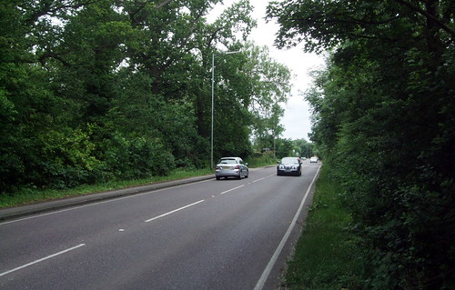
Coaches had always struggled up the steep hill to the south of Bell Bar and in 1851 a diversionary route was opened to the east, also diverting the road away from the grounds of Hatfield House, where successive owners have proved adept at deflecting rights of way. Bell Bar itself was bypassed, with a huge economic impact not only on the pubs but on the farms that had provided overnight pasture for cattle being driven to Smithfield market. The project also failed to return on its investment: a year earlier, the Great Northern Railway had opened on the parallel route we crossed near the start of this section, and was soon winning much of the through traffic. The 1851 road, which we cross soon after its predecessor, was designated as part of the A1 when the current system of road classifications was introduced in 1921. Its period as part of Britain's official number 1 road was brief: in 1928 it was succeeded in its trunk road role by the Barnet and Hatfield bypasses further to the west, and renumbered A1000, though as you can see it remains a busy and important part of the local road system. We crossed two generations of successor roads at Water End in the previous section.
As a roadside sign attests, we're now at the edge of the village of Brookmans Park, also once part of the extensive manor of North Mymms traversed in the previous section. A section of that estate was sold off in 1786 to the Gaussen family who created their own distinct estate centred on Brookmans Manor. From the 1920s sections of the estate were sold off for development, boosted by the opening of a new station on the East Coast main line which had originally run through non-stop. Helped by its leafy hilltop location it's become one of London's poshest commuter retreats. One of its quirkier claims to fame is that in the late 16th century it was the home of the original model for the nursery rhyme character Little Miss Muffet, who was frightened by a spider while eating her curds and whey (a reference that puzzles contemporary children). There's little hard evidence for this as the claim wasn't recorded until the early 19th century, but the local school still includes a cobweb on its badge.
Across the road a tree-lined path runs between the transmitting towers and satellite dishes of the Brookmans Park Transmitting Station, taking advantage of the hill's summit which, at 126m, is one of the highest in Hertfordshire. The station was opened in 1929 by the BBC during the original breakup of the estate as the first step in a programme to extend regional medium wave radio coverage across the country, replacing the existing low range transmitters in central London, and was the first such station in the world built to transmit two separate radio channels simultaneously. It's remained as a radio rather than a TV transmitter, though in 1930 it was used for experimental transmissions of John Logie Baird's pioneering 30-line electromechanical television system. When the BBC bought the land it insisted that future purchasers of neighbouring sites must agree not to use them for anything that might cause interference, a factor that probably protected Brookmans Park from industrial development prior to the introduction of the Green Belt. Today it's owned by Arqiva, a privatised successor of the National Grid company, and transmits commercial radio, while a variety of other telecoms companies rent space for satellite and mobile phone applications.
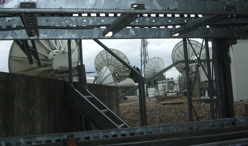
PP Eckersley, the BBC engineer who oversaw its construction, reminisced in his autobiography: "A high-power wireless station is such a lovely thing. The process is silent, there is no gas or smell or fussy reciprocation, no sound except a purposeful humming. One is conscious of power contained and controlled." His words still strike home today. It's a strange and deserted place, still humming to itself as the only outward sign of all the activity going on beneath the surface. The rows of satellite dishes stand with ears cupped heavenwards as if listening to the whisper of distant galaxies. It shatters the illusion a little when you realise what they're actually listening to is the Home Shopping Channel and endless reruns of Only Fools and Horses.
Just past the transmitting station, where a concrete water tower part hidden by trees also takes advantage of the height, the route dodges just over the official boundary of Hatfield town, though with no sign of urbanisation. It then starts descending slowly through fields, finally leaving the Colne side of the watershed for the drainage basin of the Lea. A little way down, some presumably very well off person is creating a new formal tree-lined avenue sweeping down from Kentish Lane Farm on the right, which we cross at right angles. All along the Countryway we see farm buildings transformed into luxury dwellings -- this one seems to aspire to manor house status.
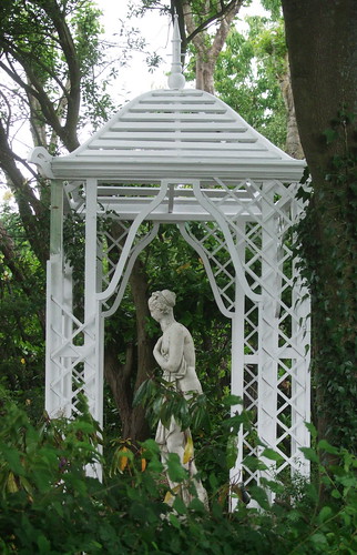
From a very rural crossroads on Kentish Lane just south of the hamlet of Wildhill, an old lane linking several farms takes the Countryway by a satisfyingly direct route to Newgate Street. Passing a rather incongruous mock Classical temple in a back garden, it first dips down into a valley cut by the Essendon Brook, which joins the Lea near Essendon a little to the north.
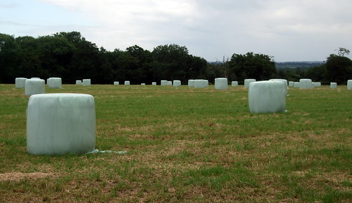
Then it climbs up again to Barbers Lodge Farm where, rather irritatingly, it's been deflected, apparently unofficially, away from the farmyard and around three sides of a barn. Instead of sheltering tractors and combine harvesters, the big barns here act as dry docks for small yachts. A satisfying stretch across an airy plateau follows, through fields dotted with giant plastic-wrapped bales looking like puzzling modernist monoliths.
After a while the Hertfordshire Way rejoins us, having followed a lengthy loop up to Royston since it left us at Sandridge Church in the last section. Then the lane develops into a residential street and emerges in the centre of the village of Newgate Street.
This is certainly familar territory -- schoolfriends had friends round here and sometimes the coach would pass through on school trips to the sailing base at Cheshunt, which we pass on the next section. The 308 bus, the second nearest bus service to our old house, still passes through two or three times a day except Sundays, not much less frequently than it did in the 1970s. Newgate Street is one of those places that challenges writers of directions, as the village has the same name as its main street, so you end up writing "At Newgate Street, turn right along Newgate Street", and the highway that approaches it from the east is even knowns as Newgate Street Road. The fact that it shared its name with a well-known street in London used to confuse me further. It's a small but pretty village that supports two pubs and a 1960s village hall, used twice a week by the mobile post office.
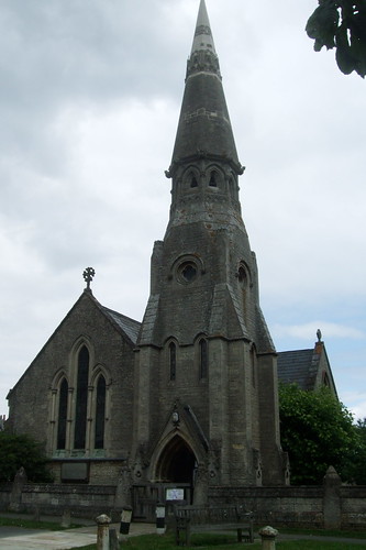
The village is wedged between two old manors. Tolmers Park to the south was once connected to Hatfield Park and passed through various owners before being used as a military hospital and a girl's school in the 20th century. Since 1940, 40ha of it has been a scout camp, one of a planned but never quite realised ring of such camps around London, while the rest, having spent some time as an NHS geriatric hospital, is now luxury flats. The Bath stone church in the village was built to serve the estate in 1848 and was originally known as St Mary's Tolmers. In 1912 it was renamed St Mary's Ponsbourne, transferring its allegiance to the northern estate through which the route now passes.
The Hertfordshire Way, meanwhile, heads south and will eventually curve round to where we last left its southern reach just east of Abbots Langley -- but our encounters with this complex route are still not quite over. And as the HW leaves we pick up another route, this time unwaymarked though shown on OS maps -- the Hertfordshire Chain Walk. Developed by the East Herts Footpath Society in the 1980s, it's cleverly designed as a chain of circular walks that can also be followed as several alternative linear routes linking Crews Hill, just within the London boundary, and Royston, on Hertfordshire's northern boundary with Cambridgeshire. It provides the first mapped footpath link in a while direct to the London Loop at Clays Hill.
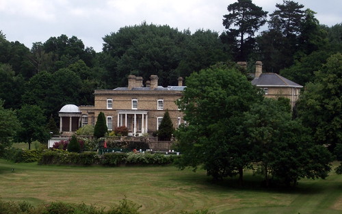
Ponsbourne Park was also carved from the manor of Hatfield and was in the hands of the family of the same name by the 13th century. 400 years later it was one of the extensive possessions of the Ferrers family, and came to be owned and later sold by Katherine Ferrers, married name Fanshawe (1634-60), whose alleged alter ego, the highwaywoman known as the Wicked Lady, terrorised travellers near Markyate. The house, perched dramatically on a steep hill rising up from a stream, was built in 1761. Since 1932 it's been a catholic boarding school, a country club, a management training centre for Tesco, and is now a hotel, restaurant and conference centre with sports facilities. Our way through follows an estate drive past tennis courts, an old walled garden and former service cottages.
Past the buildings, the track reaches the corner of a woodland, Calves Grove, where the Countryway crosses into the largest of Hertfordshire's district subdivisions, East Herts, a 1970s creation based on the towns of Bishops Stortford, Buntingford, Hertford, Sawbridgeworth and Ware. This is also where we dip into a corner of my own home parish of Bayford.
The route turns east to follow White Stubbs Lane, an old and still leafy country lane of some local importance, linking several villages. A short distance along, a low round brick structure in a field to the left reveals the route is crossing over the Ponsbourne Tunnel, in its day one of the biggest engineering challenges of one of the last great projects of the railway age. In 1871 the Great Northern Railway (GNR), whose original East Coast main line we have already crossed at Welham Green, opened a branch from Alexandra Palace to Enfield, and in 1910 this was extended to Cuffley. The intention was to continue this line via Hertford to rejoin the main line at Langley, south of Stevenage, including the 2.45km tunnel under the hill of Ponsbourne Park, to provide not only a further branch line but a relief route for expresses.
Work started in 1912 but progress was slow, interrupted by World War I, and the full loop didn't open until 1918; five years later, the GNR was incorporated into the London and North Eastern Railway (LNER) as part of the government backed Grouping process that marked the start of large scale public intervention in the railways. The relief route function has remained an important one: in the late 1970s, before main line services were electrified, I remember noting InterCity 125 High Speed Trains diverted at weekends atop the splendid viaduct across the Lea on the edge of Hertford. The remarkably rural Bayford station, once my local station, is a relatively short walk off-route using a pleasant byway.
The Hertfordshire Chain Walk splits here on another link of chain, with one section going left along White Stubbs Lane towards Bayford and the other right on a returning link. We could follow the lane right all the way to Broxbourne, but then we'd miss our walk in the woods.
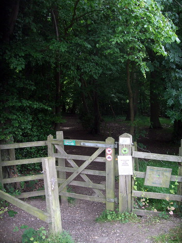
Broxbourne Woods National Nature Reserve (NNR) is the second NNR we've encountered on the Countryway, following Chobham Common. It's an impressively large, irregularly shaped sprawl of woodland -- the NNR itself, which is also designated as a Site of Special Scientific Interest (SSSI), comprises 237ha in four separate patches, two owned by the county council and two by the Woodland Trust, but additional non-designated woodland, much of it also council owned, creates continuous tree cover over a much wider area. There's been some modern conifer planting, but there are deliciously extensive swathes of rich broadleaf woodland, with many old and often coppiced trees -- the reserve's signature tree is the squat hornbeam, which doesn't grow much further north than this, but there are also sessile oaks. The rich wildlife includes bluebells and other flowers in spring, and the rare Purple Emperor butterfly. A good footpath network includes the newly waymarked 17.5km Broxbourne Woods NNR Trail, a circular route linking all the important sites.
The Countryway joins that trail briefly as it cuts off White Stubbs Lane into the calm of the Woodland Trust's Wormley Wood, the largest of the four NNR patches. This is indisputably ancient woodland in the definition given above, but some of it may well not have been continuously wooded since the ice receded -- recent archaeological research has found much evidence of Roman settlement off Ermine Street, which runs nearby, and back then the area was likely a patchwork of agricultural fields and small woodlands coppiced for timber and firewood. Sometime after the retreat of Rome agriculture was abandoned and the trees recolonised the fields, surviving farming and development pressures until the present day. The current use of coppicing in the woods is known to go back at least three centuries.
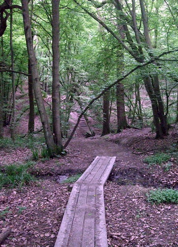
The path crosses three steeply cut streams that feed a minor Lea tributary, Wormleybury Brook -- on the steepest of these I trip and twist my ankle on the wooden steps. The voice recorder I use to take notes as I walk is switched on at the time -- I consider uploading the audio file at this point in the text but decide I'd rather keep this blog as suitable for family audiences. Our route is a shorter one than the NNR Trail, but you could stick to the latter if you wanted to view the City of London coal post. The Chain Walk also continues on the NNR Trail, heading south for Goffs Oak and Crews Hill. The woodbanks where we cut off from the NNR Trail are thought to be the remains of a Bronze Age field system.
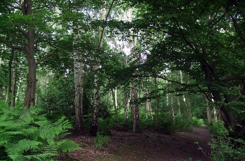
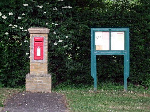
The two routes cross again at the southeast corner of Hertfordshire council's Bencroft Wood, also part of the NNR, but notably less dense and more dappled than Wormley Wood, with more spindly birch. Our route follows the wood's southern edge, here briefly picking up yet another section of the wandering Hertfordshire Way, part of an additional loop of that trail between Cuffley and Hertford via the Lea Valley. The Countryway soon leaves the NNR and the Hertfordshrie Way to cut across a field to the hamlet of Wormley West End, with its appropriately named pub, The Woodman. A post box and a village notice board form a catching composition along the lane, while the pub advertises a Country and Western evening, the sort of thing that might have caught the eye of film maker Patrick Keiller. Given the most common associations of the phrase "West End", the place is almost comically isolated, and yet, as the coal post testifies, it's well within the capital's shadow.
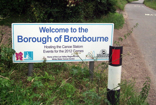
We leave the West End eastwards along its only lane -- the first path heading north looks useful on the map at first glance but is actually a dead end, and, thoughtfully, labelled as such on the ground with some additional wording on its waymark. A sign then welcomes us into another Hertfordshire district, the Borough of Broxbourne, "hosting the canoe slalom events for the 2012 Games." Note the conspicuous absence of the word "Olympic", which is jealously protected by the International Olympic Committee. I'll say more about the Games on future walks -- the next section of the Countryway passes right by the venue for the canoe events referred to on the sign.
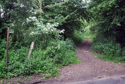
The hedged-in byway that does take us north is more significant than it looks -- as a sign attests, it's part of the historic route of Ermine Street, the Roman road from London to Lincoln and York, and one of the earliest of the northbound trunk routes we've encountered on the journey so far. The original Latin name for the route isn't known -- the current name is Saxon and refers to a tribe, the Earningas, whose home territory was around Royston. Some sections of Ermine Street, which starts out from the City along Bishopsgate, continue in use as trunk roads the A10 and A1, but here the mediaeval Old North Road gravitated away from the Roman alignment onto a lower route along the Lea Valley, as we shall see.
Ermine Street will lead you out onto White Stubbs Lane again not far from Paradise Wildlife Park, formerly the notorious Broxbourne Zoo which was once condemned as the worst zoo in Britain for the conditions under which its animals were kept, though since 1986 much improved under new owners. But the Countryway cuts off eastwards again at White Stubbs Farm through the hamlet of Carneles Green, wiggling along cinder trails in small fields overlooked by a very posh looking new red brick mansion. It reaches the fields above Baas Manor Farm, right on the lip of the Lee Valley with airy and distant views across to Essex on the other side. Along the way I pass a rather worn waymark for a Broxbourne council circular walk, which although non-standard cleverly incorporates the black pointed stripes of a badger's face, echoing the borough logo -- the name, of course, means "badger's stream".
From here we descend to the informal open space of Baas Hill Common with its woods and grassland, nowa popular local picnic spot. It was one of a number of parcels of land from the former Broxbournebury estate which were dedicated for public use under an 1890 Act of Parliament, presumably after a local struggle against overdevelopment, and since then has been managed by trustees, now in partnership with the council. I always used to assume the name was something to do with the Dutch word baas, 'boss', but it actually derives from the name of a 13th century Lord of the Manor, Henry de Baa.
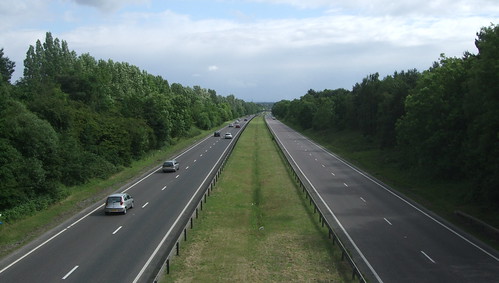
The route emerges onto White Stubbs Lane again just where it crosses the A10 on a road bridge. This sunken dual carriageway is the current successor to the Old North Road. When the principle route from London to the northeast shifted westwards through Hatfield a few centuries back, as described at Bell Bar above, the old alignment through the Lee Valley, paralleling and sometimes following the southern stretch of Ermine Street, remained in use as a through route, but with its main destination deflected to Cambridge and on through the Fens to Kings Lynn. When the trunk route system was introduced in the 1920s, this route was designated A10, and in the next decade a lengthy section south of here, between Tottenham and Turnford, was deflected slightly westwards onto a new dual carriageway named the Great Cambridge Road. In the late 1970s this bypass was extended to north of Ware via the road that's now beneath our feet -- this section is sometimes also referrred to by the 1930s name.
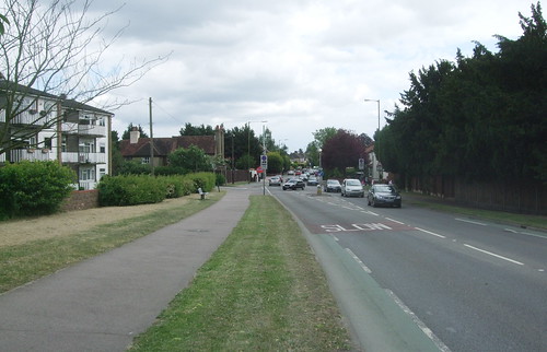
The A10 neatly marks the edge of town and country here, and on the other side, we're in London, if London is defined as the area of continuous urban development centred on the City and Westminster. The housing here is part of a long finger of built up area that reaches up the west side of the valley from Enfield as far as Hoddesdon, where a sliver of countryside separates it from Hertford and Ware. It's a textbook example of the phenomenon of ribbon development along a line of communication -- in this case the Lee and the roads and railways that parallel it -- which so offends the champions of good town planning. Indeed it was one of the examples used to spur the introduction of stronger planning laws in the postwar period that have since constrained the capital's growth. It's also the only stretch of continuous London sprawl on the Countryway, though in a close-run contest: the open country that separates West Byfleet and Kings Langley from London is painfully thin.
Officially, London stops at the edge of Enfield, just south of Waltham Cross, where the boundary roughly follows the M25. North of there is the Hertfordshire borough of Broxbourne. But, as hinted by the presence of a coal post in Wormley Wood, earlier attempts to draw the limits of London's administrative power have reached out further, and the remnants of historic boundaries persisted round here until the creation of the Greater London Authority in 2000.
At the beginning of the 19th century, England still had a post-feudal system of local administration evolved to suit the needs of a mainly rural country dotted with market towns and cathedral cities. The land was divided into counties based on feudal ownership and old tribal boundaries, but without the general administrative powers counties have today. The historic urban settlements were largely self-governing boroughs and cities, surrounded by but largely independent from the counties. Public life and work in the countryside was largely down to the Lord of the Manor or the church-based parishes and parish vestries.
London, meanwhile, was already a couple of centuries into its characteristic pattern of infill and ribbon development, spilling from the square mile of the City, already the economic hub, across the bridge and along both sides of the Thames and decisively filling the gap with Westminster, the royal and administrative capital. On John Rocque's famous map of 1745 the sprawl reaches to Rotherhithe, Walworth, Nine Elms, Chelsea, Marylebone, Sadlers Wells, Mile End and Shadwell, with tendrils already extending off the map along main roads such as Knightsbridge (A4), Upper Street (A1), Kingsland Road (A10) and Mile End Road (A11). By the early 19th century it had overtaken Paris to become the biggest city in the world, but though functioning de facto as a single metropolis, still lacked a single coordinated authority. The Cities of London and Westminster and the Borough of Southwark (the last two then considerably smaller than the modern local authorities of the same name), retained their traditional self-governing status.
The rest fell within the counties of Middlesex, Surrey and Kent, where public services remained the responsibility of parish vestries, now struggling from the increasing burdens placed upon them not only by their inhabitants but by increasing obligations under government social legislation such as the Poor Laws.
Other than the national government at Westminster, the only institution powerful enough to flex its municipal muscles across the whole urban area was the City of London. The City Corporation had long held some powers outside its own boundaries, for example controlling the Port of London along the length of the river from its upper tidal limit, for centuries at Staines but moved to Teddington when the lock at the latter opened in 1811, to a point way out in the estuary that was once reached to the mouth of the Medway but was fixed in 1851 at Gravesend. The City was interested in creating flourishing conditions for trade and industry; the government was more concerned with law and order. It's significant, given the building social pressures of London's growth and the emergence of dense areas of urban poverty, that the government got there first with a classic social containment measure: the creation of Robert Peel's Metropolitan Police as a professional, state organised police force for the capital in 1829.
The Met were initally empowered to police an area roughly corresponding to a 7-mile/11km radius from Charing Cross, but only a decade later this was extended to 15 miles/24km. The actual boundary itself was an irregular one, largely following parish boundaries, and was tweaked several times, but it already extended out to Erith, Orpington, Epsom, Staines and Bushey, and included Cheshunt. In 1974 it was extended to the whole of Broxbourne. But in the matter of policing, the historic rivalry between the City and the Palace of Westminster went the former's way: even today, the Met's powers don't extend to the city, which has its own City of London Police, founded in 1839.
In 1845 the City got its own opportunity to draw a line round London using its rights of taxation, which dated back to mediaeval times. Historically, important bulk commodities like coal had been delivered mainly by boat, with very few practical landing points, making shipments relatively easy to control and tax. But with the development of alternative modes of transport, the possible entry points multiplied enormously. An 1845 Act gave the City Corporation the power to tax coal entering within a radius of 20 miles/32km as the crow flies of the Post Office headquarters at St Martins Le Grand. This is an extensive area stretching to Northfleet near Gravesend, Redhill, Staines, Slough, St Albans and Brentwood, in places not far off the line transcribed by the Countryway. The Corporation set about demarcating this territory by erecting marker posts -- the now familiar coal posts -- where roads, railways and canals crossed its boundary. The exact definition of the boundary proved controversial, with the City sometimes accused of exceeding its powers, and in 1861 Parliament got the last laugh when the line was redrawn to match the notably smaller but better defined Metropolitan Police District. The coal posts were moved correspondingly and new ones installed -- a total of around 280, of which 210 survive, not all in their original locations.
Back at Westminster, the need for some more unified and rational public approach to managing London was becoming increasingly apparent, and especially the need for an infrastructure appropriate to this step change in the scale of urbanism. While the City was happy to collect taxes far out into the shires, it resisted all moves to expand the traditional boundaries in which it provided general public services. In 1835 local government reforms saw all other major towns and cities in England and Wales becoming municipal boroughs with elected councils, but attempts to extend this to London were resisted by the wealthy inhabitants of Westminster and Marylebone, no doubt fearing the swamping of their interests by those less fortunate than themselves.
The true forerunner of modern local government in London finally arrived in 1855, with the creation of the Metropolitan Board of Works, an appointed rather than elected body with powers limited to infrastructure projects such as roads and sewers. In the latter case it came too late to save London from the Great Stink of 1858 when a combination of warm weather and the concentration of untreated sewage in the Thames made life in central London near unbearable. The sewage system and some of the landmark structures that contained it, including the Victoria and Albert Embankments, were ultimately one of the MBW's greatest achievements and we'll encounter plenty of evidence of them later in London underfoot.
The boundary chosen for the MBW had a curious origin -- it encompassed the area defined on a parish basis as the 'Metropolis' by the General Registrar's Office for birth and death statistics, which had been collected regularly in London since an outbreak of plague in 1602, under a system originally known as the Bills of Mortality. It had a rather irregular shape, stretching on the south bank beyond Woolwich to modern-day Thamesmead, and encompassing Sydenham, Tooting, Putney, Hammersmith, Maida Vale, Hampstead, Finsbury Park and Stoke Newington before following the Lee downstream to the Thames again at Blackwall. It just about enclosed the urban area as it was at the time, but London was already starting to grow beyond it -- 1855 also saw the opening of the first phase of the Royal Docks on Plaistow Levels east of the Lee.
As the MBW was being created, an entirely independent but ultimately highly pervasive definition of London was being devised right at the hub of the City's original Coal Tax area at Martins Le Grand. The Royal Mail was one of many agencies struggling with London's lack of clearly defined boundaries and its ever-growing web of streets, not all of them uniquely named. In 1856 the Postmaster General first introduced the London Postal District, originally an area of 12 miles/19km radius from St Martins split into ten divisions lettered after the initials of compass points and 'C' for Central. A decade later, the District boundary was revised into a more defined but irregular shape, the original NE division was merged with E and the S division split between SE and SW to give the still familiar eight London postal districts of E, EC, N, NW, SE, SW, W and WC. In 1917 these were further split into numbered sectors, creating the now common verbal currency of WC1, E17, NW3 and the rest. Familiarity with these is one of the things marking out the true Londoner, but I doubt the people who drew them up ever considered that young men might be beaten up, stabbed or shot for living in the wrong one.
This system allowed much more spreading room for London, stretching considerably beyond the MBW area to Norwood, Wimbledon, Barnes, Ealing, Southgate, Chingford, Walthamstow and East Ham. But although it made things easier for posties, its lack of correspondence to municipal boundaries ultimately had the effect of confusing the public even further about where London started and ended, as we shall see.
The MBW survived until 1889 when, dogged by corruption scandals and challenged by the glaringly obvious need for a more general purpose muncipal body, it was replaced by the first London-wide elected body, the London County Council, the biggest such authority of its day, with housing, planning, education and the tram network added to the remit it inherited from its predecessor. Despite the fact that the urban area had grown considerably further in the intervening decades, the LCC inherited the MBW boundary, with significant chunks of the counties of Middlesex and Surrey, and a smaller chunk of Kent, now completely transferred to LCC control. However the full introduction of an elected two tier system of local government, largely complete throughout Britain by the end of the 19th century, came late to London. The patchwork of parish vestries and local boards responsible for delivering many routine public services persisted until 1900, when they were replaced by 28 Metropolitan Boroughs. The City still held out successfully for its own privileges, remaining largely immune from the imposition of authority from the LCC's new County Hall on the south bank just downstream of Westminster Bridge, though inevitably having to work with the LCC in practice.
But continuous urban development had already spread well beyond the LCC's territory, shaped by nothing more than the convenience and maximum profit of private developers, and the council had neither the teeth nor the will to check it. The term 'Greater London', to designate the effective extent of the metropolis in terms of continuous urban growth and internal communication, came into common use. By the beginning of the new century this Greater London had a population of 6.5million, only a million less than today, extending not only further into Middlesex, Surrey and Kent but into Essex and Hertfordshire. By 1914 it was reaching out tendrils towards Croydon, Kingston, Hounslow, Enfield and Romford, and threatening Buckinghamshire and Bedfordshire. The Lee Valley was for long the most outstanding example of ribbon development: look at maps of the growth of the builtup area over the 19th and early 20th century and in all of them you can see that spike sticking straight up from the northeast like a broken finger from the capital's fist. And with the rapid development of good, fast transport that enabled commuting and the free movement of goods, the metropolis exerted its influence on a hinterland that now extended far beyond its own brick and tarmac.
The need to coordinate and integrate that transport network, originally developed by private and local initiative, now threw up yet another view of the capital's reach. In 1933, the Underground, trams and buses, but not the main line railways, were placed under the control of a publicly appointed body, the London Passenger Transport Board, the first of several such bodies that operated under the more familiar name London Transport, normally written in the distinctive Johnston typeface in the bar of the familiar roundel logo. The board had powers in an area roughly 30 miles/48km from Charing Cross. Stretched like a rough oval on its north-south axis, it reached far beyond not only the County of London but the much bigger Met Police District. LT had a monopoly of services from almost as far north as Buntingford to almost as far south as Horley, in an area that included Gravesend, Sevenoaks, Guildford, Slough, Amersham, Harpenden, Harlow and Brentwood, and was empowered to run services beyond this area to Horsham, Tring and Bishops Stortford, and along spurs to places as far out as Maidenhead, West Wycombe, Aylesbury, Royston and Tunbridge Wells. The outer section of this, from places like Dartford, Chelsham, Slough, Watford and Epping outwards, was operated from the post-war period as London Transport's "Country Area", with green-liveried vehicles rather than the familiar urban red.
By this time the growth of London was becoming a popular concern. The newly minted conservationist and countryside movements bemoaned its blight on the surrounding landscape. Reformers, social campaigners and conscience-stricken medical professionals drew attention to the apalling environments of its dense inner districts and their impact on public health, the quality of life and social cohesion. Between the wars development had spurted again, but the state was beginning the struggle to control it: the earliest Green Belt legislation dates from 1938. In the world of planning as in so many areas of life, World War II changed everything, first interrupting all existing trends and, as peace approached, offering the opportunity to start again.
Patrick Abercrombie's aspirational Greater London Plan of 1944, a characteristic document of its time, considers the current structure of London as a series of concentric rings. In the centre is the London County Council area, by then unchanged for almost a century. Around is a rather fragmented "inner urban ring" of development as dense as the LCC zone, filling out Stratford, East and West Ham and the Royal Docks and Tottenham, reaching out to Willesden, Southall and Mitcham and with an exclave around Croydon. Next comes a "suburban ring", the rim of which attempts to pick its way alongside the inner edges significant remaining areas of open space like the sliver of farmland between Chadwell Heath and Romford or the Yeading Valley between Northolt and Hillingdon. These areas are included in the next ring, the Green Belt ring, which includes some substantial towns in their own right such as Dartford, Sevenoaks, Redhill, Watford and Romford and almost washes to Woking, Windsor, St Albans, Hertford and Brentwood.
Beyond this Abercrombie considers an "Outer Country" ring that falls within London's shadow, incorporating the rest of Hertfordshire and Surrey; Windsor in Berkshire; Buckinghamshire out to Eton, High Wycombe and Amersham; Luton in Bedfordshire; Essex out to Epping, Ongar and Billericay and downriver to Thames Haven; and Gravesend in Kent. Within this extensive region Abercrombie imagines a rational and planned metropolis with populations redistibuted from dense and unhealthy inner areas to greener suburbs interspersed with countryside, knitted together with a coherent transport network, even including a web of trunk footpaths drawn up by the Ramblers, of which more in a later piece.
While Abercrombie's blueprint was almost entirely abandoned due to lack of resources and political vision, London did stop growing, and the urban edge today is largely as it was when prime minister Neville Chamberlain made his fateful broadcast announcing war with Germany in 1939. But London's local government remained locked within a long outgrown boundary for several more decades. Not for the last time, a decision to tinker with London boundaries was driven by party politics. The Conservative governments of the 1950s were irritated that the solidly urban complexion of the LCC's territory appeared to guarantee a perpetual Labour majority, which might be broken if the more middle class suburbs were brought in. For some of the inhabitants of those suburbs, the opportunity to bolster the vote of metropolitan Tories paled under the imagined threat of subsidising the great unwashed of Lambeth and Stepney with hiked-up rates, and they fought hard to resist it.
The political horse trading with the representatives of concerned ratepayers and agressively sentimental advocates of historical boundaries explains why the Greater London that emerged in 1964 has such a peculiar boundary. The original proposals had included most of the continuous builtup area but chopped off a few ribbon extremities, including Broxbourne. Others that really ought to have been in, like Sunbury, Staines and Potters Bar, successfully campaigned to stay out. Dartford, Caterham, Ewell, Weybridge and Watford were excluded for other reasons, while significant swathes of genuine countryside south of Bromley and north and east of Upminster were in. Middlesex was wiped entirely from the map as an adminstrative entity, with a few remaining oddments handed to neighbouring counties. Hertfordshire got Fortress Potters Bar but lost territory elsewhere to London for the first time. Sunbury and Staines, despite being on the north bank for the Thames, went to Surrey, a county previously wholly south of the river. But Surrey lost much more ground to London, including even its administrative centre of Kingston -- the anomaly of Surrey County Council being based outside its own territory persists to today. London also took a major bite out of Essex for the first time, and a further bite out of Kent.
Within Greater London a new patchwork of internal boroughs was created, with much amalgamation in the old LCC boroughs, to create 32 new ones, with the City doggedly remaining a special case. The boroughs' responsibilities were upgraded while the new Greater London Council was a more strategic body. But the distinction between the old Inner London boroughs and the new Outer London ones persisted in terms of differing responsibilities. Most notably, a new body, the Inner London Education Authority, took over the education responsibilities of the LCC independenty of the GLC, while the Outer London boroughs had to establish their own educational provision.
There have been two major changes since. The GLC in turn became too dominated by Labour politicians for Tory tastes and Margaret Thatcher's Conservative government abolished it in 1986, its functions taken over by the boroughs and various quangos -- for a while London was only defined on the map as a single place by not being part of the counties around it. ILEA went shortly afterwards, and now all the boroughs do their own education. In 1999 Tony Blair's Labour government restored a unified authority to London but in a unique form, and with broad strategic responsibilities, with an elected London Assembly and directly elected Mayor. The official boundary of London has remained unaffected, as have the borough boundaries, though the City has been better integrated into the system than it was before. Yet there are still minor statutory differences between the Inner and Outer London boroughs: of particular interest to walkers is that the former are the only remaining authorities in England with no duty to produce definitive maps of off-road footpaths. Apart from the odd tweak here and there, the old plague monitoring line can still be traced around the Inner London boroughs on the official map.
For all its problems, the 1964 boundary has proved remarkably resilient and some of the other lines around London have since been adjusted to correspond to it. In 1970 the GLC was given control of the core of London Transport -- the Underground and the 'London' bus operations. The 'Country' buses became London Country, a new subsidiary of the publically-owned National Bus Company. The division between red and green buses already corresponded remarkably closely to the GLC boundary, but it's rarely operationally convenient simply to stop transport services at boundaries so numerous cross-boundary arrangements with surrounding counties have operated since. This is notably the case with the Underground: the Metropolitan Line extends far out to Amersham and Chesham, the legacy of its private predecessor's main line ambitions as discussed at Great Missenden a few sections back. The Central Line spills into the Epping Forest district of Essex, as we'll discover in the next section.
In 1981 LT's area of operation took on a very public face on the introduction of the zonal fare system with its bus passes and Travelcards. The outer boundary of the system corresponded fairly closely to the GLC boundary with the odd tweak to accommodate a stray bus stop, but tube travel on the entire Central Line including the Essex bits was included. The outer reaches of the Met line had special fares: they've long been treated as extra mini-zones. The GLC 'Fares Fair' policy launched with the zones placed transport at the heart of London's politics, making a household name of then-GLC leader Ken Livingstone, and it's remained there since. LT was removed from political control post-GLC and forced to privatise its bus operations (though mercifully permitted to continue regulating them), but is now, as Transport for London (TfL), an agency of the Mayor, with much enhanced responsibilities, including strategic development of walking and cycling and a long-coveted role in National Rail. The Met's mini-zones have since extended with the incorporation of Watford into the London Overground network of former National Rail local lines.
The 1964 boundary still didn't quite fill the Metropolitan Police District, except in Romford and Hornchurch, now in Greater London but previously not in the MPD, which was extended to incoporate them. The anomaly of the Met policing areas outside Greater London persisted so long as the Met continued to be unique among police forces in Britain in directly answering only to the UK Home Secretary with no local authority involvement. This changed in 2000 with the creation of the Metropolitan Police Authority, part of the Greater London Authority, chaired by the Mayor and appointed partly from London Assembly members, at which point the MPD was brought into line with the GLA boundary and its former territories outside London transferred to the relevant county police forces. The City, of course, continues to have its own force.
The Royal Mail, meanwhile, persisted in confusing us all. The current two-part postcode system, capable of pinpointing a delivery point to a short stretch of street or even a single building, was launched nationally in 1967 and completed in 1974, but rather than adapt it to match the newly enlarged Greater London, the Royal Mail clung to its exising London postal district, incorporating all the old codes as the first "words" of the new system. In the areas of Greater London outside the district new "post towns" were created with no reference to the London boundary. The Enfield EN code, for example, extends to Broxbourne, while many parts of the London Borough of Bexley have a DA code for the Kent town of Dartford. To make matters worse, the Royal Mail insisted quite unnecessarily that "correct postal addresses" for post towns considered to be outside big cities included a county name. In the case of Greater London outside the London postal district, the old county names were to be retained, including the now-abolished Middlesex.
During the 1990s when several further county councils were abolished in the process of creating unitary authorities outside big cities, the Royal Mail finally admitted that there was no need for a county name so long as a full postcode was included in an address. But old habits die hard, and there are still many inhabitants of Outer London boroughs with one part of their brain that believes they live in Essex, Hertfordshire, Kent, Middlesex or Surrey no matter what it says on their council tax bill. Contrast this to a more rational country like France, where postcodes match administrative communes and even car registration plates follow a nationally recognised local authority numbering system.
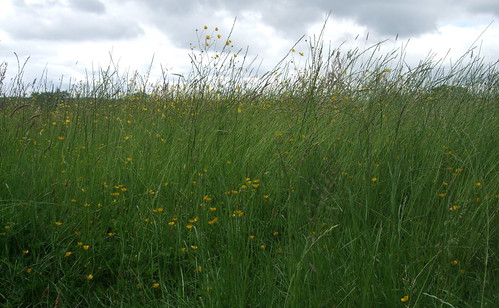
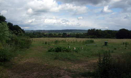
And so back to Broxbourne, no longer perhaps as much a part of London as it once was now it's lost its London buses and London coppers, but still a place in which the capital very much shapes everyday life. On the other side of the A10 there's yet another encounter with the Hertfordshire Way, heading down into the valley after its own exploration of Broxbourne Woods. Soon the route temporarily dodges back into green again, another improvement since Chesterton wrote his guidebook. Top Field and Cozens Grove Local Nature Reserve (LNR), dedicated in 2005, is a wildflower meadow sweeping down to a small strip of ancient hornbeam woodland, and where we enter at its highest point there's a spectacular view towards the valley. In 2009 it won a Green Pennant award, the equivalent of a Green Flag for community managed open spaces. A plaque records that on 5 December 2009, local people planted over 200 trees in one hour here. The earth bank you follow in the woodland is thought to be the remains of an old drove road.
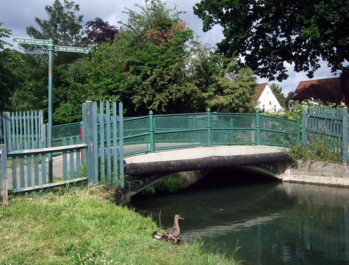
Emerging from the wood, the route joins the New River Path, and shortly afterwards crosses the New River itself. There will be lots more to say about the New River and its rather dreamlike environs, with their odd little buildings and green railings, when we explore the path that follows it on a future London underfoot walk. But I can't resist saying what all tour and walk leaders and guidebook writers love saying about the New River -- that's it's neither new nor a river, but an artificial watercourse opened in 1613 to bring drinking water from springs near Hertford to London. Between Hertford and Stoke Newington the watercourse remains in use as part of London's water supply system. Beyond this it's been abandoned, though most of the its course survives as a green strip and the occasional water feature. The 45km New River Path, developed in stages from the 1990s, follows the full original length, often using waterside maintenance paths and a southern "heritage section" on streets and park paths, to the original New River Head at Thames Water's headquarters at Sadlers Wells near Islington. Here it gives another link to the London Loop at Hilly Fields Park, Enfield.
The route turns north along High Road Broxbourne, the route of the mediaeval Old North Road or Cambridge Road, until the late 1970s the A10 trunk road between London, Ware and Cambridge but now a relatively busy local road numbered A1170. Broxbourne may now give its name to the whole district but it was once a relatively small settlement along the main road and has largely been lost in the sprawl, without a single, clear focus. The Norman manor belonged to the Knights Hospitallers and was sold to a man named John Cock after the Dissolution -- his name survives in local street names.
This stretch of the road runs through he New River Conservation Area, which boasts a number of noteworthy old buildings -- a short heritage trail is downloadable from the council website. On the left we pass the 16th century Yew Tree Cottage at number 172, and next door but on at number 168, the 17th century Bridge House. Both are timber framed buildings that are now Grade II listed. The latter stands immediately beside the bridge taking the High Road over the New River, dating from the 1840s though subsequently strengthened.
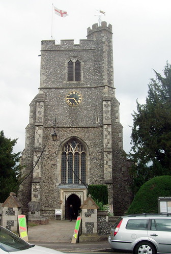
At the bridge the Countryway picks up the waterside path along the New River itself, through pleasant playing fields lined with rows of mature trees, now in the Broxbourne Conservation Area. There's a curious benchmark alongside the path reading "ft ins" with no indication of the actual measurement -- I'd guess this is a 1950s vintage Ordnance Survey mark. The most prominent feature is St Augustine's Church, probably the oldest building in Broxbourne, with its chunky three stage tower: this mainly dates from the 15th century though there is a 12th century marble font from an earlier church inside. This section of the Countryway ends on the edge of the playing fields, where the New River goes under Station Road, just before this road crosses two bridges over the railway to Nazeing in Essex.
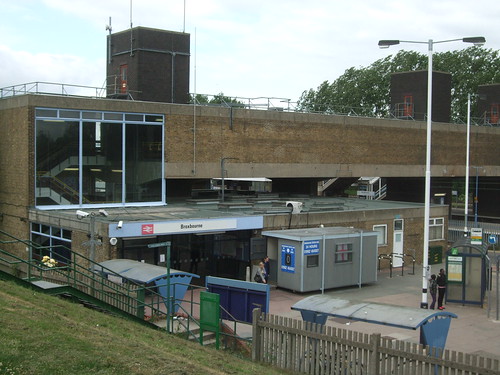
Broxbourne station is only a little further along the New River Path, or the step-free approach road. The original station here dates from 1840 when the Northern and Eastern Railway opened the first stage of a line along the Lee and Stort Valleys from Stratford, on the Eastern Counties Railway line from Bishopsgate, to Bishops Stortford and on to Cambridge. For over a year Broxbourne was the northern terminus until the line was extended, with a branch continuing along the Lee towards Hertford opened in 1843. In 1862 the NER and ECR were united into the Great Eastern Railway, and a decade later the GER opened a connection from its Lee Valley lines via Hackney Downs and Bethnal Green to its City terminal at Liverpool Street. As the lines split both to the north and south of Broxbourne, the station as an interchange between services, and though most trains now serve Liverpool Street, a regular service to the original terminus at Stratford has been running again in recent years. This group of lines is often known by the rather clumsy name "West Anglia" to distinguish them from the "East Anglia" lines continuing east and northeast from Liverpool Street and Stratford t0 Colchester, Ipswich and Norwich, but all these services are now operated by National Express East Anglia.
The station was rebuilt on the present site, a little back from Station Road, in 1959-1960, in the clean, rectangular modernist architecture of the time, and is one of the few post-war stations to earn a listing for its distinctiveness. I've long memories of the waiting room, conveniently placed for spotting connections on the bridge above the platforms, though the murals have changed, with beat age abstracts replaced by colourful depictions of train travel around the world.
At the end of this section the Hertfordshire Way follows the New River Path northwards towards Rye House, then on along the Lea Valley Path to Hertford -- finally the last we'll see of this complex trail. We're now literally a few metres from the Hertfordshire/Essex boundary, the valley floor and the river Lee itself, and the extraordinary Lee Valley Regional Park, all of which and more we'll be exploring in the next section.
View London Countryway in a larger map
Download a route description (PDF)
More information
- Hertfordshire County Council http://www.hertsdirect.org
- Hertfordshire Tourist Information http://www.hertsdirect.org/com/directory/comvol/infoad2y/intour3y/
- Hertfordshire countryside and rights of way http://www.hertsdirect.org/envroads/environment/countryside/
- lovetomove lovetowalk - getting Herts moving http://www.lovetomove.org.uk/love-to-move/love-to-walk
- Walking in Herts http://www.walkinginherts.co.uk/
- Friends of the Hertfordshire Way http://www.fhw.org.uk/
- Welwyn Hatfield Council http://www.welhat.gov.uk
- Welwyn Hatfield Cycling and Walking http://www.welhat.gov.uk/index.aspx?articleid=331
- Welwyn Hatfield Landscapes and Countryside http://www.welhat.gov.uk/index.aspx?articleid=1025
- Welwyn Hatfield Tourism and Travel http://www.welhat.gov.uk/index.aspx?articleid=320
- North Mymms Parish Council http://www.northmymmspc.org.uk/
- Watling Chase Community Forest http://www.hertslink.org/cms/getactive/placestovisit/watlingchase
- Welham Green http://www.welhamgreen.com
- East Coast main line (Wikipedia) http://en.wikipedia.org/wiki/East_Coast_Main_Line
- A1000 (Wikipedia) http://en.wikipedia.org/wiki/A1000_road
- Brookmans Park http://www.brookmans.com
- Brookmans Park transmitting station (Wikipedia) http://en.wikipedia.org/wiki/Brookmans_Park_Transmitter
- Hatfield Town Council http://www.hatfield-herts.gov.uk/
- Hertfordshire Chain Walk (LDWA) http://www.ldwa.org.uk/ldp/members/show_path.php?path_id=208
- East Herts Footpath Society (Herts Direct) http://www.hertsdirect.org/comdirectory/comvol/sport2y/spoutb3y/spwalk4y/545371
- St Marys Church Ponsbourne (Hartford Hundred West) http://hartfordhundred.org.uk/ponsb.php
- Ponsbourne Park http://www.ponsbourne-park-hertford.co.uk/
- East Herts Council http://www.eastherts.gov.uk
- East Herts Walking http://www.eastherts.gov.uk/index.jsp?articleid=9768
- East Herts Parks, Open Spaces and Countryside Access http://www.eastherts.gov.uk/index.jsp?articleid=10072
- East Herts Tourism http://www.eastherts.gov.uk/index.jsp?articleid=9495
- Bayford Parish Council http://www.begesford.co.uk
- Hertford Loop Line (Wikipedia) http://en.wikipedia.org/wiki/Hertford_Loop_Line
- Brickendon Liberty Parish Council (including footpath map) http://www.brickendon-liberty.org.uk
- Paradise Wildlife Park http://www.pwpark.com/
- Broxbourne Woods NNR (Natural England) http://www.naturalengland.org.uk/ourwork/conservation/designatedareas/nnr/1005000.aspx
- Broxbourne Woods NNR (Hertsdirect, including walkers' map) http://www.hertsdirect.org/envroads/environment/countryside/placestovisit/13060152/
- Wormley Wood & Nut Wood (Woodland Trust) http://www.woodlandtrust.org.uk/en/our-woods/Pages/wood-details.aspx?wood=4067
- Borough of Broxbourne http://www.broxbourne.gov.uk
- Borough of Broxbourne Walks http://www.broxbourne.gov.uk/leisure_and_culture/walks.aspx
- Borough of Broxbourne Parks http://www.broxbourne.gov.uk/leisure_and_culture/parks.aspx
- Borough of Broxbourne Visit Broxbourne http://www.broxbourne.gov.uk/community_and_living/visit_broxbourne.aspx
- Ermine Street (Wikipedia) http://en.wikipedia.org/wiki/Ermine_Street
- Baas Hill Common, Wormley Top Field and Cozens Grove See Broxbourne parks under Smaller parks
- A10 (Wikipedia) http://en.wikipedia.org/wiki/A10_road_%28England%29
- New River (Wikipedia) http://en.wikipedia.org/wiki/New_River_%28England%29
- New River Action Group http://www.newriver.org.uk
- New River Path (LDWA) http://www.ldwa.org.uk/ldp/members/show_path.php?path_name=New+River+Path
- New River Conservation Area (Borough of Broxbourne) http://www.broxbourne.gov.uk/PDF/PP%20-%20NewRiverConservation-Leaflet.pdf
- St Augustine's Church Broxbourne http://www.broxbournewithwormley.org.uk/
- Lee Valley Park http://www.leevalleypark.org.uk/
- Lee Valley Park walks: Ware to Waltham Abbey http://www.leevalleypark.org.uk/en/content/cms/leisure/40_routes/ware_to_waltham_abbe/ware_to_waltham_abbe.aspx
- Lea Valley Walk http://www.leavalleywalk.org.uk/
- West Anglia Main Line (Wikipedia) http://en.wikipedia.org/wiki/West_Anglia_Main_Line


