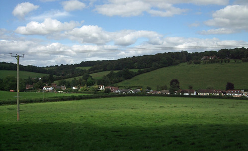
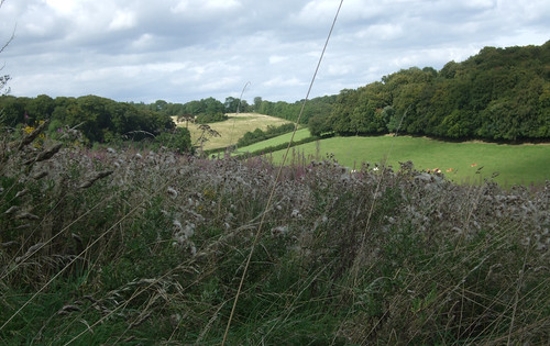
On this section and the next, the London Countryway continues through the Chilterns in almost entirely rural and remarkably quiet surroundings. This is where the roller coaster really gets into its stride with ups and downs over minor chalk ridges, your leg musles testifying to the route's alignment against the geological grain as it wanders through a succession of field edges, beech woods and ridgetop hamlets. It's amazing that such a contrasting environment exists within such easy reach of the big city, and that fewer people don't explore it -- I passed a few dog walkers and occasional strollers, but hardly anyone clutching an OS map, certainly in comparison to the Downs or the Surrey Heaths.
I opt to catch the bus from High Wycombe to the start of the section rather than retrace my steps, finding some pleasant streets and the Eden Centre, built over the river Wye and partly hidden under the A40. It's a brand new shopping mall and leisure complex, partly outdoor, partly indoor, that shows how much the design of these places has progressed, built on a big scale but still navigable, the routes through it self explanatory. The bus drops near the Pedestal Roundabout, so named because a classical-style white pedestal stands at the junction, presumably another Dashwood folly.
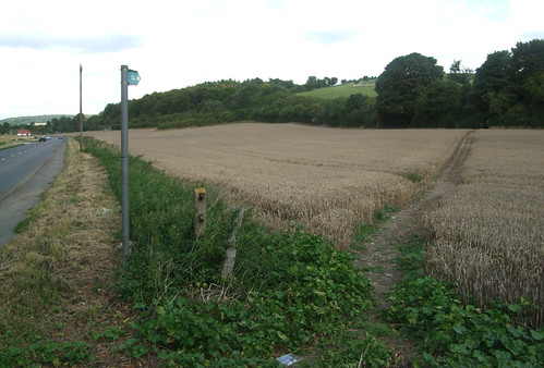
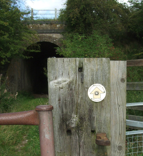
The path from the A4010 soon crosses under the railway through a well-weathered brick arch, then climbs slowly through fields, with fine views back towards Wycombe Hill. Eventually the church's distinctive palla d'oro disappears behind a ridge and the path approaches lonely wooden farm buildings grouped around a cinder courtyard. From here it picks up the drive to Cookshall Farm, but pretty soon the drive swerves left and the right of way leaves it to continue more-or-less ahead through trees. From the aerial photo it looks likely the straight alignment of the right of way is the original one, while the metalled farm track is a later diversion. The Countryway's creator and 1981-vintage guidebook writer Keith Chesterton suggests no-one will hassle you for using the farm track, and indeed a runner is using it as I approach, but the wood looks more inviting. At first the path is a broad green strip, with park-like woodland with silver birches and ferns on one side and a wilder beeches and oaks on the other, but it narrows to a woodland track before emerging into a field.
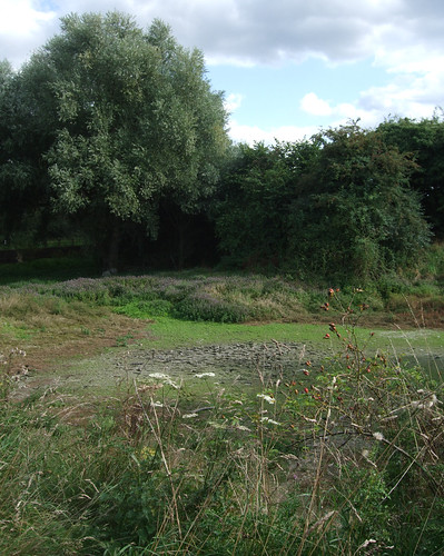
More woods ahead mark the first proper commons we've encountered since leaving Surrey, still part of the massive West Wycombe Estate but long managed as accessible public green space. There are in fact two adjacent commons, divided by a parish boundary. To the south is Downley Common, and the Countryway first reaches the northern extremity of this. The route then turns north through the short strip that links to Naphill Common, although the boundary is relatively recent, as Downley was once a "detached part" of Wycombe parish. Downley was once used for chalk and clay extraction, and during World War II was used as a testing ground for tanks made in High Wycombe. Naphill Common is bigger, the biggest in Buckinghamshire, but was once twice its present size, and less wooded, but the woodland flourished following the cessation of grazing after World War I and since 1951 it's been a Site of Special Scientific Interest precisely because of its longstanding lack of traditional grazing management.
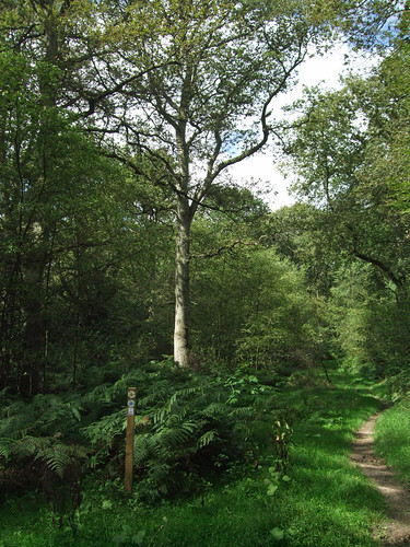
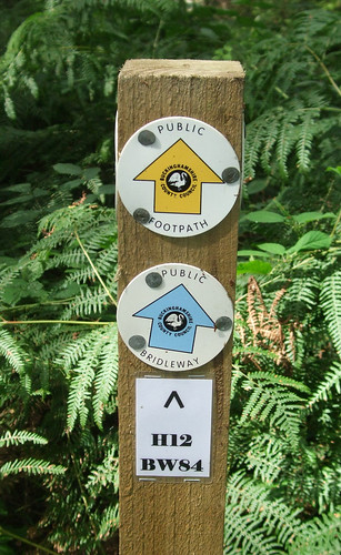
Both commons have active user groups -- the Downley Common Preservation Society and the Friends of Naphill Common. Both have been keen to facilitate walking on the commons -- Downley has a Millennium Trail, and the paths in both commons are very well waymarked, a blessing as it's easy to get lost given the dense woodland and the complex lattice of paths. The waymarking even includes the path numbers -- these are the numbers used on the "definitive map" of rights of way kept by the council, usually allocated on a parish-by-parish basis, and rarely appear on signs, but they're extremely useful here. For the most part our route is both a footpath, H12, and a bridleway, BW24, which through some quirk are recorded as separate rights of way although there's no obvious distinction on the ground.
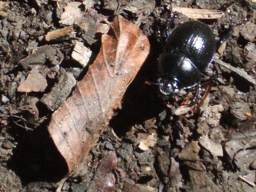
The woodland spreads out westwards and I'm soon deep among the oak and beech. The fine old trees are often wreathed by holly, there's an occasional flourish of juniper, and big black beetles -- now known in educational parlance as "minibeasts" -- scurry through the twigs and mulch on the path surface.
Eventually I arrive at the northwest corner of the common where a pleasing little collection of cottages looks out onto a green on the edge of the village of Naphill.
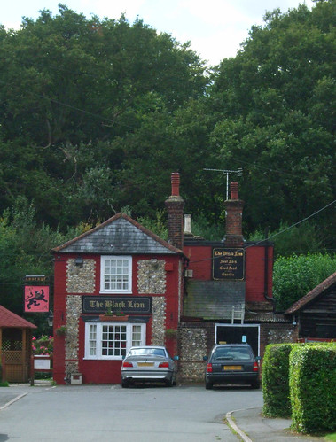
This is a sizeable village of the linear variety so common in these parts, strung out for some 1.5km along a road that is said to trace the boundary between the territories of two Celtic tribes. To the east were the Catuvellauni, who had their capital at St Albans, our destination in a few stages' time. To the west were the Atrebates, centred on Silchester -- both sites of course became important Roman settlements. The Atrebates' name could be cognate with Irish aitreibh, "building". The buildings here today are mainly of flint and brick -- the Black Lion pub, just set back from the main road, is a good example.
The village owes much of its business, and its good bus connection, to the proximity of RAF High Wycombe just up the road at Walters Ash. This isn't an airfield but a command centre, the headquarters of Air Command, the pinnacle of the Air Force's command pyramid. Aerial photos reveal a rectangular structure with three circles in a field on the east of the complex -- this is the nuclear bunker where, during the Cold War, a team of bureaucrats sat ready to sound the four minute warning.
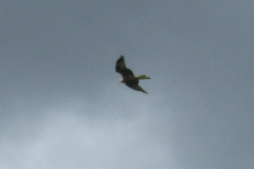
My mind turning to more cheerful matters, I head off northwest on a path well-used by locals that winds across meadows and fields towards a woodland, where I have my second wildlife moment of the day. I'm no birder, but even I notice the large birds dramatically swooping and calling with piping voices around the edge of the woods as I approach. These are red kites, and they represent one of the great conservation success stories of recent years. Once common birds of prey in Britain, they were added to the list of vermin in the 19th century and persecuted to near extinction, surviving only in small numbers in isolated Welsh valleys. From 1989 birds from Spain were reintroduced in the Chilterns, and they have flourished, with over 200 breeding pairs. They've since been reintroduced to several other sites in England and Scotland, sometimes using Chiltern-born chicks, including around Callander in Loch Lomond and the Trossachs National Park, another of my favourite places for walking. Yes, I'll stoop to a cliché -- 'magnificent birds'. They put a smile on my face, and I wonder if the birds I spot now have descendants north of the border. I certainly rather see red kites in the sky than Bomber Command.
The broad ridge that supports Naphill descends through North Dean Woods to the hamlet of Upper North Dean, where there are bus stops, but only for services that seem to run once on Tuesdays. This is one part of the country where the council have revived the use of traditional fingerpost road signs as more fitting to the local environment, as the result of a welcoming loosening of regulations at the Department for Transport.
The route then climbs again, up a hill and towards a wood, and along a surfaced track past the settlement known as Piggotts. This is the venue for the Music Camp founded by scientist Bernard Wheeler Robinson (1904-97) in 1927 near Hitchin, which moved here when it became Robinson's home in 1963. Twice a year, amateur musicians gather here for nine days of communal music making, including tackling ambitious works by the likes of Olivier Messiaen, as well popular composers like Sondheim. Piggots has even hosted its own Ring Cycle.
At the end of the track is Piggotts Hill House, set back at the end of a long drive, but I'm deterred from taking a photo by an angry dog that comes bounding down the drive towards me. There's no gate, and I'm dubious as to whether the invisible forcefield at the limits of its territory will hold the beast, so I hastily continue around the house wall and back into woods.
The path descends to another small hamlet, Bryants Bottom, and then steeply back onto a ridge surmounted by Denner Hill Farm, where some old barns have been converted into impressive homes. Then it's down again through a rough field with fantastic views to Hampden Road, which marks the district council boundary between Wycombe and Chiltern districts.
From here another path runs uphill through a field towards a wood, the delightfully named Nanfan Wood, then across to the equally oddly named Hangings Lane on the edge of the sizeable village of Prestwood. This, the sister village of Great Missenden, is an example of the more common fate of areas of common land following enclosure -- originally a common that formed part of the Mandeville estate, as in Stoke Mandeville, it was developed in Victorian times, taking advantage of its position on what was then a main road between London and Birmingham. In the local 1960s the former cherry orchards were developed as overspill housing in a government initiative.
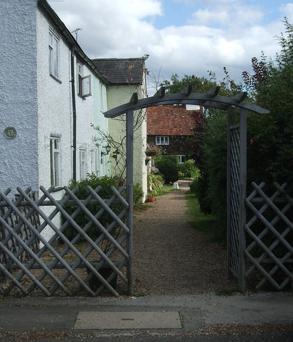
Rather uncharacteristically, the Countryway does some suburban wiggling through the village's residential streets, mainly I think as Chesterton is anxious to show us the Glebe, a pretty row of whitewashed cottages just off Kiln Lane. The gravel path that runs under a wooden archway just by these looks like a garden path, but is actually a right of way that leads into a road on the other side -- the residents entertain walkers further by keeping pretty patches of garden across the path from their homes.
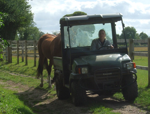
From Prestwood Farm the route heads out across fields, downhill again and through Rignall Wood. Behind me I hear the thrum of a vehicle which turns out to be a golf buggy affair, moving at a walking pace -- and towing a horse! An example of the world turned upside down, or yet another example of the curious modern phobia of physical activity?
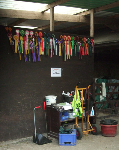
At Coney Cottage, just along from Rignall Farm, I spot a proud array of rosettes pineed on the wall of a stable. A sign warns the horses are microchipped -- presumably, like Spike in Buffy the Vampire Slayer, they can only act aggressively towards demons and vampires. I wish the same could be said of the local dogs.
Beyond this the fields flatten towards the railway to Aylesbury. Just before the tunnel under the railway, it's joined from the left by the South Buckinghamshire Way, one of a number of routes in the county originally proposed by Ramblers members but adopted by the county council. Northwest, the South Bucks Way fairly soon meets the Ridgeway National Trail near Coombe Hill, and ambitious walkers can link from there via the Ridgeway to the North Bucks Way, the first in a chain of paths that together make up the Midshires Way through middle England to Stockport, Greater Manchester, where there's a connection to the Pennine Bridleway. You could follow signed paths from here through the Pennines to Byrness and on along the Pennine Way across the Scottish border to Kirk Yetholm.
On the other side of the railway is Mobwell, where the path passes a dry hollow. During wet weather a spring bubbles up here to become the river Misbourne, the suffix "bourne" indicating a watercourse that only appears intermittently.
In fact the upper part of the river has in recent times been more dry than wet, thanks partly to dry weather, partly to water abstraction, with its course sometimes becoming obstructed, causing flooding when it does flow. It was dry between 2003 and 2007, causing much local excitement when it reappeared, but then disappeared again until early this year. The Chiltern Society are now campaigning to address the problems and properly restore the river's course. Downstream of Chalfont St Giles it's more consistently wet, and flows to join the river Colne at Denham, which in turn joins the Thames at Staines, so the waters that emerge here eventually graze the western edge of Greater London through the Colne Valley Regional Park.
Opposite the source is a substantial pub, the Black Horse, and the trail runs through its car park and on along strips of meadow beside the dry trench of the infant river. The Thames, too, looks like this on its very upper reaches near Kemble in Gloucestershire. Then you're walking between two rows of trees, with the roar of a busy road on your immediate left. This is the A413, an important link route between Gerrards Cross, Aylesbury and Banbury, the modern incarnation of that very old road that once linked London and Birmingham, and the subject of a song by cult singer-songwriter John Otway.
This section of the Countryway ends at a stile that takes you out onto the road, leaving the South Bucks Way, the next section continuing through fields opposite. But for the short link to Great Missenden station I keep ahead for a short distance on the South Bucks Way before cutting off on a convenient footpath towards the village centre. For the first time in a while there's the option of a convenient link to London -- the South Bucks Way continues down the Misbourne Valley to meet the Grand Union Canal towpath at Denham Lock, from where you can closely parallel and then join the London Loop.
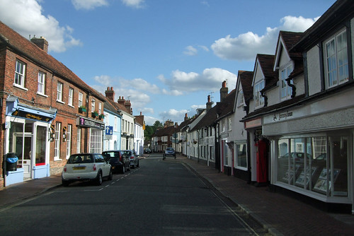
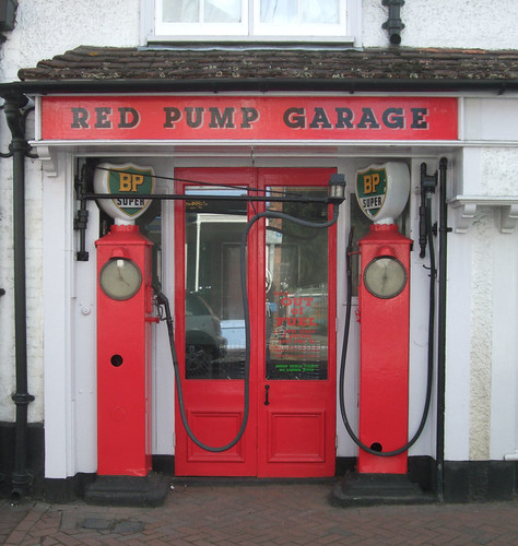
Great Missenden is a large village still very much linear in focus, once a coaching stop on the old road, though thankfully now bypassed. It's worth taking a wander down the High Street to look at the church and the former Missenden Abbey -- the street itself is lined with historic cottages. The Red Pump Garage caught my eye -- it's actually now an estate agent, but the old petrol pumps, the sort that required an attendant to operate, are still in place. A notice on the door says the garage has been out of fuel since eight gallons cost more than £1. That's about 3p a litre.
The village's biggest visitor attraction today is the Roald Dahl Museum and Story Centre, located here since author Dahl (1916-90) lived locally in later life, although he was born in Llandaff of Norwegian parents -- Plas Roald Dahl at Cardiff Bay commemorates his attendance at the Norwegian Church located there. He's internationally known for his dark children's morality tales, notably Charlie and the Chocolate Factory which has been filmed succesfully twice, but I'll forever associate him with the ITV anthology series Tales of the Unexpected. The early episodes of this were introduced by Dahl himself, his thin and gangling frame in classic storyteller pose in a leather armchair next to an open fire, sardonically name dropping titbits of his international jet set gambling lifestyle. Looking at this neat little Chiltern village high street in comparison to the New York literary salons and Monte Carlo casinos of these anecdotes, I'm even more convinced of their phoniness.
By the station, the route connects to the Chiltern Heritage Trail, further details of which have proved difficult to track down. It was a millennium project of Chiltern District Council consisting of a walker's route and three interlinked, mainly road-based, cycling routes. Guides to the cycling routes are downloadable online, but the walking route was promoted in a booklet with a cover price, stocks of which have now run out, even though the route is thoroughly signed. The council tell me they don't even have any reference copies left, and a promise to send me a photocopy of the route map was unfulfilled at the time of writing. Since the route was created they've abolished their tourism service and transferred the person responsbile to other duties. It's too frequently the case with walking projects that a certain capital sum is spent on putting something in place but without any provision for its sustainability, so something that should be delivering a legacy for decades is left to founder, in this case over only a handful of years.
As to the railway, it's what binds Great Missenden to Metroland, and its story is also part of the story of the modern transport network in London. The world's first "metro" or high density urban underground railway, the Metropolitan Railway, opened in 1863 as a cut-and-cover line along the northern edge of central London, from the Great Western main line terminus at Paddington to a station on the edge of the City at Farringdon, almost all of which is still used by London Underground's Metropolitan, Hammersmith & City and Circle lines. The Met developed into one of the most important transport undertakings in London, eventually linking with the Metropolitan and District Railway to create the Circle Line. In 1933 it became a key component of the new state-owned London Passenger Transport Board, the ancestor of today's Transport for London.
The Met long harboured ambitions beyond moving bodies between the main line termini, workplaces and leisure venues of the urban area. As mentioned in the last section, at the beginning of the 20th century it was working to create its own main line in partnership with the Great Central Railway, incorporating part of the Wycome Railway at High Wycombe. Already, from the 1870s it had been busy extending its own lines northwest from Baker Street towards Harrow and deeper into the Home Counties. Great Missenden was joined to Baker Street and Aldgate when the extension from Chalfont to Amersham and Aylesbury opened in 1892. From Aylesbury it took over an existing railway to Verney Junction, 80km from Baker Street, where there was an interchange with the London and North Western Railway's branch line from Bletchley to Oxford; for a while it also took over the Brill Tramway, originally a railway privately owned by the Duke of Buckingham, which connected Quainton Road on the Verney Junction line to Brill. But plans for further expansion foundered and Verney Junction and Brill remain historically the furthest outposts of the Metropolitan Railway and later the London Underground.
Brill's status as a London tube station was cut short when the line was closed in 1935; passenger services north of Aylesbury ceased two years later though were revived to Quainton Road for a few years in the 1940s and sections of the line continued to be used for freight. In 2008 a short length north of Aylesbury came back into use with the opening of Aylesbury Vale Parkway, but by this time the aberration of this long reach of the Underground had long since been addressed. In 1960, when the Metropolitan Line was fully electrified to Amersham, Underground services were cut back to there. British Rail took over the rest of the line to Aylesbury, its services leaving from Marylebone with limited stops to Amersham. This arrangement persists though private operator Chiltern Railways has since taken over from BR -- it's an odd joint service, involving the only stretch of line where National Rail trains run on London Underground metals.
In the early 20th century the Met came up with a novel business model for boosting traffic on its suburban lines: building its own suburbia. In 1903 it built a housing estate at Pinner and several others followed, some with stations opened specifically to serve developments. So a tentacle of classic suburbia began to fatten along the railway, promoted through posters and booklets under the name Metro-Land, most famously championed, and without the hyphen, some decades later by John Betjeman. The image was a bucolic one, of Englishmen's modest mock-Tudor castles set among greenery a convenient commute away from respectable City jobs. The message both drew upon and helped develop an ideology of Englishness as essentially rooted in an omnipresent rural past, at the very time the large-scale urbanisation and mechanisation were overturning the real life of the countryside. The truth of Metroland was dense new estates of near identical houses, imposed at a swoop on greenfield sites with little organic development around natural centres. It offered a regimented freedom that was neither rural nor urban. As Leslie Thomas puts it in one of the classic Metroland-set novels, Tropic of Ruislip, it was "in the country but not of it. The fields seemed touchable and yet remote".
The wisdom of allowing London to develop uncontrolled at the whim of private interests was always suspect and following World War II the government introduced planning controls and instituted the Green Belt, effectively putting a stop to the spread of Metroland. So it never did quite reach Great Missenden, and although there are patches of residential sprawl here and there on our journey, most date from 1960s overspill planning. Still, it's tempting to imagine this little station tucked away behind the village street, its platforms lined with London Transport roundels, in an English autumn dusk where bowler-hatted commuters from Aldgate and Moorgate turn homeward to evenings round open fires and the wireless, broadcasting John Betjeman, perhaps.
Download a route description PDF
View Google map http://maps.google.com/maps/ms?ie=UTF8&hl=en&oe=UTF8&start=323&num=200&msa=0&msid=117966169375523396049.00046414d40d8252e7b70&ll=51.707134,-0.706859&spn=0.001599,0.00478&t=h&z=18
More information
I opt to catch the bus from High Wycombe to the start of the section rather than retrace my steps, finding some pleasant streets and the Eden Centre, built over the river Wye and partly hidden under the A40. It's a brand new shopping mall and leisure complex, partly outdoor, partly indoor, that shows how much the design of these places has progressed, built on a big scale but still navigable, the routes through it self explanatory. The bus drops near the Pedestal Roundabout, so named because a classical-style white pedestal stands at the junction, presumably another Dashwood folly.
The path from the A4010 soon crosses under the railway through a well-weathered brick arch, then climbs slowly through fields, with fine views back towards Wycombe Hill. Eventually the church's distinctive palla d'oro disappears behind a ridge and the path approaches lonely wooden farm buildings grouped around a cinder courtyard. From here it picks up the drive to Cookshall Farm, but pretty soon the drive swerves left and the right of way leaves it to continue more-or-less ahead through trees. From the aerial photo it looks likely the straight alignment of the right of way is the original one, while the metalled farm track is a later diversion. The Countryway's creator and 1981-vintage guidebook writer Keith Chesterton suggests no-one will hassle you for using the farm track, and indeed a runner is using it as I approach, but the wood looks more inviting. At first the path is a broad green strip, with park-like woodland with silver birches and ferns on one side and a wilder beeches and oaks on the other, but it narrows to a woodland track before emerging into a field.
More woods ahead mark the first proper commons we've encountered since leaving Surrey, still part of the massive West Wycombe Estate but long managed as accessible public green space. There are in fact two adjacent commons, divided by a parish boundary. To the south is Downley Common, and the Countryway first reaches the northern extremity of this. The route then turns north through the short strip that links to Naphill Common, although the boundary is relatively recent, as Downley was once a "detached part" of Wycombe parish. Downley was once used for chalk and clay extraction, and during World War II was used as a testing ground for tanks made in High Wycombe. Naphill Common is bigger, the biggest in Buckinghamshire, but was once twice its present size, and less wooded, but the woodland flourished following the cessation of grazing after World War I and since 1951 it's been a Site of Special Scientific Interest precisely because of its longstanding lack of traditional grazing management.
Both commons have active user groups -- the Downley Common Preservation Society and the Friends of Naphill Common. Both have been keen to facilitate walking on the commons -- Downley has a Millennium Trail, and the paths in both commons are very well waymarked, a blessing as it's easy to get lost given the dense woodland and the complex lattice of paths. The waymarking even includes the path numbers -- these are the numbers used on the "definitive map" of rights of way kept by the council, usually allocated on a parish-by-parish basis, and rarely appear on signs, but they're extremely useful here. For the most part our route is both a footpath, H12, and a bridleway, BW24, which through some quirk are recorded as separate rights of way although there's no obvious distinction on the ground.
The woodland spreads out westwards and I'm soon deep among the oak and beech. The fine old trees are often wreathed by holly, there's an occasional flourish of juniper, and big black beetles -- now known in educational parlance as "minibeasts" -- scurry through the twigs and mulch on the path surface.
Eventually I arrive at the northwest corner of the common where a pleasing little collection of cottages looks out onto a green on the edge of the village of Naphill.
This is a sizeable village of the linear variety so common in these parts, strung out for some 1.5km along a road that is said to trace the boundary between the territories of two Celtic tribes. To the east were the Catuvellauni, who had their capital at St Albans, our destination in a few stages' time. To the west were the Atrebates, centred on Silchester -- both sites of course became important Roman settlements. The Atrebates' name could be cognate with Irish aitreibh, "building". The buildings here today are mainly of flint and brick -- the Black Lion pub, just set back from the main road, is a good example.
The village owes much of its business, and its good bus connection, to the proximity of RAF High Wycombe just up the road at Walters Ash. This isn't an airfield but a command centre, the headquarters of Air Command, the pinnacle of the Air Force's command pyramid. Aerial photos reveal a rectangular structure with three circles in a field on the east of the complex -- this is the nuclear bunker where, during the Cold War, a team of bureaucrats sat ready to sound the four minute warning.
My mind turning to more cheerful matters, I head off northwest on a path well-used by locals that winds across meadows and fields towards a woodland, where I have my second wildlife moment of the day. I'm no birder, but even I notice the large birds dramatically swooping and calling with piping voices around the edge of the woods as I approach. These are red kites, and they represent one of the great conservation success stories of recent years. Once common birds of prey in Britain, they were added to the list of vermin in the 19th century and persecuted to near extinction, surviving only in small numbers in isolated Welsh valleys. From 1989 birds from Spain were reintroduced in the Chilterns, and they have flourished, with over 200 breeding pairs. They've since been reintroduced to several other sites in England and Scotland, sometimes using Chiltern-born chicks, including around Callander in Loch Lomond and the Trossachs National Park, another of my favourite places for walking. Yes, I'll stoop to a cliché -- 'magnificent birds'. They put a smile on my face, and I wonder if the birds I spot now have descendants north of the border. I certainly rather see red kites in the sky than Bomber Command.
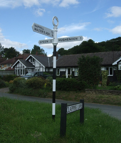
The broad ridge that supports Naphill descends through North Dean Woods to the hamlet of Upper North Dean, where there are bus stops, but only for services that seem to run once on Tuesdays. This is one part of the country where the council have revived the use of traditional fingerpost road signs as more fitting to the local environment, as the result of a welcoming loosening of regulations at the Department for Transport.
The route then climbs again, up a hill and towards a wood, and along a surfaced track past the settlement known as Piggotts. This is the venue for the Music Camp founded by scientist Bernard Wheeler Robinson (1904-97) in 1927 near Hitchin, which moved here when it became Robinson's home in 1963. Twice a year, amateur musicians gather here for nine days of communal music making, including tackling ambitious works by the likes of Olivier Messiaen, as well popular composers like Sondheim. Piggots has even hosted its own Ring Cycle.
At the end of the track is Piggotts Hill House, set back at the end of a long drive, but I'm deterred from taking a photo by an angry dog that comes bounding down the drive towards me. There's no gate, and I'm dubious as to whether the invisible forcefield at the limits of its territory will hold the beast, so I hastily continue around the house wall and back into woods.
The path descends to another small hamlet, Bryants Bottom, and then steeply back onto a ridge surmounted by Denner Hill Farm, where some old barns have been converted into impressive homes. Then it's down again through a rough field with fantastic views to Hampden Road, which marks the district council boundary between Wycombe and Chiltern districts.
From here another path runs uphill through a field towards a wood, the delightfully named Nanfan Wood, then across to the equally oddly named Hangings Lane on the edge of the sizeable village of Prestwood. This, the sister village of Great Missenden, is an example of the more common fate of areas of common land following enclosure -- originally a common that formed part of the Mandeville estate, as in Stoke Mandeville, it was developed in Victorian times, taking advantage of its position on what was then a main road between London and Birmingham. In the local 1960s the former cherry orchards were developed as overspill housing in a government initiative.
Rather uncharacteristically, the Countryway does some suburban wiggling through the village's residential streets, mainly I think as Chesterton is anxious to show us the Glebe, a pretty row of whitewashed cottages just off Kiln Lane. The gravel path that runs under a wooden archway just by these looks like a garden path, but is actually a right of way that leads into a road on the other side -- the residents entertain walkers further by keeping pretty patches of garden across the path from their homes.
From Prestwood Farm the route heads out across fields, downhill again and through Rignall Wood. Behind me I hear the thrum of a vehicle which turns out to be a golf buggy affair, moving at a walking pace -- and towing a horse! An example of the world turned upside down, or yet another example of the curious modern phobia of physical activity?
At Coney Cottage, just along from Rignall Farm, I spot a proud array of rosettes pineed on the wall of a stable. A sign warns the horses are microchipped -- presumably, like Spike in Buffy the Vampire Slayer, they can only act aggressively towards demons and vampires. I wish the same could be said of the local dogs.
Beyond this the fields flatten towards the railway to Aylesbury. Just before the tunnel under the railway, it's joined from the left by the South Buckinghamshire Way, one of a number of routes in the county originally proposed by Ramblers members but adopted by the county council. Northwest, the South Bucks Way fairly soon meets the Ridgeway National Trail near Coombe Hill, and ambitious walkers can link from there via the Ridgeway to the North Bucks Way, the first in a chain of paths that together make up the Midshires Way through middle England to Stockport, Greater Manchester, where there's a connection to the Pennine Bridleway. You could follow signed paths from here through the Pennines to Byrness and on along the Pennine Way across the Scottish border to Kirk Yetholm.
On the other side of the railway is Mobwell, where the path passes a dry hollow. During wet weather a spring bubbles up here to become the river Misbourne, the suffix "bourne" indicating a watercourse that only appears intermittently.
In fact the upper part of the river has in recent times been more dry than wet, thanks partly to dry weather, partly to water abstraction, with its course sometimes becoming obstructed, causing flooding when it does flow. It was dry between 2003 and 2007, causing much local excitement when it reappeared, but then disappeared again until early this year. The Chiltern Society are now campaigning to address the problems and properly restore the river's course. Downstream of Chalfont St Giles it's more consistently wet, and flows to join the river Colne at Denham, which in turn joins the Thames at Staines, so the waters that emerge here eventually graze the western edge of Greater London through the Colne Valley Regional Park.
Opposite the source is a substantial pub, the Black Horse, and the trail runs through its car park and on along strips of meadow beside the dry trench of the infant river. The Thames, too, looks like this on its very upper reaches near Kemble in Gloucestershire. Then you're walking between two rows of trees, with the roar of a busy road on your immediate left. This is the A413, an important link route between Gerrards Cross, Aylesbury and Banbury, the modern incarnation of that very old road that once linked London and Birmingham, and the subject of a song by cult singer-songwriter John Otway.
This section of the Countryway ends at a stile that takes you out onto the road, leaving the South Bucks Way, the next section continuing through fields opposite. But for the short link to Great Missenden station I keep ahead for a short distance on the South Bucks Way before cutting off on a convenient footpath towards the village centre. For the first time in a while there's the option of a convenient link to London -- the South Bucks Way continues down the Misbourne Valley to meet the Grand Union Canal towpath at Denham Lock, from where you can closely parallel and then join the London Loop.
Great Missenden is a large village still very much linear in focus, once a coaching stop on the old road, though thankfully now bypassed. It's worth taking a wander down the High Street to look at the church and the former Missenden Abbey -- the street itself is lined with historic cottages. The Red Pump Garage caught my eye -- it's actually now an estate agent, but the old petrol pumps, the sort that required an attendant to operate, are still in place. A notice on the door says the garage has been out of fuel since eight gallons cost more than £1. That's about 3p a litre.
The village's biggest visitor attraction today is the Roald Dahl Museum and Story Centre, located here since author Dahl (1916-90) lived locally in later life, although he was born in Llandaff of Norwegian parents -- Plas Roald Dahl at Cardiff Bay commemorates his attendance at the Norwegian Church located there. He's internationally known for his dark children's morality tales, notably Charlie and the Chocolate Factory which has been filmed succesfully twice, but I'll forever associate him with the ITV anthology series Tales of the Unexpected. The early episodes of this were introduced by Dahl himself, his thin and gangling frame in classic storyteller pose in a leather armchair next to an open fire, sardonically name dropping titbits of his international jet set gambling lifestyle. Looking at this neat little Chiltern village high street in comparison to the New York literary salons and Monte Carlo casinos of these anecdotes, I'm even more convinced of their phoniness.
By the station, the route connects to the Chiltern Heritage Trail, further details of which have proved difficult to track down. It was a millennium project of Chiltern District Council consisting of a walker's route and three interlinked, mainly road-based, cycling routes. Guides to the cycling routes are downloadable online, but the walking route was promoted in a booklet with a cover price, stocks of which have now run out, even though the route is thoroughly signed. The council tell me they don't even have any reference copies left, and a promise to send me a photocopy of the route map was unfulfilled at the time of writing. Since the route was created they've abolished their tourism service and transferred the person responsbile to other duties. It's too frequently the case with walking projects that a certain capital sum is spent on putting something in place but without any provision for its sustainability, so something that should be delivering a legacy for decades is left to founder, in this case over only a handful of years.
As to the railway, it's what binds Great Missenden to Metroland, and its story is also part of the story of the modern transport network in London. The world's first "metro" or high density urban underground railway, the Metropolitan Railway, opened in 1863 as a cut-and-cover line along the northern edge of central London, from the Great Western main line terminus at Paddington to a station on the edge of the City at Farringdon, almost all of which is still used by London Underground's Metropolitan, Hammersmith & City and Circle lines. The Met developed into one of the most important transport undertakings in London, eventually linking with the Metropolitan and District Railway to create the Circle Line. In 1933 it became a key component of the new state-owned London Passenger Transport Board, the ancestor of today's Transport for London.
The Met long harboured ambitions beyond moving bodies between the main line termini, workplaces and leisure venues of the urban area. As mentioned in the last section, at the beginning of the 20th century it was working to create its own main line in partnership with the Great Central Railway, incorporating part of the Wycome Railway at High Wycombe. Already, from the 1870s it had been busy extending its own lines northwest from Baker Street towards Harrow and deeper into the Home Counties. Great Missenden was joined to Baker Street and Aldgate when the extension from Chalfont to Amersham and Aylesbury opened in 1892. From Aylesbury it took over an existing railway to Verney Junction, 80km from Baker Street, where there was an interchange with the London and North Western Railway's branch line from Bletchley to Oxford; for a while it also took over the Brill Tramway, originally a railway privately owned by the Duke of Buckingham, which connected Quainton Road on the Verney Junction line to Brill. But plans for further expansion foundered and Verney Junction and Brill remain historically the furthest outposts of the Metropolitan Railway and later the London Underground.
Brill's status as a London tube station was cut short when the line was closed in 1935; passenger services north of Aylesbury ceased two years later though were revived to Quainton Road for a few years in the 1940s and sections of the line continued to be used for freight. In 2008 a short length north of Aylesbury came back into use with the opening of Aylesbury Vale Parkway, but by this time the aberration of this long reach of the Underground had long since been addressed. In 1960, when the Metropolitan Line was fully electrified to Amersham, Underground services were cut back to there. British Rail took over the rest of the line to Aylesbury, its services leaving from Marylebone with limited stops to Amersham. This arrangement persists though private operator Chiltern Railways has since taken over from BR -- it's an odd joint service, involving the only stretch of line where National Rail trains run on London Underground metals.
In the early 20th century the Met came up with a novel business model for boosting traffic on its suburban lines: building its own suburbia. In 1903 it built a housing estate at Pinner and several others followed, some with stations opened specifically to serve developments. So a tentacle of classic suburbia began to fatten along the railway, promoted through posters and booklets under the name Metro-Land, most famously championed, and without the hyphen, some decades later by John Betjeman. The image was a bucolic one, of Englishmen's modest mock-Tudor castles set among greenery a convenient commute away from respectable City jobs. The message both drew upon and helped develop an ideology of Englishness as essentially rooted in an omnipresent rural past, at the very time the large-scale urbanisation and mechanisation were overturning the real life of the countryside. The truth of Metroland was dense new estates of near identical houses, imposed at a swoop on greenfield sites with little organic development around natural centres. It offered a regimented freedom that was neither rural nor urban. As Leslie Thomas puts it in one of the classic Metroland-set novels, Tropic of Ruislip, it was "in the country but not of it. The fields seemed touchable and yet remote".
The wisdom of allowing London to develop uncontrolled at the whim of private interests was always suspect and following World War II the government introduced planning controls and instituted the Green Belt, effectively putting a stop to the spread of Metroland. So it never did quite reach Great Missenden, and although there are patches of residential sprawl here and there on our journey, most date from 1960s overspill planning. Still, it's tempting to imagine this little station tucked away behind the village street, its platforms lined with London Transport roundels, in an English autumn dusk where bowler-hatted commuters from Aldgate and Moorgate turn homeward to evenings round open fires and the wireless, broadcasting John Betjeman, perhaps.
Download a route description PDF
View Google map http://maps.google.com/maps/ms?ie=UTF8&hl=en&oe=UTF8&start=323&num=200&msa=0&msid=117966169375523396049.00046414d40d8252e7b70&ll=51.707134,-0.706859&spn=0.001599,0.00478&t=h&z=18
More information
- Buckinghamshire County Council http://www.buckscc.gov.uk
- Visit Buckinghamshire http://www.visitbuckinghamshire.org
- Walking in Buckinghamshire (Visit Buckinghamshire) http://www.visitbuckinghamshire.org/site/walking-in-buckinghamshire
- Buckinghamshire Walks and Rides (Bucks CC) http://www.buckscc.gov.uk/bcc/row/getting_out_on_the_network.page?
- Buckinghamshire Leisure & Culture (including parks) http://www.buckscc.gov.uk/bcc/leisure/Leisure__culture.page?
- Wycombe District Council http://www.wycombe.gov.uk/
- Wycombe Tourism http://www.wycombe.gov.uk/sitePages.asp?step=4&contentID=245&categoryID=1248
- Wycombe Parks and Recreation http://www.wycombe.gov.uk/sitePages.asp?step=4&contentID=239&categoryID=1132
- Chilterns Area of Oustanding Natural Beauty http://www.chilternsaonb.org/
- Chiltern Society http://www.chilternsociety.org.uk
- West Wycombe Parish Council http://www.westwycombe.org.uk/
- West Wycombe Estate http://www.west-wycombe-estate.co.uk/
- West Wycombe Village and Hill (National Trust) http://www.nationaltrust.org.uk/main/w-westwycombevillageandhill
- West Wycombe Park (National Trust) http://www.nationaltrust.org.uk/main/w-westwycombepark
- A40 (Wikipedia) http://en.wikipedia.org/wiki/A40_road
- West Wycombe & Bradenham Walks http://www.chilternsaonb.org/site_details.asp?siteID=391
- Hell-Fire Caves http://www.hellfirecaves.co.uk/
- Chiltern Main Line (Wikipedia) http://en.wikipedia.org/wiki/Chiltern_Main_Line
- Downley Parish Council http://www.downleypc.org/
- Wycombe Museum http://www.wycombe.gov.uk/museum/
- All Saints High Wycombe http://www.allsaintshighwycombe.org/
- Eden Shopping Centre http://www.edenshopping.co.uk/
- Hughenden Parish Council http://www.hughendenparishcouncil.org.uk
- Downley Common http://www.chilternsaonb.org/site_details.asp?siteID=702
- Downley Common Preservation Society http://www.downleycommon.org.uk/
- Special trees and woods: Naphill Common http://www.chilternsaonb.org/caring/stwp_site_details.asp?siteID=595
- Friends of Naphill Common http://www.naphillcommon.org.uk/
- RAF Command http://www.raf.mod.uk/organisation/rafcommand.cfm
- Red kite (RSPB) http://www.rspb.org.uk/ourwork/conservation/species/casestudies/redkite.asp
- Great Missenden walks: search for Great Missenden at http://www.chilternsaonb.org/
- Chiltern District Council http://www.chiltern.gov.uk
- Chiltern tourism and walks http://www.chiltern.gov.uk/tourism
- Great Missenden Parish Council http://www.greatmissendenpc.co.uk/
- Great Missenden and Prestwood visitor guide http://www.chiltern.gov.uk/downloads/GM.pdf
- South Buckinghamshire Way http://www.buckscc.gov.uk/assets/content/bcc/docs/row/promoted_routes/South_Bucks_Way_Leaflet.pdf
- River Misbourne (Wikipedia) http://en.wikipedia.org/wiki/River_Misbourne
- Chiltern Heritage Trail http://www.chilternsaonb.org/site_details.asp?siteID=222
- Roald Dahl Museum and Story Centre http://www.roalddahlmuseum.org/
- London to Aylesbury Line (Wikipedia) http://en.wikipedia.org/wiki/London_to_Aylesbury_Line


4 comments:
Thank you very much for doing these fantastic write-ups and the route notes. We've only just started doing the Loop, so the Countryway is still some time in the future, but it's fantastic to be able to read about it here. Cheers!
I recently walked the four sections from Windsor to Ashley Green. It was covered in snow thorughout and although I have Constable's book I found the descriptions here invaluable. Any plans to complete the set?
Mike
I walked this section today (Sunday 7th January 2018) on a lovely sunny day with a "crisp" cold wind. The ups and downs across the corrugated landscape were not too much of a struggle, giving good views along each valley from the ridges that border it.
Some paths were very muddy, especially at the north-west end of H12 through Naphill Common which has been turned into a canyon of mud by forestry vehicles. I had inadvertently diverged to the left of H12 before I got there, along HUG/2, and then got back on track by following HUG/5. That was not quite so muddy, but was obstructed and obscured by several felled trees and debris.(These route numbers, in the form HUG/12 rather than H12, are shown on the Buckingham Council map at https://www.buckscc.gov.uk/services/environment/rights-of-way/changes-to-public-rights-of-way/public-rights-of-way-map/)
No fierce dogs, thank goodness, but a very friendly horse guarding a gate a Idaho Farm who was rather reluctant to more to let me past. Looking back on the gate before going through the railway arch I saw a notice informing me belatedly that there were "Young bulls in fields", but hadn't seen any in the Broomfield Farm fields I had just come through.
I can confirm that the north end of Naphill Common is still in a horrendous state. The paths are all but obliterated by criss crossing deep, muddy forestry tracks. Most of the path labels have gone but I luckily spotted H1 on a marker post and escaped to the main road just by house number 155 so I all I had to do was cross the road and continue on my way.
It is easy to see why Leonard diverged to the left of H12 because the fork of byways is not at all clear and the wide, well walked track veers left, increasingly westward towards Bradenham. A compass is a great help in these woods.
Another fine and enjoyable walk with large numbers of red kites overhead.
Post a Comment